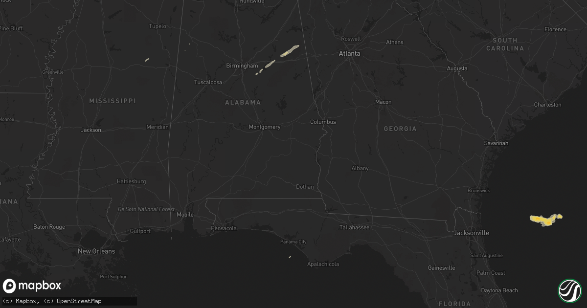
Hail Map on January 10, 2014
Get this storm
January 10 map
$229
one time, instant access
Download today. No call, no setup
Keep the $229
Bought the map and want the full workflow? Apply the entire $229 to a subscription within 7 days. None of it is wasted.
Every map, not just this one
This buys you this map. Subscription and you get every map we run, in the markets you choose from a few cities to whole states to nationwide. Plus real-time alerts the moment a storm fires.
Contact data
Name, contact info, occupancy, even credit band for addresses in the footprint. You go from where it hit to who to call.
Become the source they trust
Unlimited branding weather history reports on demand. You already have the documented answer ready for the property owner, and you are the one who showed up with it.
Property data and RoofTrace estimates
Pull up any address you have got, its value and the exact code rules for that jurisdiction, straight from One Click Code. Then RoofTrace estimates the squares, pitch, and roof value, priced the way you price.
States Impacted by Hail Map on January 10, 2014
Storm reports
Alabama
| Date | Description |
|---|---|
| 01/10/20145:40 AM CST | Near stemley |
| 01/10/20145:24 AM CST | A local report indicates 1.00 inch wind near 3 NE ANNISTON |
| 01/10/20145:23 AM CST | Two power poles snapped off and trees down across the power lines at lenlock lane and arrow avenue. |
Georgia
| Date | Description |
|---|---|
| 01/10/20145:53 AM CST | Numerous trees and powerlines down on prior station road and piedmont hwy. Corrected for the time |
| 01/10/20145:53 AM CST | Minor damage to polk medical center. 2 metal frame pieces blown off sw corner of building damaging shingles on roof...6 vehicles and nearby home. Hospital also reported |
North Carolina
| Date | Description |
|---|---|
| 01/09/201411:13 PM CST | Mutliple trees down across the county. |
| 01/09/201411:00 PM CST | Power line down in waxhaw. |