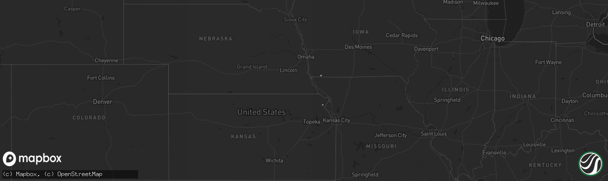
Hail Map on April 5, 2016
The weather event on April 5, 2016 includes Hail map. 2 states and 4 cities were impacted and suffered possible damage. The total estimated number of properties impacted is 0.
Want more than just the map?
Turn this storm into a full workflow.
- Owner + property data so you know who to knock
- OnDemand branded weather history reports to win the "did we even have hail?" argument
- RoofTrace estimate so reps stop guessing numbers at the door
Bought this map? Upgrade within 7 days and we'll credit the $230. (10-15 min setup call)
Hail
0
Estimated number of impacted properties by a 1.00" hail or larger0
Estimated number of impacted properties by a 1.75" hail or larger0
Estimated number of impacted properties by a 2.50" hail or largerStorm reports
Kansas
| Date | Description |
|---|---|
| 04/04/20167:13 PM CDT | Reported by pratt co em |
| 04/04/20167:13 PM CDT | Relayed by emergency management. |
Georgia
| Date | Description |
|---|---|
| 04/04/201611:40 PM CDT | Power lines were reported down on newnan road. |
| 04/04/201611:05 PM CDT | A large tree was uprooted in front of a pharmacy. |