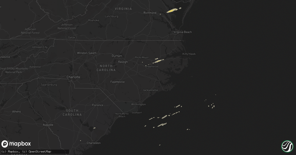
Hail Map on April 12, 2013
Get this storm
April 12 map
$229
one time, instant access
Download today. No call, no setup
Keep the $229
Bought the map and want the full workflow? Apply the entire $229 to a subscription within 7 days. None of it is wasted.
Every map, not just this one
This buys you this map. Subscription and you get every map we run, in the markets you choose from a few cities to whole states to nationwide. Plus real-time alerts the moment a storm fires.
Contact data
Name, contact info, occupancy, even credit band for addresses in the footprint. You go from where it hit to who to call.
Become the source they trust
Unlimited branding weather history reports on demand. You already have the documented answer ready for the property owner, and you are the one who showed up with it.
Property data and RoofTrace estimates
Pull up any address you have got, its value and the exact code rules for that jurisdiction, straight from One Click Code. Then RoofTrace estimates the squares, pitch, and roof value, priced the way you price.
States Impacted by Hail Map on April 12, 2013
Storm reports
Colorado
| Date | Description |
|---|---|
| 04/12/20133:14 PM CDT | A local report indicates 62 MPH wind near NE AKRON |
North Carolina
| Date | Description |
|---|---|
| 04/12/20135:05 PM CDT | Report of four cedar trees blown down with tops broken off. Shingles and gutters blown off storage shed. |
Maryland
| Date | Description |
|---|---|
| 04/12/20134:50 PM CDT | A local report indicates 69 MPH wind near 1 WSW POINT LOOKOUT |
Virginia
| Date | Description |
|---|---|
| 04/11/20138:34 PM CDT | Trees down |
| 04/11/20138:30 PM CDT | Trees down on lewis b puller hwy |
South Carolina
| Date | Description |
|---|---|
| 04/12/20132:31 PM CDT | Tree down on a powerline along highway 261 near the stuckey airport. |
| 04/12/20132:05 PM CDT | Tree in the roadway at east jacksonboro road and sc highway 64. |