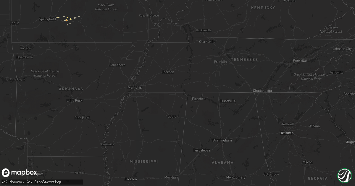
Hail Map on May 28, 2011
Get this storm
May 28 map
$229
one time, instant access
Download today. No call, no setup
Keep the $229
Bought the map and want the full workflow? Apply the entire $229 to a subscription within 7 days. None of it is wasted.
Every map, not just this one
This buys you this map. Subscription and you get every map we run, in the markets you choose from a few cities to whole states to nationwide. Plus real-time alerts the moment a storm fires.
Contact data
Name, contact info, occupancy, even credit band for addresses in the footprint. You go from where it hit to who to call.
Become the source they trust
Unlimited branding weather history reports on demand. You already have the documented answer ready for the property owner, and you are the one who showed up with it.
Property data and RoofTrace estimates
Pull up any address you have got, its value and the exact code rules for that jurisdiction, straight from One Click Code. Then RoofTrace estimates the squares, pitch, and roof value, priced the way you price.
States Impacted by Hail Map on May 28, 2011
Storm reports
Missouri
| Date | Description |
|---|---|
| 05/28/201112:56 PM CDT | Lots of golf ball size hail |
| 05/28/201112:49 PM CDT | A local report indicates 1.25 inch wind near BOWLING GREEN |
| 05/28/201112:46 PM CDT | Coming down hard |
| 05/28/201112:37 PM CDT | A local report indicates 1.00 inch wind near CURRYVILLE |
| 05/28/201112:25 PM CDT | Hail size varied from half-dollar to silver dollar. |
| 05/28/201112:20 PM CDT | A local report indicates 1.50 inch wind near PERRY |
| 05/28/201112:20 PM CDT | Hail in hutchinson missouri - 6 miles south of perry. |
| 05/28/201112:18 PM CDT | Quarter to half dollar sized hail. |
| 05/28/201111:52 AM CDT | Public report relayed by media. Report was shooter marble sized hail. |
| 05/28/201111:45 AM CDT | Public report relayed by media. Report was shooter marble sized hail. |
| 05/28/201111:30 AM CDT | A local report indicates 1.25 inch wind near PERRY |
| 05/28/20119:01 AM CDT | A local report indicates 1.50 inch wind near 8 S POTOSI |
| 05/28/20118:52 AM CDT | A local report indicates 1.25 inch wind near 4 N MANSFIELD |
| 05/28/20118:50 AM CDT | A local report indicates 1.75 inch wind near 5 S HARTVILLE |
| 05/28/20117:29 AM CDT | A local report indicates 1.00 inch wind near APPLETON CITY |
| 05/28/20116:56 AM CDT | A local report indicates 1.00 inch wind near SHERIDAN |
South Carolina
| Date | Description |
|---|---|
| 05/28/20115:00 PM CDT | Hail up to the size of quarters was reported. |
| 05/28/20114:48 PM CDT | A large tree was uprooted on bethea street near the latta united methodist church. The time was estimated based on radar data. |
| 05/28/20114:48 PM CDT | Hail up to the size of quarters was reported. The wind was estimated at 40 to 50 mph. |
| 05/28/20114:47 PM CDT | Hail bigger than a half dollar was reported. The hail lasted for 5 minutes. |
| 05/28/20114:45 PM CDT | Hail to the size of golf balls was reported. |
| 05/28/20112:45 PM CDT | Trained spotter reported quarter-size hail for 7 minutes |
Minnesota
| Date | Description |
|---|---|
| 05/28/20115:45 PM CDT | 0.5 to 1.0 inch diameter hail. Biggest hail stones were around the size of a quarter. Some gusty winds. At moose lake state park. |
| 05/28/20115:38 PM CDT | Corrected time and specific location. Reported at mile marker 212 on i-35. |
| 05/28/20115:30 PM CDT | Reported at mile marker 212 on i-35 |
| 05/28/20113:50 PM CDT | Three trees down blocking highway 5 and perch lake road. Lake county sheriffs office. |
| 05/28/20113:43 PM CDT | Forecaster reported hail has been falling for past 10 minutes...with largest pieces observed during last few minutes. |
| 05/28/20113:35 PM CDT | Tree down in gilbert. Lake county sheriffs office. |
| 05/28/20113:31 PM CDT | Hail reported near country road 7 and highway 19. |
| 05/28/20113:28 PM CDT | Some tree limbs broken off near lax lake. |
| 05/28/20113:28 PM CDT | A local report indicates 1.00 inch wind near 5 N SILVER BAY |
| 05/28/20113:20 PM CDT | Hail reported near country road 7 and highway 19. |
| 05/28/20113:20 PM CDT | Some sporadic minor tree damage along highway 15. Some broken tree limbs and a few trees blown down. |
| 05/28/20113:20 PM CDT | Hail occurred approximately 2 miles south of blakely. |
| 05/28/20113:19 PM CDT | Reported near county roads 1 and 169. |
| 05/28/20113:07 PM CDT | Tree damage was noted along a 1.9 mile long path in the superior national forest along forest route 107. This consisted of a few snapped and uprooted trees...along with |
| 05/28/20113:04 PM CDT | Some trees and tree limbs blown down in an area between marble lake and kane lake. Likely associated with a downburst before a tornado formed just east. |
| 05/28/20113:02 PM CDT | A local report indicates 1.00 inch wind near ARLINGTON |
| 05/28/20112:58 PM CDT | A couple trees blown down along the kawishiwi trail |
| 05/28/20112:40 PM CDT | A local report indicates 1.00 inch wind near 2 N WINTHROP |
| 05/28/20112:40 PM CDT | Tree blown down blocking highway 135 near highway 26. Lake county sheriffs office. |
| 05/28/20112:38 PM CDT | Trained spotter noticed debris associated with funnel. |
| 05/28/20112:30 PM CDT | Corrected time. Tree blown down blocking highway 135 near highway 26. Lake county sheriffs office. |
| 05/28/20112:11 PM CDT | A local report indicates 1.75 inch wind near 2 W GIBBON |
| 05/28/201112:55 PM CDT | A local report indicates 1.00 inch wind near 1 SE ROOSEVELT |
| 05/28/201112:45 PM CDT | A local report indicates 1.00 inch wind near 1 SE ROOSEVELT |
Florida
| Date | Description |
|---|---|
| 05/28/20116:15 PM CDT | Tree fell on power lines and partially blocked the road at plymouth-sorrento road and kelly park road. |
Indiana
| Date | Description |
|---|---|
| 05/28/20115:30 PM CDT | A local report indicates 1.00 inch wind near NORTH SALEM |
| 05/28/20114:52 PM CDT | Near the town of new goshen |
| 05/27/20117:32 PM CDT | A local report indicates 1.00 inch wind near WARREN |
| 05/27/20117:20 PM CDT | Report relayed from grant co sheriff |
Delaware
| Date | Description |
|---|---|
| 05/28/20111:45 PM CDT | Tree reported down in ellendale |
New York
| Date | Description |
|---|---|
| 05/28/20113:16 PM CDT | A local report indicates 1.75 inch wind near WARRENSBURG |
| 05/28/20111:32 PM CDT | Quarter sized hail at rogers rock campground. |
| 05/28/20111:06 PM CDT | One tree down one mile north of golf course road on route 28. |
| 05/28/20111:05 PM CDT | Half dollar sized hail at daggett lake campsites. |
| 05/28/201112:50 PM CDT | One tree down on high street near athol. |
| 05/28/201112:45 PM CDT | One tree down on landon hill road. |
| 05/28/201112:39 PM CDT | A local report indicates 1.50 inch wind near THURMAN |
Illinois
| Date | Description |
|---|---|
| 05/28/20114:30 PM CDT | Cocorahs report |
| 05/28/20114:08 PM CDT | A local report indicates 1.00 inch wind near 1 S CHARLESTON |
| 05/28/20114:04 PM CDT | Public report |
| 05/28/20113:43 PM CDT | Report from lake mattoon. Corrected time. |
| 05/28/20113:34 PM CDT | Report from lake mattoon |
| 05/28/20113:20 PM CDT | A local report indicates 1.25 inch wind near 2 E LAKEWOOD |
| 05/28/20113:10 PM CDT | Quarter size hail reported just south of tower hill |
| 05/28/20113:03 PM CDT | A local report indicates 1.00 inch wind near OCONEE |
| 05/28/20112:52 PM CDT | A local report indicates 1.25 inch wind near NOKOMIS |
| 05/28/20112:42 PM CDT | Back car window destroyed by hail. |
| 05/28/20112:41 PM CDT | A local report indicates 1.00 inch wind near IRVING |
| 05/28/20112:40 PM CDT | Hail ranged between golf balls and softballs. |
| 05/28/20112:39 PM CDT | Dime to quarter size hail almost completely covering the ground. |
| 05/28/20112:37 PM CDT | A local report indicates 2.50 inch wind near HILLSBORO |
| 05/28/20112:37 PM CDT | 3 miles east southeast of springfield capital airport. |
| 05/28/20112:35 PM CDT | Numerous car windows damaged. |
| 05/28/20112:35 PM CDT | Occurred on north side of springfield. |
| 05/28/20112:32 PM CDT | Northwest side of springfield |
| 05/28/20112:31 PM CDT | A local report indicates 1.50 inch wind near 4 N LITCHFIELD |
| 05/28/20112:30 PM CDT | Occurred at 1424 s. 2nd st. |
| 05/28/20112:30 PM CDT | A local report indicates 1.50 inch wind near 4 N LITCHFIELD |
| 05/28/20112:29 PM CDT | A local report indicates 1.75 inch wind near LITCHFIELD |
| 05/28/20112:28 PM CDT | At lou yaeger lake. |
| 05/28/20112:27 PM CDT | Report of 1 inch hail southwest side of springfield near the mall |
| 05/28/20112:25 PM CDT | A local report indicates 4.50 inch wind near 3 N LITCHFIELD |
| 05/28/20112:21 PM CDT | Reported relayed from wfo ilx |
| 05/28/20112:15 PM CDT | On route 4. |
| 05/28/20112:08 PM CDT | Hail covering ground. |
| 05/28/20112:08 PM CDT | A local report indicates 1.25 inch wind near 6 S CARLINVILLE |
| 05/28/20112:05 PM CDT | A local report indicates 1.00 inch wind near 1 W CARLINVILLE |
| 05/28/20112:04 PM CDT | A local report indicates 1.75 inch wind near CHESTERFIELD |
| 05/28/20112:00 PM CDT | A local report indicates 1.75 inch wind near CHESTERFIELD |
| 05/28/20111:59 PM CDT | A local report indicates 1.00 inch wind near KEMPER |
| 05/28/20111:56 PM CDT | Located around 3 miles south of rockbridge along the greene and jersey county line |
| 05/28/20111:55 PM CDT | A local report indicates 1.75 inch wind near 2 E JACKSONVILLE |
| 05/28/20111:55 PM CDT | A local report indicates 1.75 inch wind near ROCKBRIDGE |
| 05/28/20111:53 PM CDT | A local report indicates 1.00 inch wind near 2 SE SOUTH JACKSONVILLE |
| 05/28/20111:46 PM CDT | Accompanied by heavy rain...three quarters of an inch of rain from cell. |
| 05/28/20111:30 PM CDT | A local report indicates 1.00 inch wind near ELDRED |
| 05/28/20111:29 PM CDT | Hail fell for approximately 2 minutes. |
| 05/28/20111:28 PM CDT | A local report indicates 1.00 inch wind near 2 N LITCHFIELD |
Nebraska
| Date | Description |
|---|---|
| 05/28/20116:55 AM CDT | Mostly nickel size and smaller. Some around quarter size and a few up to half dollar size. Largest ones were not round but spikey. |
Iowa
| Date | Description |
|---|---|
| 05/28/20116:36 AM CDT | Person put quarter size hail in their freezer... |
| 05/28/20116:22 AM CDT | Quarter size hail... |
Colorado
| Date | Description |
|---|---|
| 05/27/20119:57 PM CDT | A local report indicates 1.00 inch wind near 5 NE PUNKIN CENTER |
| 05/27/20119:39 PM CDT | A local report indicates 1.75 inch wind near 6 W PUNKIN CENTER |
| 05/27/20119:26 PM CDT | A local report indicates 60 MPH wind near 6 W PUNKIN CENTER |
| 05/27/20119:03 PM CDT | Ended at 813 pm. |
Ohio
| Date | Description |
|---|---|
| 05/27/20118:58 PM CDT | A local report indicates 1.00 inch wind near LIMA |
Cities Impacted by Hail Map on May 28, 2011
- Beatrice, NE
- Liberty Center, IN
- Warren, IN
- Winterset, IA
- Nilwood, IL
- Brazil, IN
- Curryville, MO
- Terre Haute, IN
- Kampsville, IL
- Carlinville, IL
- Gillespie, IL
- Lerna, IL
- Paris, MO
- Litchfield, IL
- Butler, IL
- Medora, IL
- Mattoon, IL
- Irving, IL
- Ramsey, IL
- Charleston, IL
- Carrollton, IL
- Tower Hill, IL
- Fillmore, IL
- Fieldon, IL
- Witt, IL
- Rosedale, IN
- Chesterfield, IL
- Cowden, IL
- Gays, IL
- Stewardson, IL
- Shipman, IL
- Greenfield, IL
- Clark, MO
- Center, MO
- Shelbyville, IL
- Trilla, IL
- Clarksville, MO
- Neoga, IL
- Paris, IL
- Nebo, IL
- Kansas, IL
- Rockbridge, IL
- Eolia, MO
- Raymond, IL
- Annada, MO
- Mexico, MO
- Lakewood, IL
- New Goshen, IN
- Herrick, IL
- Bowling Green, MO
- Higbee, MO
- Centralia, MO
- Thompson, MO
- Marshall, IL
- Dennison, IL
- Kane, IL
- Moberly, MO
- Windsor, IL
- Vandalia, MO
- Hamburg, IL
- Ashmore, IL
- Martinsville, IL
- Elsberry, MO
- Farber, MO
- Perry, MO
- Hillsboro, IL
- Madison, MO
- West Terre Haute, IN
- Louisiana, MO
- Santa Fe, MO
- Strasburg, IL
- Nokomis, IL
- Westfield, IL
- Beecher City, IL
- Oconee, IL
- Eldred, IL
- Laddonia, MO
- Chrisman, IL
- Pine Village, IN
- Fairfax, MO
- Stronghurst, IL
- Media, IL
- Monmouth, IL
- Kirkwood, IL
- Carman, IL
- Roseville, IL
- Lomax, IL
- Smithshire, IL
- Latta, SC
- Osceola, IA
- Frankfort, IN
- Burlington Junction, MO
- Maryville, MO
- Hopkins, MO
- Ravenwood, MO
- Skidmore, MO
- Clearmont, MO
- Parnell, MO
- Pickering, MO
- Sheridan, MO
- Topeka, KS
- Sherman, IL
- Henderson, MN
- Belle Plaine, MN
- Ridgeland, SC
- Matheson, CO
- Limon, CO
- Ramah, CO
- Rush, CO
- Hugo, CO
- Runnells, IA
- Silver Bay, MN
- Two Harbors, MN
- Isabella, MN
- Brimson, MN
- Gibbon, MN
- Springfield, IL
- Moose Lake, MN
- Sturgeon Lake, MN
- Hartford City, IN
- Maroa, IL
- Forsyth, IL
- Decatur, IL
- Oreana, IL
- Marshfield, MO
- Fordland, MO
- Johnsburg, NY
- Diamond Point, NY
- Bolton Landing, NY
- Chestertown, NY
- Warrensburg, NY
- Stony Creek, NY
- Athol, NY
- Norwood Young America, MN
- Green Isle, MN
- Carver, MN
- Jordan, MN
- Winthrop, MN
- Arlington, MN
- Gaylord, MN
- Cologne, MN
- Rockport, IL
- Pittsfield, IL
- Pleasant Hill, IL
- Potosi, MO
- Benton, IA
- Diagonal, IA
- Marion, IN
- Yoder, CO
- Ellsworth, WI
- Jacksonville, IL
- Winchester, IL
- Creston, IA
- Macksburg, IA
- Wapakoneta, OH
- Villisca, IA
- Stanton, IA
- Ladoga, IN
- Roachdale, IN
- North Salem, IN
- New Hampton, MO
- Albany, MO
- Darlington, MO
- Clearfield, IA
- Hamer, SC
- Florence, SC
- Sellers, SC
- Marion, SC
- Rowland, NC
- Darlington, SC
- Fairmont, NC
- Dillon, SC
- Lake View, SC
- Montpelier, IN
- Willow River, MN
- Lathrop, MO
- Kearney, MO
- Plattsburg, MO
- Smithville, MO
- Turney, MO
- Cowgill, MO
- Cameron, MO
- Kingston, MO
- Hamilton, MO
- Lawson, MO
- Liberty, MO
- Kansas City, MO
- Holt, MO
- Polo, MO
- Trimble, MO
- Virginia, IL
- Alexander, IL
- Franklin, IL
- Geneva, IN
- New London, MO
- Hull, IL
- Kinderhook, IL
- Valley, NE
- Waterloo, NE
- Elkhorn, NE
- Oquawka, IL
- Little York, IL
- Seaton, IL
- Hartville, MO
- Loxahatchee, FL
- Lorimor, IA
- Orient, IA
- Afton, IA
- Atwood, IL
- Malvern, IA
- Sidney, IA
- Randolph, IA
- Tabor, IA
- Stoutsville, MO
- Monroe City, MO
- Bedford, IA
- Blockton, IA
- Prior Lake, MN
- Meadville, MO
- Hale, MO
- Van Buren, IN
- Norwood, MO
- Elkhart, IL
- Buffalo, IL
- Mount Pulaski, IL
- Clarks Hill, IN
- Perrysville, IN
- Covington, IN
- Finlayson, MN
- Pawnee City, NE
- Burchard, NE
- Cameron, IL
- Galesburg, IL
- Mansfield, MO
- Braymer, MO
- Pittsboro, IN
- Lebanon, IN
- Lizton, IN
- Brownsburg, IN
- Jamestown, IN
- Gas City, IN
- Percival, IA
- Nebraska City, NE
- Hamburg, IA
- Walterboro, SC
- Union, NE
- Thurman, IA
- Ada, OH
- Altona, IL
- Galva, IL
- Lovington, IL
- Hammond, IL
- Bement, IL
- Bonne Terre, MO
- Park Hills, MO
- Mineral Point, MO
- Leadwood, MO
- Irondale, MO
- Steelville, MO
- Belgrade, MO
- Hastings, MN
- New Riegel, OH
- Ashland, NE
- Memphis, NE
- Veedersburg, IN
- Michigantown, IN
- Hume, IL
- Metcalf, IL
- Newman, IL
- Brocton, IL
- Lakeville, MN
- West Lafayette, IN
- Prescott, WI
- Argenta, IL
- Cerro Gordo, IL
- Dana, IN
- Augusta, WI
- Fall Creek, WI
- Corning, IA
- Nodaway, IA
- Chatham, IL
- Glenarm, IL
- Spring Valley, WI
- Elmwood, WI
- Early Branch, SC
- Yemassee, SC
- Harrod, OH
- Lima, OH
- Zellwood, FL
- Apopka, FL
- Mount Dora, FL
- King City, MO
- McFall, MO
- Clyo, GA
- Springfield, GA
- Danville, IL
- Pleasant Plains, IL
- Trenton, MO
- La Fontaine, IN
- New Berlin, IL
- Wymore, NE
- Blue Springs, NE
- Barry, IL
- Loami, IL
- Riverton, IL
- Chillicothe, MO
- Grantville, KS
- Lafayette, IN
- Romney, IN
- Middle Point, OH
- Fort Jennings, OH
- Grover Hill, OH
- Carmel, IN
- Whitestown, IN
- Westfield, IN
- Zionsville, IN
- Tallula, IL
- Ashland, IL
- Clarinda, IA
- Elk Creek, NE
- Richmond, IN
- Essex, IA
- Harristown, IL
- Warrensburg, IL
- Amboy, IN
- Gravity, IA
- Lewiston, NE
- Steinauer, NE
- Liberty, NE
- Virginia, NE
- Elko New Market, MN
- Farmington, MN
- Wells, NY
- Tilton, IL
- Westville, IL
- Oneida, IL
- Shenandoah, IA
- New Prague, MN
- Menomonie, WI
- Elk Mound, WI
- Rock Port, MO
- Tarkio, MO
- Westboro, MO
- Mulberry, IN
- Rochester, IL
- Mountain Grove, MO
- Hillsdale, IN
- Rockville, IN
- Montezuma, IN
- Williamsport, IN
- Table Rock, NE
- Humboldt, NE
- Catlin, IL
- Mellott, IN
- Wingate, IN
- Hillsboro, IN
- Holliday, MO
- Casey, IL
- Bingham, IL
- Carbon, IN
- Dawson, IL
- New Knoxville, OH
- Greenwood, NE
- Ceresco, NE
- Barnum, MN
- Carbondale, KS
- Kempton, IN
- Tipton, IN
- Seymour, MO
- Moncks Corner, SC
- Graff, MO
- Jonesboro, IN
- Fairmount, IN
- Brant Lake, NY
- Bennet, NE
- Adams, NE
- Palmyra, NE
- Panama, NE
- Butler, MO
- Markle, IN
- Cromwell, IA
- Prescott, IA
- Platte City, MO
- Northboro, IA
- Farragut, IA
- Coin, IA
- Beldenville, WI
- Saint Marys, OH
- Rossville, IL
- Potomac, IL
- Frankford, MO
- Union Star, MO
- Maysville, MO
- Amity, MO
- Greencastle, IN
- Fillmore, IN
- Coatesville, IN
- Hannibal, MO
- Appleton City, MO
- Hague, NY
- Seibert, CO
- Carlisle, IA
- Osceola, MO
- Leavenworth, KS
- Cisco, IL
- Saint George, SC
- Dorchester, SC
- Fithian, IL
- Cabool, MO
- Meriden, KS
- Gilson, IL
- Pana, IL
- Mode, IL
- Ridgeville, SC
- Montpelier, VT
- Latham, IL
- Knoxville, IL
- Bismarck, IL
- Marco Island, FL
- Naples, FL
- Dawn, MO
- Bogard, MO
- Norborne, MO
- Carrollton, MO
- Rankin, IL
- College Springs, IA
- Elmo, MO
- Braddyville, IA
- Blanchard, IA
- New Market, IA
- Cannon Falls, MN
- Welch, MN
- Lake George, NY
- Webster, MN
- Round O, SC
- Glenwood, IA
- Ottawa, OH
- Leipsic, OH
- Saint Charles, IA
- Peru, IA
- Attica, IN
- Waynetown, IN
- Arenzville, IL
- Beardstown, IL
- Northville, NY
- Riverton, IA
- Ruffin, SC
- Ava, MO
- Lenox, IA
- Palmyra, MO
- Monticello, IL
- Wakarusa, KS
- Berryton, KS
- Auburn, KS
- Shambaugh, IA
- Mount Ayr, IA
- Abingdon, IL
- Swayzee, IN
- Williamsville, IL
- Illiopolis, IL
- De Land, IL
- Milmine, IL
- Niantic, IL
- Chestnut, IL
- Virginia, MN
- Biwabik, MN
- Aurora, MN
- Continental, OH
- Cloverdale, OH
- Norwalk, IA
- Indiantown, FL
- Murray, IA
- Tina, MO
- Ochopee, FL
- Immokalee, FL
- Rosemount, MN
- Monroeville, IN
- Peyton, CO
- Calhan, CO
- Macomb, MO
- Watson, MO
- Syracuse, NE
- Burr, NE
- Plainfield, VT
- Marshfield, WI
- Russellville, IN
- Gretna, NE
- Chapin, IL
- Montrose, MO
- Oakland, IL
- Hoagland, IN
- Finland, MN
- Bluffs, IL
- Athens, IL
- La Fayette, IL
- Scranton, KS
- Tiffin, OH
- Helena, MO
- Upland, IN
- Tuscola, IL