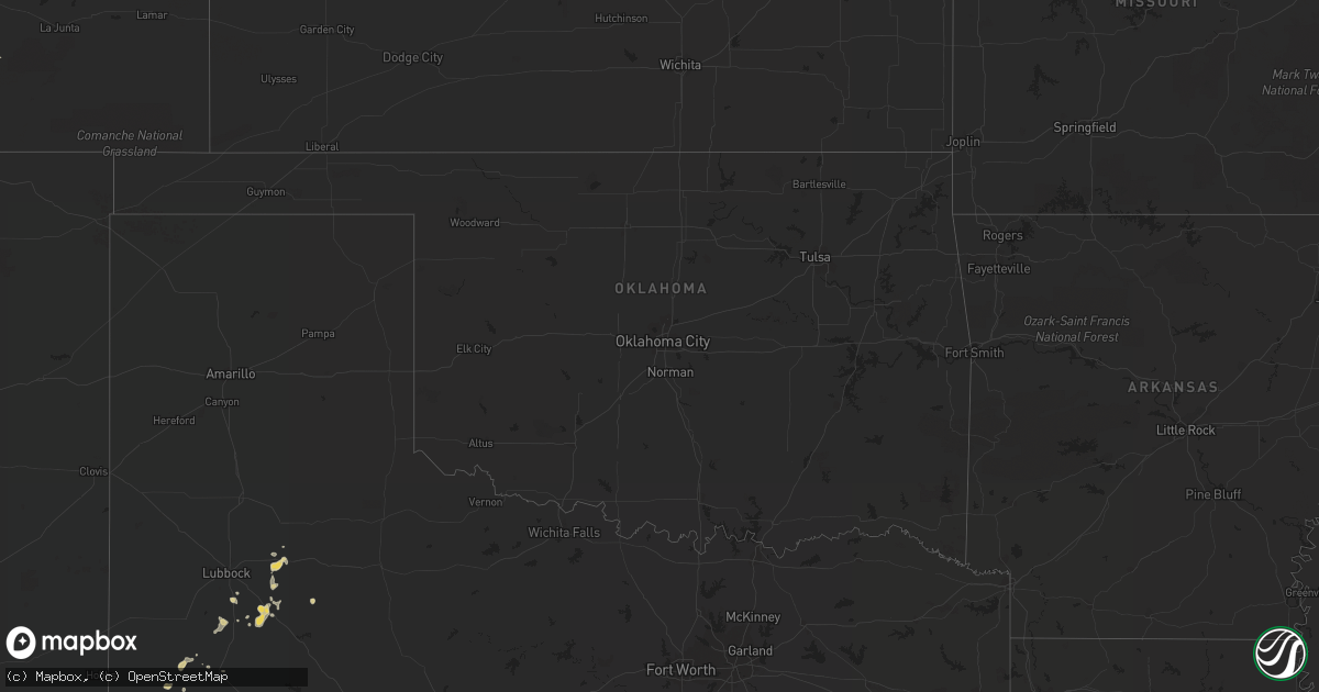
Hail Map on July 16, 2012
Get this storm
July 16 map
$229
one time, instant access
Download today. No call, no setup
Keep the $229
Bought the map and want the full workflow? Apply the entire $229 to a subscription within 7 days. None of it is wasted.
Every map, not just this one
This buys you this map. Subscription and you get every map we run, in the markets you choose from a few cities to whole states to nationwide. Plus real-time alerts the moment a storm fires.
Contact data
Name, contact info, occupancy, even credit band for addresses in the footprint. You go from where it hit to who to call.
Become the source they trust
Unlimited branding weather history reports on demand. You already have the documented answer ready for the property owner, and you are the one who showed up with it.
Property data and RoofTrace estimates
Pull up any address you have got, its value and the exact code rules for that jurisdiction, straight from One Click Code. Then RoofTrace estimates the squares, pitch, and roof value, priced the way you price.
States Impacted by Hail Map on July 16, 2012
Storm reports
Arizona
| Date | Description |
|---|---|
| 07/16/20126:10 PM CDT | At cameron trading post |
| 07/15/201210:10 PM CDT | Kold reported via twitter that power poles were down south of interstate 10 at wilmot. |
Tennessee
| Date | Description |
|---|---|
| 07/16/20126:45 PM CDT | Numerous trees and tree limbs blown down and some shingles blown off roofs near siegel middle school in the regenwood and regency park subdivisions. Reported by spotter |
| 07/15/20127:00 PM CDT | Trees blown down on west side of tullahoma at around 7 pm. Reported by ham operator. |
| 07/15/20127:00 PM CDT | Numerous trees blown down on west side of tullahoma in bel aire neighborhood including on lincoln st and crestwood dr. One tree destroyed a shed and damaged a house. An |
North Carolina
| Date | Description |
|---|---|
| 07/16/20126:54 PM CDT | Debris/trees down |
| 07/16/20126:50 PM CDT | Debris/trees down |
| 07/16/20126:08 PM CDT | Power lines down in downtown new bern |
| 07/16/20125:41 PM CDT | Trees and power lines down. |
| 07/16/20125:25 PM CDT | One tree down. |
| 07/16/20125:08 PM CDT | One tree down in the green creek area. |
| 07/16/20124:39 PM CDT | Strong winds damaged 3 homes west of snow hill. Tree limb blown through roof of one home. |
| 07/16/20124:02 PM CDT | Power lines reported down along dakota ave |
| 07/16/20124:00 PM CDT | Several small trees blown down and dime hail near hospital |
| 07/16/20123:45 PM CDT | Tree down on mobile home which split it in two sections. |
| 07/16/20123:12 PM CDT | Tree limbs down around the denver area. |
| 07/16/20123:07 PM CDT | Tree down on mt pleasant rd near sherrills foard. |
| 07/16/20123:02 PM CDT | Tree was reported blown down on a car |
| 07/16/20123:02 PM CDT | Large limbs down along bolton rd. |
| 07/16/20123:02 PM CDT | Observed along bolton rd. |
| 07/16/20122:32 PM CDT | Multiple trees and power lines down on bailey rd |
| 07/15/20127:55 PM CDT | Trees and power lines down across sauratown |
| 07/15/20127:43 PM CDT | Debris/trees down |
| 07/15/20127:30 PM CDT | Debris/trees down |
| 07/15/20127:30 PM CDT | Debris/trees down |
| 07/15/20127:26 PM CDT | Debris/trees down |
| 07/15/20127:22 PM CDT | Debris/trees down |
| 07/15/20127:22 PM CDT | Debris/trees down |
| 07/15/20127:20 PM CDT | Debris/trees down |
| 07/15/20127:20 PM CDT | Debris/trees down |
| 07/15/20127:18 PM CDT | Debris/trees down |
| 07/15/20127:18 PM CDT | Debris/trees down |
| 07/15/20127:18 PM CDT | Debris/trees down |
| 07/15/20127:18 PM CDT | Debris/trees down |
| 07/15/20127:15 PM CDT | Multiple trees down in town of francisco |
South Carolina
| Date | Description |
|---|---|
| 07/16/20126:50 PM CDT | Large branches down in the belmont area. Specific time from radar indicating wind max of 50 knots in that area. |
| 07/16/20126:44 PM CDT | Numerous trees down in and around easley. |
| 07/16/20126:37 PM CDT | Trees in roadway along sc135 near the intersection of mt tabor church rd. |
| 07/16/20125:59 PM CDT | A few large tree limbs down along bethesda rd. |
| 07/16/20125:48 PM CDT | Several trees down in abbeville |
| 07/16/20125:37 PM CDT | Numerous trees down in boiling springs sc due to strong winds |
| 07/16/20125:34 PM CDT | A local report indicates 1.00 inch wind near 6 ENE SPARTANBURG |
| 07/16/20125:18 PM CDT | Numerous trees down across central laurens county from gray court to clinton. |
| 07/16/20125:06 PM CDT | A few trees down across the county. Time estimated by radar. |
| 07/16/20124:56 PM CDT | Multiple trees down around rock hill. |
| 07/16/20124:43 PM CDT | Few trees and power lines blown down by high wind |
| 07/16/20124:34 PM CDT | Trees down on gresham rd in subdivision |
| 07/16/20124:12 PM CDT | Hail up to quarter sized. |
| 07/16/20123:40 PM CDT | Trees reported down along i-20 near the richland and kershaw county line |
| 07/16/20122:26 PM CDT | A dozen trees were reportedly uprooted across the roadway and parking lot. Two other trees were snapped. The damage occurred near the intersection of u.s. 15 and caroli |
| 07/16/20122:26 PM CDT | Multiple trees down near the governers school including one on a house at the corner of evans and milikin streets. |
| 07/15/20128:54 PM CDT | Trees down on flatwoods road and old calhoun falls rd |
| 07/15/20128:00 PM CDT | Trees and powerlines down throughout the county. |
| 07/15/20127:50 PM CDT | Numerous trees down across the county...from pendleton to iva. |
| 07/15/20127:34 PM CDT | Five to six trees reported down on mccormick highway. Time determined from radar data. |
| 07/15/20127:23 PM CDT | Numerous trees down near and east of pendleton. |
| 07/15/20127:02 PM CDT | A local report indicates 1.00 inch wind near 3 S GREENWOOD |
Utah
| Date | Description |
|---|---|
| 07/16/20126:30 PM CDT | Portable rwis 2 |
| 07/16/20126:19 PM CDT | Trees blown over...powerlines knocked down in spanish fork. |
| 07/16/20125:59 PM CDT | Nephi sensor |
| 07/16/20125:30 PM CDT | A local report indicates 1.00 inch wind near TOQUERVILLE |
| 07/16/20125:30 PM CDT | Large amount of dime to quarter size hail |
| 07/16/20125:30 PM CDT | Moderate size tree branches on the ground |
Alabama
| Date | Description |
|---|---|
| 07/16/20126:20 PM CDT | Thunderstorms winds downed 3-5 inch tree limbs along duck spring road. Bradford pear tree split. The winds knocked over patio furniture at a residence. Time estimated b |
| 07/16/20124:37 PM CDT | Trees were blown down in town creek on the peninsula north of guntersville state park. |
| 07/16/20123:45 PM CDT | Several trees down across the eastern part of the county. |
Georgia
| Date | Description |
|---|---|
| 07/16/20124:44 PM CDT | Several trees and many lines were reported down in the social circle area. Time is based on radar. |
| 07/16/20122:07 PM CDT | Multiple trees and power lines down on willingham st. |
| 07/16/20121:30 AM CDT | Several trees down in the city limits of cairo. |
| 07/16/201212:15 AM CDT | Power lines and trees down. |
Idaho
| Date | Description |
|---|---|
| 07/16/20123:20 PM CDT | A local report indicates 1.00 inch wind near 3 ENE RED RIVER HOT SPR |
| 07/15/20127:50 PM CDT | The hail was reported at camp grizzly. |
West Virginia
| Date | Description |
|---|---|
| 07/16/20124:43 PM CDT | Large branches broken. |
South Dakota
| Date | Description |
|---|---|
| 07/16/20126:35 PM CDT | A local report indicates 60 MPH wind near 4 W GLAD VALLEY |
| 07/16/20126:35 PM CDT | A local report indicates 1.25 inch wind near 4 W GLAD VALLEY |
| 07/16/20126:30 PM CDT | Heavy rain with 1/4 to 1/2 inch hail. |
| 07/16/20126:15 PM CDT | 1/2 inch hail and 0.95 inches of rain. |
| 07/16/20126:10 PM CDT | A local report indicates 60 MPH wind near 8 ESE MEADOW |
| 07/16/20126:00 PM CDT | Most hail was pea to marble with a few pieces quarter size |
| 07/16/20125:22 PM CDT | Most hail was less than 1 inch but a few quarters remain. 1/2 mile stretch of hwy 85 about 9 miles south of buffalo was covered with small hail. |
| 07/16/20125:08 PM CDT | A local report indicates 1.50 inch wind near 1 S BUFFALO |
| 07/16/20125:00 PM CDT | Hail ranging from dime to ping pong ball completely covering the ground. Wind gusts of 60 to 70 mph and 1 inch of rain. |
| 07/16/20125:00 PM CDT | Hail ranging from dime to ping pong ball completely covering the ground. Wind gusts of 60 to 70 mph and 1 inch of rain. |
| 07/16/20125:00 PM CDT | 60 to 70 mph winds |
| 07/16/20124:18 PM CDT | Pea to nickel size hail |
| 07/16/20124:18 PM CDT | Sustained winds of 40 to 50 mph with gusts over 60 mph. Dime size hail |
| 07/16/20124:15 PM CDT | Two inches of hail on the ground ranging in size from nickle to golfball. Wind gusts of 70 mph and water running everywhere from brief heavy rain. |
| 07/16/20124:15 PM CDT | Two inches of hail on the ground ranging in size from nickle to golfball. Wind gusts of 70 mph and water running everywhere from brief heavy rain. |
| 07/15/20129:45 PM CDT | Large tree down. Power outage at residence for 3 hours. |
| 07/15/20129:12 PM CDT | A local report indicates 1.50 inch wind near 1 NE DUPREE |
| 07/15/20128:50 PM CDT | Nickel size hail |
| 07/15/20128:10 PM CDT | A local report indicates 1.00 inch wind near 4 ESE FAITH |
| 07/15/20128:10 PM CDT | A local report indicates 70 MPH wind near 4 ESE FAITH |
| 07/15/20127:58 PM CDT | A local report indicates 66 MPH wind near FAITH |
| 07/15/20127:55 PM CDT | Brief heavy rain. |
| 07/15/20127:45 PM CDT | 50 to 60 mph winds. Power outage at residence. |
Virginia
| Date | Description |
|---|---|
| 07/16/20125:30 PM CDT | Two trees were snapped by thunderstorm winds. |
| 07/16/20125:25 PM CDT | Trees down on logan road |
| 07/16/20124:59 PM CDT | One tree down. In addition multiple branches broken off trees down in the road. |
| 07/16/20124:30 PM CDT | Tree and power lines down at intersection of trueview and walker road. |
| 07/16/20123:42 PM CDT | Trees down at the intersection of routes 122 and 116. |
| 07/16/20123:22 PM CDT | Trees down at the intersection of routes 122 and 116. |
| 07/16/20123:02 PM CDT | Power lines down on nover ave. |
Washington
| Date | Description |
|---|---|
| 07/15/20129:40 PM CDT | Shade tree damaged. Wind gusts estimated at 40-50 mph. |
| 07/15/20129:40 PM CDT | Shade tree damaged. Wind gusts estimated at 40-50 mph. |
Texas
| Date | Description |
|---|---|
| 07/16/20125:16 PM CDT | West texas mesonet report |
Wisconsin
| Date | Description |
|---|---|
| 07/16/20124:35 AM CDT | Trees...branches...and power lines down across the city. |
Nevada
| Date | Description |
|---|---|
| 07/15/20127:55 PM CDT | A local report indicates 1.00 inch wind near PIOCHE |
Florida
| Date | Description |
|---|---|
| 07/16/20126:00 PM CDT | Roof torn off large outbuilding. Trampoline carried deep into adjacemt wooded area. Trees down within one quarter mile of outbuilding. |
| 07/16/20125:10 PM CDT | Trained spotter in southern marion county reports quarter sized hail...estimated 45-50 mph wind gusts and one inch of rain thus far in southern marion county. Large bra |
| 07/16/20121:41 AM CDT | Power line down at 800 n 15th in mexico beach. |
Cities Impacted by Hail Map on July 16, 2012
- Ralls, TX
- Hurricane, UT
- Buffalo, SD
- Pilot Rock, OR
- Buffalo, WY
- Grifton, NC
- Vanceboro, NC
- Camden, SC
- Grouse Creek, UT
- Hildale, UT
- Colorado City, AZ
- Ely, NV
- Eureka, SD
- Long Lake, SD
- Timber Lake, SD
- McLaughlin, SD
- Woolwine, VA
- Gainesville, GA
- Faith, SD
- Dunnellon, FL
- Ocala, FL
- Camp Crook, SD
- Capitol, MT
- Dupree, SD
- Dublin, TX
- Ardmore, AL
- Toney, AL
- Manchester, KY
- Usaf Academy, CO
- Steinhatchee, FL
- Sierra Vista, AZ
- Princeton, ID
- Harvard, ID
- Tahoka, TX
- Meadow, SD
- Post, TX
- Woodruff, SC
- Tuba City, AZ
- Slaton, TX
- Kinston, NC
- Patrick Springs, VA
- Pioche, NV
- Chesnee, SC
- New Bern, NC
- Heppner, OR
- Eagle Butte, SD
- Lantry, SD
- Isabel, SD
- Mud Butte, SD
- Reva, SD
- Bison, SD
- Prairie City, SD
- Ault, CO
- Stephenville, TX
- Lawsonville, NC
- Glendale, UT
- Alton, UT
- Oakes, ND
- Calhoun Falls, SC
- Abbeville, SC
- Greeley, CO
- Ware Shoals, SC
- Honea Path, SC
- Scranton, NC
- Belhaven, NC
- Spartanburg, SC
- Ayden, NC
- Warden, WA
- Cornelia, GA
- Iva, SC
- Mound City, SD
- Huntersville, NC
- Grover, CO
- Saint John, WA
- Colfax, WA
- Oakesdale, WA
- Thornton, WA
- Rock Hill, SC
- Overton, NV
- Eldorado Springs, CO
- Wilson, TX
- Harvest, AL
- Angier, NC
- Willow Spring, NC
- Tullahoma, TN
- Pulaski, TN
- McKee, KY
- Irvine, KY
- Pueblo, CO
- Stuart, VA
- Albertville, AL
- Crossville, AL
- Geraldine, AL
- Cheyenne, WY
- Eaton, CO
- Littlefield, AZ
- Ninety Six, SC
- Forest City, NC
- Panama City, FL
- Social Circle, GA
- Piedmont, SC
- Greenville, SC
- Bowling Green, KY
- Oakland, KY
- Rutledge, GA
- Hampton, TN
- Pikeville, NC
- Fremont, NC
- Lamont, WA
- Augusta, GA
- Hephzibah, GA
- Lincolnton, GA
- Lorenzo, TX
- Farmington, WA
- Leola, SD
- Marietta, SC
- Travelers Rest, SC
- Harrells, NC
- Charlotte, NC
- Bethune, SC
- Cassatt, SC
- Lubbock, TX
- Lamoure, ND
- Fullerton, ND
- Herreid, SD
- Floyd, VA
- Imbler, OR
- Elgin, OR
- Catawba, NC
- Sherrills Ford, NC
- Morriston, FL
- Birney, MT
- Clancy, MT
- Basin, MT
- Smithville, TN
- Trail City, SD
- Beattyville, KY
- Collinsville, AL
- Chiefland, FL
- Carr, CO
- Hazel Green, AL
- Flintville, TN
- Marlin, WA
- Selby, SD
- Lugoff, SC
- Rembert, SC
- Potlatch, ID
- Enoree, SC
- Perry, FL
- Walnut Cove, NC
- Inglis, FL
- Crystal River, FL
- New Market, AL
- Wallace, NC
- Lind, WA
- Alachua, FL
- Seagraves, TX
- Denver, CO
- Murfreesboro, TN
- Danbury, NC
- Westfield, NC
- Bishopville, SC
- Moses Lake, WA
- Marston, NC
- Hoffman, NC
- Elk City, ID
- Mauldin, SC
- Easley, SC
- Elgin, SC
- Horseshoe Beach, FL
- Old Town, FL
- New Hope, AL
- Wahpeton, ND
- Pendleton, OR
- Gray Court, SC
- Fountain Inn, SC
- Simpsonville, SC
- Greeneville, TN
- Grimesland, NC
- Chocowinity, NC
- Cove City, NC
- Winterville, NC
- Dover, NC
- Evergreen, CO
- Conifer, CO
- Mobridge, SD
- Glenham, SD
- Wayan, ID
- Alzada, MT
- Jefferson, SC
- Pageland, SC
- Clermont, GA
- Lula, GA
- Ardmore, TN
- Hodges, SC
- La Verkin, UT
- Toquerville, UT
- Spring Creek, NV
- Rutherfordton, NC
- Columbus, NC
- Tryon, NC
- Washington, NC
- Greenville, NC
- Harrington, WA
- Wakpala, SD
- Huntsville, AL
- Drewsey, OR
- Kaycee, WY
- Crosbyton, TX
- Saint Maries, ID
- Pollock, SD
- Gaffney, SC
- Gate City, VA
- Nickelsville, VA
- Platteville, CO
- Fort Lupton, CO
- Donalds, SC
- Ivanhoe, NC
- Ashley, ND
- Central City, CO
- Bennettsville, SC
- Sprague, WA
- Ekalaka, MT
- Broomfield, CO
- Brighton, CO
- South Pittsburg, TN
- Tavares, FL
- Java, SD
- Matthews, NC
- Connelly Springs, NC
- Howey In The Hills, FL
- Ballinger, TX
- Ferrum, VA
- Brevard, NC
- Mulberry, TN
- Belvidere, TN
- Seminole, TX
- Hiko, NV
- Sanford, NC
- Piney Flats, TN
- Lowndesville, SC
- Bellvue, CO
- Laurens, SC
- Boiling Springs, SC
- Society Hill, SC
- Desmet, ID
- Ernul, NC
- McIntosh, SD
- Whitehorse, SD
- Ritzville, WA
- Forbes, ND
- Bassett, VA
- Saluda, NC
- Columbia, SC
- Taft, TN
- Fayetteville, TN
- Fayetteville, NC
- Batesburg, SC
- Morrison, CO
- Little Eagle, SD
- Elberton, GA
- Mohler, WA
- Lamesa, TX
- Breckenridge, MN
- Taylors, SC
- Sundance, WY
- Willcox, AZ
- Belle Fourche, SD
- Clinton, SC
- Williamston, SC
- Troy, SC
- Boaz, AL
- Liberty, SC
- Great Falls, SC
- Fort Mill, SC
- Gainesville, FL
- Iron Station, NC
- Denver, NC
- Decatur, AL
- Trinity, AL
- Greenwood, SC
- Hartsville, SC
- Oakley, ID
- Cross City, FL
- Hamlet, NC
- Rosalia, WA
- Lynnville, TN