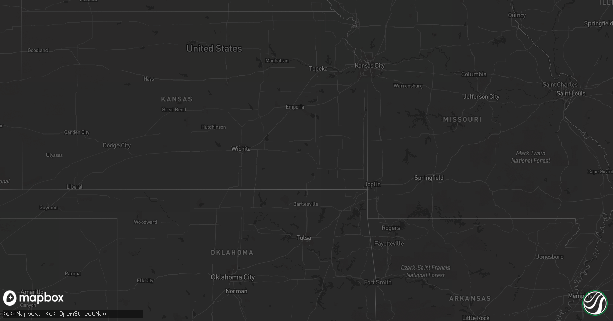
Hail Map on September 16, 2018
Get this storm
September 16 map
$229
one time, instant access
Download today. No call, no setup
Keep the $229
Bought the map and want the full workflow? Apply the entire $229 to a subscription within 7 days. None of it is wasted.
Every map, not just this one
This buys you this map. Subscription and you get every map we run, in the markets you choose from a few cities to whole states to nationwide. Plus real-time alerts the moment a storm fires.
Contact data
Name, contact info, occupancy, even credit band for addresses in the footprint. You go from where it hit to who to call.
Become the source they trust
Unlimited branding weather history reports on demand. You already have the documented answer ready for the property owner, and you are the one who showed up with it.
Property data and RoofTrace estimates
Pull up any address you have got, its value and the exact code rules for that jurisdiction, straight from One Click Code. Then RoofTrace estimates the squares, pitch, and roof value, priced the way you price.
States Impacted by Hail Map on September 16, 2018
Storm reports
Wisconsin
| Date | Description |
|---|---|
| 09/16/20186:27 AM CDT | Trees down. Delayed report. Time estimated. |
South Carolina
| Date | Description |
|---|---|
| 09/16/20184:59 PM CDT | A tornado caused minor damage to the tops of trees on the east side of blue moon drive as it moved north for 0.7 mile. It crossed harlees bridge road... And snapped sev |
| 09/16/20182:48 PM CDT | A tornado with estimated maximum winds of 75 mph touched down near sr 17-198 and skipped north along the east side of west county club road. Several large limbs were br |
| 09/16/201811:26 AM CDT | Tornado touched down south of lester rd between the little pee dee river and riverview loop. It crossed lester rd moving north... Broke large limbs out of several trees |
| 09/16/201811:17 AM CDT | A brief tornado touched down just north of broadway at the beach in myrtly beach... Sc at 12:17 pm and was on the ground for approximately 2 minutes |
| 09/16/201811:16 AM CDT | Video captured waterspout coming onshore as a tornado near 21st ave in myrtle beach. |
| 09/15/20188:22 PM CDT | A brief tornado touched down in northern horry county causing spotty damage to pine trees and minor roof damage. |
North Carolina
| Date | Description |
|---|---|
| 09/16/20185:30 PM CDT | Trained spotter saw a rain wrapped tornado on the ground near exit 215 on i-85. |
| 09/16/20183:48 PM CDT | Tree down |
| 09/16/20183:29 PM CDT | Tornado touched down south of sr 1134... Moved north for 0.25 mile... And lifted on north side of sr 1134. Minor to substantial tree damage was noted along the path. Ma |
| 09/16/20182:35 PM CDT | Sheriff observed tornado touch down on nearby field near gaddys mill rd. |
| 09/16/20186:45 AM CDT | At 1144 PM EDT, a severe thunderstorm was located near Elizabethtown, moving north at 35 mph. HAZARD...60 mph wind gusts. SOURCE...Radar indicated. IMPACT...Expect wind damage to trees and power lines. Locations impacted include... Elizabethtown, Ammon, White Lake and Bladen County Hospital. |
| 09/16/20186:07 AM CDT | Trees down and minor strucural damage to homes on leo drive... Lynhaven drive... And watson lane. |
| 09/16/20185:55 AM CDT | At 1055 PM EDT, a severe thunderstorm was located near Williams, or near Whiteville, moving northeast at 30 mph. HAZARD...60 mph wind gusts. SOURCE...Radar indicated. IMPACT...Expect wind damage to trees and power lines. Locations impacted include... Whiteville, Chadbourn, Hallsboro, Lisbon, Abbottsburg, Redbug, Sidney, Elkton, Emerson, Southeastern Community College, Clarendon, Williams, Mollie, Brunswick, Clarkton and Columbus Regional Healthcare System.This includes US Route 74 between mile markers 384 and 400. |
| 09/16/20184:58 AM CDT | Trees reported down on william court. |
| 09/16/20184:58 AM CDT | Tree damage on william drive which is adjacent to william court. |
| 09/16/20182:57 AM CDT | Wayne co emergency management report trees down and some minor structural damage to a home on mount carmel church road. |
| 09/16/20182:55 AM CDT | A short lived and weak ef0 tornado with maximum wind speeds of 70 mph associated with tropical depression florence touched down in the pre-dawn hours just east of the w |
| 09/15/201811:26 PM CDT | Law enforcement report roofs off buildings in the roseboro area. |
| 09/15/201811:26 PM CDT | Deputies report tin roofing and debris in the road near roseboro/salemburg coincident with a tds signature on both the krax and kltx radars. |
| 09/15/20189:38 PM CDT | Nws storm survey assessed damage from a possible tornado near tabor city... Nc and found evidence of a 105 mph... Ef1 tornado. Abount 50 large trees were snapped or upr |
| 09/15/20188:40 PM CDT | Stokes county 911 center reported about 10 trees down in the last couple of hours across the county and as many as 20 total for the day. |
Florida
| Date | Description |
|---|---|
| 09/16/20183:45 PM CDT | Action news jacksonville reports a large tree downed over a residence along salt marsh circle in ponte vedra that resulted in substantial damage to the home.time of dam |
| 09/15/201811:28 PM CDT | At 427 PM EDT, a severe thunderstorm was located over Durbin, or 8 miles east of Fruit Cove, moving northeast at 10 mph. HAZARD...60 mph wind gusts. SOURCE...Radar indicated. IMPACT...Expect damage to roofs, siding, and trees. Locations impacted include... Ponte Vedra Beach, Palm Valley, Sawgrass, Nocatee, Bayard, Durbin and Guana River State Park. |