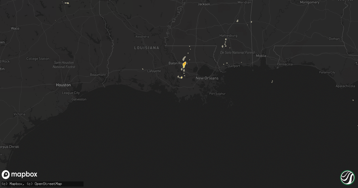
Hail Map on September 22, 2011
Get this storm
September 22 map
$229
one time, instant access
Download today. No call, no setup
Keep the $229
Bought the map and want the full workflow? Apply the entire $229 to a subscription within 7 days. None of it is wasted.
Every map, not just this one
This buys you this map. Subscription and you get every map we run, in the markets you choose from a few cities to whole states to nationwide. Plus real-time alerts the moment a storm fires.
Contact data
Name, contact info, occupancy, even credit band for addresses in the footprint. You go from where it hit to who to call.
Become the source they trust
Unlimited branding weather history reports on demand. You already have the documented answer ready for the property owner, and you are the one who showed up with it.
Property data and RoofTrace estimates
Pull up any address you have got, its value and the exact code rules for that jurisdiction, straight from One Click Code. Then RoofTrace estimates the squares, pitch, and roof value, priced the way you price.
States Impacted by Hail Map on September 22, 2011
Storm reports
Tennessee
| Date | Description |
|---|---|
| 09/22/20113:30 PM CDT | Tree fell on a house. Reported by dispatch. |
| 09/22/20113:30 PM CDT | Dispatch reported trees down at 3187 candies creek ridge road...mcpherson road...8011 eureka road northwest...and moore circle road northwest. |
Louisiana
| Date | Description |
|---|---|
| 09/22/20115:38 PM CDT | Numerous trees down. |
| 09/22/20115:10 PM CDT | A tree was blown down on a house on burgess avenue. |
| 09/22/20115:10 PM CDT | Quarter size hail was observed. |
| 09/22/20115:05 PM CDT | A tree was blown donw on a house on dabney street. |
| 09/22/20115:00 PM CDT | Golfball size hail was reported south of denham springs. |
Georgia
| Date | Description |
|---|---|
| 09/22/20115:50 PM CDT | Forysth county emegency management relayed report of a tree downed along bettis tribble gap road. Power outages were also reported in the silver city area. |
| 09/22/20115:50 PM CDT | Location just west of silver city. 5 trees down. 1 down on house. 3 of them were snapped in half. A power pole was snapped. |
Arkansas
| Date | Description |
|---|---|
| 09/22/20114:23 PM CDT | Trees blocking hwy 82 west of magnolia |
| 09/22/20114:12 PM CDT | Power pole down and power out hwy 29 north of lewisville |
| 09/21/20118:00 PM CDT | Trees across road |
| 09/21/20117:20 PM CDT | Trees down. Reported by ashley s.o. |
Mississippi
| Date | Description |
|---|---|
| 09/21/20118:35 PM CDT | Downed trees in the cemetery and on poplar and oak streets. |
Cities Impacted by Hail Map on September 22, 2011
- Carrollton, GA
- Bowdon, GA
- Waco, GA
- Hermitage, AR
- Gadsden, AL
- Crowley, LA
- Prairieville, LA
- Geismar, LA
- Seville, FL
- Del Rio, TX
- Denham Springs, LA
- Bushnell, FL
- Floral City, FL
- Sebring, FL
- Vidalia, GA
- Ailey, GA
- Tarrytown, GA
- Dryden, TX
- Hamburg, AR
- Greensburg, LA
- Baton Rouge, LA
- Walker, LA
- Comstock, TX
- Napoleonville, LA
- Plattenville, LA
- Holden, LA
- Lyons, GA
- Collins, GA
- Reidsville, GA
- McNeil, AR
- Magnolia, AR
- Charleston, TN
- Cleveland, TN
- Calhoun, TN
- Longwood, FL
- Portland, AR
- Pomona Park, FL
- Crescent City, FL
- Spearsville, LA
- Belle Rose, LA
- Georgetown, TN
- Fort Myers, FL
- Purvis, MS
- Waldo, AR
- Sylvania, AL
- Rainsville, AL
- Henagar, AL
- Saint James, LA
- Alva, FL
- Montrose, AR
- Rock Island, TN
- Spencer, TN
- Doyle, TN
- Quebeck, TN
- Sparta, TN
- Lake Mary, FL
- Sanford, FL
- Parkdale, AR
- Stamps, AR
- Lewisville, AR
- Buckner, AR
- Bronson, FL
- Tyler, TX
- Wilmot, AR
- Brackettville, TX
- Lumberton, MS
- Waynesboro, MS
- Claxton, GA
- Pembroke, GA
- Statesboro, GA
- Register, GA
- Darrow, LA
- Donaldsonville, LA
- Bonita Springs, FL
- Crossett, AR
- El Dorado, AR
- Junction City, AR
- Gonzales, LA
- Geneva, FL
- Queen City, TX
- Chattanooga, TN
- Tullahoma, TN
- Laurel, MS
- Heidelberg, MS
- Pierre Part, LA
- Avon Park, FL
- Pass Christian, MS
- Oviedo, FL
- Riceville, TN
- Stevenson, AL
- Manchester, TN
- Morrison, TN
- Tampa, FL
- Peachtree City, GA
- Hillsboro, TN
- Maud, TX
- Valley Head, AL
- Fort Payne, AL
- Pisgah, AL
- Strong, AR
- Silas, AL
- Palestine, TX
- Venus, FL
- Kiln, MS
- Brooklet, GA