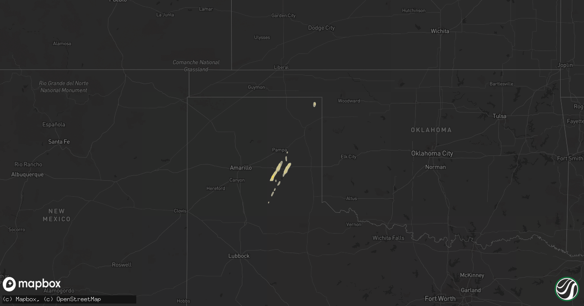
Hail Map on December 12, 2015
Get this storm
December 12 map
$229
one time, instant access
Download today. No call, no setup
Keep the $229
Bought the map and want the full workflow? Apply the entire $229 to a subscription within 7 days. None of it is wasted.
Every map, not just this one
This buys you this map. Subscription and you get every map we run, in the markets you choose from a few cities to whole states to nationwide. Plus real-time alerts the moment a storm fires.
Contact data
Name, contact info, occupancy, even credit band for addresses in the footprint. You go from where it hit to who to call.
Become the source they trust
Unlimited branding weather history reports on demand. You already have the documented answer ready for the property owner, and you are the one who showed up with it.
Property data and RoofTrace estimates
Pull up any address you have got, its value and the exact code rules for that jurisdiction, straight from One Click Code. Then RoofTrace estimates the squares, pitch, and roof value, priced the way you price.
Storm reports
Oklahoma
| Date | Description |
|---|---|
| 12/11/20157:45 PM CST | Damaged homes....down trees... And power lines near slim road...roof road....pine creek...peaceful home road. |
| 12/11/20157:25 PM CST | *** 2 inj *** damaged homes....down trees... And power lines... Near slim road...roof road....pine creek...peaceful home road. |
| 12/11/20157:17 PM CST | *** 3 inj *** nws survey crew confirms an ef-2 tornado began just south of us hwy 70 west of valliant and traveled nne for over 7 miles ending very close to pine creek |
| 12/11/20156:04 PM CST | Dozens of trees snapped or uprooted in raymond gary state park. Rated ef-1 by the survey team. |
| 12/11/20156:01 PM CST | Several trees downed in raymond gary state park |
Texas
| Date | Description |
|---|---|
| 12/12/20155:53 PM CST | Brief tornado touchdown as shown in storm chaser video. |
| 12/12/20155:14 PM CST | An ef-1 tornado briefly developed near the intersection of fm 411 and county road 1245. Some trees were snapped and an outbuilding was completely destroyed. |
| 12/12/20155:04 PM CST | Tree down highway 37 |
| 12/12/20154:59 PM CST | Nws survey crew confirms an ef-1 tornado ssw of bogata tx. Several trees had limbs broken or snapped trunks. The most significant damage occurred when most of the roof |
| 12/12/20154:46 PM CST | Power outages and trees down 37 south and fm196 |
| 12/12/20154:46 PM CST | Damage to dairy farm near county road 900 ...3170...and 3190 |
| 12/12/20154:18 PM CST | *** 2 inj *** nws survey crew confirms an ef-2 tornado between winnsboro and i-30 and travelled north just east of the hopkins/franklin county. 20 structures were damag |
| 12/12/20153:53 PM CST | Uprooted trees and damage to one business reported at interstate 45 and shepherd hill road. Damage to several rv nearby to business. Damage rating pending assessment. |
| 12/12/20153:53 PM CST | Uprooted trees and damage to one business reported at interstate 45 and shepherd hill road. Possible tornado. |
| 12/12/20153:25 PM CST | Originally reported by local law enforcement. Nws survey crew confirms ef-2 tornado travelled north through the east side of lindale. Appox. 50 homes sustained damage w |
| 12/12/20153:20 PM CST | Confirmed tornado in lindale area. Homes damaged. |
| 12/12/20155:25 AM CST | An nws storm survey concluded that storm damage south and northeast of quitman was consistent with that of straight line wind gusts. This damage began near randy road t |
| 12/12/20153:35 AM CST | 62 mph wind gust rported by the asos in rockwall |
| 12/12/20153:00 AM CST | Wooden fence blown down. Chicken coop and trash cans blown into field to the north of the location approx 200-300 yards |
| 12/12/20152:15 AM CST | Wind speed was estimated to be at least 60 mph if not higher |
| 12/12/20152:08 AM CST | 60 mph wind gust reported by dfw asos |
| 12/12/20152:08 AM CST | Some shingle damage and miscellaneous holiday decorations damaged. Davis weather unit anemometer used for report. |
| 12/12/20152:00 AM CST | Delayed report---public sent pictures of wind damage to barn near itasca. Time estimated at around 200-210 am on sunday via radar. |
| 12/12/20152:00 AM CST | Wooden fencing blown down along with shingles torn from roof...time estimated by radar |
| 12/12/20151:08 AM CST | 53 knot or 61 mph windgust measured by the hondo asos. |
| 12/12/20151:00 AM CST | Wind gusts e60-70mph...8-10 inch dia. Trunk trees downed...a barn steel-anchored in concrete was lifted out of ground...a 12 ft. Feed trough was blown over 100 yds and |
| 12/12/201512:30 AM CST | Houses damaged...trees and powerlines down on north side of lake hawkins near the intersection of cr 3810 and 3811 |
| 12/11/201511:05 PM CST | High wind gusts caused downed power lines and city power outages...time estimated by radar |
| 12/11/20159:38 PM CST | A local report indicates 60 MPH wind near FUNSTON |
| 12/11/20158:42 PM CST | Hail up to the size of half dollars was covering road near follett. |
| 12/11/20158:30 PM CST | *** 2 inj *** spotter called with straightline wind damage. 1 eight inch diameter tree uprooted. 1 ten inch cedar tree downed. 6 vehicle windows broken. Gutters ripped |
| 12/11/20158:10 PM CST | Power pole down at interstate 20 and mile marker 239. |
| 12/11/20157:25 PM CST | Trees down north of clarksville near highway 37. |
| 12/11/20157:17 PM CST | Sterling city has no power at this time. |
| 12/11/20156:32 PM CST | Quarter size hail fell along fm 291. |
| 12/11/20156:30 PM CST | A local report indicates 64 MPH wind near 5 SW ST. LAWRENCE |
| 12/11/20156:17 PM CST | Sterling city has no power at this time. |
Arkansas
| Date | Description |
|---|---|
| 12/11/201510:47 PM CST | Tree uprooted |
| 12/11/201510:45 PM CST | 2 sheds from the lowes blew into the walmart parking lot. Some roof damage to the garden center at the lowes. Tree damage extends from siloam springs to gentry. |
| 12/11/201510:45 PM CST | Several trees uprooted to the north and northwest just north of arkotex road |
| 12/11/201510:41 PM CST | Trees damaged near kenwood street and lewis circle |