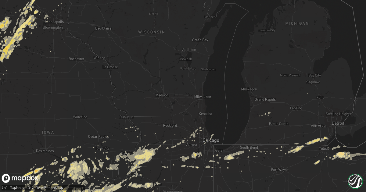
Hail Map in Michigan on May 29, 2011
Get this storm
May 29 map
$229
one time, instant access
Download today. No call, no setup
Keep the $229
Bought the map and want the full workflow? Apply the entire $229 to a subscription within 7 days. None of it is wasted.
Every map, not just this one
This buys you this map. Subscription and you get every map we run, in the markets you choose from a few cities to whole states to nationwide. Plus real-time alerts the moment a storm fires.
Contact data
Name, contact info, occupancy, even credit band for addresses in the footprint. You go from where it hit to who to call.
Become the source they trust
Unlimited branding weather history reports on demand. You already have the documented answer ready for the property owner, and you are the one who showed up with it.
Property data and RoofTrace estimates
Pull up any address you have got, its value and the exact code rules for that jurisdiction, straight from One Click Code. Then RoofTrace estimates the squares, pitch, and roof value, priced the way you price.
Storm reports in Michigan
Michigan
| Date | Description |
|---|---|
| 05/29/20115:30 PM CDT | Peak wind measured at 74 mph and funnel cloud overhead. |
| 05/29/20115:21 PM CDT | An 8 to 12 inch diamter tree was blown down. |
| 05/29/20115:17 PM CDT | Large tree down across us-23. Estimated 2 foot diameter dead tree. |
| 05/29/20115:15 PM CDT | A local report indicates 70 MPH wind near LAPEER |
| 05/29/20115:14 PM CDT | House moved off foundation and apartment damage at brookshire apartments. |
| 05/29/20115:05 PM CDT | A local report indicates 70 MPH wind near 2 SSW FLINT |
| 05/29/20114:52 PM CDT | Twisted branches and 1 to 4 foot diameter trees down. |
| 05/29/20114:50 PM CDT | 2 to 5 inch diameter tree limbs blown down. |
| 05/29/20114:50 PM CDT | Numerous 6 to 8 inch diamter tree limbs down. |
| 05/29/20114:46 PM CDT | Multiple large limbs down. |
| 05/29/20114:45 PM CDT | 3 foot diameter tree down over road. |
| 05/29/20114:42 PM CDT | Several large trees were blown down. |
| 05/29/20114:40 PM CDT | Reports of trees down throughout tyrone township. One report estimated 50 to 70 trees down...some uprooted. |
| 05/29/20114:40 PM CDT | 10 inch tree limb down over road. |
| 05/29/20114:30 PM CDT | 3 to 4 small trees uprooted and/or snapped. |
| 05/29/20114:30 PM CDT | Large tree down across us-23. Estimated 2 foot diameter dead tree. |
| 05/29/20114:25 PM CDT | A storm survey conducted by the nws found ef1 tornado damage in shiawassee county. A tornado entered the county near lovejoy and locke roads and tracked northeast for 2 |
| 05/29/20114:21 PM CDT | 16 inch diameter healthy tree branch down just off road on willoughby just west of dobie. Tree branch was healthy. Fence damaged. Corrected lsr. |
| 05/29/20114:21 PM CDT | 18 inch diameter tree was blown onto the road. |
| 05/29/20114:20 PM CDT | Powerlines and trees down on holt road. Large trees in road. |
| 05/29/20114:16 PM CDT | Spotter reported extremely high winds with at least an inch of rain falling. |
| 05/29/20114:16 PM CDT | 30 foot tree sheared off 8 feet off the ground. |
| 05/29/20114:12 PM CDT | Scattered tree damage and power lines down near tucker and bellevue roads. Trees are 6 inches. |
| 05/29/20114:12 PM CDT | Multiple 2 to 3 foot diameter trees down. |
| 05/29/20114:12 PM CDT | Multiple trees down near holt. Trees appeared healthy and were up to 2 feet in diameter. |
| 05/29/20114:10 PM CDT | Second hand report from mason fire dept. Trees and powerlines reported down. |
| 05/29/20114:08 PM CDT | Two 2 ft diameter trees down near kinneville rd. One tree was on a house. Both appeared to be healthy. |
| 05/29/20114:07 PM CDT | Multiple large trees are down on cooper road near pleasant lake. There appears to be structural/property damage as well. |
| 05/29/20114:02 PM CDT | One home completely destroyed. 3 other homes damaged. |
| 05/29/20114:00 PM CDT | Numerous trees down blocking road near the intersection of bellevue highway and houston road. |
| 05/29/20113:54 PM CDT | A three and a half foot healthy tree is down. |
| 05/29/20113:54 PM CDT | Trees down with some house damage as well in the vicinity of duck lake. |
| 05/29/20113:53 PM CDT | Measured at brooks field in marshall. |
| 05/29/20113:49 PM CDT | Three trees down on pine street near eaton. Minor car damage. |
| 05/29/20113:45 PM CDT | 5 healthy trees uprooted in various directions on south clinton trail. |
| 05/29/20113:45 PM CDT | 3 large trees on top of house. Spotter currently blocked in. |
| 05/29/20113:44 PM CDT | Trees have been uprooted. Possible rotation in the area at the present time. |
| 05/29/20113:40 PM CDT | 60 mph estimated gust. Pea sized hail. Number of trees and power lines down. Trees lying in the same direction. |
| 05/29/20113:40 PM CDT | Lakeview middle school near columbia and helmer sustained damage. Trees down around the area as well. |
| 05/29/20113:35 PM CDT | Estimated around 50 trees down near the 100 block of south 30th street in battle creek. |
| 05/29/20113:35 PM CDT | Multiple trees down in the 1700 block of watkins road near battle creek. Trees range from 6 inches to 2 feet in diameter. |
| 05/29/20113:35 PM CDT | Multiple reports of estimate wind speeds around 60 mph throughout battle creek. |
| 05/29/20113:32 PM CDT | Multiple reports of damage for a quarter of a mile in the area of us 12 and i69 in coldwater. Roof off house and pole barn. Roof and doors off storage facility. Debris |
| 05/29/20113:30 PM CDT | Trees are blocking i-94 business loop. Location is approximate. |
| 05/29/20113:30 PM CDT | Numerous reports of trees and power lines down in northern part of county |
| 05/29/20113:25 PM CDT | Spotter estimated the winds of 75-80 mph just north of the kalamazoo/st. Joseph county line. |
| 05/29/20113:24 PM CDT | Possible tornado reported in vicksburg near sprinkle road. Reported as a funnel cloud which may have briefly touched down. |
| 05/29/20113:23 PM CDT | Multiple large trees down and blocking roads near columbia and 28th |
| 05/29/20113:23 PM CDT | Wind gust reported via the public in south portage |
| 05/29/20113:21 PM CDT | Multiple trees down. Snapped off at the base. Reported by vicksburg coop observer |
| 05/29/20113:21 PM CDT | Large grain silo destroyed. Roof taken off of a hog barn. |
| 05/29/20113:20 PM CDT | Silo...farm...and tree damage near the intersection of w avenue and 38th street. |
| 05/29/20113:18 PM CDT | Trees are down east of vicksburg with some impacts to property. Report from emergency manager. |
| 05/29/20113:15 PM CDT | Measured at bronson hospital parking ramp. |
| 05/29/20113:15 PM CDT | Numerous reports of trees and power lines down |
| 05/29/20113:15 PM CDT | Multiple trees down just south of vickburg. Silver st. Near the county line is nearly impassable. |
| 05/29/20113:10 PM CDT | Trees down on 6 to 10 houses. Uprooted trees as well |
| 05/29/20113:10 PM CDT | Measured in downtown schoolcraft. |
| 05/29/20113:10 PM CDT | Large tree down and another tree split |
All States Impacted by Hail Map on May 29, 2011
Cities Impacted by Hail Map on May 29, 2011
- Momence, IL
- West Point, IA
- Woodburn, IA
- Gaylord, KS
- Cedar, KS
- Watkins, MN
- Litchfield, MN
- Eden Valley, MN
- Greenville, PA
- Fredonia, PA
- Transfer, PA
- Hutchinson, MN
- Askov, MN
- Bruno, MN
- Trivoli, IL
- Glasford, IL
- Hanna City, IL
- Chicago, IL
- Foley, MN
- Clear Lake, MN
- Sauk Rapids, MN
- Saint Cloud, MN
- Clearwater, MN
- Kellerton, IA
- Redding, IA
- Mount Ayr, IA
- Lindsey, OH
- Fremont, OH
- Oak Harbor, OH
- Memphis, MO
- Hartington, NE
- Annandale, MN
- Maple Lake, MN
- Clio, IA
- Allerton, IA
- Lake City, PA
- Fairview, PA
- Alexandria, MO
- Wayland, MO
- Caledonia, NY
- Armour, SD
- Ivanhoe, MN
- Flandreau, SD
- Dell Rapids, SD
- Garretson, SD
- Pipestone, MN
- Trent, SD
- Jasper, MN
- Siren, WI
- Frederic, WI
- Grantsburg, WI
- Gilson, IL
- Dahinda, IL
- Middleville, MI
- Shelbyville, MI
- Delton, MI
- Wayland, MI
- Winthrop, MN
- Gibbon, MN
- Dassel, MN
- Kimball, MN
- Darwin, MN
- Murray, IA
- Osceola, IA
- New Virginia, IA
- Shannon City, IA
- Afton, IA
- Thayer, IA
- Diagonal, IA
- Sleepy Eye, MN
- Adrian, MI
- Palmyra, MI
- Sand Creek, MI
- Morenci, MI
- Dundee, MI
- Riga, MI
- Petersburg, MI
- Deerfield, MI
- Blissfield, MI
- Clayton, MI
- Jasper, MI
- Atwater, MN
- Geneseo, IL
- Rock Rapids, IA
- Fulda, MN
- Montezuma, IA
- Belmont, NY
- Bonfield, IL
- Westfield, IA
- Hinton, IA
- Merrill, IA
- Le Mars, IA
- Mystic, IA
- Ewing, NE
- Clearwater, NE
- Orchard, NE
- Lynch, NE
- Hitchcock, SD
- Comfrey, MN
- Tabor, SD
- Niobrara, NE
- Springfield, SD
- Verdigre, NE
- Center, NE
- Bloomfield, NE
- Gordon, WI
- Garrett, WY
- Clarendon, PA
- La Crosse, KS
- Harvey, IA
- Pella, IA
- Redwood Falls, MN
- Dante, SD
- Wagner, SD
- Avon, SD
- Wabasso, MN
- Vesta, MN
- Seaforth, MN
- Roseville, IL
- Avon, IL
- Morgan, MN
- Springfield, MN
- Alvordton, OH
- Pioneer, OH
- Franklin, MN
- Albia, IA
- Williamsfield, OH
- Jamestown, PA
- Hartstown, PA
- Atlantic, PA
- Adamsville, PA
- Kinsman, OH
- Unionville, IA
- Blakesburg, IA
- Moravia, IA
- Minong, WI
- Rio, IL
- Warren, OH
- Port Clinton, OH
- Russell, IA
- Melrose, IA
- Lovilia, IA
- Bussey, IA
- Great Valley, NY
- Middlefield, OH
- Stanley, NY
- Canandaigua, NY
- Renville, MN
- Danube, MN
- Blomkest, MN
- Gibsonburg, OH
- Garrettsville, OH
- Hiram, OH
- Burton, OH
- Akron, IA
- Unionville, MO
- Cincinnati, IA
- Centerville, IA
- Seymour, IA
- Martin, MI
- Searsboro, IA
- Malcom, IA
- Warren, PA
- Plano, IA
- Promise City, IA
- Wilson, WI
- Clinton, IA
- Bryant, IA
- New Windsor, IL
- North Henderson, IL
- Fairbury, NE
- Hubbell, NE
- Reynolds, NE
- Hebron, NE
- Little Falls, MN
- Omaha, NE
- Humeston, IA
- Corydon, IA
- Platteville, WI
- Tampico, IL
- Buffalo, MN
- Pierce, NE
- Avon Lake, OH
- Huron, SD
- Shell Lake, WI
- Spooner, WI
- Inman, NE
- Page, NE
- Hatfield, MO
- Eagleville, MO
- Martinsville, MO
- Lake Lillian, MN
- Prinsburg, MN
- Raymond, MN
- Olivia, MN
- Willmar, MN
- Sacred Heart, MN
- Nappanee, IN
- Milford, IN
- Taunton, MN
- Brookings, SD
- Canby, MN
- Hendricks, MN
- Minneota, MN
- Porter, MN
- White, SD
- Aurora, SD
- Bruce, SD
- Astoria, SD
- Howard Lake, MN
- Silver Lake, MN
- Cokato, MN
- Osmond, NE
- Southington, OH
- Bristolville, OH
- West Farmington, OH
- Springbrook, WI
- Lismore, MN
- Erie, PA
- Cambridge, IL
- Hedrick, IA
- Hayesville, IA
- Delta, IA
- Sigourney, IA
- Oneill, NE
- Huntsburg, OH
- Montville, OH
- Windsor, OH
- Webster, SD
- Valparaiso, IN
- Tioga, PA
- Nelson, PA
- Lawrenceville, PA
- Kouts, IN
- Luray, MO
- La Harpe, IL
- Kahoka, MO
- Raritan, IL
- Argyle, IA
- Hamilton, IL
- Niota, IL
- Nauvoo, IL
- Donnellson, IA
- Dallas City, IL
- Lomax, IL
- Saint Patrick, MO
- Keokuk, IA
- Blandinsville, IL
- Montrose, IA
- Fort Madison, IA
- Carthage, IL
- Revere, MO
- Streator, IL
- Tonica, IL
- Ladysmith, WI
- Truro, IA
- Vickery, OH
- Lakeside Marblehead, OH
- Parkston, SD
- Lesterville, SD
- Utica, SD
- Menno, SD
- Marshall, MN
- Clarkfield, MN
- Echo, MN
- Wood Lake, MN
- Hanley Falls, MN
- Cottonwood, MN
- Granite Falls, MN
- Bingham Lake, MN
- Jeffers, MN
- Sanborn, MN
- Windom, MN
- Glen Elder, KS
- Beloit, KS
- Mankato, KS
- Putnam, IL
- McNabb, IL
- Magnolia, IL
- Hennepin, IL
- Henry, IL
- South Bend, IN
- Joliet, IL
- Orwell, OH
- Chardon, OH
- North Bloomfield, OH
- Raymond, SD
- Illinois City, IL
- Reynolds, IL
- Davenport, IA
- Milan, IL
- Andalusia, IL
- Buffalo, IA
- Taylor Ridge, IL
- Blue Grass, IA
- Muscatine, IA
- Joy, IL
- New Boston, IL
- Bloomfield, IA
- Gackle, ND
- Atkinson, IL
- Prophetstown, IL
- Clara City, MN
- Ghent, MN
- Belview, MN
- Volga, SD
- Kandiyohi, MN
- Hayward, WI
- Guernsey, IA
- Deep River, IA
- Brooklyn, IA
- Downing, MO
- Smithshire, IL
- Kankakee, IL
- Bourbonnais, IL
- Saint Anne, IL
- Rock Valley, IA
- Letcher, SD
- Artesian, SD
- Big Rock, IL
- Cleveland, OH
- Maple Heights, OH
- Potosi, WI
- West Unity, OH
- Fayette, OH
- Edon, OH
- Montpelier, OH
- Kimball, SD
- Pukwana, SD
- South Haven, MN
- Glenvil, NE
- Fairview, IL
- Ellisville, IL
- London Mills, IL
- Canton, IL
- Cantril, IA
- Douds, IA
- Pulaski, IA
- Keosauqua, IA
- Milton, IA
- Mineral Point, WI
- Wessington Springs, SD
- Eldon, IA
- Floris, IA
- Minooka, IL
- Channahon, IL
- Stacy, MN
- Wyoming, MN
- Geneseo, NY
- Weldon, IA
- Grand River, IA
- Van Wert, IA
- Tracy, MN
- Walnut Grove, MN
- Jackson, MN
- Hays, KS
- Schoenchen, KS
- Wolsey, SD
- Knoxville, IA
- Lacona, IA
- Melcher Dallas, IA
- Millersburg, IN
- Ligonier, IN
- Verona, IL
- Kinsman, IL
- New Ulm, MN
- Galesburg, IL
- Savanna, IL
- Prairie Farm, WI
- Woodhull, IL
- Brownton, MN
- Dewittville, NY
- Sinclairville, NY
- Stockton, NY
- Hamlet, IN
- Knox, IN
- Plainwell, MI
- Morton, MN
- Clements, MN
- Hamilton, IA
- Hertel, WI
- Howard, SD
- Tyndall, SD
- Tripp, SD
- Scotland, SD
- Kaylor, SD
- Rudolph, OH
- Custar, OH
- Wheeling, IL
- Buffalo Grove, IL
- Arlington Heights, IL
- Prospect Heights, IL
- Buffalo Lake, MN
- Hector, MN
- Fairfax, MN
- Stewart, MN
- Bertha, MN
- Sandusky, OH
- Keithsburg, IL
- Oakville, IA
- Owosso, MI
- Deshler, OH
- Bowling Green, OH
- Weston, OH
- Cygnet, OH
- Portage, OH
- Mitchell, SD
- Ethan, SD
- Almond, NY
- Independence, OH
- Corsica, SD
- Dimock, SD
- Mount Vernon, SD
- Fulton, SD
- Freeman, SD
- Bridgewater, SD
- Clifton Springs, NY
- Chariton, IA
- Wever, IA
- Randall, MN
- Wahkon, MN
- Alexis, IL
- Union Mills, IN
- La Porte, IN
- Kingsford Heights, IN
- Willseyville, NY
- Spencer, NY
- Ellston, IA
- Walnut, IL
- Hooppole, IL
- Sheffield, IL
- Mineral, IL
- Osco, IL
- Kewanee, IL
- Annawan, IL
- Canisteo, NY
- Eureka, SD
- Zeeland, ND
- Cattaraugus, NY
- Little Valley, NY
- Randolph, NY
- Lancaster, MO
- Queen City, MO
- Shorewood, IL
- Ottumwa, IA
- Fremont, IA
- Ransom, IL
- Inland, NE
- Harvard, NE
- Hastings, NE
- Pekin, IL
- Monticello, MN
- Alpena, SD
- Berwyn, IL
- Oak Park, IL
- Cicero, IL
- Deerfield, IL
- Brandon, MN
- Royal, NE
- Wanatah, IN
- Bergen, NY
- Byron, NY
- Esbon, KS
- Osborne, KS
- Cawker City, KS
- Downs, KS
- Tipton, KS
- Waldo, KS
- Glencoe, MN
- Lester Prairie, MN
- Virgil, SD
- Allegan, MI
- Lakefield, MN
- Spirit Lake, IA
- Chagrin Falls, OH
- Ainsworth, IA
- Amboy, IL
- Dixon, IL
- Faulkton, SD
- Brainerd, MN
- Franklin, PA
- Walworth, NY
- Marion, NY
- Troupsburg, NY
- Waterport, NY
- Medina, NY
- Lyndonville, NY
- Elgin, NE
- Leighton, IA
- Oskaloosa, IA
- Tracy, IA
- New Germany, MN
- Mayer, MN
- Bison, KS
- Oak Park, MN
- Monmouth, IL
- Selby, SD
- Java, SD
- Chillicothe, IA
- Eddyville, IA
- Cedar, IA
- Drakesville, IA
- Kirkville, IA
- Rose Hill, IA
- Inavale, NE
- Platte, SD
- Cable, WI
- Morris, IL
- Burr Oak, KS
- Mountain Lake, MN
- Winsted, MN
- Princeton, MO
- Ophiem, IL
- Alpha, IL
- Lynn Center, IL
- Hammondsport, NY
- Bedford, OH
- Solon, OH
- Worthington, MN
- Glenwood, MO
- Lehr, ND
- Delmont, SD
- Pemberville, OH
- Clarks Mills, PA
- Marinette, WI
- Wausa, NE
- Magnet, NE
- Randolph, NE
- Mclean, NE
- Morrison, IL
- Sterling, IL
- Lyndon, IL
- Rolling Meadows, IL
- Palatine, IL
- Schaumburg, IL
- Solon Springs, WI
- Viola, IL
- Salem, IA
- Brewster, MN
- Storden, MN
- Heron Lake, MN
- Rushmore, MN
- Bigelow, MN
- Reading, MN
- Westbrook, MN
- Winnetoon, NE
- Creighton, NE
- Brunswick, NE
- Sioux City, IA
- Slayton, MN
- Oneida, IL
- Grand View, WI
- Drummond, WI
- Mason, WI
- Beecher, IL
- Cedar Lake, IN
- Lowell, IN
- Grant Park, IL
- Waverly, MN
- Powersville, MO
- Mercer, MO
- Forman, ND
- Wheatfield, IN
- Rensselaer, IN
- Monroe, MI
- Ida, MI
- Barron, WI
- Cortland, OH
- North Branch, MN
- Denver, MO
- Albany, MO
- Kane, PA
- Sheffield, PA
- Angola, IN
- Batavia, IA
- Grant City, MO
- Farmdale, OH
- Lineville, IA
- Foxboro, WI
- Lockridge, IA
- Brighton, IA
- Keota, IA
- Fairfield, IA
- Washington, IA
- Luckey, OH
- Harper, IA
- Trego, WI
- Victoria, KS
- Fayette, NY
- Romulus, NY
- Waterloo, NY
- Geneva, NY
- Seneca Falls, NY
- Elwood, IL
- Euclid, OH
- Lakewood, OH
- Beachwood, OH
- Rocky River, OH
- Currie, MN
- Danbury, WI
- Webster, WI
- New London, IA
- Danville, IA
- Biggsville, IL
- Crawfordsville, IA
- Wayland, IA
- Mount Pleasant, IA
- Clayton, WI
- Clear Lake, WI
- Montrose, MN
- Orange City, IA
- Ashley, ND
- Nichols, IA
- Columbus Junction, IA
- Letts, IA
- Conesville, IA
- Orion, IL
- Coal Valley, IL
- Toronto, SD
- Galva, IL
- Iona, MN
- Wilmont, MN
- Hinsdale, NY
- Allegany, NY
- Packwood, IA
- Ollie, IA
- Carpenter, SD
- Doland, SD
- Clark, SD
- Van Etten, NY
- Cayuta, NY
- Arbela, MO
- Chenoa, IL
- Sherman, NY
- Panama, NY
- Clymer, NY
- Olivet, SD
- Watertown, MN
- Lamberton, MN
- Norwood Young America, MN
- Plato, MN
- Young America, MN
- West Chicago, IL
- Warrenville, IL
- Erie, IL
- Hanna, IN
- La Crosse, IN
- Davis City, IA
- Leon, IA
- Cainsville, MO
- Bremen, IN
- Decatur, IA
- Osseo, MN
- Maple Grove, MN
- Loretto, MN
- Rogers, MN
- Hamel, MN
- Cameron, NY
- Lake Andes, SD
- Ree Heights, SD
- Deer Grove, IL
- New Bedford, IL
- Colona, IL
- Peru, IA
- Tingley, IA
- North Sioux City, SD
- Jefferson, SD
- Plainfield, IL
- Mokena, IL
- New Lenox, IL
- Manhattan, IL
- Millport, NY
- Pine Valley, NY
- Horseheads, NY
- Maquoketa, IA
- La Motte, IA
- Libertyville, IA
- Agency, IA
- Richland, IA
- Wessington, SD
- Canova, SD
- Grove City, MN
- Kirkland, IL
- Ortley, SD
- Alton, KS
- Barrington, IL
- Hillsboro, IA
- Bradley, SD
- Farmington, IA
- Miles, IA
- Solon, IA
- Cosmos, MN
- Belmont, WI
- Reddick, IL
- Gardner, IL
- South Wilmington, IL
- Elburn, IL
- McKean, PA
- Sciota, IL
- Earlville, IL
- Paw Paw, IL
- Shabbona, IL
- Jud, ND
- Jamestown, ND
- Montpelier, ND
- Goshen, IN
- Hannibal, MO
- New London, MO
- East Bethany, NY
- Pavilion, NY
- Stafford, NY
- Waldron, MI
- Hillsdale, MI
- Osseo, MI
- Pittsford, MI
- Freeport, MN
- Altona, IL
- Renner, SD
- Sioux Falls, SD
- Keswick, IA
- Hadley, PA
- Stoneboro, PA
- Jackson Center, PA
- Mercer, PA
- Harmon, IL
- Waubay, SD
- Conde, SD
- Bristol, SD
- Avoca, MN
- Hawarden, IA
- Ireton, IA
- Phillips, WI
- Catawba, WI
- Churchville, NY
- Freedom, NY
- Long Lake, MN
- Hall, NY
- Bellona, NY
- Penn Yan, NY
- Westfield, PA
- Miller, SD
- Maple Park, IL
- Pleasantville, IA
- Mediapolis, IA
- Morning Sun, IA
- Wapello, IA
- Tilden, NE
- Petersburg, NE
- Newman Grove, NE
- Ellendale, ND
- Winter, WI
- Glen Flora, WI
- Maurice, IA
- Peoria, IL
- Lostant, IL
- Arlington, MN
- Green Isle, MN
- Hamilton, IN
- Bryan, OH
- Pleasant Lake, IN
- Dundee, IL
- Hawkins, WI
- Caneadea, NY
- Browerville, MN
- Dwight, IL
- Lacarne, OH
- Castalia, OH
- Blythedale, MO
- Shinglehouse, PA
- Starbuck, MN
- Cyrus, MN
- Plymouth, IN
- Farmington, IL
- Elmwood, IL
- Nekoma, KS
- Edgerton, MN
- Sisseton, SD
- Lyons, IL
- Summit Argo, IL
- La Grange, IL
- Isle Saint George, OH
- Middle Bass, OH
- Fairfax, SD
- Spencer, NE
- Butte, NE
- Titusville, PA
- Lucan, MN
- Luck, WI
- Faribault, MN
- Morristown, MN
- Salamanca, NY
- Fullerton, ND
- Mantua, OH
- Pierz, MN
- Sioux Center, IA
- Brooklyn, WI
- Lisbon, IA
- Emery, SD
- Vernon Hills, IL
- Lake Zurich, IL
- Cameron Mills, NY
- Addison, NY
- Rice Lake, WI
- Selma, IA
- Herscher, IL
- Iowa City, IA
- Andover, MN
- Gorin, MO
- Rutledge, MO
- Wyaconda, MO
- Mount Sterling, IA
- Media, IL
- Bonaparte, IA
- Manito, IL
- Corry, PA
- Hubbard, NE
- Jackson, NE
- Batavia, IL
- Geneva, IL
- Prattsburgh, NY
- Bath, NY
- Avoca, NY
- Milo, IA
- Walkerton, IN
- Long Prairie, MN
- Oregon, OH
- Alexander, NY
- Hanover, IL
- Lowry, MN
- Farwell, MN
- Hancock, MN
- Winamac, IN
- Kewanna, IN
- Lamoni, IA
- Crown Point, IN
- Rochester, NY
- Bellevue, IA
- Mound City, SD
- Liebenthal, KS
- Ironton, MN
- Stickney, SD
- Plankinton, SD
- Saint John, IN
- Schererville, IN
- Merrillville, IN
- Sublette, IL
- Mendota, IL
- West Brooklyn, IL
- North Olmsted, OH
- Brookpark, OH
- Westlake, OH
- Olds, IA
- Winfield, IA
- Adrian, MN
- Bruce, WI
- Polo, IL
- Eldred, PA
- Turtlepoint, PA
- Seneca, IL
- North East, PA
- Findley Lake, NY
- Berwick, IL
- Howe, IN
- Lagrange, IN
- Lone Tree, IA
- Waterford, PA
- Moulton, IA
- Exline, IA
- Livonia, MO
- Sandstone, MN
- Silver Springs, NY
- Saint Charles, IL
- Wattsburg, PA
- Union City, PA
- Kill Buck, NY
- Newark, IL
- Marseilles, IL
- Cameron, IL
- Prairie City, IL
- Roanoke, IL
- Franklin Grove, IL
- Ashton, IL
- Elgin, IL
- Wayne, IL
- Hoffman Estates, IL
- Streamwood, IL
- Bartlett, IL
- South Elgin, IL
- Albany, MN
- Burtrum, MN
- Harrisburg, SD
- Canton, SD
- Green Valley, IL
- South Pekin, IL
- Weyerhaeuser, WI
- Wayzata, MN
- Minneapolis, MN
- Stoughton, WI
- Oregon, WI
- Sarona, WI
- Hinckley, IL
- Britton, SD
- Amherst, SD
- Langford, SD
- New Glarus, WI
- Belleville, WI
- Moline, IL
- Sherrard, IL
- Manlius, IL
- Rock Island, IL
- Wataga, IL
- Aledo, IL
- Gerlaw, IL
- Carbon Cliff, IL
- Port Byron, IL
- Albany, IL
- Andover, IL
- East Moline, IL
- Neponset, IL
- Hillsdale, IL
- Silvis, IL
- Lorimor, IA
- Cohocton, NY
- Otsego, MI
- Bowlus, MN
- Donovan, IL
- Penfield, NY
- Mapleton, IL
- Norris, IL
- Good Hope, IL
- Smithfield, IL
- Rome, OH
- Groton, SD
- Andover, SD
- Bloomfield, NY
- Gary, SD
- Dyer, IN
- Crete, IL
- Crofton, NE
- Tiffin, IA
- Williamsburg, IA
- Marion, SD
- Foreston, MN
- Spencerport, NY
- Erin, NY
- Hollandale, WI
- Kalona, IA
- Wellman, IA
- Demotte, IN
- Fair Oaks, IN
- Birmingham, IA
- Westville, IN
- Boone Grove, IN
- North Liberty, IN
- Hebron, IN
- Peninsula, OH
- Limestone, NY
- Cologne, MN
- Meadow Grove, NE
- Curtice, OH
- Brockport, NY
- Helena, OH
- Milan, OH
- Avon, OH
- Sheffield Lake, OH
- Huron, OH
- Lorain, OH
- Centerville, PA
- Revere, MN
- Friendship, NY
- Cuba, NY
- What Cheer, IA
- Barnes City, IA
- Essex, IL
- Alexander, KS
- Claire City, SD
- Yarmouth, IA
- Union Springs, NY
- Scipio Center, NY
- Alfred Station, NY
- Hornell, NY
- Alfred, NY
- Ferney, SD
- Victor, IA
- New Effington, SD
- Thomson, IL
- Mount Carroll, IL
- West Liberty, IA
- Stockport, IA
- Columbus, PA
- Lucas, KS
- Luray, KS
- Paradise, KS
- Leola, SD
- Rome City, IN
- Topeka, IN
- Finlayson, MN
- Andover, NY
- Scio, NY
- Canistota, SD
- Clear Lake, SD
- Estelline, SD
- Peoria Heights, IL
- East Peoria, IL
- Washington, IL
- Livonia, NY
- Hemlock, NY
- Olin, IA
- Brandon, SD
- Valley Springs, SD
- New Sharon, IA
- Hinckley, MN
- Brook Park, MN
- Waterman, IL
- Dekalb, IL
- Knoxville, IL
- Kennedy, NY
- Frewsburg, NY
- Cherry Creek, NY
- Cassadaga, NY
- Woonsocket, SD
- Butler, IN
- Waterloo, IN


