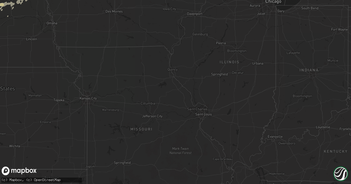
Hail Map on June 3, 2011
Get this storm
June 3 map
$229
one time, instant access
Download today. No call, no setup
Keep the $229
Bought the map and want the full workflow? Apply the entire $229 to a subscription within 7 days. None of it is wasted.
Every map, not just this one
This buys you this map. Subscription and you get every map we run, in the markets you choose from a few cities to whole states to nationwide. Plus real-time alerts the moment a storm fires.
Contact data
Name, contact info, occupancy, even credit band for addresses in the footprint. You go from where it hit to who to call.
Become the source they trust
Unlimited branding weather history reports on demand. You already have the documented answer ready for the property owner, and you are the one who showed up with it.
Property data and RoofTrace estimates
Pull up any address you have got, its value and the exact code rules for that jurisdiction, straight from One Click Code. Then RoofTrace estimates the squares, pitch, and roof value, priced the way you price.
States Impacted by Hail Map on June 3, 2011
Storm reports
New Mexico
| Date | Description |
|---|---|
| 06/02/20119:22 PM CDT | Kcvs asos. |
| 06/02/20117:03 PM CDT | Kcvs asos. |
Kansas
| Date | Description |
|---|---|
| 06/03/20111:05 AM CDT | The report was at the syracuse airport. |
| 06/02/20118:48 PM CDT | Numerous branches and a few power poles were downed. |
| 06/02/20118:45 PM CDT | Power poles were downed at the intersections of county roads 3 and p. |
| 06/02/20118:16 PM CDT | A local report indicates 59 MPH wind near JOHNSON CITY |
| 06/02/20118:00 PM CDT | Powerpoles snapped along rd 35 14 miles south of syracuse. |
Georgia
| Date | Description |
|---|---|
| 06/03/20116:25 PM CDT | Quarter sized hail reported by public along with tree limbs down |
| 06/03/20116:20 PM CDT | Quarter sized hail reported by public |
| 06/03/20116:09 PM CDT | A local report indicates 1.00 inch wind near 5 NW SYLVANIA |
| 06/03/20116:00 PM CDT | Burke county sheriff reports tree down on hwy 305 just north of gough |
| 06/03/20114:56 PM CDT | 2 trees down in rocky ford. |
| 06/03/20114:30 PM CDT | A local report indicates 1.00 inch wind near 1 SSE DEMOREST |
| 06/03/20114:30 PM CDT | A local report indicates 1.25 inch wind near CORNELIA |
| 06/03/20114:15 PM CDT | Hail slightly larger than golf ball broke car windshield. |
| 06/03/20114:10 PM CDT | Near the intersection of new liberty road and hollywood highway. |
| 06/03/20114:00 PM CDT | Trees down on powerlines near faith lane and hollywood highway. |
| 06/03/20113:58 PM CDT | Trees down on powerlines near new liberty road and okelly road. |
| 06/03/20117:01 AM CDT | Burke county dispatch reported several trees down south of waynesboro on porter carswell and rosier roads. |
| 06/02/20119:38 PM CDT | Irrigation systems turned over and numerous trees and power lines down. Time estimated by radar. |
| 06/02/20117:40 PM CDT | Trees down along portions of jones lake. Time estimated based on radar. |
| 06/02/20117:39 PM CDT | Quarter size hail near the tattnall county high school. |
| 06/02/20117:30 PM CDT | Golfball size hail fell off the mendes highway. |
| 06/02/20117:22 PM CDT | Quarter size hail covering the ground. Hail was wind driven by very high winds. |
| 06/02/20117:21 PM CDT | Quarter size hail was falling and was getting bigger. |
Louisiana
| Date | Description |
|---|---|
| 06/03/20116:48 PM CDT | Trees and power lines downed across the city |
| 06/03/20116:38 AM CDT | Public reported wind damage along i-49 between sunset and opelousas. Several trees and highway signs were blown down. |
| 06/02/20118:25 PM CDT | Trees were downed along state highway 605 south of newellton...one was downed across a bridge. |
| 06/02/20118:22 PM CDT | A couple power poles blown down. |
| 06/02/20118:05 PM CDT | Power lines downed...and a power pole was blown down along state highway 923 between jonesville and harrisonburg |
| 06/02/20118:00 PM CDT | Several trees and power lines downed across the city...some lines downed across houses. |
| 06/02/20117:37 PM CDT | Several trees and power lines down along hwy 566. |
| 06/02/20117:26 PM CDT | Multiple trees and power lines downed in the area...one tree was blocking the road...another tree fell on a home |
| 06/02/20117:17 PM CDT | A tree and power line were downed |
Mississippi
| Date | Description |
|---|---|
| 06/03/20116:45 PM CDT | A few trees were down along with a power line. |
| 06/03/20116:11 PM CDT | Trees and power lines were downed around hazlehurst. A power pole was snapped and several pieces of tin were thrown. Damage photos indicate 70-80 mph winds. |
| 06/02/20119:00 PM CDT | A few trees down...one across a rd. |
| 06/02/20118:15 PM CDT | Public report of dime to quarter size hail at teh intersection of hwy 63 and hwy 26 in lucedale. |
| 06/02/20117:57 PM CDT | Multiple trees downed in the city...one fell on a business |
| 06/02/20117:10 PM CDT | Several trees down on power lines. |
Iowa
| Date | Description |
|---|---|
| 06/03/20114:30 AM CDT | Pea to quarter sized hail |
| 06/03/20114:20 AM CDT | Primarily quarter sized hail with a few larger stones. Some damage to corn crops. |
| 06/03/20114:20 AM CDT | Mostly half inch hail with a few embedded one inch hail stones. Some corn leaves stripped in farm fields. Hail damage swath noted from 1 mile north to 1.5 miles south o |
| 06/03/20113:35 AM CDT | A local report indicates 65 MPH wind near STORM LAKE |
| 06/03/20113:20 AM CDT | Primarily quarter sized hail with a few larger stones. Some damage to corn crops. |
| 06/03/20113:20 AM CDT | Mostly half inch hail with a few embedded one inch hail stones. Some corn leaves stripped in farm fields. Hail damage swath noted from 1 mile north to 1.5 miles south o |
Nebraska
| Date | Description |
|---|---|
| 06/03/20111:30 AM CDT | Several 4 inch tree limbs busted. A few trees uprooted. |
| 06/02/20119:53 PM CDT | A local report indicates 1.00 inch wind near NORTH PLATTE |
| 06/02/20119:49 PM CDT | Deputy reported quarter to golf ball size hail at walker rd and buffalo rd in north platte. |
Michigan
| Date | Description |
|---|---|
| 06/03/201111:17 AM CDT | Wind gust measured from the northwest. |
| 06/03/20115:20 AM CDT | A local report indicates 1.50 inch wind near TOWER |
| 06/02/201110:17 PM CDT | Wind gust measured from the northwest. |
Wisconsin
| Date | Description |
|---|---|
| 06/02/20118:50 PM CDT | Time estimated from radar |
Colorado
| Date | Description |
|---|---|
| 06/02/20118:30 PM CDT | Several power poles down |
Oklahoma
| Date | Description |
|---|---|
| 06/02/20118:35 PM CDT | A local report indicates 64 MPH wind near 3 SSE BOISE CITY |
Cities Impacted by Hail Map on June 3, 2011
- Shell Rock, IA
- Waverly, IA
- Lorman, MS
- Grand Marais, MI
- Newberry, MI
- Winnebago, NE
- Anthon, IA
- Moville, IA
- Climbing Hill, IA
- Hornick, IA
- Colquitt, GA
- Girard, GA
- Brooklet, GA
- Lanse, MI
- Dougherty, IA
- Aredale, IA
- Sheffield, IA
- Correctionville, IA
- Glidden, WI
- Clarksville, IA
- Plainfield, IA
- Hovland, MN
- Grand Marais, MN
- Bay Minette, AL
- Herbster, WI
- Bayfield, WI
- Cornucopia, WI
- Indian River, MI
- Afton, MI
- Toccoa, GA
- Palmer, NE
- Bristow, IA
- Clayton, LA
- Ferriday, LA
- Winona, KS
- Leigh, NE
- Clarkson, NE
- Stanton, NE
- Loxley, AL
- Stapleton, AL
- Lucedale, MS
- Spalding, NE
- Keysville, GA
- Waynesboro, GA
- Louisville, GA
- Clarion, IA
- Goldfield, IA
- Minneapolis, MN
- Hampton, IA
- Primrose, NE
- Onaway, MI
- Galva, IA
- Mohawk, MI
- Copper Harbor, MI
- Defuniak Springs, FL
- Lula, GA
- Alto, GA
- North Platte, NE
- Clare, IA
- Eagle Grove, IA
- Badger, IA
- Fort Dodge, IA
- Vincent, IA
- Register, GA
- Statesboro, GA
- Galt, IA
- Wayne, NE
- Pender, NE
- Wisner, NE
- Wakefield, NE
- Pocahontas, IA
- Gilmore City, IA
- Palmer, IA
- Hoxie, KS
- Clovis, NM
- Belgrade, NE
- Humboldt, IA
- Thor, IA
- Lake Linden, MI
- Copper City, MI
- Allouez, MI
- Calumet, MI
- Ahmeek, MI
- Salix, IA
- Sloan, IA
- Oto, IA
- Glennville, GA
- Pilger, NE
- Ontonagon, MI
- Dumont, IA
- Clarkesville, GA
- Claxton, GA
- Reidsville, GA
- Jonesville, LA
- Sicily Island, LA
- Storm Lake, IA
- Schaller, IA
- Early, IA
- Tribune, KS
- Sheridan Lake, CO
- Cornelia, GA
- Maysville, GA
- Mount Airy, GA
- Homer, GA
- Baldwin, GA
- Lyons, GA
- Whigham, GA
- Natchez, MS
- Alanson, MI
- Cheboygan, MI
- Chassell, MI
- Toivola, MI
- Portal, GA
- Skanee, MI
- Emerson, NE
- Thurston, NE
- Colby, KS
- Sylvania, GA
- Wadley, GA
- Gilbert, LA
- Levant, KS
- Ojibwa, WI
- Exeland, WI
- Winter, WI
- Radisson, WI
- Madison, NE
- Cushing, IA
- Albion, NE
- Manson, IA
- Pomeroy, IA
- Jolley, IA
- Grand Portage, MN
- Silver Bay, MN
- Two Harbors, MN
- Monument, KS
- Oakley, KS
- Melrose, NM
- Vidalia, LA
- Pembroke, GA
- Almena, KS
- Greenwood, FL
- Marianna, FL
- Wilmer, AL
- Nemaha, IA
- Eckerman, MI
- Paradise, MI
- Robertsdale, AL
- Daphne, AL
- Sardis, GA
- Brutus, MI
- Newman Grove, NE
- Humphrey, NE
- Lindsay, NE
- Demorest, GA
- Midville, GA
- Wolbach, NE
- Greeley, NE
- Creston, NE
- Floyd, NM
- Columbus, NE
- Vidalia, GA
- Eight Mile, AL
- Semmes, AL
- Citronelle, AL
- Beemer, NE
- Holstein, IA
- Brady, NE
- Howells, NE
- Long Island, KS
- Ponce De Leon, FL
- Westville, FL
- Callaway, NE
- Molino, FL
- Bronson, IA
- Roswell, NM
- Collins, GA
- Newell, IA
- Alexander, IA
- Belmond, IA
- La Pointe, WI
- Pelkie, MI
- Atlantic Mine, MI
- Port Wing, WI
- Houghton, MI
- Saint Edward, NE
- Camilla, GA
- Michigamme, MI
- Pengilly, MN
- Ida Grove, IA
- Saint Ignace, MI
- Selden, KS
- Rexford, KS
- Gem, KS
- Vinegar Bend, AL
- Damascus, GA
- Burwell, NE
- Curtis, NE
- Milton, FL
- Cairo, GA
- Pelham, GA
- Bainbridge, GA
- Stapleton, NE
- Fonda, IA
- Latimer, IA
- Central City, NE
- Maxwell, NE
- Fullerton, NE
- Cuthbert, GA
- Rocky Ford, GA
- Alta, IA
- Odebolt, IA
- Sac City, IA
- Varina, IA
- Battle Creek, IA
- Danbury, IA
- Albert City, IA
- North Loup, NE
- Scotia, NE
- Grady, NM
- Millersburg, MI
- Comstock, NE
- Goetzville, MI
- Minden, NE
- Woolstock, IA
- Edson, KS
- Hoskins, NE
- Winside, NE
- Portales, NM
- Elida, NM
- Port Gibson, MS
- Maywood, NE
- Bascom, FL
- Millen, GA
- Moran, MI
- Norfolk, NE
- Dows, IA
- Hershey, NE
- Grand Rapids, MN
- Broadview, NM
- Hessel, MI
- Poplarville, MS
- Hugoton, KS