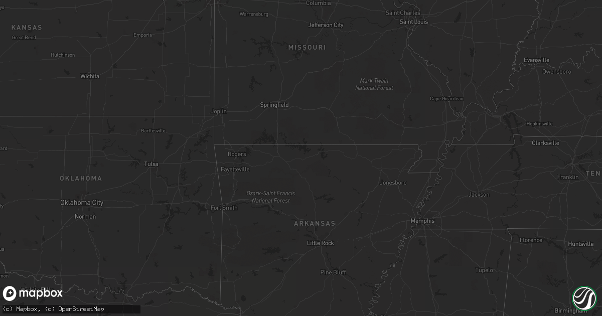
Hail Map in Nebraska on June 28, 2012
Get this storm
June 28 map
$229
one time, instant access
Download today. No call, no setup
Keep the $229
Bought the map and want the full workflow? Apply the entire $229 to a subscription within 7 days. None of it is wasted.
Every map, not just this one
This buys you this map. Subscription and you get every map we run, in the markets you choose from a few cities to whole states to nationwide. Plus real-time alerts the moment a storm fires.
Contact data
Name, contact info, occupancy, even credit band for addresses in the footprint. You go from where it hit to who to call.
Become the source they trust
Unlimited branding weather history reports on demand. You already have the documented answer ready for the property owner, and you are the one who showed up with it.
Property data and RoofTrace estimates
Pull up any address you have got, its value and the exact code rules for that jurisdiction, straight from One Click Code. Then RoofTrace estimates the squares, pitch, and roof value, priced the way you price.
Storm reports in Nebraska
Nebraska
| Date | Description |
|---|---|
| 06/28/20122:37 AM CDT | Downburst caused winds gusts of 78 mph. The temperature rose from 73 to 81 degrees and the dew point dropped from 63 to 52. |
| 06/28/20122:35 AM CDT | Downburst caused winds gusts of 78 mph. The temperature rose from 73 to 82 degrees and the dew point dropped from 63 to 52 degrees. |
| 06/28/20122:00 AM CDT | Downburst caused winds gusts of 64 mph. The temperature rose from 73 to 81 degrees and the dew point dropped from 61 to 52 degrees. |
| 06/28/20121:39 AM CDT | Downburst caused winds gusts of 60 mph. The temperature rose from 73 to 81 degrees and the dew point dropped from 61 to 55. |
| 06/27/201211:37 PM CDT | A local report indicates 61 MPH wind near 3 E NORTH PLATTE |
| 06/27/201210:10 PM CDT | Spotter on highway 25 two miles south of swanson reservoir. Also had winds in excess of 50 mph. |
| 06/27/20129:22 PM CDT | A local report indicates 61 MPH wind near IMPERIAL |
All States Impacted by Hail Map on June 28, 2012
Cities Impacted by Hail Map on June 28, 2012
- Haigler, NE
- Herndon, PA
- Dornsife, PA
- Klingerstown, PA
- Mission, SD
- Hayes Center, NE
- Kennerdell, PA
- Cranberry, PA
- Franklin, PA
- Cockeysville, MD
- Parkville, MD
- Perry Hall, MD
- White Marsh, MD
- Lutherville Timonium, MD
- Towson, MD
- Middle River, MD
- Phoenix, MD
- Baldwin, MD
- Upper Falls, MD
- Sparks Glencoe, MD
- Rosedale, MD
- Glen Arm, MD
- Joppa, MD
- Hydes, MD
- Kingsville, MD
- Nottingham, MD
- Fallston, MD
- Fork, MD
- Huntingdon, PA
- McDonald, KS
- Saint Francis, SD
- Elgin, AZ
- Sonoita, AZ
- Monroeville, NJ
- Elmer, NJ
- Mullica Hill, NJ
- Swedesboro, NJ
- Woodstown, NJ
- Max, NE
- Stratton, NE
- Trenton, NE
- Titusville, PA
- Centerville, PA
- Wellsboro, PA
- Tionesta, PA
- Oil City, PA
- Pleasantville, PA
- Coatesville, PA
- West Grove, PA
- Lockport, IL
- Winterset, IA
- Earlham, IA
- Knox, PA
- Emlenton, PA
- Fortescue, NJ
- Lucerne, IN
- Kewanna, IN
- Twelve Mile, IN
- Rochester, IN
- Moorefield, NE
- Orwell, OH
- Elgin, IL
- Bartlett, IL
- South Elgin, IL
- Smethport, PA
- Gifford, PA
- Rockton, PA
- Penfield, PA
- Du Bois, PA
- Hammonton, NJ
- Atco, NJ
- Waterford Works, NJ
- Springview, NE
- Calumet City, IL
- South Holland, IL
- Lansing, IL
- Chappell, NE
- Gunpowder, MD
- Edgewood, MD
- Colon, NE
- Grand Valley, PA
- Haxtun, CO
- Sedgwick, CO
- Conneaut Lake, PA
- Upperstrasburg, PA
- Fannettsburg, PA
- Fort Loudon, PA
- Willow Hill, PA
- Salix, IA
- Parmelee, SD
- Fleming, CO
- Cambridge Springs, PA
- Guys Mills, PA
- Townville, PA
- Penns Grove, NJ
- Salem, NJ
- Cape May, NJ
- Wildwood, NJ
- Garland, PA
- Spring Creek, PA
- Spartansburg, PA
- Corry, PA
- Pittsfield, PA
- Beaver Crossing, NE
- Philadelphia, PA
- Roca, NE
- Julian, PA
- Bellefonte, PA
- Warren, PA
- Youngsville, PA
- Irvine, PA
- Nogales, AZ
- Blue Island, IL
- Posen, IL
- Harvey, IL
- Crosby, PA
- Palisade, NE
- Frankfort, IL
- Orland Park, IL
- Mokena, IL
- Tinley Park, IL
- Conneautville, PA
- Saegertown, PA
- Jamestown, PA
- Midlothian, IL
- Palos Heights, IL
- Crestwood, IL
- Shippensburg, PA
- Biglerville, PA
- Fayetteville, PA
- Orrtanna, PA
- Vowinckel, PA
- Cooksburg, PA
- Leeper, PA
- Holyoke, CO
- Crown Point, IN
- Wallace, NE
- Dickens, NE
- Amado, AZ
- Pennsville, NJ
- Oxford, PA
- Kirkwood, PA
- Nottingham, PA
- Peach Bottom, PA
- Quarryville, PA
- Atwood, KS
- Bridgeton, NJ
- Alloway, NJ
- Saint John, IN
- Dyer, IN
- Morrisdale, PA
- Rio Rico, AZ
- Andover, OH
- Jefferson, OH
- Williamsfield, OH
- Bear Lake, PA
- Valparaiso, IN
- Oak Lawn, IL
- Hammond, IN
- Griffith, IN
- Markham, IL
- Evergreen Park, IL
- Hometown, IL
- Hobart, IN
- Burbank, IL
- Schererville, IN
- Chicago, IL
- East Chicago, IN
- Merrillville, IN
- Highland, IN
- Steger, IL
- Hebron, IN
- Gary, IN
- Munster, IN
- Cedar Lake, IN
- Thornton, IL
- Dolton, IL
- Chicago Heights, IL
- Robbins, IL
- Alsip, IL
- Lowell, IN
- Crete, IL
- Riverdale, IL
- Ovid, CO
- Carrolltown, PA
- Curwensville, PA
- New Millport, PA
- Olanta, PA
- Matteson, IL
- Chambersburg, PA
- Gettysburg, PA
- Burwell, NE
- Elkton, MD
- Port Allegany, PA
- Roulette, PA
- Mohrsville, PA
- Leesport, PA
- Bernville, PA
- Three Springs, PA
- Mapleton Depot, PA
- Seneca, PA
- Shippenville, PA
- Clarion, PA
- Sligo, PA
- New Bethlehem, PA
- Fairmount City, PA
- Clarendon, PA
- Sugar Grove, PA
- Russell, PA
- Columbus, PA
- Lickingville, PA
- Richland, PA
- Lebanon, PA
- Newmanstown, PA
- Myerstown, PA
- Macy, IN
- Houston, TX
- Missouri City, TX
- Stafford, TX
- Orrstown, PA
- Kouts, IN
- Martinsburg, PA
- Saxton, PA
- North Bloomfield, OH
- Tower City, PA
- Valley View, PA
- Muir, PA
- Hegins, PA
- Pine Grove, PA
- Sacramento, PA
- Bethel, PA
- Gallitzin, PA
- Ashville, PA
- Loretto, PA
- Rossiter, PA
- Oliveburg, PA
- Glen Campbell, PA
- Mahaffey, PA
- Summerville, PA
- Coolspring, PA
- Anita, PA
- Reynoldsville, PA
- Brookville, PA
- De Lancey, PA
- Punxsutawney, PA
- Marienville, PA
- Hunt Valley, MD
- Abingdon, MD
- Pierpont, OH
- Fontanelle, IA
- Glenmoore, PA
- Elverson, PA
- Hazel Crest, IL
- Country Club Hills, IL
- Glenwood, IL
- Homewood, IL
- Flossmoor, IL
- Aurora, NE
- Sigel, PA
- Adamsville, PA
- Atlantic, PA
- Greenville, PA
- Indianola, NE
- Stockville, NE
- Curtis, NE
- Reading, PA
- Bradford, PA
- Chestertown, MD
- Rock Hall, MD
- Yuma, CO
- Benkelman, NE
- Harsens Island, MI
- Linesville, PA
- Cochranton, PA
- Meadville, PA
- Deerfield, IL
- Highland Park, IL
- Wellfleet, NE
- Alexandria, PA
- Dorset, OH
- Sparrows Point, MD
- Essex, MD
- Dundalk, MD
- Kennett Square, PA
- Polk, NE
- Malmo, NE
- Kinzers, PA
- New Holland, PA
- Gap, PA
- Gordonville, PA
- Mayport, PA
- Birdsboro, PA
- Maywood, NE
- Winner, SD
- Pottstown, PA
- Spring City, PA
- Phoenixville, PA
- Hanover, PA
- Spring Grove, PA
- Rensselaer, IN
- Wheatfield, IN
- Kirk, CO
- Joes, CO
- Rollinsville, CO
- Farmdale, OH
- Kinsman, OH
- Hawk Run, PA
- Philipsburg, PA
- Munson, PA
- Chadds Ford, PA
- Temple, PA
- Winamac, IN
- Knox, IN
- La Crosse, IN
- Monterey, IN
- San Pierre, IN
- North Judson, IN
- Denver, PA
- Ephrata, PA
- Stevens, PA
- Genesee, PA
- Ebensburg, PA
- Duncansville, PA
- Altoona, PA
- Schuyler, NE
- Streamwood, IL
- Hanover Park, IL
- Leola, PA
- Bird In Hand, PA
- Lititz, PA
- Manheim, PA
- Lancaster, PA
- Narvon, PA
- Hershey, PA
- East Earl, PA
- Elizabethtown, PA
- Palmyra, PA
- East Petersburg, PA
- Ronks, PA
- Reinholds, PA
- Adamstown, PA
- Mohnton, PA
- Newtown Square, PA
- Berwyn, PA
- Parsippany, NJ
- Norristown, PA
- Collegeville, PA
- Patagonia, AZ
- Frenchville, PA
- Chester Springs, PA
- Malvern, PA
- Tyrone, PA
- Westminster, MD
- Manchester, MD
- Hampstead, MD
- Eustis, NE
- Eckley, CO
- Wernersville, PA
- Akron, PA
- Mount Gretna, PA
- Intercourse, PA
- Morgantown, PA
- Hummelstown, PA
- Harrisburg, PA
- Brownstown, PA
- Callaway, NE
- Broken Bow, NE
- Pleasant Hall, PA
- North Platte, NE
- Lansdale, PA
- Harleysville, PA
- Hydetown, PA
- West Decatur, PA
- Allport, PA
- Wallaceton, PA
- Woodland, PA
- Coudersport, PA
- Newville, PA
- Carlisle, PA
- David City, NE
- Linwood, NE
- Lykens, PA
- Williamstown, PA
- Spring Glen, PA
- Warriors Mark, PA
- Osceola Mills, PA
- Denver, IN
- Douglassville, PA
- Oley, PA
- Womelsdorf, PA
- Boyertown, PA
- Galeton, PA
- Sprankle Mills, PA
- Walston, PA
- Boulder, CO
- Cooperstown, PA
- Schwenksville, PA
- Rome, OH
- Springboro, PA
- Kingsville, OH
- Conneaut, OH
- Park Forest, IL
- Olympia Fields, IL
- Richton Park, IL
- Oshkosh, NE
- Culbertson, NE
- Waterford, PA
- Hartstown, PA
- Edinboro, PA
- Strattanville, PA
- Utica, PA
- Hadley, PA
- Union City, PA
- Lucinda, PA
- Venus, PA
- Sandy Lake, PA
- Carlton, PA
- Rouseville, PA
- Polk, PA
- Fryburg, PA
- Venango, PA
- Kossuth, PA
- Marble, PA
- Crescent, IA
- Parks, NE
- Littlestown, PA
- Wray, CO
- Oak Forest, IL
- Pennsylvania Furnace, PA
- Spruce Creek, PA
- Palos Park, IL
- Homer Glen, IL
- Maxwell, NE
- Kearney, NE
- Albion, PA
- Corsica, PA
- Sandy Ridge, PA
- Newark, DE
- West Chester, PA
- Downingtown, PA
- Wilmington, DE
- New Castle, DE
- Ridgway, PA
- Comstock, NE
- Washington Boro, PA
- Columbia, PA
- Clarington, PA
- Cyclone, PA
- Lewis Run, PA
- Bainbridge, PA
- Mount Wolf, PA
- Lemont, IL
- Tumacacori, AZ
- Beecher, IL
- Bridgeview, IL
- Peru, IN
- Chicago Ridge, IL
- Star City, IN
- Demotte, IN
- Boone Grove, IN
- Logansport, IN
- Worth, IL
- White River, SD
- Sargent, NE
- Pedricktown, NJ
- Hollidaysburg, PA
- Williamstown, NJ
- Pitman, NJ
- Blackwood, NJ
- Sewell, NJ
- Glassboro, NJ
- Columbus, NE
- Hillsdale, PA
- Commodore, PA
- Marion Center, PA
- Cherry Tree, PA
- Clearfield, PA
- Luthersburg, PA
- Tidioute, PA
- Timblin, PA
- Wauneta, NE
- Austin, PA
- Somerdale, NJ
- Berlin, NJ
- Stratford, NJ
- West Berlin, NJ
- Magnolia, NJ
- Voorhees, NJ
- Mount Ephraim, NJ
- Gibbsboro, NJ
- Runnemede, NJ
- Clementon, NJ
- Barrington, NJ
- Bellmawr, NJ
- Woodbury, NJ
- Gloucester City, NJ
- Westville, NJ
- Haddon Heights, NJ
- Glendora, NJ
- Lincoln, NE
- Falls Creek, PA
- Monkton, MD
- Parkton, MD
- Aberdeen Proving Ground, MD
- Baltimore, MD
- Fort Howard, MD
- Bolingbrook, IL
- Darien, IL
- Naperville, IL
- Woodridge, IL
- Downers Grove, IL
- Hoxie, KS
- Port Norris, NJ
- Cedarville, NJ
- Millville, NJ
- Mauricetown, NJ
- Exton, PA
- State College, PA
- Spring Mills, PA
- Centre Hall, PA


