Hail Map in Minnesota on July 13, 2012
Get this storm
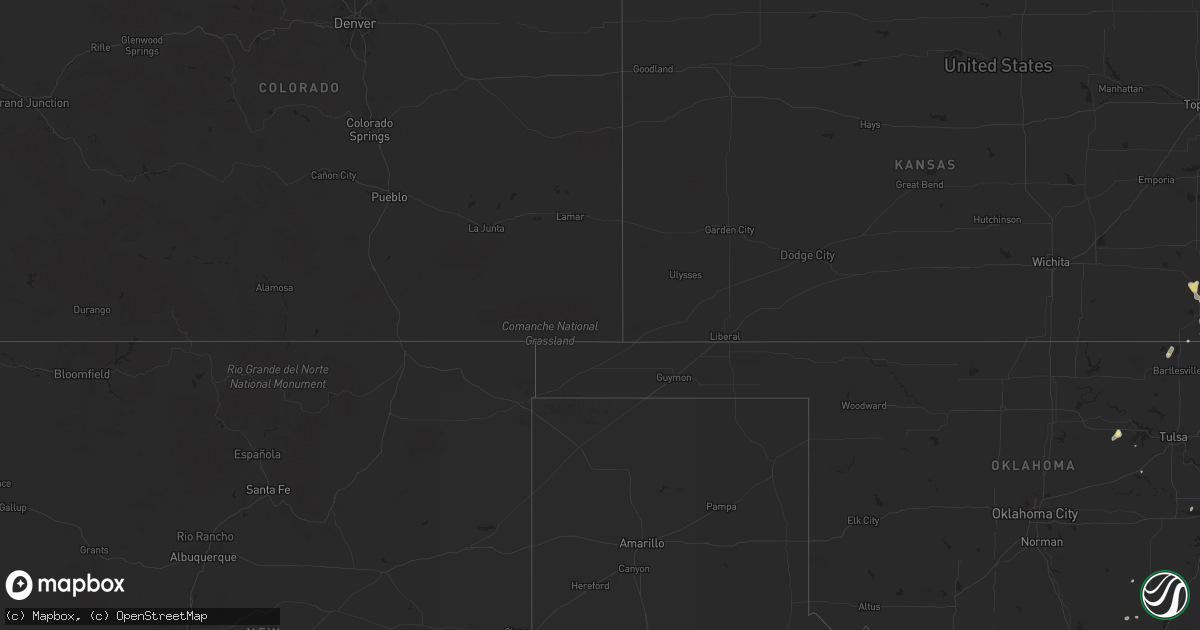
July 13 map
$229
one time, instant access
Download today. No call, no setup
Keep the $229
Bought the map and want the full workflow? Apply the entire $229 to a subscription within 7 days. None of it is wasted.
Every map, not just this one
This buys you this map. Subscription and you get every map we run, in the markets you choose from a few cities to whole states to nationwide. Plus real-time alerts the moment a storm fires.
Contact data
Name, contact info, occupancy, even credit band for addresses in the footprint. You go from where it hit to who to call.
Become the source they trust
Unlimited branding weather history reports on demand. You already have the documented answer ready for the property owner, and you are the one who showed up with it.
Property data and RoofTrace estimates
Pull up any address you have got, its value and the exact code rules for that jurisdiction, straight from One Click Code. Then RoofTrace estimates the squares, pitch, and roof value, priced the way you price.
Storm reports in Minnesota
Minnesota
| Date | Description |
|---|---|
| 07/13/20125:51 PM CDT | Six inch limbs onto power line. Electric service out. |
| 07/13/20125:49 PM CDT | A local report indicates 1.00 inch wind near 4 WNW FARIBAULT |
| 07/13/20125:33 PM CDT | A local report indicates 1.50 inch wind near 3 WNW MENDOTA |
| 07/13/20124:21 PM CDT | Officer in silver lake reported quater to ping pong ball sized hail. |
| 07/13/20124:20 PM CDT | Power lines down |
| 07/12/20128:24 PM CDT | A local report indicates 60 MPH wind near HAYFIELD |
| 07/12/20128:23 PM CDT | A local report indicates 1.00 inch wind near 1 E MANCHESTER |
| 07/12/20128:00 PM CDT | Has been ongoing for 10 minutes. |
| 07/12/20127:45 PM CDT | A local report indicates 1.00 inch wind near 2 NNE BRICELYN |
| 07/12/20127:42 PM CDT | Significant crop damage reported from large hail. |
| 07/12/20127:32 PM CDT | A local report indicates 1.00 inch wind near 2 SW FROST |
All States Impacted by Hail Map on July 13, 2012
Cities Impacted by Hail Map on July 13, 2012
- Rice, MN
- Sauk Rapids, MN
- Uniontown, KS
- Erie, KS
- Moran, KS
- Stark, KS
- Savonburg, KS
- Whittemore, IA
- West Bend, IA
- Ottosen, IA
- Rolfe, IA
- Arco, MN
- Ivanhoe, MN
- Canby, MN
- Porter, MN
- North Branch, MN
- Foreston, MN
- Milaca, MN
- Oak Park, MN
- El Dorado Springs, MO
- Osceola, MO
- Bristow, OK
- South Saint Paul, MN
- Saint Paul, MN
- Hampton, MN
- Cannon Falls, MN
- Stillwater, MN
- Butterfield, MN
- Ellendale, MN
- Waseca, MN
- Owatonna, MN
- Gorin, MO
- Rutledge, MO
- Milton Freewater, OR
- Albert Lea, MN
- Glenville, MN
- Rhinelander, WI
- Three Lakes, WI
- Bronaugh, MO
- Garland, KS
- Arcadia, KS
- Pittsburg, KS
- Weir, KS
- Alden, MN
- Medford, MN
- West Concord, MN
- Claremont, MN
- Fairmont, MN
- Swea City, IA
- Armstrong, IA
- Saint Michael, MN
- Independence, KS
- Coffeyville, KS
- Liberty, KS
- Marshall, MO
- Richton, MS
- Madison, FL
- Bancroft, IA
- Hutchinson, MN
- Silver Lake, MN
- Cambridge, MN
- Elgin, OR
- Rogers, MN
- Saint James, MN
- Roma, TX
- Brookshire, TX
- Walla Walla, WA
- Cookson, OK
- Park Hill, OK
- Vian, OK
- Kennewick, WA
- Granada, MN
- Lone Rock, IA
- Fenton, IA
- Blooming Prairie, MN
- Geneva, MN
- Glencoe, MN
- Bemidji, MN
- Laporte, MN
- Foley, MN
- Slater, MO
- Gilliam, MO
- Litchfield, MN
- Lake Havasu City, AZ
- Ogilvie, MN
- Milwaukee, WI
- South Milwaukee, WI
- Cudahy, WI
- Oak Creek, WI
- Paynesville, MN
- Eden Valley, MN
- Watkins, MN
- Giddings, TX
- Jennings, OK
- Yale, OK
- Perry, FL
- San Ygnacio, TX
- Sherburn, MN
- Alpha, MN
- Jackson, MN
- Jesup, IA
- Newburg, MO
- Dale, TX
- Rosemount, MN
- Inver Grove Heights, MN
- Ottawa, IL
- Marseilles, IL
- Oronoco, MN
- Olympia, WA
- Old Town, FL
- Gonvick, MN
- Galesburg, KS
- Parsons, KS
- Guerra, TX
- Zapata, TX
- Fort Gibson, OK
- Delano, MN
- Waitsburg, WA
- Minnetonka, MN
- Eden Prairie, MN
- Hopkins, MN
- Minneapolis, MN
- Mendota, MN
- Saint Francis, WI
- Chanute, KS
- Burnsville, MN
- Savage, MN
- Bradford, IL
- Janesville, MN
- Saint Cloud, MN
- Fairfax, MN
- Maple Plain, MN
- Hebbronville, TX
- Warrensburg, MO
- Wells, MN
- Adams, MN
- Rose Creek, MN
- Mora, MN
- Franklin, MN
- Morgan, MN
- Sleepy Eye, MN
- Royalton, MN
- Concordia, MO
- Clover, SC
- Aitkin, MN
- Trimont, MN
- Kasson, MN
- Hayfield, MN
- Dodge Center, MN
- Butler, MO
- Glasgow, MO
- Fulton, KS
- Fort Scott, KS
- Memphis, MO
- Clarks Grove, MN
- New Richland, MN
- Frost, MN
- Kiester, MN
- Kenyon, MN
- Bricelyn, MN
- Conger, MN
- Hollandale, MN
- Hartland, MN
- Faribault, MN
- Elmore, MN
- Blue Earth, MN
- Mantorville, MN
- Waltham, MN
- Freeborn, MN
- Columbus, TX
- Henley, MO
- Northfield, MN
- Lonsdale, MN
- Keokuk, IA
- Liberal, MO
- Denton, GA
- Moundville, MO
- Deerfield, MO
- Moultrie, GA
- Pease, MN
- Ochlocknee, GA
- Coolidge, GA
- Desert Center, CA
- Waelder, TX
- Shiner, TX
- Gonzales, TX
- Farmington, MN
- Lakeville, MN
- Flovilla, GA
- Jackson, GA
- Hanover, MN
- Albertville, MN
- Rockford, MN
- Osseo, MN
- Loretto, MN
- Hamel, MN
- Maple Grove, MN
- Buffalo, MN
- Cedar Key, FL
- Sartell, MN
- Lincoln, TX
- Wann, OK
- Caney, KS
- Cherryvale, KS
- Neodesha, KS
- Altoona, KS
- Fredonia, KS
- New Richmond, WI
- Laquey, MO
- Mannford, OK
- Walnut, KS
- Elsmore, KS
- Redfield, KS
- Lake George, MN
- Elk River, MN
- Council Hill, OK
- Delaware, OK
- Scandia, MN
- Marine On Saint Croix, MN
- Shady Dale, GA
- Monticello, GA
- Algona, IA
- Naples, ID
- Boston, GA
- Holmen, WI
- Mindoro, WI
- Greenville, FL
- Wellton, AZ
- Buffalo Lake, MN
- Hector, MN
- Stewart, MN
- Lyle, MN
- Austin, MN
- Pawhuska, OK
- Copan, OK
- Mound, MN
- San Antonio, TX
- Richards, TX
- Creston, IA
- Quitman, GA
- Garwood, TX
- Kirksville, MO
- Novinger, MO
- Green Castle, MO
- Smithville, TX
- Rosanky, TX
- Lacey, WA
- Gore, OK
- Benedict, KS
- Ione, OR
- Yuma, AZ
- Stanchfield, MN
- Dalbo, MN
- Princeton, MN
- Braham, MN
- Peru, IL
- Oglesby, IL
- Tonica, IL
- Shelton, WA
- Darwin, MN
- Somerset, WI
- Morton, MN
- Bradgate, IA
- Falcon, MO
- Hartville, MO
- Excelsior, MN
- Chanhassen, MN
- Stonewall, OK
- Somerville, TX
- Caldwell, TX
- Cameron, TX
- Burt, IA
- Hastings, MN
- Randolph, MN
- Menahga, MN
- Huron, TN
- Waverly, MN
- Welling, OK
- Helix, OR
- Hermiston, OR
- Stacy, MN
- Camilla, GA
- Muskogee, OK
- Kahoka, MO
- Paige, TX
- Maquon, IL
- Thayer, KS
- Hillman, MN
- Horseshoe Beach, FL
- Lake Zurich, IL
- Vernon Hills, IL
- Lincolnshire, IL
- Manor, TX
- Austin, TX
- Warsaw, IL
- Basco, IL
- Carthage, IL
- Everett, WA
- Rolla, MO
- Taopi, MN
- Palisade, MN
- Hudson, WI
- Tupelo, OK
- Cokato, MN
- Onamia, MN
- Rio Grande City, TX
- Hayward, MN
- Kilkenny, MN
- Park Rapids, MN
- Dundas, MN
- Williamstown, MO
- Sheldon, MO
- Nerstrand, MN
- Fowlerton, TX
- Long Lake, MN
- Pierz, MN
- Dunnellon, FL
- Allen, OK
- Maramec, OK
- Columbus, KS
- Miami, OK
- North Aurora, IL
- Aurora, IL
- Lithia Springs, GA
- Wayzata, MN
- Grove City, MN
- Cedar Park, TX
- Dennison, MN
- Brawley, CA
- Northwood, IA
- Whitsett, TX
- Three Rivers, TX
- Nashoba, OK
- Rattan, OK
- Barnesville, GA
- Henry, IL
- Hamilton, IL
- Picher, OK
- Bryan, TX
- Red Rock, TX
- Sedona, AZ
- North Zulch, TX
- Bastrop, TX
- Serena, IL
- Scammon, KS
- Galena, KS
- Farlington, KS
- Hartsfield, GA
- Osceola, WI
- Seligman, AZ
- Saint Patrick, MO
- Prior Lake, MN
- Buffalo Grove, IL
- Lehigh Acres, FL


