Hail Map in Arkansas on July 14, 2012
Get this storm
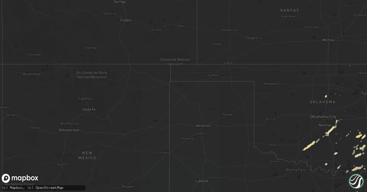
July 14 map
$229
one time, instant access
Download today. No call, no setup
Keep the $229
Bought the map and want the full workflow? Apply the entire $229 to a subscription within 7 days. None of it is wasted.
Every map, not just this one
This buys you this map. Subscription and you get every map we run, in the markets you choose from a few cities to whole states to nationwide. Plus real-time alerts the moment a storm fires.
Contact data
Name, contact info, occupancy, even credit band for addresses in the footprint. You go from where it hit to who to call.
Become the source they trust
Unlimited branding weather history reports on demand. You already have the documented answer ready for the property owner, and you are the one who showed up with it.
Property data and RoofTrace estimates
Pull up any address you have got, its value and the exact code rules for that jurisdiction, straight from One Click Code. Then RoofTrace estimates the squares, pitch, and roof value, priced the way you price.
Storm reports in Arkansas
Arkansas
| Date | Description |
|---|---|
| 07/14/20126:15 PM CDT | Trees down in woodlawn. |
| 07/14/20122:05 PM CDT | A local report indicates 1.00 inch wind near 3 SE CHISMVILLE |
| 07/14/20121:55 PM CDT | Power lines blown down. |
| 07/14/20121:55 PM CDT | Power lines blown down. |
| 07/14/20121:55 PM CDT | Power out caused by outflow winds |
| 07/14/20121:47 PM CDT | Highway sign blown down onto highway 40 near the oklahoma and arkansas state line. |
| 07/14/20121:42 PM CDT | Highway sign blown down onto interstate 540 and interstate 40 junction. |
All States Impacted by Hail Map on July 14, 2012
Cities Impacted by Hail Map on July 14, 2012
- Muldrow, OK
- Rogersville, MO
- Lamont, WA
- Russell, IA
- Chariton, IA
- Toledo, IA
- Montour, IA
- Tama, IA
- Elgin, IA
- Ashkum, IL
- San Marcos, TX
- Pearsall, TX
- Guthrie Center, IA
- Coon Rapids, IA
- Audubon, IA
- Bates, OR
- Natural Dam, AR
- Prairie Grove, AR
- Stilwell, OK
- Evansville, AR
- Uniontown, AR
- Sallisaw, OK
- Van Buren, AR
- Canehill, AR
- West Fork, AR
- Cedarville, AR
- Gans, OK
- Coalgate, OK
- Edgewood, IA
- Strawberry Point, IA
- Manchester, IA
- Bennington, OK
- Davis, OK
- Milo, IA
- Lacona, IA
- Linden, AL
- Demopolis, AL
- Long Creek, OR
- Peridot, AZ
- Globe, AZ
- Cole Camp, MO
- Lincoln, MO
- Ute, IA
- Soldier, IA
- Centrahoma, OK
- Bokchito, OK
- Wynnewood, OK
- Thompsons Station, TN
- Williamsburg, KY
- Tucson, AZ
- Red Oak, OK
- Bokoshe, OK
- Mccurtain, OK
- Wilson Creek, WA
- Needles, CA
- Mohave Valley, AZ
- Union, OR
- Haines, OR
- North Powder, OR
- Clayton, OK
- Martinton, IL
- Clifton, IL
- Logan, IA
- Woodbine, IA
- Brandenburg, KY
- Laconia, IN
- Mauckport, IN
- Milo, ME
- Stuart, IA
- Dougherty, OK
- Sulphur, OK
- Springer, OK
- Greenwood, MS
- Shawnee, OK
- Rio Grande City, TX
- Fort Towson, OK
- Rattan, OK
- Mcalester, OK
- Bickleton, WA
- Lucas, IA
- Clermont, IA
- White Bird, ID
- Purcell, OK
- Ely, NV
- Fayetteville, AR
- Marshalltown, IA
- Albion, IA
- Creston, IA
- Orient, IA
- Macomb, OK
- Noble, OK
- Sioux City, IA
- Sergeant Bluff, IA
- Mulhall, OK
- Roosevelt, AZ
- Boone, IA
- Uvalde, TX
- Edwardsburg, MI
- Unity, OR
- Ironside, OR
- Prairie City, OR
- Welch, WV
- Herndon, WV
- Northfork, WV
- Bridgeport, OR
- Huntington, OR
- Calvin, OK
- Stuart, OK
- Allen, OK
- Canaan, ME
- Pittsfield, ME
- Clinton, ME
- Waterville, ME
- Burnham, ME
- Castalia, IA
- West Union, IA
- Gouldsboro, ME
- Kingman, AZ
- Sahuarita, AZ
- Granger, IN
- Niles, MI
- Duncan, OK
- Rush Springs, OK
- Lawton, OK
- Walters, OK
- Marlow, OK
- Winslow, AR
- Pittsburg, OK
- Roma, TX
- Booneville, AR
- Magazine, AR
- Culver, OR
- Madras, OR
- Terrebonne, OR
- Elkins, AR
- Steinhatchee, FL
- Lagrange, ME
- Wilson, OK
- Lexington, OK
- Hawkeye, IA
- Antlers, OK
- Kingsville, TX
- Chandler, AZ
- Gilbert, AZ
- San Ygnacio, TX
- Jesup, IA
- Independence, IA
- Eutaw, AL
- Talihina, OK
- Maricopa, AZ
- Manilla, IA
- Irwin, IA
- Kiowa, OK
- Atoka, OK
- Oelwein, IA
- Rison, AR
- Pine Bluff, AR
- Keota, OK
- Miami, AZ
- Ada, OK
- Konawa, OK
- Rudy, AR
- Chester, AR
- Dixmont, ME
- Helotes, TX
- San Antonio, TX
- Mico, TX
- Hendrix, OK
- Colbert, OK
- Calera, OK
- Durant, OK
- Hartford, KY
- Wardville, OK
- Monument, OR
- Mount Auburn, IL
- Blue Mound, IL
- Star City, AR
- Grady, AR
- Yorktown, AR
- Farmersburg, IA
- Kirkland, AZ
- Eureka, NV
- Garwin, IA
- Boerne, TX
- Royal Center, IN
- Dysart, IA
- Garrison, IA
- Wadena, IA
- Kerrville, TX
- Greenfield, IA
- Fayette, IA
- Randalia, IA
- Wayne, OK
- La Porte City, IA
- Dunlap, IA
- Farmersville, TX
- Celeste, TX
- Onley, VA
- Marion, TX
- Seguin, TX
- McQueeney, TX
- Sasakwa, OK
- Ozark, AR
- Arlington, IA
- Kingston, TN
- Ten Mile, TN
- Baker, CA
- Hereford, OR
- Claypool, AZ
- Casa Grande, AZ
- Stillwater, OK
- Terry, MS
- Charleston, AR
- Branch, AR
- Fort Smith, AR
- Jonesville, VA
- Pennington Gap, VA
- Mesa, AZ
- Monticello, FL
- Bishop, TX
- Robstown, TX
- Accomac, VA
- Cove, OR
- Augusta, MT
- Coolidge, AZ
- Bapchule, AZ
- Granby, MO
- Neosho, MO
- Raymondville, TX
- Athens, OH
- Bunch, OK
- Sparks, OK
- Marietta, OK
- Heavener, OK
- New Braunfels, TX
- Martindale, TX
- Duffield, VA
- Fort Irwin, CA
- Boswell, OK
- Ellsworth, ME
- Earling, IA
- Casey, IA
- Warsaw, MO
- New Hampton, IA
- Vinton, IA
- Lockhart, TX
- Fairbank, IA
- Declo, ID
- Batesville, MS
- Marana, AZ
- Monona, IA
- Rio Grande, OH
- Thurman, OH
- Gallipolis, OH
- Vinton, OH
- Bidwell, OH
- Overbrook, OK
- Wickenburg, AZ
- Morristown, AZ
- Westgate, IA
- Dunkerton, IA
- Stanley, IA
- Waterloo, IA
- Brandon, IA
- Hazleton, IA
- Maynard, IA
- Gilbertville, IA
- Oran, IA
- Sumner, IA
- Palmyra, ME
- Lavaca, AR
- Quincy, WA
- Kingston, OK
- Madill, OK
- Lebanon, OK
- Moyers, OK
- Lindsay, OK
- Kyle, TX
- Maxwell, TX
- Aurora, ME
- Maysville, OK
- Coleman, OK
- Centertown, KY
- Gilman, IL
- Danforth, IL
- Fallon, MT
- Newberry Springs, CA
- Tuscola, IL
- Elkader, IA
- Gladbrook, IA
- Cassopolis, MI
- Stratford, OK
- Coeur D Alene, ID
- Story City, IA
- Van Alstyne, TX
- Perry, FL
- Stella, MO
- Traer, IA
- Gallion, AL
- Shidler, OK
- Armstrong, TX
- Franklin, ME
- Baker City, OR
- Wister, OK
- Soper, OK
- Amado, AZ
- Thetford Center, VT
- Holdenville, OK
- Panora, IA
- Raysal, WV
- Richland, OR
- Prescott, AZ
- Bagdad, AZ
- Greenbush, ME
- Cibolo, TX
- Combs, AR
- Stringtown, OK
- Clutier, IA
- Warrenton, MO
- Saint Olaf, IA
- Wanette, OK
- Moorhead, IA
- Denison, TX
- Pottsboro, TX
- Conroe, TX
- Rio Medina, TX
- Lawrenceburg, KY
- Hebbronville, TX
- Petersburg, TN
- Frankewing, TN
- Schlater, MS
- Tupelo, OK
- Wapanucka, OK
- Dale, TX
- Forkland, AL
- Eloy, AZ
- Pipe Creek, TX
- Oak Hill, OH
- Ogden, IA
- Caddo, OK
- Vail, AZ
- Fort Atkinson, IA
- Menlo, IA
- Jewell, IA
- Randall, IA
- Tallahassee, FL
- Oracle, AZ
- Greenwood, AR
- Ratcliff, AR
- Paris, AR
- Mammoth, AZ
- Silverdale, WA
- South Bend, IN
- Mishawaka, IN
- Rhineland, MO
- Saint Charles, VA
- Howland, ME
- Spencerville, OK
- Huntsville, AR
- Anawalt, WV
- Jeffersonville, KY
- West Lebanon, IN
- Williamsport, IN
- Tecumseh, OK
- John Day, OR
- Greeley, IA
- Keokee, VA
- Lyford, TX
- Garciasville, TX
- Red Rock, TX
- Drewsey, OR
- Boardman, OR
- Winkelman, AZ
- Ashwood, OR
- Buda, TX
- Council, ID
- Mulberry, AR
- Zapata, TX
- Newell, SD
- Jonesburg, MO
- Momence, IL


