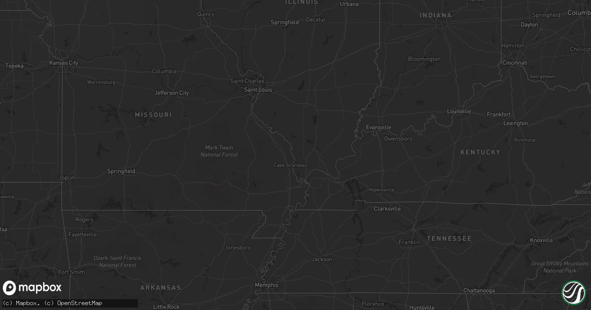
Hail Map in North Dakota on July 22, 2011
Get this storm
July 22 map
$229
one time, instant access
Download today. No call, no setup
Keep the $229
Bought the map and want the full workflow? Apply the entire $229 to a subscription within 7 days. None of it is wasted.
Every map, not just this one
This buys you this map. Subscription and you get every map we run, in the markets you choose from a few cities to whole states to nationwide. Plus real-time alerts the moment a storm fires.
Contact data
Name, contact info, occupancy, even credit band for addresses in the footprint. You go from where it hit to who to call.
Become the source they trust
Unlimited branding weather history reports on demand. You already have the documented answer ready for the property owner, and you are the one who showed up with it.
Property data and RoofTrace estimates
Pull up any address you have got, its value and the exact code rules for that jurisdiction, straight from One Click Code. Then RoofTrace estimates the squares, pitch, and roof value, priced the way you price.
Storm reports in North Dakota
North Dakota
| Date | Description |
|---|---|
| 07/22/20116:40 PM CDT | Public spotted debris from great distance from storm. |
| 07/22/20116:40 PM CDT | Public spotted debris from great distance from storm. |
| 07/22/20116:35 PM CDT | Hail ongoing at 645 pm. Ground white with hail and hail size is increasing. Very heavy rain. Wind speed 20 mph. |
| 07/22/20113:40 AM CDT | Tree down and blocking the road. Time estimated from radar. |
| 07/22/20113:35 AM CDT | Wind gust measured by asos at hector international airport |
| 07/22/20113:31 AM CDT | Measured wind in south fargo |
| 07/22/20113:30 AM CDT | Trees knocked over and split. Time estimated from radar. |
| 07/22/20113:30 AM CDT | Trees down in west fargo blocking street |
| 07/22/20113:30 AM CDT | Significant damage to apartments in south fargo at 5170 amber valley parkway |
| 07/22/20113:27 AM CDT | Thunderstorm wind gust 60 to 70 mph in west fargo |
| 07/22/20113:20 AM CDT | A few split trees that were 10 inches in diameter. Time estimated by radar. |
| 07/22/20113:00 AM CDT | Trees down in town. |
| 07/22/20111:00 AM CDT | A local report indicates 1.00 inch wind near 4 E REGENT |
| 07/22/201112:40 AM CDT | Winds gusted for about 3 to 5 minutes |
| 07/22/201112:30 AM CDT | Quonset and pole barn on farmstead totally destoryed. Shingle and siding damage to house. Two trees down. Branches stuck in west side of house. All debris southeast of |
| 07/21/201111:15 PM CDT | A local report indicates 60 MPH wind near MANDAN |
| 07/21/201111:10 PM CDT | Nickel to quarter sized hail reported by trained weather spotter... |
| 07/21/201111:06 PM CDT | Ongoing in city. |
| 07/21/201111:01 PM CDT | Large branches down...estimated 60 to 65 mph. Also one half inch hail. |
| 07/21/201110:56 PM CDT | A local report indicates 63 MPH wind near MANDAN |
| 07/21/201110:54 PM CDT | Campers flipper over from winds. Report relayed by media. |
| 07/21/201110:45 PM CDT | A local report indicates 1.00 inch wind near CROWN BUTTE LAKE |
| 07/21/201110:45 PM CDT | A local report indicates 60 MPH wind near CROWN BUTTE LAKE |
| 07/21/201110:10 PM CDT | Trained weather spotter reported that a tornado appeared to be on the ground...seen with lightning... |
| 07/21/201110:01 PM CDT | Penny to quarter size hail. |
| 07/21/201110:00 PM CDT | A local report indicates 65 MPH wind near NEW ENGLAND |
| 07/21/20119:40 PM CDT | Reported by nd atmospheric resource board observer. |
| 07/21/20119:40 PM CDT | Nd atmospheric resource board observer reports 1.25 inch hail with strong winds. |
| 07/21/20119:30 PM CDT | Hail up to the size of half dollars...with heavy rain |
| 07/21/20119:05 PM CDT | Tornado reported by fire department. Tornado lasted 5 minutes. |
| 07/21/20119:05 PM CDT | Late report. |
| 07/21/20118:39 PM CDT | A local report indicates 59 MPH wind near KILLDEER |
| 07/21/20118:35 PM CDT | Trained weather spotter reported debris on the south side of city...no visible funnel... |
| 07/21/20118:31 PM CDT | At least 60 mph straight line winds. |
| 07/21/20118:30 PM CDT | Some tree branches broken off. Storm ongoing at 834 pm cdt. |
| 07/21/20118:23 PM CDT | Witnesses and fire department reported one semi was picked up and hit another. |
| 07/21/20117:40 PM CDT | Peak gust of 66 mph with sustained winds at 30 to 35 mph. |
All States Impacted by Hail Map on July 22, 2011
Cities Impacted by Hail Map on July 22, 2011
- Opheim, MT
- Hinsdale, MT
- Wharncliffe, WV
- Gilbert, WV
- Ralph, SD
- Lodgepole, SD
- Bismarck, ND
- Lambert, MT
- Circle, MT
- Clinton, MN
- Ortonville, MN
- Fort Ransom, ND
- Marion, ND
- Verona, ND
- Litchville, ND
- Lamoure, ND
- Poplar, MT
- Webster, SD
- Kinsey, MT
- Whiteville, NC
- Ezel, KY
- West Liberty, KY
- Mandan, ND
- Bloomfield, MT
- Hurdsfield, ND
- Chaseley, ND
- Watertown, SD
- Strandburg, SD
- Labolt, SD
- Revillo, SD
- Westport, SD
- Tuttle, ND
- Pawnee City, NE
- Hettinger, ND
- Richey, MT
- Ekalaka, MT
- Buffalo, SD
- Camp Crook, SD
- Frazer, MT
- Ypsilanti, ND
- Nashua, MT
- Fort Peck, MT
- Terry, MT
- Brockton, MT
- Jobstown, NJ
- Columbus, NJ
- Chesterfield, NJ
- Wrightstown, NJ
- Joint Base Mdl, NJ
- Malta, MT
- Wallingford, KY
- Maple Hill, NC
- Saint Francis, SD
- Parmelee, SD
- Forsyth, MT
- Rhame, ND
- Glenwood, MN
- Alexandria, MN
- Appleton, MN
- Wolf Point, MT
- Belfield, ND
- Blackshear, GA
- Miles City, MT
- Grassy Butte, ND
- Selfridge, ND
- Crystal City, TX
- Richland, MT
- Fort Myers, FL
- Baker, MT
- Killdeer, ND
- Chauncey, WV
- Dawson, MN
- Madison, MN
- Woodworth, ND
- Sykeston, ND
- Carrington, ND
- Aberdeen, SD
- Kingwood, TX
- Humble, TX
- Huffman, TX
- Stockholm, ME
- New Sweden, ME
- South Shore, SD
- Summit, SD
- Williston, ND
- Cartwright, ND
- Alexander, ND
- Fort Davis, TX
- Maysville, NC
- Twin Brooks, SD
- New Rockford, ND
- Holyoke, CO
- Ismay, MT
- Lisbon, ND
- Milnor, ND
- Draper, VA
- Pulaski, VA
- Wilmot, SD
- Reva, SD
- Jamestown, ND
- Montpelier, ND
- Elbow Lake, MN
- Ashby, MN
- Dalton, MN
- Bowman, ND
- Culbertson, MT
- Beulah, ND
- Hazen, ND
- Driscoll, ND
- Cleveland, ND
- Braddock, ND
- Moffit, ND
- Robinson, ND
- Tappen, ND
- Dawson, ND
- Medina, ND
- Napoleon, ND
- Gackle, ND
- Streeter, ND
- Steele, ND
- Jud, ND
- Glasgow, MT
- Ludlow, SD
- Sinclair, ME
- Linton, ND
- Wishek, ND
- Zeeland, ND
- Kintyre, ND
- Concordia, KS
- Independence, VA
- Elk Creek, VA
- Vida, MT
- Long Lake, SD
- Leola, SD
- Marietta, MN
- Dickey, ND
- Brockway, MT
- Cohagen, MT
- Bunceton, MO
- Axson, GA
- Nicholls, GA
- Woonsocket, SD
- Wessington Springs, SD
- Dickinson, ND
- New England, ND
- Regent, ND
- Grace City, ND
- Lodge Grass, MT
- Mission, SD
- Rosebud, SD
- Todd, NC
- Creston, NC
- Ozona, TX
- Crane, TX
- Lemmon, SD
- Regan, ND
- Trenton, NC
- Watford City, ND
- Wray, CO
- Lowry, MN
- Villard, MN
- Wilton, ND
- Higbee, MO
- Ashley, ND
- Aurora, KS
- Lehigh Acres, FL
- Zap, ND
- Hazel, SD
- Washburn, ND
- Quemado, TX
- Deland, FL
- Burchard, NE
- Brandon, MN
- Garfield, MN
- Parkers Prairie, MN
- Doland, SD
- Clermont, FL
- Coin, IA
- Mcville, ND
- Donnelly, MN
- Herman, MN
- Ashland, ME
- Mchenry, ND
- Lindsay, MT
- Glendive, MT
- Keene, ND
- New Town, ND
- Mandaree, ND
- Mercer, ND
- Mcclusky, ND
- White River, SD
- Mott, ND
- Morristown, SD
- Keldron, SD
- New Leipzig, ND
- Watauga, SD
- Warrensville, NC
- Savage, MT
- Brackettville, TX
- Menoken, ND
- Caribou, ME
- Plankinton, SD
- Letcher, SD
- Murdock, MN
- Corona, SD
- Scranton, ND
- Sparta, NC
- Uvalde, TX
- Steinauer, NE
- Arnegard, ND
- Niagara, ND
- Petersburg, ND
- Aneta, ND
- Hyden, KY
- Medora, ND
- Hazelton, ND
- Oakwood, VA
- Foxhome, MN
- Fergus Falls, MN
- Campbell, MN
- Alden, IA
- Radcliffe, IA
- Warrenton, NC
- Norlina, NC
- Sanderson, FL
- Glen Saint Mary, FL
- Clark, SD
- Raymond, SD
- Verdon, NE
- Shubert, NE
- Falls City, NE
- Nemaha, NE
- Houston, TX
- Amidon, ND
- South Heart, ND
- California, MO
- Latham, MO
- Golden Valley, ND
- Breckenridge, MN
- Dumont, MN
- Chokio, MN
- Chapmanville, WV
- Dingess, WV
- Johnson, NE
- Eustis, FL
- Porter, TX
- Richlands, VA
- Fort Kent, ME
- Salyersville, KY
- Royalton, KY
- Orange City, FL
- Deltona, FL
- Paisley, FL
- Lake Helen, FL
- Vincentown, NJ
- Pemberton, NJ
- Browns Mills, NJ
- Reeder, ND
- Prairie City, SD
- Cathay, ND
- Nelson, MN
- Ashton, SD
- Willmar, MN
- Spicer, MN
- New London, MN
- Evansville, MN
- Battle Lake, MN
- Crumpler, NC
- Bradley, SD
- Graceville, MN
- Beaver, WV
- Parrish, FL
- Myakka City, FL
- New Salem, ND
- Almont, ND
- Danvers, MN
- Benson, MN
- York, PA
- Red Lion, PA
- Windsor, PA
- Dallastown, PA
- Fairview, MT
- Table Rock, NE
- Elk Creek, NE
- Saint Anthony, ND
- Halliday, ND
- Clarendon, NC
- Emigrant, MT
- Beckley, WV
- Dawson, NE
- Humboldt, NE
- Eagle Pass, TX
- Richardton, ND
- Marion, VA
- Chilhowie, VA
- Santa Rosa, NM
- Northwood, ND
- Hurt, VA
- Harvey, ND
- Orange Park, FL
- Big Springs, NE
- Glade Spring, VA
- Meadowview, VA
- Sidney, MT
- Mount Hope, WV
- Wyola, MT
- Madison, WV
- Sandy Hook, KY
- New Egypt, NJ
- Bordentown, NJ
- Cookstown, NJ
- Lakehurst, NJ
- Chatsworth, NJ
- Peerless, MT
- Mountain City, TN
- Cyclone, WV
- Larimore, ND
- Dunn Center, ND
- Naples, FL
- Volborg, MT
- Wellington, KY
- Swords Creek, VA
- Honaker, VA
- Scarbro, WV
- Starbuck, MN
- Moberly, MO
- Flasher, ND
- Lexington, KY
- Arthur, NE
- Hanover, KS
- Washington, KS
- Holloway, MN
- Jackson, KY
- Dodge, ND
- Ortley, SD
- Marvin, SD
- Stockholm, SD
- Goodwin, SD
- Peever, SD
- Clear Fork, WV
- Davin, WV
- Oceana, WV
- Amherstdale, WV
- Yolyn, WV
- Edgeley, ND
- Rowe, VA
- Goodrich, ND
- Saulsville, WV
- Pekin, ND
- Kingsport, TN
- Fall Branch, TN
- Manchester Township, NJ
- Fort Stockton, TX
- Stewartstown, PA
- Correll, MN
- Nichols, SC
- Galivants Ferry, SC
- Green Sea, SC
- Logan, WV
- Lyburn, WV
- Switzer, WV
- Omar, WV
- Man, WV
- Verner, WV
- Kensington, MN
- Saint Agatha, ME
- Stanton, ND
- Frenchville, ME
- Kerkhoven, MN
- Hancock, MN
- Clontarf, MN
- Sunburg, MN
- Manning, ND
- Jeffrey, WV
- Danville, WV
- Clarksburg, MO
- Bighorn, MT
- Conde, SD
- Farwell, MN
- Felton, PA
- Lost Creek, KY
- Wing, ND
- Nahunta, GA
- La Pryor, TX
- Florence, SD
- Rock Port, MO
- Starke, FL
- Jacksonville, FL
- Saint Johns, FL
- Davenport, FL
- Harts, WV
- Morehead, KY
- Huntsville, MO
- Barrett, MN
- Underwood, MN
- Cedar Bluff, VA
- Taylor, ND
- Sorrento, FL
- Hillsboro, KY
- Iraan, TX
- Bristol, TN
- Michigan, ND
- Altavista, VA
- Pennock, MN
- Saltville, VA
- Manson, IA
- Palmer, IA
- Pomeroy, IA
- Debord, KY
- Tomahawk, KY
- Surveyor, WV
- Glen Daniel, WV
- Glen White, WV
- Crab Orchard, WV
- Slab Fork, WV
- Lester, WV
- Alpine, TX
- Saco, MT
- Cuba, MO
- Steelville, MO
- Raven, VA
- Big Stone City, SD
- Cape Coral, FL
- North Fort Myers, FL
- Milbank, SD
- Paynesville, MN
- Hoffman, MN
- Groton, SD
- Stratford, SD
- Prestonsburg, KY
- Auxier, KY
- East Point, KY
- Hagerhill, KY
- Versailles, MO
- Barnett, MO
- Conway, SC
- Center, ND
- Fairfield, ND
- Beardsley, MN
- Osakis, MN
- Johnson City, TN
- Glen Fork, WV
- Jesse, WV
- Matheny, WV
- Ravencliff, WV
- West Jefferson, NC
- Westboro, MO
- Fredonia, ND
- Frankfort, SD
- Arcadia, FL
- Bristol, SD
- Clear Creek, WV
- Garden City, SD
- Lehr, ND
- Alma, GA
- Lansing, NC
- Baldwin, ND
- Jonesborough, TN
- Wheaton, MN
- Waubay, SD
- Louisa, KY
- Del Rio, TX
- Ipswich, SD
- Canal Point, FL
- Manor, GA
- Saint George, GA
- Hiwassee, VA
- Belgrade, MN
- Cool Ridge, WV
- Willis, VA
- Waycross, GA
- Kenansville, FL
- Fairfax, MO
- Stella, NE
- Saint Augustine, FL
- Wallace, SD
- Tolna, ND
- Boonville, MO


