Hail Map in Georgia on August 3, 2012
Get this storm
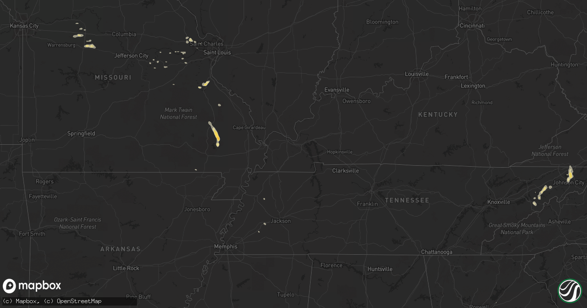
August 3 map
$229
one time, instant access
Download today. No call, no setup
Keep the $229
Bought the map and want the full workflow? Apply the entire $229 to a subscription within 7 days. None of it is wasted.
Every map, not just this one
This buys you this map. Subscription and you get every map we run, in the markets you choose from a few cities to whole states to nationwide. Plus real-time alerts the moment a storm fires.
Contact data
Name, contact info, occupancy, even credit band for addresses in the footprint. You go from where it hit to who to call.
Become the source they trust
Unlimited branding weather history reports on demand. You already have the documented answer ready for the property owner, and you are the one who showed up with it.
Property data and RoofTrace estimates
Pull up any address you have got, its value and the exact code rules for that jurisdiction, straight from One Click Code. Then RoofTrace estimates the squares, pitch, and roof value, priced the way you price.
Storm reports in Georgia
Georgia
| Date | Description |
|---|---|
| 08/03/20126:55 PM CDT | Emergency manager reports several roofs off businesses at 1583 north highway 85. |
| 08/03/20126:50 PM CDT | Numerous powerlines reported down along highway 85 in eastern portions of the county. |
| 08/02/20127:15 PM CDT | Several power lines down. |
| 08/02/20127:00 PM CDT | Roofs blown off of 3 to 4 business on the north end of fayetteville along highway 85. |
All States Impacted by Hail Map on August 3, 2012
Cities Impacted by Hail Map on August 3, 2012
- Cresbard, SD
- Northville, SD
- Mansfield, SD
- Faulkton, SD
- Tyrone, OK
- Turpin, OK
- Mosheim, TN
- Meade, KS
- Mobile, AL
- Castlewood, SD
- Hayti, SD
- Grand Marais, MN
- Gothenburg, NE
- Maxwell, NE
- Brady, NE
- Mantorville, MN
- Kasson, MN
- Byron, MN
- Richfield, KS
- Rockham, SD
- Gary, SD
- Revillo, SD
- State Line, MS
- Fruitdale, AL
- Felton, MN
- Linn, MO
- Bland, MO
- Sedalia, MO
- Granville, IA
- Paullina, IA
- Johnstown, NE
- Elsmere, NE
- Thedford, NE
- Plains, KS
- Murdock, MN
- Sioux Rapids, IA
- Albert City, IA
- Alta, IA
- Linn Grove, IA
- Rembrandt, IA
- Webb, IA
- Marathon, IA
- Atkinson, NE
- Roscoe, SD
- Greeneville, TN
- Algona, IA
- Long Pine, NE
- Bassett, NE
- Newport, NE
- Ainsworth, NE
- Little Mountain, SC
- Boyd, MN
- Canby, MN
- Minneota, MN
- Bartlett, NE
- Chambers, NE
- Burwell, NE
- Sunburg, MN
- Pennock, MN
- Oldham, SD
- Ramona, SD
- Canova, SD
- Salem, SD
- Alexandria, SD
- Spencer, SD
- Glenham, SD
- Selby, SD
- Williamson, GA
- Lyons, GA
- Naples, FL
- Lumberton, MS
- Parrottsville, TN
- New London, MN
- Aliceville, AL
- Donnelly, MN
- Albion, NE
- Boligee, AL
- De Soto, MO
- Mantee, MS
- Woodland, MS
- Elmore, MN
- Buffalo Center, IA
- Frost, MN
- Mills, NE
- Lake Wilson, MN
- Huron, SD
- Wolsey, SD
- Virgil, SD
- Fedora, SD
- Artesian, SD
- Tulare, SD
- Alpena, SD
- Letcher, SD
- Yale, SD
- Cavour, SD
- Hitchcock, SD
- Carpenter, SD
- Iroquois, SD
- Woonsocket, SD
- Carthage, SD
- Newman Grove, NE
- Lindsay, NE
- Petersburg, NE
- Meadow Grove, NE
- Stanton, NE
- Leigh, NE
- Madison, NE
- Humphrey, NE
- Tilden, NE
- Albany, MN
- Holdingford, MN
- Fayetteville, GA
- Jonesboro, GA
- Holt, FL
- Mound City, SD
- Mobridge, SD
- Wentzville, MO
- Dodge City, KS
- Correll, MN
- Lamberton, MN
- Springfield, SD
- Andalusia, AL
- Swanville, MN
- Burtrum, MN
- Minneola, KS
- Fowler, KS
- Ensign, KS
- Bucklin, KS
- Ford, KS
- Houstonia, MO
- Sweet Springs, MO
- Longwood, FL
- Laurens, IA
- Saint Charles, MO
- Parrish, FL
- McKenzie, AL
- Elizabethtown, KY
- Cecilia, KY
- Jenkinsville, SC
- Calumet, IA
- Sutherland, IA
- Peterson, IA
- Larrabee, IA
- Primghar, IA
- Gipsy, MO
- Zalma, MO
- Wappapello, MO
- McGee, MO
- Greenville, MO
- Lowndes, MO
- Bunnell, FL
- Malta Bend, MO
- Florala, AL
- Bismarck, ND
- White Lake, SD
- Kimball, SD
- Lost Springs, KS
- Burdick, KS
- Herington, KS
- Collins, MS
- Bonita Springs, FL
- Estero, FL
- Deland, FL
- Plankinton, SD
- Stickney, SD
- Lewis, KS
- Belpre, KS
- Gackle, ND
- Georgetown, MN
- Borup, MN
- Moorhead, MN
- Ulen, MN
- Yankton, SD
- Bowdle, SD
- Java, SD
- Needham, AL
- Butler, AL
- Gilbertown, AL
- Toxey, AL
- Mission Hill, SD
- Vermillion, SD
- Volin, SD
- Jachin, AL
- Lisman, AL
- Wahpeton, ND
- Fairmount, ND
- Tintah, MN
- Wheaton, MN
- Dolliver, IA
- Swea City, IA
- Bancroft, IA
- Armstrong, IA
- Fenton, IA
- Ringsted, IA
- Estherville, IA
- Maple Hill, NC
- Lennox, SD
- Gardner, ND
- Grandin, ND
- Winnsboro, SC
- Liberty Hill, SC
- Ridgeway, SC
- Niobrara, NE
- Crofton, NE
- Sublette, KS
- Flatwoods, WV
- Oconto, NE
- Callaway, NE
- Palisade, NE
- Hayes Center, NE
- North Platte, NE
- Tryon, NE
- Platte, SD
- Amargosa Valley, NV
- Lakefield, MN
- Lake Preston, SD
- Halsey, NE
- Webster, FL
- Grant, NE
- Madrid, NE
- Imperial, NE
- Etters, PA
- York Haven, PA
- Thompson, IA
- Lakota, IA
- Bricelyn, MN
- Rake, IA
- Ledyard, IA
- Moscow, KS
- Hugoton, KS
- Shelly, MN
- Sunflower, AL
- Wagarville, AL
- McIntosh, AL
- Stapleton, NE
- Arnold, NE
- Mount Vernon, SD
- Fredericktown, MO
- Redfield, SD
- Barrett, MN
- Evansville, MN
- Bristol, FL
- Carrollton, AL
- Tabor, SD
- Tyndall, SD
- Forest City, IA
- Erhard, MN
- Fergus Falls, MN
- Wolverton, MN
- Arlington, SD
- Manter, KS
- Langhorne, PA
- Bensalem, PA
- Wright, KS
- Offerle, KS
- Gregory, SD
- Hermann, MO
- Hillsboro, ND
- Caledonia, ND
- Underwood, MN
- Battle Lake, MN
- Hooker, OK
- Pahrump, NV
- Galesburg, ND
- Heath Springs, SC
- Toquerville, UT
- Elkhart, KS
- Culbertson, NE
- Bruce, SD
- Walnut Grove, MN
- Faribault, MN
- Tolstoy, SD
- Onaka, SD
- Frederick, SD
- Hollywood, FL
- Arthur, NE
- Anselmo, NE
- Mooreton, ND
- Ripton, VT
- Langdon, ND
- Westbrook, MN
- Revere, MN
- Oviedo, FL
- Orlando, FL
- Danvers, MN
- Appleton, MN
- Estelline, SD
- Rock Valley, IA
- Clarkfield, MN
- Hanley Falls, MN
- Fairmont, MN
- Welcome, MN
- Center, NE
- Verdigre, NE
- Bloomfield, NE
- Johnson City, TN
- Lithia, FL
- Taunton, MN
- Lakeland, FL
- Hialeah, FL
- Dunning, NE
- Maynard, MN
- Montevideo, MN
- Foristell, MO
- Dallas, SD
- Brookings, SD
- Breckenridge, MN
- Holloway, MN
- New Rockford, ND
- Stirum, ND
- Milnor, ND
- Fort Ransom, ND
- Lisbon, ND
- Waynesboro, GA
- Doland, SD
- Springview, NE
- Tolna, ND
- Chandler, MN
- Fort Lauderdale, FL
- Opa Locka, FL
- Marthasville, MO
- Lidgerwood, ND
- Wyndmere, ND
- Madison, MN
- Kenyon, MN
- Sherburn, MN
- Granada, MN
- Trimont, MN
- Rosebud, MO
- Piney Flats, TN
- Watauga, TN
- Bluff City, TN
- Colome, SD
- Cottonwood, MN
- Marshall, MN
- Liberal, KS
- Kismet, KS
- Keysville, GA
- Mandan, ND
- Spearville, KS
- Filley, NE
- Beatrice, NE
- Virginia, NE
- Afton, TN
- Chuckey, TN
- Egan, SD
- Colman, SD
- Flandreau, SD
- Kathleen, FL
- Altamonte Springs, FL
- Hoven, SD
- Newport, TN
- Taylor, NE
- Oakdale, NE
- Harwood, ND
- Hunter, ND
- Currie, MN
- Bradley, FL
- Wakpala, SD
- Litchfield, MN
- Hallowell, ME
- Augusta, ME
- Forgan, OK
- Westport, SD
- Ipswich, SD
- Ramona, KS
- Tampa, KS
- Red Lake Falls, MN
- Berger, MO
- New Haven, MO
- Stuart, NE
- Naper, NE
- Mellette, SD
- Ord, NE
- Williams, AZ
- Medina, ND
- Woodworth, ND
- Keyes, OK
- Northwood, IA
- Hanlontown, IA
- Lake Mills, IA
- Joice, IA
- Kensett, IA
- Beaver, OK
- Fort Meade, FL
- Bartow, FL
- Lamoure, ND
- Deltona, FL
- Otterville, MO
- Pilot Grove, MO
- Smithton, MO
- Moscow Mills, MO
- Euclid, MN
- Stafford, VA
- Houghton, SD
- Trenton, TN
- Feasterville Trevose, PA
- Levittown, PA
- Philadelphia, PA
- Seneca, NE
- Montezuma, KS
- Kinsley, KS
- Hardesty, OK
- Adrian, TX
- Jackson, AL
- Blackwell, MO
- Cadet, MO
- Greensboro, AL
- Hancock, MN
- Martin, ND
- Herrick, SD
- Burke, SD
- Shoshone, CA
- Eustis, FL
- Parkers Prairie, MN
- Bryant, SD
- Sutherland, NE
- Hershey, NE
- Farwell, MN
- Kensington, MN
- Glen Ullin, ND
- Annandale, MN
- Orange City, IA
- Alton, IA
- Hospers, IA
- Baldwin, ND
- Geneva, FL
- Blue Earth, MN
- Charlottesville, VA
- Wood Lake, NE
- Clarkson, NE
- Cannon Falls, MN
- Eden, NC
- Ruffin, NC
- Bowling Green, FL
- Blountville, TN
- Bristol, TN
- Dundas, MN
- Northfield, MN
- Lonsdale, MN
- Goodwell, OK
- Waynesboro, MS
- Ormond Beach, FL
- Detroit Lakes, MN
- Leasburg, MO
- Goodwin, SD
- Festus, MO
- Eutaw, AL
- Berlin, ND
- Verona, ND
- Fullerton, ND
- Lakewood, NJ
- Jackson, NJ
- Toms River, NJ
- Manchester Township, NJ
- Walhalla, ND
- O'Fallon, MO
- Strandburg, SD
- Labolt, SD
- Adams, ND
- Lawton, ND
- Somerville, TN
- Stanton, TN
- Ashton, SD
- Dodge Center, MN
- Gordo, AL
- Kennedy, AL
- Reform, AL
- Hawarden, IA
- Fort McCoy, FL
- Hurley, SD
- Winter Park, FL
- Oakes, ND
- Gwinner, ND
- Osage, MN
- Gayville, SD
- Citronelle, AL
- Chunchula, AL
- Wagner, SD
- Maurice, IA
- Sioux Center, IA
- Aurelia, IA
- Archer, IA
- Remsen, IA
- Winter Springs, FL
- Casselberry, FL
- Lake Mary, FL
- Clark, SD
- Georgiana, AL
- Lake Helen, FL
- New Smyrna Beach, FL
- Daytona Beach, FL
- Conde, SD
- Johnson, KS
- Michigan, ND
- Leonard, ND
- Scooba, MS
- Emelle, AL
- Macon, MS
- Polk City, FL
- Miami, FL
- Howard, SD
- Morris, MN
- Chapin, SC
- Pomaria, SC
- Washington, MO
- Menahga, MN
- Dresden, ME
- Fordville, ND
- Fort Myers, FL
- Gallion, AL
- Faunsdale, AL
- Alberta, MN
- Edgerton, MN
- Woodstock, MN
- Cedar City, UT
- Miltona, MN
- Litchville, ND
- Brainerd, MN
- Elizabethton, TN
- Birmingham, AL
- Norcross, MN
- Lakota, ND
- Pekin, ND
- Evergreen, AL
- Centerville, SD
- Wakonda, SD
- Beresford, SD
- Bowdoinham, ME
- Upton, KY
- Sonora, KY
- Hudson, SD
- Alcester, SD
- Alvord, IA
- Doon, IA
- Henning, MN
- Ottertail, MN
- Clitherall, MN
- Leola, SD
- Vesta, MN
- Wood Lake, MN
- Claremont, MN
- West Concord, MN
- New Salem, ND
- Sargent, NE
- Hamilton, ND
- Clubb, MO
- Vining, MN
- Burt, IA
- Motley, MN
- Wallingford, IA
- Leland, IA
- Manly, IA
- Scarville, IA
- Kindred, ND
- Marietta, MN
- Saint Hilaire, MN
- Grove City, MN
- Rolla, KS
- Frankfort, SD
- Pilger, NE
- Lake Norden, SD
- Winner, SD
- Rosholt, SD
- Greenville, FL
- Leicester, NC
- Villa Ridge, MO
- Union, MO
- Goodhue, MN
- Myakka City, FL
- Homestead, FL
- Sarasota, FL
- Bradenton, FL
- Elsie, NE
- Doniphan, MO
- Oxly, MO
- Marshall, MO
- Sheldon, ND
- Mulberry, FL
- Edgecomb, ME
- Dillwyn, VA
- Littlefield, AZ
- Thurston, NE
- Ivanhoe, MN
- Napoleonville, LA
- Pierre Part, LA
- Jackson, MN
- Alpha, MN
- Mcleod, ND
- Dunnell, MN
- Walsh, CO
- Croydon, PA
- Holland, MN
- Aberdeen, SD
- Waterloo, IL
- Parker, SD
- Marion, SD
- Wiscasset, ME
- Richmond, ME
- Blackville, SC
- Marion, AL
- Colorado City, AZ
- Grey Eagle, MN
- Dawson, ND
- Walcott, ND
- Del Rio, TN
- Bonesteel, SD
- Raymond, SD
- Montrose, SD
- Waseca, MN
- Spicer, MN
- Goodrich, ND
- Mchenry, ND
- Saint Libory, NE
- Hazel, SD
- Maurepas, LA
- Webster, SD
- Wessington, SD
- Seneca, SD
- Turton, SD
- Eagle Butte, SD
- Brentford, SD
- Aneta, ND
- Argusville, ND
- Perley, MN
- Arthur, ND
- Buford, GA
- Deer Creek, MN
- Hewitt, MN
- Indiantown, FL
- Erwin, SD
- Augusta, MO
- Bristol, VA
- Alexandria, MN
- Lakeville, MN
- Belle Plaine, MN
- Jud, ND
- Owensville, MO
- Edgeley, ND
- Groveland, FL
- Midway, TN
- Kimball, MN
- Pipestone, MN
- Stanton, ND
- Center, ND
- Tingley, IA
- Peterman, AL
- Mcville, ND
- Madison, SD
- Colton, SD
- Montgomery, AL
- Iona, MN
- Prentiss, MS
- Oak Vale, MS
- Clear Lake, IA
- Mason City, IA
- Sawyerville, AL
- Brewster, MN
- Okabena, MN
- Worthington, MN
- Round Lake, MN
- Reading, MN
- Thief River Falls, MN
- Sterling, ND
- Colfax, ND
- Sanford, FL
- Adrian, MN
- Rushmore, MN
- Fredonia, ND
- Volga, SD
- Saint Joseph, MN
- Avon, MN
- Corinna, ME
- Bushnell, FL
- Monroeville, AL
- Dell Rapids, SD
- Yuma, CO
- Benson, MN
- Portales, NM
- Driscoll, ND
- Exeter, ME
- Ty Ty, GA
- New Oxford, PA
- Brownsville, TN
- Winfred, SD
- Riverdale, GA
- Slayton, MN
- Davis, SD
- Fults, IL
- Saint Peters, MO
- Ponsford, MN
- Gonzales, LA
- De Smet, SD
- Monticello, FL
- Viborg, SD
- Glendale, KY
- Cantonment, FL
- Cyrus, MN
- Clara City, MN
- Willow Lake, SD
- White, SD
- Ironton, MN
- Deerwood, MN
- Salix, IA
- New Cumberland, PA
- Lewisberry, PA
- Staunton, VA
- Gerald, MO
- Beatty, NV
- Wrens, GA
- Red Wing, MN
- Hutchinson, MN
- Bradley, SD
- Garden City, SD
- Dumont, MN
- Forest Home, AL
- Bay Minette, AL
- Highmore, SD
- Milan, MN
- Saint Helena, NE
- Pensacola, FL
- Chamois, MO
- Mount Olive, MS
- Magee, MS
- Orient, SD


