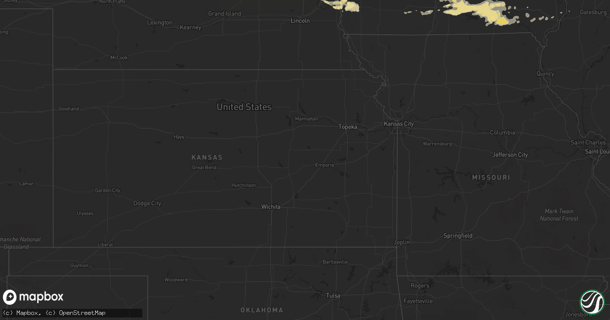
Hail Map in Minnesota on August 15, 2012
Get this storm
August 15 map
$229
one time, instant access
Download today. No call, no setup
Keep the $229
Bought the map and want the full workflow? Apply the entire $229 to a subscription within 7 days. None of it is wasted.
Every map, not just this one
This buys you this map. Subscription and you get every map we run, in the markets you choose from a few cities to whole states to nationwide. Plus real-time alerts the moment a storm fires.
Contact data
Name, contact info, occupancy, even credit band for addresses in the footprint. You go from where it hit to who to call.
Become the source they trust
Unlimited branding weather history reports on demand. You already have the documented answer ready for the property owner, and you are the one who showed up with it.
Property data and RoofTrace estimates
Pull up any address you have got, its value and the exact code rules for that jurisdiction, straight from One Click Code. Then RoofTrace estimates the squares, pitch, and roof value, priced the way you price.
Storm reports in Minnesota
Minnesota
| Date | Description |
|---|---|
| 08/15/20126:25 PM CDT | A local report indicates 1.25 inch wind near 5 NW BENSON |
| 08/15/20126:06 PM CDT | A local report indicates 1.00 inch wind near 3 SE MORRIS |
| 08/15/20125:55 PM CDT | A local report indicates 1.00 inch wind near MORRIS |
| 08/15/20125:55 PM CDT | A local report indicates 1.25 inch wind near N MORRIS |
| 08/15/20125:40 PM CDT | A local report indicates 1.00 inch wind near DONNELLY |
| 08/15/20125:35 PM CDT | A local report indicates 1.75 inch wind near 3 W DONNELLY |
| 08/15/20125:10 PM CDT | Few hailstones to golf ball size...with more quarter to half dollar sized hail. |
| 08/15/20124:45 PM CDT | A local report indicates 1.00 inch wind near 2 NW BECIDA |
| 08/14/20127:24 PM CDT | At the intersection of hwy 7 and 160th ave |
| 08/14/20127:16 PM CDT | A local report indicates 1.00 inch wind near 1 NE CLARA CITY |
All States Impacted by Hail Map on August 15, 2012
Cities Impacted by Hail Map on August 15, 2012
- Salem, IA
- New London, IA
- Mount Pleasant, IA
- Audubon, IA
- Earling, IA
- Peridot, AZ
- Globe, AZ
- Tampico, IL
- Sheffield, IL
- Truckee, CA
- Keota, OK
- New Sharon, IA
- La Crosse, WI
- Iowa Falls, IA
- Alden, IA
- Papillion, NE
- Gretna, NE
- Springfield, NE
- Lake City, MN
- Black Canyon City, AZ
- Scranton, IA
- Cedar Rapids, IA
- Swisher, IA
- Mount Gilead, NC
- Jackson Springs, NC
- Candor, NC
- Ellerbe, NC
- Reasnor, IA
- Newton, IA
- Montevideo, MN
- Raymond, MN
- Murdock, MN
- Benson, MN
- Clara City, MN
- Maynard, MN
- Boston, GA
- Solway, MN
- Chariton, IA
- Russell, IA
- Spring Grove, MN
- Houston, MN
- Caledonia, MN
- Winona, MN
- Lacona, IA
- Oxford, WI
- Wisconsin Dells, WI
- Westby, WI
- Coon Valley, WI
- Stoddard, WI
- Chaseburg, WI
- Rayville, LA
- Ladora, IA
- Williamsburg, IA
- Eldora, IA
- Bemidji, MN
- Hertford, NC
- Alpha, IL
- Wahpeton, ND
- Dodge, WI
- Dakota, MN
- West Salem, WI
- Galesville, WI
- Sparta, WI
- Trempealeau, WI
- Arcadia, WI
- Mindoro, WI
- Fountain City, WI
- Rockland, WI
- Bangor, WI
- Holmen, WI
- Merritt, NC
- Oriental, NC
- Allen, NE
- Littlefork, MN
- Loman, MN
- Aspinwall, IA
- Manilla, IA
- Manning, IA
- Black River Falls, WI
- Lanesboro, MN
- Thomasville, GA
- Lake Hopatcong, NJ
- Oak Ridge, NJ
- Delmar, IA
- Clinton, IA
- Pella, IA
- Oskaloosa, IA
- Zwingle, IA
- Bernard, IA
- Stigler, OK
- Shevlin, MN
- Staten Island, NY
- Breckenridge, MN
- Danville, IA
- Middletown, IA
- West Burlington, IA
- Drakesville, IA
- Milo, IA
- Blakesburg, IA
- Williamson, IA
- Indianola, IA
- Albia, IA
- Bloomfield, IA
- Ottumwa, IA
- Floris, IA
- Moravia, IA
- Hedrick, IA
- Unionville, IA
- Lucas, IA
- Liberty Center, IA
- Melcher Dallas, IA
- Corydon, IA
- Melrose, IA
- New Virginia, IA
- Eddyville, IA
- Derby, IA
- Woodburn, IA
- Blackduck, MN
- Tenstrike, MN
- Hines, MN
- Ivor, VA
- Watertown, WI
- Reeseville, WI
- Belleville, WI
- New Glarus, WI
- Rockaway, NJ
- Newfoundland, NJ
- Woodward, IA
- Adel, IA
- Dawson, IA
- Bagley, IA
- Minburn, IA
- Yale, IA
- Redfield, IA
- Jamaica, IA
- Panora, IA
- Bouton, IA
- Stuart, IA
- Perry, IA
- Jefferson, IA
- Rippey, IA
- Dallas Center, IA
- Guthrie Center, IA
- Linden, IA
- Herman, NE
- Blair, NE
- Arlington, NE
- Laporte, MN
- Elroy, WI
- Mauston, WI
- New Lisbon, WI
- Altura, MN
- Cochrane, WI
- Alma, WI
- Kellogg, MN
- Plattsmouth, NE
- Fairfax, IA
- Onalaska, WI
- Rollingstone, MN
- Minnesota City, MN
- Melrose, WI
- Plainview, MN
- Ettrick, WI
- Columbus, WI
- Hubbard, IA
- Hereford, TX
- Clarendon, TX
- Coon Rapids, IA
- La Crescent, MN
- Monticello, IA
- New Smyrna Beach, FL
- Mechanicsville, IA
- Deep River, IA
- Montezuma, IA
- Guernsey, IA
- Brooklyn, IA
- Park Rapids, MN
- Melville, NY
- Old Bethpage, NY
- Plainview, NY
- Bethpage, NY
- Madrid, IA
- Middletown, NJ
- Atlantic Highlands, NJ
- Red Bank, NJ
- Norcatur, KS
- Oberlin, KS
- What Cheer, IA
- Ackley, IA
- Hillsboro, IA
- Ashland, NE
- Waterloo, NE
- Osteen, FL
- Churdan, IA
- Lohrville, IA
- Amelia Court House, VA
- Delta, IA
- Rose Hill, IA
- Rubicon, WI
- Oconomowoc, WI
- Hartford, WI
- Colgate, WI
- Hartland, WI
- Donnelly, MN
- Collins, MS
- Norton, KS
- Newhebron, MS
- Humeston, IA
- Lovilia, IA
- Chillicothe, IA
- Douds, IA
- Birchwood, WI
- Elberon, VA
- Smithfield, VA
- Wakefield, VA
- Castana, IA
- Delhi, IA
- Manchester, IA
- Earlville, IA
- Delaware, IA
- West Point, NE
- Dodge, NE
- Scribner, NE
- Winter Park, FL
- Winter Springs, FL
- Casselberry, FL
- Oviedo, FL
- Palm Coast, FL
- Dysart, IA
- Rowley, IA
- Brandon, IA
- Independence, IA
- Mount Auburn, IA
- Jesup, IA
- La Porte City, IA
- Buckingham, IA
- Hancock, MN
- Holloway, MN
- Wheaton, MN
- Alberta, MN
- Sacred Heart, MN
- Clontarf, MN
- Danvers, MN
- Renville, MN
- Chokio, MN
- Kerkhoven, MN
- Dumont, MN
- Morris, MN
- Bagley, MN
- Webster, IA
- Keswick, IA
- Gibson, IA
- South English, IA
- North English, IA
- Barnes City, IA
- Norcross, MN
- Puposky, MN
- Pennington, MN
- Cass Lake, MN
- Glidden, IA
- Carroll, IA
- New Providence, IA
- Union, IA
- Omaha, NE
- Council Bluffs, IA
- Fort Calhoun, NE
- Bennington, NE
- Carter Lake, IA
- Pacific Junction, IA
- Ormond Beach, FL
- Flagler Beach, FL
- Bunnell, FL
- Murray, IA
- Woodhaven, NY
- Woodside, NY
- South Richmond Hill, NY
- South Ozone Park, NY
- Ridgewood, NY
- Richmond Hill, NY
- Rego Park, NY
- Ozone Park, NY
- Maspeth, NY
- Middle Village, NY
- Elmhurst, NY
- Brooklyn, NY
- Radcliffe, IA
- Dimmitt, TX
- Denison, IA
- Marion, IA
- Springville, IA
- Goodhue, MN
- Cannon Falls, MN
- Waverly, VA
- Disputanta, VA
- Waukee, IA
- Sarona, WI
- Barronett, WI
- Shell Lake, WI
- Kendall, WI
- Cashton, WI
- Ontario, WI
- Cumming, IA
- Norwalk, IA
- Duncombe, IA
- Fort Dodge, IA
- Lyndon Station, WI
- Prophetstown, IL
- Edenton, NC
- Irwin, IA
- Marshall, TX
- Canyon, TX
- Glenwood, IA
- Malvern, IA
- Hastings, IA
- Emerson, IA
- Silver City, IA
- Walnut, IL
- Oakland, NE
- Ryan, IA
- Polk City, IA
- Parkersburg, IA
- Deforest, WI
- Brownsville, MN
- Hokah, MN
- Windsor, VA
- Lynnville, IA
- Nashua, MN
- Monsey, NY
- Spring Valley, NY
- West Nyack, NY
- New City, NY
- Nanuet, NY
- New Bern, NC
- Grantsboro, NC
- Aurora, NC
- Sully, IA
- Monroe, IA
- Otley, IA
- Leighton, IA
- Sigourney, IA
- Fremont, IA
- Searsboro, IA
- University Park, IA
- Cedar, IA
- Satsuma, AL
- Elkhorn, WI
- Blairsburg, IA
- Webster City, IA
- Kamrar, IA
- Earlham, IA
- Portage, WI
- Baraboo, WI
- Sperry, IA
- Burlington, IA
- Eldon, IA
- Tomah, WI
- Emerson, NE
- Deltona, FL
- Oquawka, IL
- Hiawatha, IA
- Highlands, NJ
- Rumson, NJ
- Prole, IA
- Mabel, MN
- Wilton, WI
- Benson, AZ
- Happy, TX
- Pinola, MS
- Mendenhall, MS
- Orlando, FL
- Maitland, FL
- Ellston, IA
- Grand River, IA
- Afton, IA
- Thayer, IA
- Osceola, IA
- Mineola, IA
- Norman Park, GA
- Winnebago, NE
- Walthill, NE
- Eagle Grove, IA
- Fairfield, IA
- Batavia, IA
- Princeton, IL
- Amana, IA
- Roosevelt, NJ
- Sanford, FL
- Colquitt, GA
- Endeavor, WI
- Geneva, IA
- Aplington, IA
- Hicksville, NY
- Charter Oak, IA
- Mapleton, IA
- Ute, IA
- De Witt, IA
- Camanche, IA
- Virginia Beach, VA
- Selden, KS
- Charlotte, IA
- Goose Lake, IA
- Marengo, IA
- Campbell, MN
- Van Meter, IA
- Stanwood, IA
- Dubuque, IA
- Traer, IA
- Saddle River, NJ
- Mahwah, NJ
- Ronkonkoma, NY
- Steamboat Rock, IA
- Zumbro Falls, MN
- Millstone Township, NJ
- Galva, IA
- Schaller, IA
- Cherokee, IA
- Early, IA
- Holstein, IA
- Aurelia, IA
- Storm Lake, IA
- Quimby, IA
- Nemaha, IA
- Alta, IA
- Camp Douglas, WI
- Hustler, WI
- Mount Olive, MS
- Leonardo, NJ
- Le Mars, IA
- Ireton, IA
- Agency, IA
- Columbia, IA
- Udell, IA
- Keosauqua, IA
- Milton, IA
- Birmingham, IA
- Moulton, IA
- Weldon, IA
- Knoxville, IA
- Stoughton, WI
- Poynette, WI
- Adel, GA
- Anamosa, IA
- Moultrie, GA
- Taylorsville, MS
- Spring Grove, VA
- Rio, WI
- Norwood, NC
- Beaufort, NC
- Grinnell, IA
- Friona, TX
- Zumbrota, MN
- Wanamingo, MN
- Mazeppa, MN
- Norway, IA
- Atkins, IA
- Olin, IA
- Loyal, WI
- Bellevue, NE
- Fenton, IL
- Wolverton, MN
- Dorchester, IA
- New Albin, IA
- Palco, KS
- Plainville, KS
- Clive, IA
- Bayard, IA
- Oakdale, NY
- West Sayville, NY
- Sayville, NY
- Wendell, MN
- Fort Atkinson, WI
- Milton, WI
- Whitewater, WI
- Appleton, MN
- Monticello, FL
- Lenox, IA
- Shannon City, IA
- Williston Park, NY
- Carle Place, NY
- East Meadow, NY
- Garden City, NY
- Mineola, NY
- Old Westbury, NY
- Westbury, NY
- New Hyde Park, NY
- International Falls, MN
- Kilkenny, MN
- Le Center, MN
- Browns Mills, NJ
- Cookstown, NJ
- Solon, IA
- Ely, IA
- Ackworth, IA
- Ochlocknee, GA
- Meigs, GA
- Tracy, IA
- Killduff, IA
- Norwalk, WI
- Winthrop, IA
- Masonville, IA
- Farmingdale, NY
- Lowden, IA
- Clarence, IA
- Tallahassee, FL
- Onawa, IA
- Daytona Beach, FL
- Deland, FL
- Wellsburg, IA
- Deloit, IA
- Hooper, NE
- Schleswig, IA
- Soldier, IA
- Ricketts, IA
- Kirkville, IA
- Pensacola, FL
- Victor, IA
- Ellsworth, IA
- Story City, IA
- Pavo, GA
- Rushford, MN
- Lewiston, MN
- Clearwater, NE
- Darien, WI
- Delavan, WI
- Mahnomen, MN
- Bronx, NY
- Barney, GA
- Dunlap, IA
- Morland, KS
- Geneva, FL
- Mims, FL
- Colby, KS
- Grand Junction, IA
- Winterset, IA
- Offutt Afb, NE
- Mount Vernon, IA
- Wayside, TX
- Lyndon, IL
- Tulia, TX
- Dixie, GA
- Parnell, IA
- Monroe, WI
- Argyle, WI
- Palo, IA
- Great River, NY
- Islip, NY
- Bay Shore, NY
- West Islip, NY
- North Babylon, NY
- Brightwaters, NY
- East Islip, NY
- Deer Park, NY
- Templeton, IA
- Gray, IA
- Hazleton, IA
- Aurora, IA
- Iowa City, IA
- Hill City, KS
- Stockport, IA
- Spring Valley, MN
- Joint Base Mdl, NJ
- Crescent, IA
- Lake City, IA
- Decorah, IA
- Tintah, MN
- Walker, IA
- Fairmount, ND
- Central City, IA
- Martelle, IA
- Lisbon, IA
- Elmont, NY
- Springfield Gardens, NY
- Howard Beach, NY
- Cambria Heights, NY
- Lynbrook, NY
- Rosedale, NY
- Corona, NY
- Jamaica, NY
- Forest Hills, NY
- Kew Gardens, NY
- Valley Stream, NY
- Malverne, NY
- Hewlett, NY
- Highland, WI
- Coggon, IA
- Biloxi, MS
- Diberville, MS
- Vancleave, MS
- Nogales, AZ
- Wykoff, MN
- Pomeroy, IA
- Alton, IA
- Dedham, IA
- Defiance, IA
- New Bedford, IL
- Erie, IL
- Ohio, IL
- Manlius, IL
- Wyanet, IL
- Deer Grove, IL
- Willcox, AZ
- Wabasha, MN
- Cumberland, WI
- Alburnett, IA
- Cascade, IA
- Lockridge, IA


