Hail Map in Ohio on November 14, 2011
Get this storm
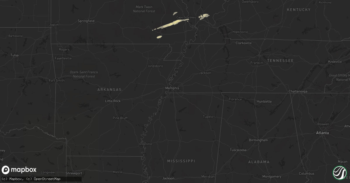
November 14 map
$229
one time, instant access
Download today. No call, no setup
Keep the $229
Bought the map and want the full workflow? Apply the entire $229 to a subscription within 7 days. None of it is wasted.
Every map, not just this one
This buys you this map. Subscription and you get every map we run, in the markets you choose from a few cities to whole states to nationwide. Plus real-time alerts the moment a storm fires.
Contact data
Name, contact info, occupancy, even credit band for addresses in the footprint. You go from where it hit to who to call.
Become the source they trust
Unlimited branding weather history reports on demand. You already have the documented answer ready for the property owner, and you are the one who showed up with it.
Property data and RoofTrace estimates
Pull up any address you have got, its value and the exact code rules for that jurisdiction, straight from One Click Code. Then RoofTrace estimates the squares, pitch, and roof value, priced the way you price.
Storm reports in Ohio
Ohio
| Date | Description |
|---|---|
| 11/14/20115:58 PM CST | Followed by a lot of 1/2 inch hail |
| 11/14/20115:58 PM CST | A local report indicates 1.00 inch wind near 2 W RUSHSYLVANIA |
| 11/14/20115:53 PM CST | Large limbs down. |
| 11/14/20115:50 PM CST | South side of town on cr 130 |
| 11/14/20115:33 PM CST | A local report indicates 1.25 inch wind near ANNA |
| 11/14/20115:10 PM CST | One tree down on goodin st. |
| 11/14/20115:08 PM CST | A local report indicates 60 MPH wind near 3 N KENTON |
| 11/14/20114:55 PM CST | Wind damage to barn |
| 11/14/20113:33 PM CST | Large pole barn sustained roof damage with trees down on elm sugar road between dutch john and john brown rds |
| 11/14/20112:58 PM CST | Quarter to ping pong ball size hail. |
| 11/14/201112:56 PM CST | Widespread power outages in town. Relayed via amateur radio |
| 11/13/20119:03 PM CST | One tree down |
| 11/13/20118:37 PM CST | Large tree branch blocking road near taylor pike and sr 133 |
| 11/13/20118:31 PM CST | One tree down on sugar grove rd. |
| 11/13/20118:30 PM CST | One tree down on fort st. |
| 11/13/20118:30 PM CST | Lines down along goshen rd. Corrected time. |
| 11/13/20118:22 PM CST | One tree down |
| 11/13/20118:18 PM CST | One tree down at wheeling rd/orchard view rd. |
| 11/13/20118:12 PM CST | 36 foot travel trailer moved and tipped over. Time approximated. |
| 11/13/20118:12 PM CST | Lines down along goshen rd. |
| 11/13/20118:05 PM CST | One tree down |
| 11/13/20118:04 PM CST | A few small trees down near intersection of i 70 and sr 37. |
| 11/13/20117:42 PM CST | Large limbs down on wilmington college campus |
| 11/13/20117:41 PM CST | 1 tree down on spring st. Near xenia ave. |
| 11/13/20116:25 PM CST | A local report indicates 1.00 inch wind near MINERAL RIDGE |
| 11/13/20116:25 PM CST | Some large limbs down. |
| 11/13/20116:25 PM CST | Penny to quarter size. |
| 11/13/20116:20 PM CST | A local report indicates 1.00 inch wind near WARREN |
| 11/13/20116:15 PM CST | Large limbs down. |
| 11/13/20116:14 PM CST | A few trees down. |
| 11/13/20116:14 PM CST | A local report indicates 1.00 inch wind near NEWTON FALLS |
All States Impacted by Hail Map on November 14, 2011
Cities Impacted by Hail Map on November 14, 2011
- Olney, IL
- Noble, IL
- Claremont, IL
- Vienna, IL
- Belknap, IL
- Grantsburg, IL
- Kenton, OH
- Lake Milton, OH
- Newton Falls, OH
- Windham, OH
- North Jackson, OH
- Niles, OH
- Warren, OH
- Mineral Ridge, OH
- Diamond, OH
- Ravenna, OH
- McDonald, OH
- Leavittsburg, OH
- Frankfort, IN
- Remington, IN
- Wolcott, IN
- Fowler, IN
- Brookston, IN
- Chalmers, IN
- Star City, IN
- Royal Center, IN
- Zalma, MO
- Williamsport, IN
- Rossville, IL
- Alvin, IL
- Thomasboro, IL
- Champaign, IL
- Dewey, IL
- Mahomet, IL
- Seymour, IL
- Fisher, IL
- Mansfield, IL
- White Heath, IL
- Eagle Pass, TX
- Brackettville, TX
- Liberty Center, IN
- Bluffton, IN
- Poneto, IN
- Warren, IN
- Columbia City, IN
- Cutler, IN
- Russiaville, IN
- La Pryor, TX
- Uvalde, TX
- Napoleon, OH
- Panama, NY
- Clymer, NY
- Tamaroa, IL
- Pinckneyville, IL
- Montpelier, IN
- Van Buren, IN
- Berne, IN
- Geneva, IN
- Monroe, IN
- Marion, OH
- Morral, OH
- Oaktown, IN
- Edwardsport, IN
- Bruceville, IN
- Bicknell, IN
- Pierceton, IN
- South Whitley, IN
- Larwill, IN
- Rensselaer, IN
- Lawrenceville, IL
- Sandborn, IN
- Bridgeport, IL
- Flat Rock, IL
- Westphalia, IN
- Freelandville, IN
- Urbana, IN
- West Lafayette, IN
- Westpoint, IN
- Attica, IN
- Potomac, IL
- Otterbein, IN
- Pine Village, IN
- Lafayette, IN
- Penfield, IL
- Henning, IL
- Armstrong, IL
- Roanoke, IN
- Fort Wayne, IN
- Arcola, IN
- North Manchester, IN
- Huntington, IN
- Mount Victory, OH
- West Mansfield, OH
- Archbold, OH
- Stryker, OH
- Mark Center, OH
- Edgerton, OH
- Hicksville, OH
- Evansport, OH
- Sherwood, OH
- Defiance, OH
- Ney, OH
- Bryan, OH
- Cisco, IL
- Argenta, IL
- Monticello, IL
- Tolono, IL
- Bement, IL
- Ivesdale, IL
- Milmine, IL
- Ridgeville Corners, OH
- Dunbridge, OH
- Butler, IN
- Walbridge, OH
- Leo, IN
- Millbury, OH
- Liberty Center, OH
- Delta, OH
- Stony Ridge, OH
- Saint Joe, IN
- Wauseon, OH
- Perrysburg, OH
- Spencerville, IN
- Waterville, OH
- Pemberville, OH
- Bowling Green, OH
- Monclova, OH
- Luckey, OH
- Swanton, OH
- Haskins, OH
- Grand Rapids, OH
- Auburn, IN
- Neapolis, OH
- Whitehouse, OH
- Claypool, IN
- Silver Lake, IN
- Warsaw, IN
- Seymour, IN
- Columbus, IN
- Greenwood, IN
- Kirklin, IN
- Lebanon, IN
- Sheridan, IN
- Quemado, TX
- Cicero, IN
- Macy, IN
- Battle Ground, IN
- La Rue, OH
- Clarks Hill, IN
- Walton, IN
- Galveston, IN
- Northwood, OH
- Sidney, OH
- Anna, OH
- Middletown, OH
- Trenton, OH
- Marshall, IL
- Casey, IL
- Greenup, IL
- Dennison, IL
- Martinsville, IL
- Trilla, IL
- Neoga, IL
- West Terre Haute, IN
- Toledo, IL
- Lerna, IL
- Hoopeston, IL
- Burnettsville, IN
- Lucerne, IN
- Huntsville, OH
- Advance, MO
- Marble Hill, MO
- Whitewater, MO
- Williston, OH
- Curtice, OH
- Martin, OH
- Oregon, OH
- Grissom Arb, IN
- Peru, IN
- Jackson Center, PA
- Mercer, PA
- New Wilmington, PA
- Grove City, PA
- Harrisville, PA
- Belle Center, OH
- De Graff, OH
- Quincy, OH
- Yorkshire, OH
- Minster, OH
- Versailles, OH
- Rushsylvania, OH
- Lewistown, OH
- Fort Loramie, OH
- Bellefontaine, OH
- Maplewood, OH
- Jackson Center, OH
- Russia, OH
- Shinglehouse, PA
- Wapakoneta, OH
- Flora, IL
- Rinard, IL
- Wingate, IN
- New Richmond, IN
- Veedersburg, IN
- Mellott, IN
- Sharpsville, IN
- Greensburg, IN
- Bedford, IN
- Heltonville, IN
- Williamsville, MO
- Ellsinore, MO
- Andrews, IN
- Reelsville, IN
- Stilesville, IN
- Quincy, IN
- Centerpoint, IN
- Cloverdale, IN
- Martinsville, IN
- Brazil, IN
- Poland, IN
- Churubusco, IN
- Tontogany, OH
- Huntertown, IN
- Genoa, OH
- Oran, MO
- McGee, MO
- Wappapello, MO
- Gipsy, MO
- Sturdivant, MO
- Chaffee, MO
- Greenville, MO
- Kokomo, IN
- Gifford, IL
- Ludlow, IL
- Rantoul, IL
- Linden, IN
- Covington, IN
- Newtown, IN
- Forest, IN
- Kempton, IN
- Colfax, IN
- Romney, IN
- Crawfordsville, IN
- Michigantown, IN
- Tipton, IN
- Girard, OH
- Norman, IN
- Oreana, IL
- Vincennes, IN
- Clay City, IL
- Sumner, IL
- Plainville, IN
- Calhoun, IL
- Elnora, IN
- Scott City, MO
- Monticello, IN
- Bunker Hill, IN
- Carey, OH
- Lagro, IN
- Camby, IN
- Mooresville, IN
- Wellington, IL
- Ambia, IN
- Kewanna, IN
- Milford, IL
- Winamac, IN
- Goodland, IN
- Brook, IN
- Rochester, IN
- Monon, IN
- Idaville, IN
- Earl Park, IN
- Reynolds, IN
- Poplar Bluff, MO
- Harviell, MO
- Delphi, IN
- Emlenton, PA
- Hermitage, PA
- Kennerdell, PA
- Boyers, PA
- Sharpsville, PA
- Clintonville, PA
- West Middlesex, PA
- La Fontaine, IN
- Markle, IN
- Marion, IN
- Craigville, IN
- Youngstown, OH
- Southington, OH
- Cypress, IL
- Brooklyn, IN
- Knippa, TX
- De Land, IL
- Westville, IL
- Perrysville, IN
- Danville, IL
- Pennville, IN
- Weldon, IL
- Farmer City, IL
- Paxton, IL
- Caledonia, OH
- New Bloomington, OH
- Roberts, IL
- Westfield, IN
- Burlington, IN
- Rossville, IN
- Zionsville, IN
- Whitestown, IN
- Decatur, IN
- Wabash, IN
- Saint Marys, OH
- New Knoxville, OH
- Ripley, NY
- Westfield, NY
- Logansport, IN
- Miami, IN
- Camden, IN
- Harrod, OH
- Upper Sandusky, OH
- Roundhead, OH
- Waynesfield, OH
- Lakeview, OH
- New Hampshire, OH
- Harpster, OH
- Scheller, IL
- Du Bois, IL
- Monrovia, IN
- Danville, IN
- Coatesville, IN
- Bainbridge, IN
- Maumee, OH
- Toledo, OH
- Grabill, IN
- Elmore, OH
- Woodville, OH
- Rossford, OH
- McClure, OH
- Ridgeway, OH
- Rossburg, OH
- Houston, OH
- Boswell, IN
- Bolivar, NY
- Little Genesee, NY
- Weston, OH
- Keenes, IL
- Sims, IL
- Thebes, IL
- Sabinal, TX
- Greencastle, IN
- Cape Girardeau, MO
- McClure, IL
- Brownwood, MO
- Flora, IN
- Bringhurst, IN
- New Ross, IN
- Jamestown, IN
- Jefferson, OH
- Dorset, OH
- Yoder, IN
- Batesville, IN
- Brookville, IN
- Portland, IN
- Woodburn, IN
- New Haven, IN
- Collison, IL
- Oxford, IN
- West Lebanon, IN
- Ogden, IL
- Rankin, IL
- Urbana, IL
- Saint Joseph, IL
- Templeton, IN
- Buck Creek, IN
- Young America, IN
- Cerro Gordo, IL
- Fairdealing, MO
- Grandin, MO
- Ceres, NY
- Portville, NY
- Wellsville, NY
- Eldred, PA
- Alma, NY
- Genesee, PA
- Coudersport, PA
- Akron, IN
- Roann, IN
- Laketon, IN
- Liberty Mills, IN
- New Waverly, IN
- Holland, OH
- Westfield, IL
- Catlin, IL
- Oldenburg, IN
- North East, PA
- Rudolph, OH
- Custar, OH
- Upland, IN
- Hartford City, IN
- Allentown, NY
- Polk, PA
- Freetown, IN
- Golconda, IL
- Metropolis, IL
- Karnak, IL
- Grand Chain, IL
- Melvin, IL
- Brownstown, IN
- Holgate, OH
- Oakwood, OH
- Paulding, OH
- Ullin, IL
- Denver, IN
- Mount Erie, IL
- Cisne, IL
- Patton, MO
- Millersville, MO


