Hail Map in Alabama on December 21, 2013
Get this storm
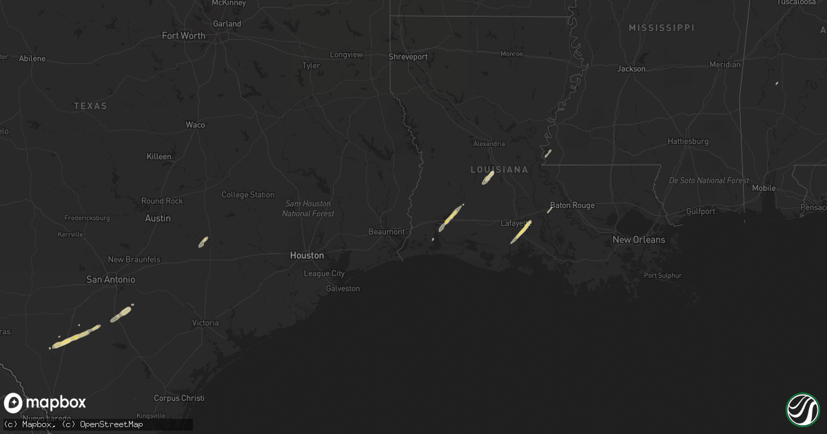
December 21 map
$229
one time, instant access
Download today. No call, no setup
Keep the $229
Bought the map and want the full workflow? Apply the entire $229 to a subscription within 7 days. None of it is wasted.
Every map, not just this one
This buys you this map. Subscription and you get every map we run, in the markets you choose from a few cities to whole states to nationwide. Plus real-time alerts the moment a storm fires.
Contact data
Name, contact info, occupancy, even credit band for addresses in the footprint. You go from where it hit to who to call.
Become the source they trust
Unlimited branding weather history reports on demand. You already have the documented answer ready for the property owner, and you are the one who showed up with it.
Property data and RoofTrace estimates
Pull up any address you have got, its value and the exact code rules for that jurisdiction, straight from One Click Code. Then RoofTrace estimates the squares, pitch, and roof value, priced the way you price.
Storm reports in Alabama
Alabama
| Date | Description |
|---|---|
| 12/21/20131:35 AM CST | Roof peeled back from mobile home along scott branch road. Report relayed by madison county ema. |
| 12/20/201310:12 PM CST | A tree was reported down on east avenue/cr 497. |
| 12/20/20139:34 PM CST | Multiple trees reported down approaching waterloo on the westbound lane. |
| 12/20/20138:58 PM CST | Cwop station dw9506 reported a wind gust to 63 mph. |
| 12/20/20138:55 PM CST | Tree reported down on riverton rose trail. |
All States Impacted by Hail Map on December 21, 2013
Cities Impacted by Hail Map on December 21, 2013
- Cotulla, TX
- Youngsville, LA
- Abbeville, LA
- New Iberia, LA
- Broussard, LA
- Erath, LA
- Saint Martinville, LA
- Pleasanton, TX
- Floresville, TX
- Falls City, TX
- Big Wells, TX
- Charlotte, TX
- Pearsall, TX
- Iowa, LA
- Kinder, LA
- Lake Charles, LA
- La Grange, TX
- West Point, TX
- Ville Platte, LA
- Oakdale, LA
- Muldoon, TX
- Woodville, MS
- Hackberry, LA
- Grosse Tete, LA
- Sweet Water, AL


