Hail Map in Mississippi on June 4, 2012
Get this storm
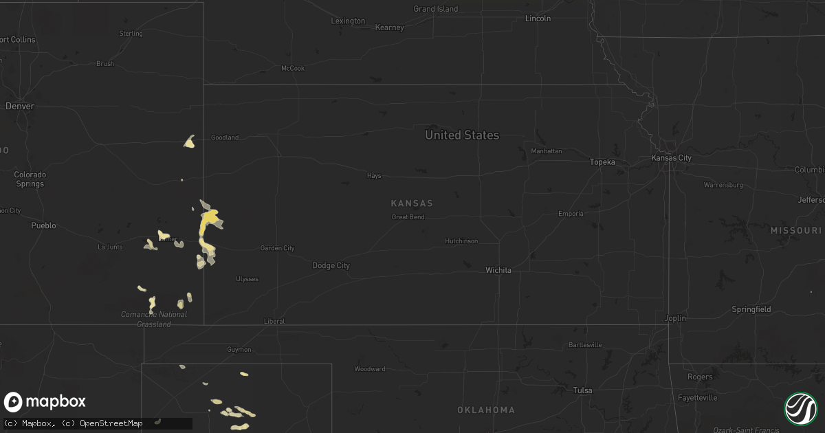
June 4 map
$229
one time, instant access
Download today. No call, no setup
Keep the $229
Bought the map and want the full workflow? Apply the entire $229 to a subscription within 7 days. None of it is wasted.
Every map, not just this one
This buys you this map. Subscription and you get every map we run, in the markets you choose from a few cities to whole states to nationwide. Plus real-time alerts the moment a storm fires.
Contact data
Name, contact info, occupancy, even credit band for addresses in the footprint. You go from where it hit to who to call.
Become the source they trust
Unlimited branding weather history reports on demand. You already have the documented answer ready for the property owner, and you are the one who showed up with it.
Property data and RoofTrace estimates
Pull up any address you have got, its value and the exact code rules for that jurisdiction, straight from One Click Code. Then RoofTrace estimates the squares, pitch, and roof value, priced the way you price.
Storm reports in Mississippi
Mississippi
| Date | Description |
|---|---|
| 06/03/20129:55 PM CDT | Several large tree limbs blocking roads in belzoni. |
| 06/03/20128:35 PM CDT | Several trees and power lines down |
| 06/03/20128:26 PM CDT | A local report indicates 1.75 inch wind near 2 W ARCOLA |
| 06/03/20128:25 PM CDT | Power outages due to trees falling on wires. |
| 06/03/20128:05 PM CDT | Entire roof was removed from one unit at an apartment complex resulting in two families being displaced. |
| 06/03/20127:42 PM CDT | A local report indicates 1.00 inch wind near WINTERVILLE |
| 06/03/20127:35 PM CDT | Some lines down |
All States Impacted by Hail Map on June 4, 2012
Cities Impacted by Hail Map on June 4, 2012
- Paducah, TX
- Seymour, TX
- Superior, MT
- Olton, TX
- Leola, AR
- Tulia, TX
- Carter, MT
- Brunswick, GA
- Darien, GA
- Jesup, GA
- Townsend, GA
- Hortense, GA
- Corvallis, MT
- Lockney, TX
- Floydada, TX
- Dongola, IL
- Rison, AR
- Spur, TX
- Girard, TX
- Dickens, TX
- Woodburn, KY
- Franklin, KY
- Bowling Green, KY
- Matador, TX
- Cairo, IL
- Fitzgerald, GA
- Ambrose, GA
- Wray, GA
- Broxton, GA
- Harrold, SD
- Paron, AR
- Ludowici, GA
- Walsh, CO
- Ballwin, MO
- High Ridge, MO
- Eureka, MO
- Lincoln, MT
- Bard, NM
- San Jon, NM
- Seminole, TX
- Fort Shaw, MT
- Morton, TX
- Mccall, ID
- Donnelly, ID
- Fairfield, MT
- Mershon, GA
- Alma, GA
- Happy, TX
- Silverton, TX
- Sunray, TX
- Sheridan, AR
- Blackshear, GA
- Bristol, GA
- Old Glory, TX
- Rochester, TX
- O'Brien, TX
- Eagle Pass, TX
- Cohagen, MT
- Turkey, TX
- Mcadoo, TX
- Claude, TX
- Quitaque, TX
- McClure, IL
- Jonesboro, IL
- Vaughn, MT
- Power, MT
- Gildford, MT
- Kremlin, MT
- Box Elder, MT
- Benton, KY
- Calvert City, KY
- Gilbertsville, KY
- Borger, TX
- O'Fallon, MO
- Saint Peters, MO
- Loraine, TX
- Glennville, GA
- Shelby, MT
- Valier, MT
- Cypress, IL
- Ullin, IL
- Sun River, MT
- Oxford, MS
- Batesville, MS
- Sardis, MS
- Floweree, MT
- Brussels, IL
- Golden Eagle, IL
- Gold Creek, MT
- Quanah, TX
- Odum, GA
- Fort Benton, MT
- Snyder, TX
- Gail, TX
- Plains, TX
- Red Boiling Springs, TN
- Courtland, MS
- Crenshaw, MS
- Dutton, MT
- Ralls, TX
- Abernathy, TX
- Cascade, ID
- Holly, CO
- Sheridan Lake, CO
- Tribune, KS
- Dalhart, TX
- Paris, TN
- Batchtown, IL
- Eldorado, OK
- Sikeston, MO
- Hamilton, MT
- Lakin, KS
- Elk City, ID
- Roswell, NM
- Frederick, OK
- Big Spring, TX
- Fort Stewart, GA
- Hinesville, GA
- Villa Ridge, IL
- Olmsted, IL
- La Center, KY
- Barlow, KY
- Russellville, KY
- Lewisburg, KY
- Auburn, KY
- Syracuse, KS
- Midway, GA
- Crosbyton, TX
- Pritchett, CO
- Savannah, GA
- Greenville, MS
- Justiceburg, TX
- Chinook, MT
- Chesterfield, MO
- Wildwood, MO
- Imperial, MO
- Barnhart, MO
- House Springs, MO
- Loma, MT
- Tunica, MS
- Seeley Lake, MT
- Ovando, MT
- Bonner, MT
- Hale Center, TX
- Cottonwood, ID
- Buncombe, IL
- Vienna, IL
- Kingsland, AR
- Stevensville, MT
- Wisdom, MT
- Pendroy, MT
- West Green, GA
- Patterson, GA
- Hazlehurst, GA
- Stinnett, TX
- Springfield, CO
- Golconda, IL
- Metropolis, IL
- Dermott, AR
- Lake Village, AR
- Burlington, CO
- Plummer, ID
- Saint Maries, ID
- Harrison, ID
- Fluvanna, TX
- Post, TX
- Conrad, MT
- Ledger, MT
- Brady, MT
- Eudora, AR
- Hollandale, MS
- Jordan, MT
- White Bird, ID
- Grangeville, ID
- Sweet Grass, MT
- Cut Bank, MT
- Bynum, MT
- Sunburst, MT
- Kevin, MT
- Choteau, MT
- Ethridge, MT
- Big Sandy, MT
- North Little Rock, AR
- Brownfield, TX
- Adrian, TX
- Hereford, TX
- Vega, TX
- Karnak, IL
- Grand Chain, IL
- Weippe, ID
- Kamiah, ID
- Wolf Creek, MT
- Cascade, MT
- Augusta, MT
- Kress, TX
- Westbrook, TX
- Coahoma, TX
- Sterling City, TX
- Littlefield, TX
- Council, ID
- Cadiz, KY
- Traskwood, AR
- Baxley, GA
- Wayside, TX
- Chaffee, MO
- Hardin, IL
- Lorenzo, TX
- Clarendon, TX
- Petersburg, TX
- Aspermont, TX
- Afton, TX
- Riggins, ID
- Laredo, TX
- Stratford, TX
- Reidsville, GA
- Cottonwood, CA
- McGehee, AR
- Benton, MO
- Scott City, MO
- Oran, MO
- Emmett, ID
- Molt, MT
- Fritch, TX
- Rotan, TX
- Henry, TN
- Plainview, TX
- Brockway, MT
- Circle, MT
- Brookport, IL
- Clovis, NM
- Orofino, ID
- Senatobia, MS
- Roaring Springs, TX
- Hasty, CO
- Tompkinsville, KY
- Carrollton, AL
- Columbus, MS
- Ethelsville, AL
- Coffeeville, MS
- Sundance, WY
- Sweet, ID
- Saint Charles, MO
- Winfield, MO
- Flomot, TX
- Philipsburg, MT
- Riceboro, GA
- Great Falls, MT
- Rohwer, AR
- Benoit, MS
- Arkansas City, AR
- Musselshell, MT
- Seagraves, TX
- Puryear, TN
- Nara Visa, NM
- Lamar, CO
- Wiley, CO
- Saint Simons Island, GA
- Charleston, MO
- Thebes, IL
- Miller City, IL
- Clinton, MT
- Celina, TN
- Gamaliel, KY
- Mount Hermon, KY
- Moss, TN
- Whitleyville, TN
- Gainesboro, TN
- Summer Shade, KY
- Glasgow, KY
- Boise City, OK
- Talladega, AL
- Munford, AL
- Drummond, MT
- Holly Springs, MS
- Jemison, AL
- Anaconda, MT
- Canyon, TX
- Crowell, TX
- Olive Branch, IL
- Welch, TX
- Fort Peck, MT
- Olney, TX
- Kooskia, ID
- Leland, MS
- Cookeville, TN
- Leoti, KS
- Surrency, GA
- Hart, TX
- Missoula, MT
- Redding, CA
- Anderson, CA
- Morse, TX
- New Meadows, ID
- Malvern, AR
- Moriarty, NM
- Pollock, SD
- McClave, CO
- Lovington, NM
- Hamburg, IL
- Tillar, AR
- Allenhurst, GA
- Andrews, TX
- Camden, TN
- Gruver, TX
- Levelland, TX
- Helmville, MT
- Tishomingo, OK
- Stonewall, OK
- Mansfield, TN
- Coldwater, MS
- Cottage Grove, TN
- Belzoni, MS
- Isola, MS
- Elsberry, MO
- Old Monroe, MO
- Foley, MO
- Wickliffe, KY
- Hartley, TX
- Springville, TN
- Buchanan, TN
- Ingomar, MT
- Grapevine, AR
- Garrison, MT
- Causey, NM
- Gould, OK
- Warren, AR
- Maple, TX
- Mesa, ID
- Dupuyer, MT
- Glenham, SD
- Mill Creek, OK
- Red Bluff, CA
- Ledbetter, KY
- West Paducah, KY
- Kevil, KY
- Paducah, KY
- Elida, NM
- Dimmitt, TX
- Lindsay, MT
- Trail City, SD
- Carthage, AR
- Dow, IL
- Godfrey, IL
- West Alton, MO
- Denver City, TX
- Tatum, NM
- Cambridge, ID
- Mountain Grove, MO
- Cedar Grove, TN
- Childress, TX
- Havre, MT
- Saint Louis, MO
- Stites, ID
- Olivehill, TN
- Matthews, MO
- Cape Girardeau, MO
- Bertrand, MO
- Rochelle, GA
- Cheyenne Wells, CO
- Scott, AR
- Lonoke, AR
- Estancia, NM
- Oilmont, MT
- Knox City, TX
- Fieldton, TX
- Jayton, TX
- Poyen, AR
- Ivan, AR
- Tamms, IL
- Avon, MT
- Hall, MT
- Hingham, MT
- Highwood, MT
- Simms, MT
- Galata, MT
- Water Valley, MS
- Calera, AL
- Grantsburg, IL
- New Concord, KY
- Hernando, MS
- Benton, AR
- Midvale, ID
- Paris, MS
- Felt, OK
- Screven, GA
- Fenton, MO
- Annada, MO
- Atoka, OK
- Pittsburg, OK
- Clayton, NM
- Tensed, ID
- Lyons, GA
- Soperton, GA
- Reform, AL
- Desmet, ID
- Ira, TX
- Presho, SD
- Smithland, KY
- Belknap, IL
- Anna, IL
- Darby, MT
- Hazel, KY
- McKenzie, TN
- Hollow Rock, TN
- Huntingdon, TN
- Colorado City, TX
- Kuttawa, KY
- Nicholls, GA
- Breckenridge, TX
- Lonsdale, AR
- Anton, TX
- Denton, GA
- Dumas, TX


