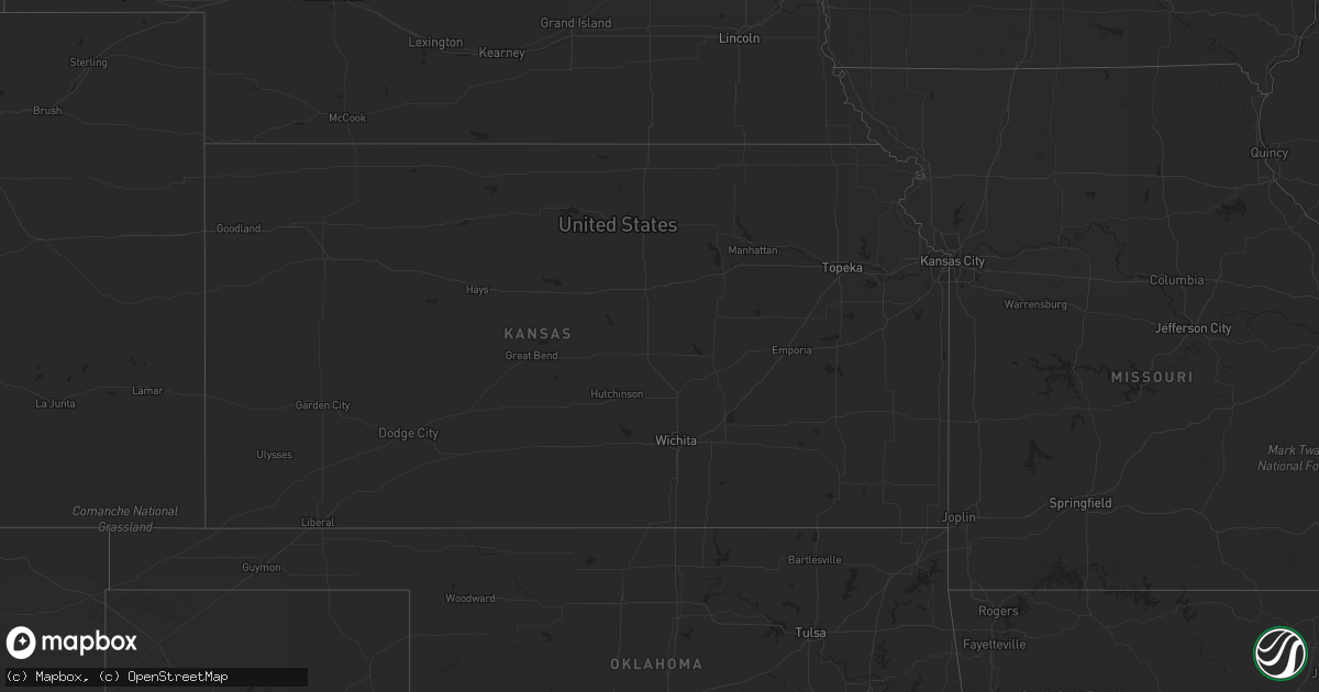
Hail Map in Mississippi on June 6, 2011
Get this storm
June 6 map
$229
one time, instant access
Download today. No call, no setup
Keep the $229
Bought the map and want the full workflow? Apply the entire $229 to a subscription within 7 days. None of it is wasted.
Every map, not just this one
This buys you this map. Subscription and you get every map we run, in the markets you choose from a few cities to whole states to nationwide. Plus real-time alerts the moment a storm fires.
Contact data
Name, contact info, occupancy, even credit band for addresses in the footprint. You go from where it hit to who to call.
Become the source they trust
Unlimited branding weather history reports on demand. You already have the documented answer ready for the property owner, and you are the one who showed up with it.
Property data and RoofTrace estimates
Pull up any address you have got, its value and the exact code rules for that jurisdiction, straight from One Click Code. Then RoofTrace estimates the squares, pitch, and roof value, priced the way you price.
Storm reports in Mississippi
Mississippi
| Date | Description |
|---|---|
| 06/06/20115:05 PM CDT | A few trees were blown down. |
| 06/06/20114:03 PM CDT | Reported in the carnes community |
| 06/06/20112:58 PM CDT | Half dollar size hail reported at anchor lake road and bouie road. |
| 06/06/20112:52 PM CDT | Quarter size hail at intersection of bouie road and ron dossett road in southeast pearl river county. |
| 06/06/20112:35 PM CDT | Quarter size hail at mississippi highway 53 and shaw road in lyman. |
| 06/06/20112:28 PM CDT | Quarter sized hail reported 1 mile nw of lyman. |
| 06/06/20112:23 PM CDT | Ice cube size hail at u.s. Highway 49 and school road north of gulfport. |
All States Impacted by Hail Map on June 6, 2011
Cities Impacted by Hail Map on June 6, 2011
- Maple, WI
- Frenchtown, MT
- Huson, MT
- West Green, GA
- Nicholls, GA
- Pensacola, FL
- Bell, FL
- Stockett, MT
- Enning, SD
- White Owl, SD
- Live Oak, FL
- Saint Francis, SD
- Mission, SD
- Crookston, NE
- Power, MT
- Buna, TX
- Canyon, MN
- Alborn, MN
- Saginaw, MN
- Grand Rapids, MN
- Cohasset, MN
- Port Allen, LA
- Greenville, FL
- Granville, ND
- Towner, ND
- Bantry, ND
- Dawsonville, GA
- Talking Rock, GA
- Fairmount, GA
- Suches, GA
- Jasper, GA
- Blairsville, GA
- Ellijay, GA
- Frazer, MT
- Fort Peck, MT
- Guyton, GA
- Saint James, LA
- Remer, MN
- Deer River, MN
- Fort McCoy, FL
- Citra, FL
- Reddick, FL
- Ocala, FL
- Anthony, FL
- Sulphur, LA
- Waycross, GA
- McAlpin, FL
- Milwaukee, WI
- Saint Francis, WI
- Astor, FL
- Pierson, FL
- O'Brien, FL
- Bozeman, MT
- Dade City, FL
- Brooksville, FL
- Baton Rouge, LA
- Picayune, MS
- Lake Charles, LA
- Edna, TX
- Big Timber, MT
- Melville, MT
- Wewahitchka, FL
- Columbus, MT
- Antelope, MT
- Reserve, MT
- Scott, LA
- Duson, LA
- Lyons, GA
- Reidsville, GA
- Foley, AL
- Summerdale, AL
- Inverness, FL
- Ambrose, GA
- Wray, GA
- Fitzgerald, GA
- Gonzales, LA
- Sorrento, LA
- Saint Amant, LA
- Willow City, ND
- Dayton, TX
- Elberta, AL
- Sanderson, FL
- Saint George, GA
- Reed Point, MT
- Florence, WI
- Homosassa, FL
- Vaughn, MT
- Fort Shaw, MT
- Sun River, MT
- Pearland, TX
- Houston, TX
- White Springs, FL
- New Iberia, LA
- Bemidji, MN
- Cass Lake, MN
- Ashland, WI
- Washburn, WI
- Ashtabula, OH
- Burnett, WI
- Ryegate, MT
- Shawmut, MT
- Lumberton, TX
- Rio, WI
- Poynette, WI
- Columbus, WI
- Arlington, WI
- Sycamore, GA
- Sweeny, TX
- Bay City, TX
- Van Vleck, TX
- Perry, FL
- Otter, MT
- Alma, GA
- Blue Ridge, GA
- Epworth, GA
- Rome, OH
- Rock Creek, OH
- Ludowici, GA
- Floweree, MT
- Coloma, WI
- Hancock, WI
- Berlin, WI
- Neshkoro, WI
- Redgranite, WI
- Wautoma, WI
- Damon, TX
- Toston, MT
- Lafayette, LA
- Carencro, LA
- Juneau, WI
- Murtaugh, ID
- Bloomingdale, GA
- Pooler, GA
- Fort Stewart, GA
- Poplar, MT
- Federal Dam, MN
- Bena, MN
- Lavina, MT
- Roundup, MT
- Broadview, MT
- Winnett, MT
- Rapelje, MT
- Kingsland, GA
- King Hill, ID
- Beaumont, TX
- Adel, GA
- Bay Minette, AL
- Lake City, FL
- Hinckley, MN
- Sandstone, MN
- Foster City, MI
- Perronville, MI
- Felch, MI
- Geyser, MT
- Marquette, MI
- Deerton, MI
- Skandia, MI
- Westby, MT
- Dagmar, MT
- Butternut, WI
- Hearne, TX
- Musselshell, MT
- Molt, MT
- Winnie, TX
- Silsbee, TX
- Iron Mountain, MI
- Leeds, ND
- Three Forks, MT
- Baker, LA
- Orange, TX
- Helena, MT
- Alamo, ND
- Fresno, TX
- Rosharon, TX
- Missouri City, TX
- Valentine, NE
- Horseshoe Beach, FL
- Vidor, TX
- Karlstad, MN
- Great Falls, MT
- Sand Coulee, MT
- Madison, OH
- Geneva, OH
- Stennis Space Center, MS
- Bay Saint Louis, MS
- Belt, MT
- Ripon, WI
- Pickett, WI
- Oshkosh, WI
- Baytown, TX
- Ingomar, MT
- Martinsdale, MT
- White Sulphur Springs, MT
- Orwell, OH
- Morgan City, LA
- Jeanerette, LA
- Franklin, LA
- Baldwin, LA
- Abbeville, LA
- Cullowhee, NC
- Vinton, LA
- Eastpoint, FL
- Emily, MN
- Fifty Lakes, MN
- Mayo, FL
- Ragley, LA
- Reeves, LA
- Brooklyn, MS
- Glennville, GA
- Marathon, WI
- Wausau, WI
- Edgar, WI
- Livingston, LA
- Holden, LA
- Hope, NM
- Mayhill, NM
- Claxton, GA
- Collins, GA
- Eustis, FL
- Umatilla, FL
- Luling, LA
- Hahnville, LA
- Boutte, LA
- High Springs, FL
- Newberry, FL
- Alachua, FL
- Trenton, FL
- Grayling, MI
- Hermansville, MI
- Nahunta, GA
- Patterson, GA
- Danbury, WI
- Hardeeville, SC
- Shepherd, MT
- Franklinton, LA
- Wolf Point, MT
- Box Elder, SD
- Piedmont, SD
- Folsom, LA
- Breaux Bridge, LA
- Inez, TX
- Fort White, FL
- Devers, TX
- Wallisville, TX
- Hankamer, TX
- Liberty, TX
- Belleview, FL
- Kinde, MI
- Hartford, WI
- Slinger, WI
- Rubicon, WI
- Deweyville, TX
- Grenora, ND
- Eunice, LA
- Sour Lake, TX
- Kountze, TX
- El Campo, TX
- Hampton, FL
- Gainesville, FL
- Lockport, LA
- Raceland, LA
- Des Allemands, LA
- Branford, FL
- Old Town, FL
- Wiggins, MS
- Backus, MN
- Pine River, MN
- Hackensack, MN
- Bristol, FL
- Folkston, GA
- White Oak, GA
- Louise, TX
- Medicine Lake, MT
- Homestead, MT
- Saint Martinville, LA
- Broussard, LA
- Lutz, FL
- Dayton, WY
- Youngsville, LA
- Lolita, TX
- Opelousas, LA
- Church Point, LA
- Huntley, MT
- Custer, MT
- Sand Springs, MT
- Melstone, MT
- Absarokee, MT
- Worden, MT
- Park City, MT
- Forsyth, MT
- Hilliard, FL
- Riceboro, GA
- Midway, GA
- Perkinston, MS
- Kiln, MS
- Starke, FL
- Keystone Heights, FL
- Youngstown, FL
- Panama City, FL
- Lakeland, GA
- Gibson, LA
- Dunnellon, FL
- Chipley, FL
- Alford, FL
- Carriere, MS
- Hackberry, LA
- Cameron, LA
- Chiefland, FL
- Arlee, MT
- Bogalusa, LA
- Blountstown, FL
- Windsor, OH
- Perry, OH
- Thompson, OH
- Jefferson, OH
- Austinburg, OH
- Woodbine, GA
- Manvel, TX
- Tickfaw, LA
- Independence, LA
- La Place, LA
- Bluffton, SC
- Okatie, SC
- Ishpeming, MI
- Little Lake, MI
- Rock, MI
- Gwinn, MI
- Miller, SD
- Ridgeland, SC
- Lodgepole, SD
- Silverhill, AL
- Blackshear, GA
- Nashua, MT
- Glasgow, MT
- Brook Park, MN
- Wharton, TX
- East Bernard, TX
- Colgate, WI
- Lannon, WI
- Menomonee Falls, WI
- Sussex, WI
- Erath, LA
- Odum, GA
- Screven, GA
- Bagley, MN
- Parmelee, SD
- Young Harris, GA
- Quincy, FL
- Chardon, OH
- Painesville, OH
- Maringouin, LA
- Lottie, LA
- Wisconsin Rapids, WI
- Pittsville, WI
- Loranger, LA
- Covington, LA
- Purvis, MS
- Hattiesburg, MS
- Lumberton, MS
- Greenbush, MI
- Mikado, MI
- Richmond Hill, GA
- Fleming, GA
- Savannah, GA
- Chattahoochee, FL
- Tampa, FL
- Floodwood, MN
- Swan River, MN
- Goodland, MN
- Hibbing, MN
- Meadowlands, MN
- Butler, WI
- Brookfield, WI
- Pierre Part, LA
- Belle Rose, LA
- Napoleonville, LA
- White Castle, LA
- Port Hope, MI
- Brockton, MT
- Summerfield, FL
- Loxley, AL
- Madison, FL
- Lee, FL
- Marrero, LA
- Westwego, LA
- Duluth, MN
- Port Neches, TX
- Glidden, WI
- Monarch, MT
- Spooner, WI
- Woodville, MS
- Crosby, ND
- Luzerne, MI
- Roscommon, MI
- Starks, LA
- Hampden, ND
- Sturgis, SD
- Broxton, GA
- Denton, GA
- Grafton, ND
- Charlo, MT
- Gueydan, LA
- Kaplan, LA
- Morse, LA
- Westlake, LA
- Rugby, ND
- Thibodaux, LA
- Minnewaukan, ND
- Glennie, MI
- Port Arthur, TX
- Nederland, TX
- Bridge City, TX
- Groves, TX
- Centreville, MS
- Slidell, LA
- Hernando, FL
- Wildwood, FL
- Oxford, FL
- Lake Panasoffkee, FL
- Bushnell, FL
- Sumterville, FL
- Birnamwood, WI
- Bryan, TX
- Fred, TX
- Warren, TX
- Callahan, FL
- Argyle, MN
- Stephen, MN
- New Orleans, LA
- Ray City, GA
- Nashville, GA
- Coleraine, MN
- Warba, MN
- Bovey, MN
- Surrency, GA
- Gulfport, MS
- Saucier, MS
- Hustisford, WI
- Neosho, WI
- Morriston, FL
- Ironwood, MI
- Hinesville, GA
- Greycliff, MT
- Belgrade, MT
- Bristol, GA
- Norway, MI
- Vulcan, MI
- Fargo, GA
- Donaldsonville, LA
- Convent, LA
- Reserve, LA
- Edgard, LA
- Churchs Ferry, ND
- Rosenberg, TX
- Beasley, TX
- Plaquemine, LA
- Walker, LA
- Webster, FL
- Floral City, FL
- Ocklawaha, FL
- Silver Springs, FL
- Coleman, FL
- Cambria, WI
- Jacksonville, FL
- Wyola, MT
- McGrath, MN
- Bruneau, ID
- Panama City Beach, FL
- Brusett, MT
- Pardeeville, WI
- Dalton, WI
- Clearbrook, MN
- Crystal Falls, MI
- Harbor Beach, MI
- Saint Augustine, FL
- Elkton, FL
- Highlands, TX
- Hazlehurst, GA
- Denham Springs, LA
- Lansford, ND
- Sugar Land, TX
- Plainfield, WI
- Eldorado, WI
- Bancroft, WI
- Outing, MN
- Sneads, FL
- Greenwood, FL
- Marianna, FL
- Grand Ridge, FL
- Bascom, FL
- Donalsonville, GA
- Lamont, FL
- Wild Rose, WI
- Palestine, TX
- Ventress, LA
- New Roads, LA
- Mccomb, MS
- Summit, MS
- Salem, FL
- Green Cove Springs, FL
- China, TX
- Strandquist, MN
- Stanley, ND
- Powers Lake, ND
- Starkweather, ND
- Almond, WI
- Jesup, GA
- Hortense, GA
- Hoboken, GA
- Schriever, LA
- Ganado, TX
- Micanopy, FL
- Lynn Haven, FL
- Palatka, FL
- McLeod, MT
- Omro, WI
- Oscoda, MI
- Archer, FL
- Bronson, FL
- Graceville, FL
- Campbellton, FL
- Smiley, TX
- Iron Ridge, WI
- Lake City, PA
- Hawthorne, FL
- Rebecca, GA
- Hammond, LA
- Ponchatoula, LA
- Springfield, LA
- Walker, MN
- Filion, MI
- Kirbyville, TX
- Caldwell, TX
- Van Dyne, WI
- Nekoosa, WI
- Green Lake, WI
- Gray, LA
- Oconomowoc, WI
- Alvin, TX
- Champion, MI
- Harrison, MT
- Boling, TX
- Sparks, GA
- Brazoria, TX
- Maurice, LA
- Amite, LA
- Poplarville, MS
- Laporte, MN
- Williston, ND
- Crosby, TX
- Ringle, WI
- Baxley, GA
- Lewiston, MI
- Brooklet, GA
- Athens, WI
- Bunnell, FL
- Two Dot, MT
- Yoder, WY
- Penn, ND
- Tylertown, MS
- Douglas, GA
- Humble, TX
- Hubertus, WI
- Guy, TX
- Richards, TX
- Saint Gabriel, LA
- Prairieville, LA
- Lodi, WI
- Floresville, TX
- Hull, TX
- Saint Francisville, LA
- Jackson, LA
- New Underwood, SD
- Mershon, GA
- Mellen, WI
- Merriman, NE
- Robertsdale, AL
- Lengby, MN
- Nye, MT
- Fishtail, MT
- Longville, MN
- Pearl River, LA
- Wolford, ND
- Anahuac, TX
- Hardin, MT
- Liberty, MS
- Smithdale, MS
- Grand Bay, AL
- Abbeville, GA
- Interlachen, FL
- Ravalli, MT
- Moreauville, LA
- Kilgore, NE
- Big Falls, MN
- Mabton, WA
- Pasadena, TX
- Hobson, MT
- Acton, MT
- Hysham, MT
- Port Wing, WI
- Shevlin, MN
- Yulee, FL
- Vernon, FL
- Trego, WI
- Lance Creek, WY
- Adams, ND
- Irvington, AL
- Foxworth, MS
- Kokomo, MS
- Arpin, WI
- Solway, MN
- Prairie City, SD
- Monticello, FL
- Cottondale, FL
- Missoula, MT
- Lake Butler, FL
- Richfield, WI
- Watertown, WI
- Hahira, GA
- Angie, LA
- Houma, LA
- Lufkin, TX
- Lucedale, MS
- Call, TX
- Cando, ND
- Bessemer, MI
- Richmond, TX
- Waleska, GA
- Middleburg, FL
- Webster, ND
- Schofield, WI
- Crowley, LA
- Chula, GA
- Pass Christian, MS
- Posen, MI
- Bainbridge, GA
- Needville, TX
- Fountain, FL
- Rayne, LA
- Monterey, LA
- Garyville, LA
- Grass Range, MT
- Pennington, MN
- Uvalda, GA
- Kenmare, ND
- Plattenville, LA
- Paulina, LA
- Townsend, GA
- Ellabell, GA
- Rincon, GA
- Pembroke, GA
- Williston, FL
- Gause, TX
- Powers, MI
- Spalding, MI
- Groveton, TX
- Lovelady, TX


