Hail Map in Nebraska on June 25, 2012
Get this storm
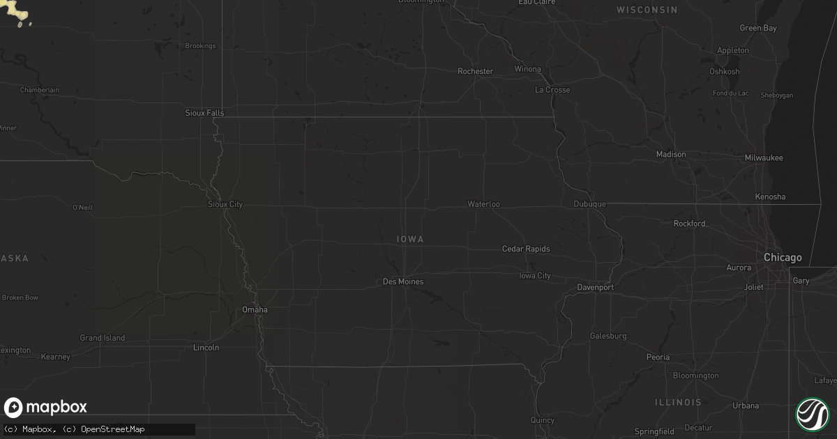
June 25 map
$229
one time, instant access
Download today. No call, no setup
Keep the $229
Bought the map and want the full workflow? Apply the entire $229 to a subscription within 7 days. None of it is wasted.
Every map, not just this one
This buys you this map. Subscription and you get every map we run, in the markets you choose from a few cities to whole states to nationwide. Plus real-time alerts the moment a storm fires.
Contact data
Name, contact info, occupancy, even credit band for addresses in the footprint. You go from where it hit to who to call.
Become the source they trust
Unlimited branding weather history reports on demand. You already have the documented answer ready for the property owner, and you are the one who showed up with it.
Property data and RoofTrace estimates
Pull up any address you have got, its value and the exact code rules for that jurisdiction, straight from One Click Code. Then RoofTrace estimates the squares, pitch, and roof value, priced the way you price.
Storm reports in Nebraska
Nebraska
| Date | Description |
|---|---|
| 06/24/20128:50 PM CDT | A local report indicates 1.25 inch wind near 7 N HAY SPRINGS |
| 06/24/20127:45 PM CDT | A local report indicates 60 MPH wind near 17 N RUSHVILLE |
| 06/24/20127:20 PM CDT | A local report indicates 60 MPH wind near 13 N HAY SPRINGS |
| 06/24/20127:15 PM CDT | A local report indicates 1.00 inch wind near 12 N HAY SPRINGS |
| 06/24/20127:10 PM CDT | A local report indicates 60 MPH wind near 10 SE CHADRON |
| 06/24/20127:05 PM CDT | Downburst winds estimated 55 to 60 mph. No hail. |
All States Impacted by Hail Map on June 25, 2012
Cities Impacted by Hail Map on June 25, 2012
- Choteau, MT
- White Owl, SD
- Howes, SD
- Ocean View, DE
- Frankford, DE
- Millsboro, DE
- Bethany Beach, DE
- Millville, DE
- Rehoboth Beach, DE
- Lewes, DE
- Dagsboro, DE
- Corolla, NC
- Chester, MT
- Scenic, SD
- Aladdin, WY
- Beulah, WY
- Shawnee, WY
- Windsor, NC
- Como, NC
- Gettysburg, SD
- Onida, SD
- Holabird, SD
- Highmore, SD
- Harrold, SD
- Agar, SD
- Mechanicsville, VA
- Richmond, VA
- Quinton, VA
- Lanexa, VA
- Charles City, VA
- Henrico, VA
- Providence Forge, VA
- Sandston, VA
- Emporia, VA
- Freeman, VA
- Havre, MT
- Chinook, MT
- Box Elder, MT
- Harlem, MT
- Surry, VA
- Gordonsville, VA
- Tarboro, NC
- Raleigh, NC
- Gillette, WY
- Weston, WY
- Williamston, NC
- Pinetown, NC
- Pantego, NC
- Plymouth, NC
- Jamesville, NC
- Douglas, WY
- Sunbury, NC
- Hobbsville, NC
- Lakehurst, NJ
- Ledger, MT
- Hertford, NC
- Belvidere, NC
- Louisburg, NC
- Allentown, NJ
- Jackson, NJ
- Millstone Township, NJ
- Cream Ridge, NJ
- New Egypt, NJ
- Kremlin, MT
- Cut Bank, MT
- Wanblee, SD
- Dupree, SD
- Manderson, SD
- Wounded Knee, SD
- Porcupine, SD
- Shelby, MT
- Pine Ridge, SD
- Patchogue, NY
- Medford, NY
- Holtsville, NY
- Bohemia, NY
- Farmingville, NY
- Blue Point, NY
- Sayville, NY
- Holbrook, NY
- Bayport, NY
- Conrad, MT
- Ocean City, MD
- Roscoe, SD
- Zebulon, NC
- Wendell, NC
- Terry, MT
- Fallon, MT
- Glendive, MT
- Caputa, SD
- Dupuyer, MT
- Heart Butte, MT
- Bynum, MT
- Pendroy, MT
- Valier, MT
- Catskill, NY
- Athens, NY
- Cape Charles, VA
- Bowdle, SD
- Belle Fourche, SD
- Hoven, SD
- Spring Hope, NC
- Nashville, NC
- Snow Hill, NC
- Hookerton, NC
- Columbia, VA
- Kents Store, VA
- Goochland, VA
- Maidens, VA
- Bumpass, VA
- Mineral, VA
- Rockville, VA
- Sandy Hook, VA
- Glen Allen, VA
- Oilville, VA
- Louisa, VA
- Gum Spring, VA
- Toano, VA
- Montpelier, VA
- Williamsburg, VA
- Manakin Sabot, VA
- Egg Harbor Township, NJ
- Galata, MT
- Whitlash, MT
- Joplin, MT
- Java, SD
- Beach Haven, NJ
- Barnegat Light, NJ
- Fort Pierre, SD
- Fort Benton, MT
- Islandia, NY
- Central Islip, NY
- Ronkonkoma, NY
- Hauppauge, NY
- Rudyard, MT
- Inverness, MT
- Hingham, MT
- Whitewood, SD
- Big Arm, MT
- Polson, MT
- Manns Harbor, NC
- Lillington, NC
- Bunnlevel, NC
- Loring, MT
- Whitewater, MT
- Dodson, MT
- Winterville, NC
- Dutton, MT
- Ismay, MT
- Salisbury, MD
- Branchville, VA
- Margarettsville, NC
- Winnett, MT
- Kenbridge, VA
- Spearfish, SD
- Guernsey, WY
- Big Sandy, MT
- Augusta, MT
- Gildford, MT
- Fairfield, MT
- Lothair, MT
- Power, MT
- Brady, MT
- Carrollton, VA
- Norfolk, VA
- Suffolk, VA
- Portsmouth, VA
- Newport News, VA
- Hampton, VA
- Fort Eustis, VA
- Smithfield, VA
- Windsor, VA
- Yorktown, VA
- Whitakers, NC
- Palmyra, ME
- Robersonville, NC
- Ayden, NC
- Wheatland, WY
- Berlin, MD
- Bishopville, MD
- Sturgis, SD
- Heathsville, VA
- Reedville, VA
- Elizabeth City, NC
- Camden, NC
- Bracey, VA
- Pikeville, NC
- Faith, SD
- Kenly, NC
- Sims, NC
- Greenville, NC
- Fountain, NC
- Macclesfield, NC
- Hogeland, MT
- Littleton, NC
- Manahawkin, NJ
- Carter, MT
- Selbyville, DE
- Showell, MD
- Parsonsburg, MD
- Pittsville, MD
- Willards, MD
- Fenwick Island, DE
- Delmar, MD
- Whaleyville, MD
- Long Valley, SD
- Hays, MT
- Exmore, VA
- Birdsnest, VA
- Machipongo, VA
- Elm City, NC
- Gates, NC
- Wasta, SD
- Bosler, WY
- Garrett, WY
- Bayville, NJ
- Lanoka Harbor, NJ
- Weems, VA
- Palmyra, VA
- Lakeside, MT
- Enfield, NC
- Glasgow, MT
- Capron, VA
- Courtland, VA
- Columbia, NC
- Sayreville, NJ
- Wakefield, VA
- Carrsville, VA
- Zuni, VA
- Ivor, VA
- Chadron, NE
- Roundup, MT
- Grass Range, MT
- Wilson, NC
- Bailey, NC
- Kevin, MT
- Wall, SD
- Kadoka, SD
- Quinn, SD
- Corapeake, NC
- Franklin, VA
- Eure, NC
- Gatesville, NC
- Sedley, VA
- Washington, NC
- Aulander, NC
- Ahoskie, NC
- Hartville, WY
- Newcastle, WY
- Princess Anne, MD
- Snow Hill, MD
- Willow Spring, NC
- Angier, NC
- Rushville, NE
- Whitney, NE
- Hay Springs, NE
- Zurich, MT
- Philip, SD
- Kyle, SD
- Hanna, UT
- Princeton, NC
- Centereach, NY
- Cape May, NJ
- Coxsackie, NY
- West End, NC
- Coats, NC
- Benson, NC
- Dunn, NC
- Erwin, NC
- Fuquay Varina, NC
- Seneca, SD
- Troy, VA
- Four Oaks, NC
- Lawrenceville, VA
- Earlton, NY
- Leeds, NY
- Freehold, NY
- Laurel, DE
- Delmar, DE
- Mardela Springs, MD
- Hebron, MD
- Manasquan, NJ
- Brielle, NJ
- Point Pleasant Beach, NJ
- Grimesland, NC
- Vanceboro, NC
- Grifton, NC
- Martin, SD
- Batesland, SD
- Painter, VA
- Belle Haven, VA
- Nassawadox, VA
- Franktown, VA
- Fort Meade, SD
- Shirley, NY
- Farmville, NC
- Mount Pleasant, NC
- Albemarle, NC
- Wadesboro, NC
- Polkton, NC
- Edenton, NC
- South Mills, NC
- Zortman, MT
- Malta, MT
- Dexter, ME
- Saint Albans, ME
- Corinna, ME
- Macon, NC
- Brusett, MT
- Point Harbor, NC
- Harbinger, NC
- Mastic, NY
- Brookhaven, NY
- Mastic Beach, NY
- Moriches, NY
- Center Moriches, NY
- East Moriches, NY
- Eastport, NY
- Manorville, NY
- Lavina, MT
- Saint Onge, SD
- Oilmont, MT
- Sunburst, MT
- Middlesex, NC
- Lead, SD
- Selden, NY
- Hobgood, NC
- Spring Lake, NC
- Garner, NC
- Linden, NC
- Coinjock, NC
- Aydlett, NC
- Barco, NC
- Rich Square, NC
- White River, SD
- Virginia Beach, VA
- Alberta, VA
- Chesapeake, VA
- Brick, NJ
- Lakewood, NJ
- Free Union, VA
- Crozet, VA
- Manville, WY
- Turner, MT
- Pocomoke City, MD
- Norwood, NC
- Mount Gilead, NC
- Hulett, WY
- Jackson Springs, NC
- Deep River, CT
- Killingworth, CT
- Belmar, NJ
- Irvington, VA
- Georgetown, DE
- Trenton, NJ
- Robbinsville, NJ
- Lewiston Woodville, NC
- Midland, SD
- Colerain, NC
- Freehold, NJ
- Dayton, MT
- Knightdale, NC
- Wake Forest, NC
- Rolesville, NC
- Victoria, VA
- Islip Terrace, NY
- Brentwood, NY
- Lucama, NC
- Broadus, MT
- Barboursville, VA
- Keswick, VA
- Charlottesville, VA
- Blounts Creek, NC
- Charlotte, NC
- Rocky Mount, NC
- Scotland Neck, NC
- Shiloh, NC
- Shawboro, NC
- Cofield, NC
- Harrellsville, NC
- Winton, NC
- Capitol, MT
- Lingle, WY
- Newark, MD
- Sanford, NC
- Murfreesboro, NC
- Lebanon, SD
- Bunn, NC
- Fremont, NC
- Selma, NC
- Goldsboro, NC
- Kelford, NC
- Woodland, NC
- Middle Island, NY
- Yaphank, NY
- Ridge, NY
- Bellport, NY
- Alva, WY
- Fairburn, SD
- Monroe, NC
- Marshville, NC
- Bethel, NC
- Pinetops, NC
- Holly Springs, NC
- Eagle Butte, SD
- Peachland, NC
- Seaside Park, NJ
- Toms River, NJ
- Seaside Heights, NJ
- Lavallette, NJ
- Ashland, VA
- Monroe, VA
- Lost Springs, WY
- Roy, MT
- Tyner, NC
- New Hill, NC
- Morganville, NJ
- Marlboro, NJ
- Chester, CT


