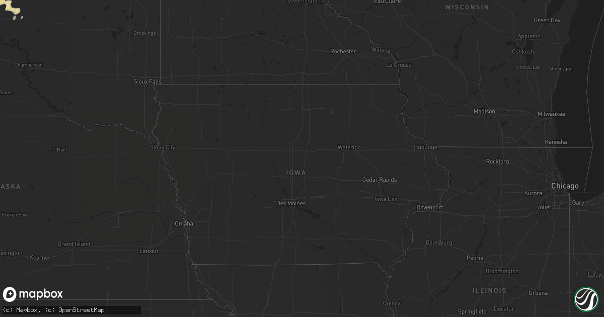
Hail Map in Virginia on June 25, 2012
Get this storm
June 25 map
$229
one time, instant access
Download today. No call, no setup
Keep the $229
Bought the map and want the full workflow? Apply the entire $229 to a subscription within 7 days. None of it is wasted.
Every map, not just this one
This buys you this map. Subscription and you get every map we run, in the markets you choose from a few cities to whole states to nationwide. Plus real-time alerts the moment a storm fires.
Contact data
Name, contact info, occupancy, even credit band for addresses in the footprint. You go from where it hit to who to call.
Become the source they trust
Unlimited branding weather history reports on demand. You already have the documented answer ready for the property owner, and you are the one who showed up with it.
Property data and RoofTrace estimates
Pull up any address you have got, its value and the exact code rules for that jurisdiction, straight from One Click Code. Then RoofTrace estimates the squares, pitch, and roof value, priced the way you price.
Storm reports in Virginia
Virginia
| Date | Description |
|---|---|
| 06/25/20124:40 PM CDT | Tree down on house |
| 06/25/20124:15 PM CDT | Large tree down in road at willow wood drive and gramby st. |
| 06/25/20124:00 PM CDT | Several medium sized branches down along interstate 664 at exit 4 with large hail. |
| 06/25/20124:00 PM CDT | Several medium sized branches down along interstate 664 at exit 4 with large hail. |
| 06/25/20124:00 PM CDT | Weatherflow ob |
| 06/25/20123:30 PM CDT | Numerous large trees down county-wide. |
| 06/25/20123:23 PM CDT | Awos |
| 06/25/20122:50 PM CDT | Widespread trees down blocking roads across eastern charles city county. |
| 06/25/20122:45 PM CDT | Gazebo destroyed and several trees uprooted |
| 06/25/20122:45 PM CDT | Structure collapse with woman trapped inside. |
| 06/25/20122:42 PM CDT | Widespread trees down from new kent to providence forge. Trees blocking interstate 64. |
| 06/25/20122:40 PM CDT | Several trees snapped in half near interstate 64 and 295 on the west side. |
| 06/25/20122:21 PM CDT | Tree down on creighton road. |
| 06/25/20122:15 PM CDT | A local report indicates 1.75 inch wind near SANDSTON |
| 06/25/20122:12 PM CDT | A local report indicates 60 MPH wind near RICHMOND |
| 06/25/20122:12 PM CDT | Damage being repored at the richmond diamond. Rows of seats have been blown around and a wall is leaning near collapse. |
| 06/25/20122:10 PM CDT | Large trees down with people trapped in homes in broad meadows subdivision. |
| 06/25/20122:05 PM CDT | Trees down at charles city road and williamsburg road. |
| 06/25/20122:05 PM CDT | Widespread trees down across herico with numerous power lines down. |
| 06/25/20122:05 PM CDT | Widespread trees down across herico with numerous power lines down. |
| 06/25/20122:00 PM CDT | Several 3 to 4 inch diameter tree limbs down in highland springs. |
| 06/25/20122:00 PM CDT | Numerous trees down...including several downed onto homes...on crystalwood lane in innsbrook section of western henrico county. Estimated winds between 80 and 90 mph. |
| 06/25/20121:53 PM CDT | Trees down across the area. |
| 06/25/20121:50 PM CDT | Numerous trees down and minor structural damage in markham subdivision in rockville. Estimated winds 80 to 90 mph. |
| 06/25/20121:50 PM CDT | Widespread trees down blocking roads across eastern charles city county. |
| 06/25/20121:48 PM CDT | Widespread trees down with some on houses from short pump through west end. Emergency crews are performing damage surveys. |
| 06/25/20121:45 PM CDT | Numerous trees down and minor structural damage along vontay road...va highway 617. Estimated winds between 80 and 90 mph. |
| 06/25/20121:45 PM CDT | Several large trees down with roof off corporate building in innsbrook corporate center. |
| 06/25/20121:40 PM CDT | Several trees snapped in half near interstate 64 and 295 on the west side. |
| 06/25/20121:40 PM CDT | Several tops of trees snapped and split...mailbox found hundreds of feet away and board sticking in siding. |
| 06/25/20121:40 PM CDT | Twisted and snapped trees in path in rockville. Metal shed also destroyed. |
| 06/25/20121:40 PM CDT | Trees down at summer ridge place and vonte road. |
| 06/25/20121:40 PM CDT | A local report indicates 1.00 inch wind near 1 SSE ROCKVILLE |
| 06/25/20121:35 PM CDT | Numerous trees down highway 288 and west broad st. |
| 06/25/20121:30 PM CDT | Trees down along interstate 64 in louisa county. |
| 06/25/20121:30 PM CDT | A local report indicates 1.75 inch wind near GUM SPRING |
| 06/25/201212:32 PM CDT | Power poles snapped plus multiple trees blown down by strong thunderstorm winds. |
| 06/25/201211:51 AM CDT | Strong thunderstorm wind blew small tree branches down. |
All States Impacted by Hail Map on June 25, 2012
Cities Impacted by Hail Map on June 25, 2012
- Choteau, MT
- White Owl, SD
- Howes, SD
- Ocean View, DE
- Frankford, DE
- Millsboro, DE
- Bethany Beach, DE
- Millville, DE
- Rehoboth Beach, DE
- Lewes, DE
- Dagsboro, DE
- Corolla, NC
- Chester, MT
- Scenic, SD
- Aladdin, WY
- Beulah, WY
- Shawnee, WY
- Windsor, NC
- Como, NC
- Gettysburg, SD
- Onida, SD
- Holabird, SD
- Highmore, SD
- Harrold, SD
- Agar, SD
- Mechanicsville, VA
- Richmond, VA
- Quinton, VA
- Lanexa, VA
- Charles City, VA
- Henrico, VA
- Providence Forge, VA
- Sandston, VA
- Emporia, VA
- Freeman, VA
- Havre, MT
- Chinook, MT
- Box Elder, MT
- Harlem, MT
- Surry, VA
- Gordonsville, VA
- Tarboro, NC
- Raleigh, NC
- Gillette, WY
- Weston, WY
- Williamston, NC
- Pinetown, NC
- Pantego, NC
- Plymouth, NC
- Jamesville, NC
- Douglas, WY
- Sunbury, NC
- Hobbsville, NC
- Lakehurst, NJ
- Ledger, MT
- Hertford, NC
- Belvidere, NC
- Louisburg, NC
- Allentown, NJ
- Jackson, NJ
- Millstone Township, NJ
- Cream Ridge, NJ
- New Egypt, NJ
- Kremlin, MT
- Cut Bank, MT
- Wanblee, SD
- Dupree, SD
- Manderson, SD
- Wounded Knee, SD
- Porcupine, SD
- Shelby, MT
- Pine Ridge, SD
- Patchogue, NY
- Medford, NY
- Holtsville, NY
- Bohemia, NY
- Farmingville, NY
- Blue Point, NY
- Sayville, NY
- Holbrook, NY
- Bayport, NY
- Conrad, MT
- Ocean City, MD
- Roscoe, SD
- Zebulon, NC
- Wendell, NC
- Terry, MT
- Fallon, MT
- Glendive, MT
- Caputa, SD
- Dupuyer, MT
- Heart Butte, MT
- Bynum, MT
- Pendroy, MT
- Valier, MT
- Catskill, NY
- Athens, NY
- Cape Charles, VA
- Bowdle, SD
- Belle Fourche, SD
- Hoven, SD
- Spring Hope, NC
- Nashville, NC
- Snow Hill, NC
- Hookerton, NC
- Columbia, VA
- Kents Store, VA
- Goochland, VA
- Maidens, VA
- Bumpass, VA
- Mineral, VA
- Rockville, VA
- Sandy Hook, VA
- Glen Allen, VA
- Oilville, VA
- Louisa, VA
- Gum Spring, VA
- Toano, VA
- Montpelier, VA
- Williamsburg, VA
- Manakin Sabot, VA
- Egg Harbor Township, NJ
- Galata, MT
- Whitlash, MT
- Joplin, MT
- Java, SD
- Beach Haven, NJ
- Barnegat Light, NJ
- Fort Pierre, SD
- Fort Benton, MT
- Islandia, NY
- Central Islip, NY
- Ronkonkoma, NY
- Hauppauge, NY
- Rudyard, MT
- Inverness, MT
- Hingham, MT
- Whitewood, SD
- Big Arm, MT
- Polson, MT
- Manns Harbor, NC
- Lillington, NC
- Bunnlevel, NC
- Loring, MT
- Whitewater, MT
- Dodson, MT
- Winterville, NC
- Dutton, MT
- Ismay, MT
- Salisbury, MD
- Branchville, VA
- Margarettsville, NC
- Winnett, MT
- Kenbridge, VA
- Spearfish, SD
- Guernsey, WY
- Big Sandy, MT
- Augusta, MT
- Gildford, MT
- Fairfield, MT
- Lothair, MT
- Power, MT
- Brady, MT
- Carrollton, VA
- Norfolk, VA
- Suffolk, VA
- Portsmouth, VA
- Newport News, VA
- Hampton, VA
- Fort Eustis, VA
- Smithfield, VA
- Windsor, VA
- Yorktown, VA
- Whitakers, NC
- Palmyra, ME
- Robersonville, NC
- Ayden, NC
- Wheatland, WY
- Berlin, MD
- Bishopville, MD
- Sturgis, SD
- Heathsville, VA
- Reedville, VA
- Elizabeth City, NC
- Camden, NC
- Bracey, VA
- Pikeville, NC
- Faith, SD
- Kenly, NC
- Sims, NC
- Greenville, NC
- Fountain, NC
- Macclesfield, NC
- Hogeland, MT
- Littleton, NC
- Manahawkin, NJ
- Carter, MT
- Selbyville, DE
- Showell, MD
- Parsonsburg, MD
- Pittsville, MD
- Willards, MD
- Fenwick Island, DE
- Delmar, MD
- Whaleyville, MD
- Long Valley, SD
- Hays, MT
- Exmore, VA
- Birdsnest, VA
- Machipongo, VA
- Elm City, NC
- Gates, NC
- Wasta, SD
- Bosler, WY
- Garrett, WY
- Bayville, NJ
- Lanoka Harbor, NJ
- Weems, VA
- Palmyra, VA
- Lakeside, MT
- Enfield, NC
- Glasgow, MT
- Capron, VA
- Courtland, VA
- Columbia, NC
- Sayreville, NJ
- Wakefield, VA
- Carrsville, VA
- Zuni, VA
- Ivor, VA
- Chadron, NE
- Roundup, MT
- Grass Range, MT
- Wilson, NC
- Bailey, NC
- Kevin, MT
- Wall, SD
- Kadoka, SD
- Quinn, SD
- Corapeake, NC
- Franklin, VA
- Eure, NC
- Gatesville, NC
- Sedley, VA
- Washington, NC
- Aulander, NC
- Ahoskie, NC
- Hartville, WY
- Newcastle, WY
- Princess Anne, MD
- Snow Hill, MD
- Willow Spring, NC
- Angier, NC
- Rushville, NE
- Whitney, NE
- Hay Springs, NE
- Zurich, MT
- Philip, SD
- Kyle, SD
- Hanna, UT
- Princeton, NC
- Centereach, NY
- Cape May, NJ
- Coxsackie, NY
- West End, NC
- Coats, NC
- Benson, NC
- Dunn, NC
- Erwin, NC
- Fuquay Varina, NC
- Seneca, SD
- Troy, VA
- Four Oaks, NC
- Lawrenceville, VA
- Earlton, NY
- Leeds, NY
- Freehold, NY
- Laurel, DE
- Delmar, DE
- Mardela Springs, MD
- Hebron, MD
- Manasquan, NJ
- Brielle, NJ
- Point Pleasant Beach, NJ
- Grimesland, NC
- Vanceboro, NC
- Grifton, NC
- Martin, SD
- Batesland, SD
- Painter, VA
- Belle Haven, VA
- Nassawadox, VA
- Franktown, VA
- Fort Meade, SD
- Shirley, NY
- Farmville, NC
- Mount Pleasant, NC
- Albemarle, NC
- Wadesboro, NC
- Polkton, NC
- Edenton, NC
- South Mills, NC
- Zortman, MT
- Malta, MT
- Dexter, ME
- Saint Albans, ME
- Corinna, ME
- Macon, NC
- Brusett, MT
- Point Harbor, NC
- Harbinger, NC
- Mastic, NY
- Brookhaven, NY
- Mastic Beach, NY
- Moriches, NY
- Center Moriches, NY
- East Moriches, NY
- Eastport, NY
- Manorville, NY
- Lavina, MT
- Saint Onge, SD
- Oilmont, MT
- Sunburst, MT
- Middlesex, NC
- Lead, SD
- Selden, NY
- Hobgood, NC
- Spring Lake, NC
- Garner, NC
- Linden, NC
- Coinjock, NC
- Aydlett, NC
- Barco, NC
- Rich Square, NC
- White River, SD
- Virginia Beach, VA
- Alberta, VA
- Chesapeake, VA
- Brick, NJ
- Lakewood, NJ
- Free Union, VA
- Crozet, VA
- Manville, WY
- Turner, MT
- Pocomoke City, MD
- Norwood, NC
- Mount Gilead, NC
- Hulett, WY
- Jackson Springs, NC
- Deep River, CT
- Killingworth, CT
- Belmar, NJ
- Irvington, VA
- Georgetown, DE
- Trenton, NJ
- Robbinsville, NJ
- Lewiston Woodville, NC
- Midland, SD
- Colerain, NC
- Freehold, NJ
- Dayton, MT
- Knightdale, NC
- Wake Forest, NC
- Rolesville, NC
- Victoria, VA
- Islip Terrace, NY
- Brentwood, NY
- Lucama, NC
- Broadus, MT
- Barboursville, VA
- Keswick, VA
- Charlottesville, VA
- Blounts Creek, NC
- Charlotte, NC
- Rocky Mount, NC
- Scotland Neck, NC
- Shiloh, NC
- Shawboro, NC
- Cofield, NC
- Harrellsville, NC
- Winton, NC
- Capitol, MT
- Lingle, WY
- Newark, MD
- Sanford, NC
- Murfreesboro, NC
- Lebanon, SD
- Bunn, NC
- Fremont, NC
- Selma, NC
- Goldsboro, NC
- Kelford, NC
- Woodland, NC
- Middle Island, NY
- Yaphank, NY
- Ridge, NY
- Bellport, NY
- Alva, WY
- Fairburn, SD
- Monroe, NC
- Marshville, NC
- Bethel, NC
- Pinetops, NC
- Holly Springs, NC
- Eagle Butte, SD
- Peachland, NC
- Seaside Park, NJ
- Toms River, NJ
- Seaside Heights, NJ
- Lavallette, NJ
- Ashland, VA
- Monroe, VA
- Lost Springs, WY
- Roy, MT
- Tyner, NC
- New Hill, NC
- Morganville, NJ
- Marlboro, NJ
- Chester, CT


