Hail Map in South Carolina on July 29, 2012
Get this storm
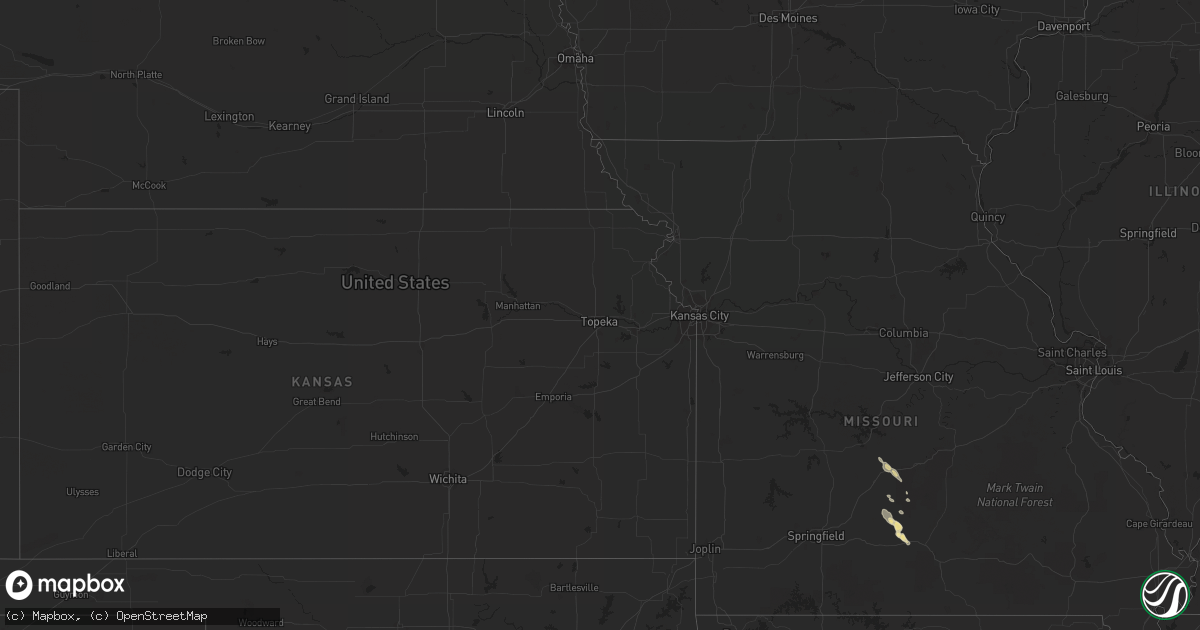
July 29 map
$229
one time, instant access
Download today. No call, no setup
Keep the $229
Bought the map and want the full workflow? Apply the entire $229 to a subscription within 7 days. None of it is wasted.
Every map, not just this one
This buys you this map. Subscription and you get every map we run, in the markets you choose from a few cities to whole states to nationwide. Plus real-time alerts the moment a storm fires.
Contact data
Name, contact info, occupancy, even credit band for addresses in the footprint. You go from where it hit to who to call.
Become the source they trust
Unlimited branding weather history reports on demand. You already have the documented answer ready for the property owner, and you are the one who showed up with it.
Property data and RoofTrace estimates
Pull up any address you have got, its value and the exact code rules for that jurisdiction, straight from One Click Code. Then RoofTrace estimates the squares, pitch, and roof value, priced the way you price.
Storm reports in South Carolina
South Carolina
| Date | Description |
|---|---|
| 07/29/20123:02 PM CDT | Tree down on a car at the lebanon quick stop. Time estimated based on radar. |
| 07/29/20122:50 PM CDT | Tree down on sc hwy 46 in hardeeville. |
| 07/29/20122:46 PM CDT | Tree down on hwy 78. |
| 07/29/20122:46 PM CDT | One tree was reported down near the intersection of old baileys road and rawstrom drive. |
| 07/29/20122:45 PM CDT | Tree down on delee road. Time estimated based on radar. |
| 07/29/20122:38 PM CDT | Tree down on state highway 174 near cypress bottom road. Time estimated based on radar. |
| 07/29/20122:31 PM CDT | Tree blown down on a mobile home on orvin street. |
| 07/29/20122:30 PM CDT | Tree blown down on fassitt rd in north charleston. |
| 07/29/20122:27 PM CDT | Tree down on jehossee road near highway 174. |
| 07/29/20122:27 PM CDT | Tree down on sc hwy 174 near dahoo bridge. |
| 07/29/20122:23 PM CDT | Tree down on cypress gardens rd near old depot rd. |
| 07/29/20122:23 PM CDT | Powerlines down on 2nd texas road. Time estimated based on radar. |
| 07/29/20122:13 PM CDT | Tree down on deer ridge lane. |
| 07/29/20121:50 PM CDT | Tree down on log hall rd at sc hwy 462. |
| 07/29/20121:27 PM CDT | Tree down at intersection of sc hwy 3 and pine level church rd. |
| 07/29/20121:16 PM CDT | One tree down along the intersection of patriot blvd and rocking porch lane and one large branch down in residential yard. Time estimated by radar. |
| 07/29/201212:41 PM CDT | The hampton county 911 call center relayed a report of a power line down near cummings south carolina. A tree was also reported down near the intersection of savannah h |
All States Impacted by Hail Map on July 29, 2012
Cities Impacted by Hail Map on July 29, 2012
- Charleston, SC
- Hertford, NC
- Tyner, NC
- Belvidere, NC
- Saint Helena Island, SC
- Gatzke, MN
- Warroad, MN
- Salol, MN
- Metter, GA
- Woodland Park, CO
- Darien, GA
- Townsend, GA
- Abbeville, GA
- Pansey, AL
- Ashford, AL
- Donalsonville, GA
- Blakely, GA
- Jakin, GA
- Colquitt, GA
- Lebanon, MO
- Varnville, SC
- Estill, SC
- Georgetown, SC
- Eckley, CO
- Yuma, CO
- Blanding, UT
- Cope, SC
- Climax, MN
- Reynolds, ND
- Fisher, MN
- Big Sur, CA
- Big Falls, MN
- Dothan, AL
- Ponsford, MN
- Coolidge, AZ
- Fleming, CO
- Sterling, CO
- Iliff, CO
- Blackshear, GA
- Ely, MN
- Redvale, CO
- Roseau, MN
- Baxley, GA
- Lyons, GA
- Uvalda, GA
- Badger, MN
- Galivants Ferry, SC
- Rhine, GA
- Saint George, SC
- Tillman, SC
- Quincy, FL
- Portal, GA
- Statesboro, GA
- Thomasville, GA
- Sunbury, NC
- Manning, SC
- Buchanan, ND
- Jamestown, ND
- Columbia, SC
- Jacksonville, GA
- Milan, GA
- Quitman, MS
- Shubuta, MS
- Heidelberg, MS
- Millen, GA
- Ochlocknee, GA
- Littlefork, MN
- International Falls, MN
- Queen Creek, AZ
- Wannaska, MN
- Lake City, SC
- Olanta, SC
- Turbeville, SC
- Midway, GA
- Richmond Hill, GA
- Hatton, ND
- Hardeeville, SC
- Sparkman, AR
- Mountain Grove, MO
- Goose Creek, SC
- Bigfork, MN
- Bovey, MN
- Marcell, MN
- Nashwauk, MN
- Lockwood, CA
- Norwood, MO
- Fort Davis, AL
- Tuskegee, AL
- Union Springs, AL
- Register, GA
- Tallahassee, FL
- Starke, FL
- Crookston, MN
- Gable, SC
- Gresham, SC
- Monticello, FL
- Akron, CO
- Effie, MN
- Bapchule, AZ
- Chandler, AZ
- Midland City, AL
- Hephzibah, GA
- Augusta, GA
- Brunswick, GA
- Cope, CO
- Waynesboro, GA
- Keysville, GA
- Wakpala, SD
- Adel, GA
- Sparks, GA
- Lewistown, MT
- Moore, MT
- Thompson, ND
- Tuba City, AZ
- Kelliher, MN
- Fort Gaines, GA
- Winnabow, NC
- Hawkinsville, GA
- Orangeburg, SC
- Neeses, SC
- Newton, GA
- Valley City, ND
- Kathryn, ND
- Walterboro, SC
- Smoaks, SC
- Effingham, SC
- Timmonsville, SC
- Pinewood, SC
- Sumter, SC
- Greenbush, MN
- Ivanhoe, NC
- Bonifay, FL
- Coolidge, GA
- San Tan Valley, AZ
- Gove, KS
- Leary, GA
- Skandia, MI
- East Grand Forks, MN
- Grand Forks, ND
- Divide, CO
- Babbitt, MN
- Crane Lake, MN
- Tower, MN
- Midway, AL
- Sanborn, ND
- Litchville, ND
- Fingal, ND
- Jessieville, AR
- Andrews, SC
- Conway, SC
- Spiritwood, ND
- Florissant, CO
- Sedalia, CO
- Middle River, MN
- Trenary, MI
- Carthage, AR
- Euclid, MN
- Warren, MN
- Thief River Falls, MN
- Hartville, MO
- Stoutland, MO
- Richland, MO
- Ridgeville, SC
- Dorchester, SC
- Leland, NC
- Waycross, GA
- Savannah, GA
- Buckeye, AZ
- Northome, MN
- Twin City, GA
- Kimball, NE
- Clarkdale, AZ
- Aynor, SC
- Claxton, GA
- Glennville, GA
- Swainsboro, GA
- Forbes, MN
- Banks, AL
- Early Branch, SC
- Pineland, SC
- Vossburg, MS
- Benton, AR
- Ridgeland, SC
- Surrency, GA
- Saxon, WI
- Reidsville, GA
- Langdon, ND
- Lumber City, GA
- Ashland, WI
- Eutawville, SC
- Strathcona, MN
- Fountain Hills, AZ
- Cook, MN
- Sylvester, GA
- Albany, GA
- Doerun, GA
- Cornville, AZ
- Pittsview, AL
- Eufaula, AL
- Nome, ND
- Waynesboro, MS
- Emerado, ND
- Pembroke, GA
- North, SC
- Sundance, WY
- Beulah, WY
- Greenville, FL
- Grovespring, MO
- Boston, GA
- Otis, CO
- Ozark, AL
- Glenwood, GA
- Joes, CO
- Iron, MN
- Eveleth, MN
- Pine River, MN
- Backus, MN
- Hackensack, MN
- Longville, MN
- Bauxite, AR
- Luverne, AL
- Brantley, AL
- Westville, FL
- Spearfish, SD
- Clyo, GA
- Springfield, GA
- Flagler, CO
- Blythe, GA
- Vienna, GA
- Newton, AL
- Cameron, SC
- Falcon, MO
- Roosevelt, MN
- Nashville, GA
- Grand Rapids, MN
- Rantoul, KS
- Hortense, GA
- Sorrento, FL
- Wrightsville, GA
- McRae Helena, GA
- Alamo, GA
- Hobbsville, NC
- Ashburn, GA
- Crawfordville, FL
- Collins, GA
- Hilton Head Island, SC
- Okatie, SC
- Moncks Corner, SC
- Williams, MN
- Lynchburg, SC
- Scranton, SC
- Alma, GA
- Mershon, GA
- Axson, GA
- Bristol, GA
- Kite, GA
- Millwood, GA
- Coosawhatchie, SC
- Cottonwood, AZ
- Tyler, AL
- Huger, SC
- North Charleston, SC
- Tucson, AZ
- Odum, GA
- Waskish, MN
- Northwood, ND
- New Raymer, CO
- Lynchburg, MO
- Swansea, SC
- Upson, WI
- Arvilla, ND
- Mount Vernon, GA
- Skipperville, AL
- Clio, AL
- Sellers, SC
- Wagener, SC
- Gaston, SC
- Pelion, SC
- Leesville, SC
- Sylvania, GA
- Marion Junction, AL
- Cordele, GA
- Bamberg, SC
- Denmark, SC
- Soperton, GA
- Nesmith, SC
- Blackville, SC
- Haxtun, CO


