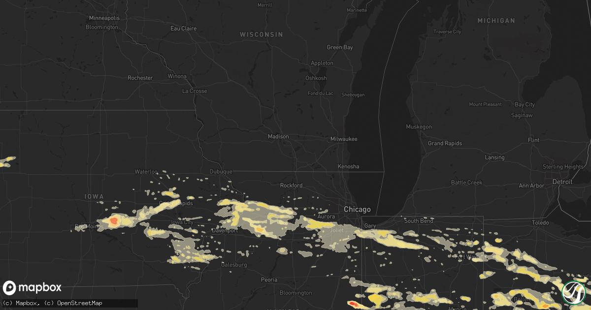
Hail Map in Ohio on June 29, 2012
Get this storm
June 29 map
$229
one time, instant access
Download today. No call, no setup
Keep the $229
Bought the map and want the full workflow? Apply the entire $229 to a subscription within 7 days. None of it is wasted.
Every map, not just this one
This buys you this map. Subscription and you get every map we run, in the markets you choose from a few cities to whole states to nationwide. Plus real-time alerts the moment a storm fires.
Contact data
Name, contact info, occupancy, even credit band for addresses in the footprint. You go from where it hit to who to call.
Become the source they trust
Unlimited branding weather history reports on demand. You already have the documented answer ready for the property owner, and you are the one who showed up with it.
Property data and RoofTrace estimates
Pull up any address you have got, its value and the exact code rules for that jurisdiction, straight from One Click Code. Then RoofTrace estimates the squares, pitch, and roof value, priced the way you price.
Storm reports in Ohio
Ohio
| Date | Description |
|---|---|
| 06/29/20126:20 PM CDT | Numerous large trees blown down. |
| 06/29/20126:20 PM CDT | Numerous large trees blown down. |
| 06/29/20126:20 PM CDT | Numerous large trees blown down. |
| 06/29/20126:03 PM CDT | Trees down. Event occurred between 650 |
| 06/29/20126:00 PM CDT | Large branches broken |
| 06/29/20125:58 PM CDT | Trees down. Roof damage |
| 06/29/20125:30 PM CDT | Large trees...up to 2 feet in diameter...down |
| 06/29/20125:30 PM CDT | Numerous structural damage. Numerous trees down |
| 06/29/20125:30 PM CDT | Large trees down |
| 06/29/20125:30 PM CDT | A local report indicates 1.00 inch wind near WOODSFIELD |
| 06/29/20125:30 PM CDT | Numerous structural damage. Numerous trees down |
| 06/29/20125:29 PM CDT | Trees down |
| 06/29/20125:27 PM CDT | Structural damage. |
| 06/29/20125:27 PM CDT | Roof of structure damaged and tree down on camper with one minor injury. Event occurred at fairgrounds. |
| 06/29/20125:26 PM CDT | Multiple trees down |
| 06/29/20125:25 PM CDT | Asos at albany airport measured 51kt gust |
| 06/29/20125:25 PM CDT | Tree ripped across road in half |
| 06/29/20125:23 PM CDT | Large tree down in nelsonville ohio. Power is out. |
| 06/29/20125:20 PM CDT | Large branches down |
| 06/29/20125:20 PM CDT | Tornado on ground unconfirmed |
| 06/29/20125:19 PM CDT | A local report indicates 1.75 inch wind near SMITHFIELD |
| 06/29/20125:15 PM CDT | Trees down |
| 06/29/20125:15 PM CDT | A local report indicates 59 MPH wind near 2 SW ALBANY |
| 06/29/20125:15 PM CDT | Numerous trees down |
| 06/29/20125:15 PM CDT | Two foot diamerter trees down in jackson |
| 06/29/20125:15 PM CDT | Numerous 80 foot pine trees snapped off at around 35-40 feet |
| 06/29/20125:15 PM CDT | Roof blown off house. |
| 06/29/20125:12 PM CDT | A local report indicates 64 MPH wind near ATHENS |
| 06/29/20125:10 PM CDT | Clock tower damaged on courthouse... Church collapsed... And several other structures damaged in cambridge. |
| 06/29/20125:10 PM CDT | Numerous trees down |
| 06/29/20125:10 PM CDT | Numerous trees down...power out |
| 06/29/20125:10 PM CDT | Tornado on ground unconfirmed |
| 06/29/20125:10 PM CDT | Tree down on a house |
| 06/29/20125:08 PM CDT | Over 200 trees down throughout the county. Over a dozen homes in the county sustained damage due to tree impacts. |
| 06/29/20125:07 PM CDT | Barn destroyed and trees down along luther rd. Time estimated from radar. |
| 06/29/20125:06 PM CDT | A local report indicates 1.00 inch wind near CAMBRIDGE |
| 06/29/20125:06 PM CDT | Trees down. Structural damage including roof damage. |
| 06/29/20125:05 PM CDT | Large tree down on trailer. |
| 06/29/20125:04 PM CDT | Significant tree damage around the city |
| 06/29/20125:03 PM CDT | Mesonet site |
| 06/29/20125:00 PM CDT | Trees down. |
| 06/29/20125:00 PM CDT | Trees down |
| 06/29/20125:00 PM CDT | Peak wind gust at kzzv asos. |
| 06/29/20125:00 PM CDT | Multiple trees down |
| 06/29/20125:00 PM CDT | Lots of trees down. Power outages. Structural damage |
| 06/29/20125:00 PM CDT | Large trees blown down. |
| 06/29/20124:57 PM CDT | Ohio route 335 closed near beaver due to downed power lines. |
| 06/29/20124:57 PM CDT | Multiple trees down |
| 06/29/20124:53 PM CDT | A local report indicates 63 MPH wind near 2 WSW BRIDGEVILLE |
| 06/29/20124:52 PM CDT | Several trees down. Sporadic power outages. |
| 06/29/20124:50 PM CDT | Lots of trees down in and around town. Time estimated by radar. |
| 06/29/20124:50 PM CDT | A local report indicates 62 MPH wind near NEW LEXINGTON |
| 06/29/20124:50 PM CDT | Multiple trees down. Roof blown off. Garage destroyed. |
| 06/29/20124:50 PM CDT | Structural damage |
| 06/29/20124:49 PM CDT | Numerous roads closed across the area due to snapped trees. |
| 06/29/20124:47 PM CDT | Several trees and limbs down in clark. |
| 06/29/20124:47 PM CDT | Multiple trees down in mohican state park. |
| 06/29/20124:45 PM CDT | Trees down...some on power lines. Multiple large branches down. |
| 06/29/20124:45 PM CDT | Numerous trees downed in hocking hills state park. |
| 06/29/20124:45 PM CDT | Large tree snapped midway up. Numerous large tree branches down. |
| 06/29/20124:45 PM CDT | Multiple trees down. Report from iln |
| 06/29/20124:44 PM CDT | Ohio route 551 closed near lake white due to downed power lines. |
| 06/29/20124:44 PM CDT | Ohio route 220 closed west of waverly due to downed power lines. |
| 06/29/20124:42 PM CDT | Numerous trees down |
| 06/29/20124:42 PM CDT | Trees down and power out. Corrected time from 455 pm to 542 pm. |
| 06/29/20124:41 PM CDT | Tree on a mobile home. |
| 06/29/20124:40 PM CDT | Multiple trees were reported down due to thunderstorm winds. |
| 06/29/20124:40 PM CDT | Numerous trees downed in tar hollow state forest. |
| 06/29/20124:40 PM CDT | One tree down |
| 06/29/20124:40 PM CDT | Power out. |
| 06/29/20124:38 PM CDT | Numerous trees and power lines down in massieville and elsewhere around ross county |
| 06/29/20124:37 PM CDT | Horns mill road was closed due to numerous trees downed. |
| 06/29/20124:36 PM CDT | 4-6 mile stretch north of felicity with numerous trees down along highway |
| 06/29/20124:35 PM CDT | Large trees down. |
| 06/29/20124:34 PM CDT | A local report indicates 81 MPH wind near LANCASTER |
| 06/29/20124:33 PM CDT | A metal roof was removed from a building on race street. |
| 06/29/20124:31 PM CDT | A large tree was downed on a pickup truck. Siding damage reported at a house. |
| 06/29/20124:30 PM CDT | Trees down |
| 06/29/20124:30 PM CDT | Tree uprooted. Time estimated |
| 06/29/20124:30 PM CDT | Multiple large tree limbs downed. Siding damage to buildings. |
| 06/29/20124:27 PM CDT | Large tree limbs down. |
| 06/29/20124:27 PM CDT | Tree branches down |
| 06/29/20124:26 PM CDT | Several trees down along route 22 between amanda and lancaster. |
| 06/29/20124:26 PM CDT | A local report indicates 70 MPH wind near NEWARK |
| 06/29/20124:25 PM CDT | A local report indicates 69 MPH wind near KLHQ LANCASTER APT |
| 06/29/20124:25 PM CDT | Large branches down in anderson township |
| 06/29/20124:25 PM CDT | Numerous large limbs and small trees down. One fell on a vehicle. |
| 06/29/20124:25 PM CDT | A garage was destroyed...numerous trees were downed...and a roof was taken off a barn. One horse was killed. |
| 06/29/20124:23 PM CDT | Trees down. |
| 06/29/20124:22 PM CDT | Trees down |
| 06/29/20124:21 PM CDT | 2 large branches down. |
| 06/29/20124:20 PM CDT | Trees down on main street and a utility pole down. |
| 06/29/20124:20 PM CDT | 10-12 inch diameter tree limbs down. |
| 06/29/20124:19 PM CDT | A large tree was downed on a house on half avenue. |
| 06/29/20124:18 PM CDT | Large branches down. |
| 06/29/20124:17 PM CDT | At lunken field. |
| 06/29/20124:17 PM CDT | A local report indicates 65 MPH wind near LEXINGTON |
| 06/29/20124:17 PM CDT | A tree fell on a mobile home near the intersection of mad river and riber roads. |
| 06/29/20124:15 PM CDT | A local report indicates 66 MPH wind near 2 SE JOHNSTOWN |
| 06/29/20124:15 PM CDT | A local report indicates 66 MPH wind near NEWARK |
| 06/29/20124:15 PM CDT | Large tree branches down |
| 06/29/20124:15 PM CDT | Large trees and limbs down. |
| 06/29/20124:15 PM CDT | Trees down. |
| 06/29/20124:15 PM CDT | Trees down...shingles off the roof. No power. |
| 06/29/20124:14 PM CDT | A tree fell on a mobile home near the intersection of mad river and riber roads. Time estimated from radar. |
| 06/29/20124:13 PM CDT | Several trees uprooted along sr 135 near allensburg. |
| 06/29/20124:12 PM CDT | Small trees down. No electric power in the town. |
| 06/29/20124:11 PM CDT | At rickenbacker afb. |
| 06/29/20124:10 PM CDT | Golf ball hail at mid ohio race track. |
| 06/29/20124:10 PM CDT | Several trees down along dade road. Time estimated from radar. |
| 06/29/20124:10 PM CDT | Widespread tree damage here and in clintonville...and worthington. Most of franklin county. |
| 06/29/20124:10 PM CDT | At mid ohio race track. |
| 06/29/20124:10 PM CDT | Poles snapped and wires down |
| 06/29/20124:08 PM CDT | Numerous trees downed in johnstown. Two rooves were removed from houses. |
| 06/29/20124:08 PM CDT | *** 1 inj *** at least a dozen power poles snapped along hamilton rd. At least one injury from pole falling on car. |
| 06/29/20124:07 PM CDT | A local report indicates 72 MPH wind near 2 NNE GAHANNA |
| 06/29/20124:07 PM CDT | Numerous trees downed near duncan plains road. |
| 06/29/20124:06 PM CDT | At port columbus international airport |
| 06/29/20124:06 PM CDT | Siding ripped from a home. Time estimated. |
| 06/29/20124:05 PM CDT | A local report indicates 70 MPH wind near 1 E WESTERVILLE |
| 06/29/20124:05 PM CDT | Large trees down. Time estimated |
| 06/29/20124:05 PM CDT | Shutter off house. Power lines down. |
| 06/29/20124:05 PM CDT | Large trees down. |
| 06/29/20124:05 PM CDT | Siding off of two homes. |
| 06/29/20124:05 PM CDT | Trees down on the ohio state university campus. |
| 06/29/20124:03 PM CDT | Large 100 year old tree uprooted. Numerous trees and branches down around fayette county. Three semi trucks overturned on i-71. |
| 06/29/20124:03 PM CDT | Large trees down. |
| 06/29/20124:03 PM CDT | Tree uprooted. Time corrected from 530 pm to 503 pm. |
| 06/29/20124:02 PM CDT | At nws wilmington. |
| 06/29/20124:02 PM CDT | Utility poles down. |
| 06/29/20124:02 PM CDT | A local report indicates 71 MPH wind near 3 E HUBER RIDGE |
| 06/29/20124:02 PM CDT | Wall of attached garage blown out/damaged. |
| 06/29/20124:01 PM CDT | A local report indicates 58 MPH wind near KILN WILMINGTON APT |
| 06/29/20124:01 PM CDT | One foot diameter tree snapped |
| 06/29/20124:00 PM CDT | A local report indicates 67 MPH wind near KILN WILMINGTON APT |
| 06/29/20124:00 PM CDT | Large tree limbs down. |
| 06/29/20124:00 PM CDT | Trees down on osu campus |
| 06/29/20124:00 PM CDT | Large trees down along us 22 in deerfield township |
| 06/29/20124:00 PM CDT | 2 trees down |
| 06/29/20124:00 PM CDT | Several trees down near liberty keuter road and oregonia road. |
| 06/29/20124:00 PM CDT | 4 inch branch broken. |
| 06/29/20124:00 PM CDT | 70-80 mph estimated gust in edison. |
| 06/29/20123:59 PM CDT | Numerous large limbs down and shingles ripped off homes near i-270 and cleveland ave. Time estimated from radar. |
| 06/29/20123:59 PM CDT | Brick structure in downtown area with a roof off |
| 06/29/20123:59 PM CDT | A local report indicates 63 MPH wind near 2 WSW BRIDGEVILLE |
| 06/29/20123:59 PM CDT | Trees down. Via broadcast media |
| 06/29/20123:57 PM CDT | Near interstate 74 |
| 06/29/20123:57 PM CDT | Numerous trees downed on northland and proprietors roads. |
| 06/29/20123:57 PM CDT | Numerous trees downed on stafford and clearview streets. |
| 06/29/20123:56 PM CDT | A local report indicates 70 MPH wind near MOUNT GILEAD |
| 06/29/20123:55 PM CDT | Large tree down |
| 06/29/20123:55 PM CDT | Trees down and power out. |
| 06/29/20123:54 PM CDT | Trees down. 56 mph measured gust. |
| 06/29/20123:54 PM CDT | Odot garage sensor. |
| 06/29/20123:54 PM CDT | Several trees down |
| 06/29/20123:54 PM CDT | A tractor trailer was blown over on interstate 71. |
| 06/29/20123:54 PM CDT | Trees down. |
| 06/29/20123:53 PM CDT | A local report indicates 82 MPH wind near KOSU OSU AIRPORT |
| 06/29/20123:52 PM CDT | Trees down. |
| 06/29/20123:50 PM CDT | Trees down and power lines down |
| 06/29/20123:50 PM CDT | Numerous trees uprooted and several others partially downed on cranston drive in dublin. |
| 06/29/20123:50 PM CDT | Tree snapped off. |
| 06/29/20123:50 PM CDT | 2 large trees down. |
| 06/29/20123:50 PM CDT | Trees down along curve rd. |
| 06/29/20123:47 PM CDT | A local report indicates 1.75 inch wind near 1 E MARION |
| 06/29/20123:47 PM CDT | 2 large trees down. |
| 06/29/20123:47 PM CDT | A local report indicates 64 MPH wind near KDLZ DELAWARE APT |
| 06/29/20123:46 PM CDT | A local report indicates 63 MPH wind near KMWO MIDDLETOWN APT |
| 06/29/20123:45 PM CDT | A brick chimney was blown off a house in hamilton. |
| 06/29/20123:45 PM CDT | A local report indicates 1.00 inch wind near 3 ESE MARION |
| 06/29/20123:45 PM CDT | Large tree down on lebanon street |
| 06/29/20123:44 PM CDT | Large tree limbs down |
| 06/29/20123:44 PM CDT | A local report indicates 1.50 inch wind near MARYSVILLE |
| 06/29/20123:43 PM CDT | A local report indicates 2.00 inch wind near MARYSVILLE |
| 06/29/20123:42 PM CDT | Trees downed. Sheet metal stripped off barns and barn roof. |
| 06/29/20123:42 PM CDT | Damage to outbuildings with a few large tree limbs downed. |
| 06/29/20123:41 PM CDT | Numerous trees and power lines down |
| 06/29/20123:40 PM CDT | A 60 x 108 foot pole barn was destroyed. Numerous trees were downed. |
| 06/29/20123:40 PM CDT | Semi truck rolled over. |
| 06/29/20123:40 PM CDT | Large tree branches down. |
| 06/29/20123:40 PM CDT | Numerous large trees down with siding damage to several homes. |
| 06/29/20123:39 PM CDT | Trees downed on randall road near franklin ohio. |
| 06/29/20123:39 PM CDT | Numerous trees downed near downtown franklin. Some roof and car damage due to the winds and falling trees. |
| 06/29/20123:37 PM CDT | Large tree down on a side of a house |
| 06/29/20123:37 PM CDT | A local report indicates 60 MPH wind near 1 NE XENIA |
| 06/29/20123:37 PM CDT | Numerous large trees and limbs are down throughout the county. Power lines down. 2 house fires. |
| 06/29/20123:37 PM CDT | Trees down. |
| 06/29/20123:37 PM CDT | A local report indicates 60 MPH wind near CENTERVILLE |
| 06/29/20123:36 PM CDT | Two trees down |
| 06/29/20123:35 PM CDT | Several trees and limbs down. |
| 06/29/20123:32 PM CDT | Several big trees down in the area around rahn rd and mad river rd. Time estimated from radar. |
| 06/29/20123:32 PM CDT | Tree down |
| 06/29/20123:31 PM CDT | A local report indicates 60 MPH wind near EATON |
| 06/29/20123:30 PM CDT | Tree snapped in osborn park |
| 06/29/20123:30 PM CDT | Many limbs less than 3 inches in diameter blown off trees. |
| 06/29/20123:30 PM CDT | Trees down and quarter sized hail. |
| 06/29/20123:30 PM CDT | Structural damage at dayton mall. |
| 06/29/20123:28 PM CDT | Large trees down. Power poles snapped. Tree on a house. Multiple roads blocked. From spotternetwork.org |
| 06/29/20123:27 PM CDT | Numerous 4 inch plus limbs down. Damage to small shed. |
| 06/29/20123:27 PM CDT | Large branches down |
| 06/29/20123:25 PM CDT | Trees down. Time corrected from am to pm. |
| 06/29/20123:25 PM CDT | A local report indicates 75 MPH wind near DAYTON |
| 06/29/20123:25 PM CDT | A local report indicates 84 MPH wind near FINDLAY |
| 06/29/20123:25 PM CDT | Damage occurred across much of jackson township in southwest wyandot county. The roof was blown off of a couple of barns. Roof shingles and sheet metal was blown off se |
| 06/29/20123:24 PM CDT | Ohio dot sensor. |
| 06/29/20123:24 PM CDT | Structural damage. Time corrected from am to pm. |
| 06/29/20123:23 PM CDT | Numerous trees and power lines down in german township |
| 06/29/20123:23 PM CDT | Multiple large tree limbs downed in the walnut hills neighborhood of dayton. |
| 06/29/20123:21 PM CDT | Large trees down |
| 06/29/20123:20 PM CDT | Tree down on a car and large branches down. Power out |
| 06/29/20123:20 PM CDT | Numerous trees down and roof damage to several buildings. |
| 06/29/20123:20 PM CDT | 4 or 5 semi trucks blown over on i-75 between findlay and bluffton. Trees down. |
| 06/29/20123:20 PM CDT | A local report indicates 63 MPH wind near HUBER HEIGHTS |
| 06/29/20123:19 PM CDT | Power pole and line down on sr 122 west due to a tree on it. Numerous tree limbs down in town. Time of damage estimated from radar. |
| 06/29/20123:18 PM CDT | A local report indicates 82 MPH wind near KDAY DAYTON COX APT |
| 06/29/20123:16 PM CDT | A local report indicates 70 MPH wind near KDAY DAYTON COX APT |
| 06/29/20123:15 PM CDT | Penny hail. |
| 06/29/20123:15 PM CDT | Trees down. Barn blown over. |
| 06/29/20123:15 PM CDT | Large branch blocking us 33/68 exit ramp. Also water ponded here. Other large limbs down in area. |
| 06/29/20123:15 PM CDT | Sturctures damaged in findlay with roofs blown off. |
| 06/29/20123:15 PM CDT | Trees down. |
| 06/29/20123:15 PM CDT | Siding off homes...numerous tress down |
| 06/29/20123:15 PM CDT | Large branches broken. Time estimated from radar. |
| 06/29/20123:14 PM CDT | Several large tree branches down. |
| 06/29/20123:14 PM CDT | A large tree was downed in spring grove cemetery. |
| 06/29/20123:14 PM CDT | Numerous trees down...some on cars. |
| 06/29/20123:13 PM CDT | Roof damage throughout the city. |
| 06/29/20123:10 PM CDT | A local report indicates 64 MPH wind near 3 SE NEW BAVARIA |
| 06/29/20123:10 PM CDT | 8-10 inch tree down. |
| 06/29/20123:08 PM CDT | Report of tree fell through house near pandora. Time estimated from radar. |
| 06/29/20123:05 PM CDT | Numerous large trees and large branches down. |
| 06/29/20123:04 PM CDT | Numerous trees and large limbs down |
| 06/29/20123:03 PM CDT | A local report indicates 63 MPH wind near 1 S KENTON |
| 06/29/20123:02 PM CDT | A local report indicates 61 MPH wind near 1 W SIDNEY |
| 06/29/20123:00 PM CDT | 1 foot diameter tree snapped. |
| 06/29/20123:00 PM CDT | Power lines and small limbs down throughout town |
| 06/29/20123:00 PM CDT | A local report indicates 70 MPH wind near ADA |
| 06/29/20123:00 PM CDT | Large tree branches down. |
| 06/29/20122:59 PM CDT | Several rvs were blown over at a dealership. A roof of a show room was significantly damaged. |
| 06/29/20122:59 PM CDT | *** 1 inj *** a tree was downed on a pickup truck. One person in the truck was injured. |
| 06/29/20122:58 PM CDT | 4.5-6 inch limbs down. Also pea size hail. |
| 06/29/20122:55 PM CDT | Swing set destroyed |
| 06/29/20122:55 PM CDT | Tree limbs down and pea sized hail |
| 06/29/20122:55 PM CDT | Roof blown off factory. Trees uprooted. |
| 06/29/20122:54 PM CDT | Large limbs down. Estimated 70-75 mph winds. |
| 06/29/20122:52 PM CDT | A local report indicates 74 MPH wind near KAXV WAPAKONETA APT |
| 06/29/20122:52 PM CDT | *** 1 inj *** glass windows blown in at an automotive dealership. One person was injured by the glass. |
| 06/29/20122:51 PM CDT | *** 1 inj *** a woman was struck by a falling tree limb near the auglaize county public library. |
| 06/29/20122:50 PM CDT | Trees down. Time estimated from radar. |
| 06/29/20122:50 PM CDT | Trees down |
| 06/29/20122:50 PM CDT | 11 trees downed at the auglaize county fairgrounds. |
| 06/29/20122:50 PM CDT | Report of a second story collapse of a home and a blown down barn in the extreme southeast portion of defiance county. Time estimated from radar. |
| 06/29/20122:50 PM CDT | Ohio 109 closed from ottawa to ohio 613 due to wind damage. |
| 06/29/20122:50 PM CDT | Very large limbs broken. Time estimated. |
| 06/29/20122:49 PM CDT | Boat driven into rocks. Boat was taking on water. Man was rescued by the fire department. On bresler lake. |
| 06/29/20122:49 PM CDT | A local report indicates 63 MPH wind near KAXV WAPAKONETA APT |
| 06/29/20122:45 PM CDT | A local report indicates 64 MPH wind near 3 NNW CONVOY |
| 06/29/20122:45 PM CDT | Multiple trees down along kemp rd. Shingles blown off many roofs in the area. |
| 06/29/20122:45 PM CDT | Trees down. Time estimated from radar. |
| 06/29/20122:45 PM CDT | Large branches broken. Time estimated from radar. |
| 06/29/20122:44 PM CDT | Measured on us24 at the indiana state line. |
| 06/29/20122:42 PM CDT | A local report indicates 82 MPH wind near 1 W WAPAKONETA |
| 06/29/20122:42 PM CDT | Roof of structure damaged and tree down on camper with one minor injury. Event occurred at fairgrounds. Corrected time. |
| 06/29/20122:42 PM CDT | Tractor trailer rolled over along route 33 near kettlersville road. |
| 06/29/20122:40 PM CDT | Wind damage throughout western auglaize county...from st. Marys to new knoxville to new bremen. Several large trees down and roof damage to some buildings. |
| 06/29/20122:40 PM CDT | *** 1 inj *** damage to a stage at a festival in downtown celina. One stage crew member injured. |
| 06/29/20122:37 PM CDT | Hundreds of trees down countywide...widespread power outages with roofs off of many homes. Cars and trucks flipped across portions of the county. |
| 06/29/20122:37 PM CDT | 18 foot boat docked on east end of lake st. Marys lifted and blown onto roadway. |
| 06/29/20122:37 PM CDT | Measured along guadalupe rd. |
| 06/29/20122:37 PM CDT | Several power and phone poles down. Roof torn off a mobile home. |
| 06/29/20122:36 PM CDT | 80 foot pine tree snapped 20 feet up. Corner of 7th street and main street. |
| 06/29/20122:36 PM CDT | 80 foot pine tree snapped 20 feet up. Corner of 7th street and main street. |
| 06/29/20122:35 PM CDT | A local report indicates 64 MPH wind near 3 NNW CONVOY |
| 06/29/20122:32 PM CDT | A local report indicates 80 MPH wind near VERSAILLES |
| 06/29/20122:30 PM CDT | Church steeple knocked over. Power lines also down. |
| 06/29/20122:25 PM CDT | A local report indicates 76 MPH wind near 2 WSW ANTWERP |
| 06/29/20122:22 PM CDT | Measured in the town of paulding |
| 06/29/20122:20 PM CDT | A local report indicates 59 MPH wind near 2 WNW CONVOY |
| 06/29/20122:17 PM CDT | Widespread large trees down. Possible structural damage in town. |
All States Impacted by Hail Map on June 29, 2012
Cities Impacted by Hail Map on June 29, 2012
- Washington, WV
- Belpre, OH
- Parkersburg, WV
- Little Hocking, OH
- Todd, PA
- James Creek, PA
- Parshall, ND
- Roseglen, ND
- New Carlisle, OH
- Bluffton, OH
- Lima, OH
- Harrod, OH
- Columbus Grove, OH
- Beaverdam, OH
- Forest, IN
- Frankfort, IN
- Windfall, IN
- Swayzee, IN
- Kempton, IN
- Kokomo, IN
- Elwood, IN
- Fairmount, IN
- Greentown, IN
- Russiaville, IN
- Michigantown, IN
- Sharpsville, IN
- Tipton, IN
- Richwood, OH
- Lawton, IA
- Sioux City, IA
- Hinton, IA
- Earlville, IL
- Southwest Harbor, ME
- Mount Desert, ME
- Chapmanville, WV
- Westerville, OH
- Tippecanoe, OH
- Breezewood, PA
- Clearville, PA
- Warfordsburg, PA
- Needmore, PA
- Dupree, SD
- Redkey, IN
- Dunkirk, IN
- Hartford City, IN
- Leon, WV
- Fairmont, WV
- Shinnston, WV
- Bridgeport, WV
- Grafton, WV
- Le Claire, IA
- Frenchville, ME
- Madawaska, ME
- Gordonsville, VA
- Louisa, VA
- Williston, ND
- Colton, SD
- Chester, SD
- Dell Rapids, SD
- Walnut, IL
- Holland, MN
- Ruthton, MN
- Tyler, MN
- Pipestone, MN
- Indianapolis, IN
- Brownsburg, IN
- Newark, DE
- Wilmington, DE
- New Castle, DE
- Elkton, MD
- Steward, IL
- Ashton, IL
- West Brooklyn, IL
- Franklin Grove, IL
- Perham, ME
- New Sweden, ME
- Stockholm, ME
- Caribou, ME
- Washburn, ME
- Fort Fairfield, ME
- Limestone, ME
- Calvin, PA
- Colman, SD
- Malta, OH
- Mcconnelsville, OH
- Crooksville, OH
- Chana, IL
- Walton, KY
- Morning View, KY
- Independence, KY
- Hebron, IN
- Valparaiso, IN
- Boone Grove, IN
- McComb, OH
- Groveport, OH
- Moville, IA
- Galva, IA
- Storm Lake, IA
- Pierson, IA
- Cleghorn, IA
- Holstein, IA
- Alta, IA
- Kingsley, IA
- Aurelia, IA
- Quimby, IA
- Washta, IA
- Cherokee, IA
- Correctionville, IA
- Marcus, IA
- Newton, WV
- Left Hand, WV
- Looneyville, WV
- Wallback, WV
- Clendenin, WV
- Procious, WV
- Amma, WV
- Jamestown, OH
- Mount Vernon, OH
- Fredericktown, OH
- Butler, OH
- New Plymouth, OH
- Nelsonville, OH
- New Marshfield, OH
- Shade, OH
- Gallipolis, OH
- Albany, OH
- Rutland, OH
- Thurman, OH
- The Plains, OH
- Langsville, OH
- Patriot, OH
- Wilkesville, OH
- Wellston, OH
- Athens, OH
- Jackson, OH
- Rio Grande, OH
- Pomeroy, OH
- McArthur, OH
- Oak Hill, OH
- Bidwell, OH
- Vinton, OH
- Delaware City, DE
- Prophetstown, IL
- Leipsic, OH
- Findlay, OH
- Luray, VA
- Coolville, OH
- Steuben, ME
- Charlottesville, IN
- Knightstown, IN
- Greenfield, IN
- Wilkinson, IN
- Trenton, OH
- Oxford, OH
- Hamilton, OH
- Somerville, OH
- Middletown, OH
- Mansfield, OH
- Fowler, IN
- Patten, ME
- Independence, IA
- Jesup, IA
- Brandon, IA
- Woodstock, MN
- Marysville, OH
- Morris, IL
- Keswick, VA
- Troy, VA
- Flandreau, SD
- Wood Lake, NE
- Valentine, NE
- New London, IA
- Glenford, OH
- Heath, OH
- Streator, IL
- Franklinville, NJ
- Brigantine, NJ
- Landisville, NJ
- Port Republic, NJ
- Vineland, NJ
- Absecon, NJ
- Vincentown, NJ
- Chatsworth, NJ
- Buena, NJ
- Newtonville, NJ
- Hammonton, NJ
- Tuckerton, NJ
- New Gretna, NJ
- Pleasantville, NJ
- Minotola, NJ
- Egg Harbor City, NJ
- Mays Landing, NJ
- Newfield, NJ
- Atlantic City, NJ
- Malaga, NJ
- Ventnor City, NJ
- Williamstown, NJ
- Egg Harbor Township, NJ
- Pembroke Township, IL
- Saint Anne, IL
- Plainfield, IL
- Sheridan, IL
- Yorkville, IL
- Newark, IL
- Sandwich, IL
- Plano, IL
- Oswego, IL
- Millbrook, IL
- Millington, IL
- Yarmouth, IA
- Mount Union, IA
- Canaan, ME
- Skowhegan, ME
- Pittsfield, ME
- Milledgeville, IL
- Polo, IL
- Woosung, IL
- Oregon, IL
- Chadwick, IL
- Dixon, IL
- Compton, IL
- Sterling, IL
- Laotto, IN
- Avilla, IN
- Gaithersburg, MD
- Aledo, IL
- Sublette, IL
- Fair Oaks, IN
- Wheatfield, IN
- Rensselaer, IN
- Salisbury, PA
- West Salisbury, PA
- Springs, PA
- Fort Hill, PA
- Newton, IA
- Louisa, KY
- West Liberty, IA
- Nichols, IA
- Rockwood, PA
- Ohio City, OH
- Willshire, OH
- Rockford, OH
- Decatur, IN
- Monroe, IN
- Wren, OH
- Van Wert, OH
- Vienna, WV
- Vincent, OH
- Amesville, OH
- Waterford, OH
- Cutler, OH
- Orient, SD
- Beallsville, MD
- Dickerson, MD
- Clarksburg, MD
- Sterling, VA
- Hamilton, VA
- Ashburn, VA
- Tuscarora, MD
- Boyds, MD
- Point Of Rocks, MD
- Montgomery Village, MD
- Potomac, MD
- Rockville, MD
- Paeonian Springs, VA
- Waterford, VA
- Poolesville, MD
- Barnesville, MD
- Purcellville, VA
- Leesburg, VA
- Germantown, MD
- Stafford, VA
- Bucyrus, OH
- Summitville, IN
- Alexandria, IN
- Winner, SD
- Cedar Rapids, IA
- Marion, IA
- Plainview, NE
- Neligh, NE
- Wayland, IA
- Mount Pleasant, IA
- Lockridge, IA
- Brighton, IA
- Hague, VA
- Montross, VA
- Waterloo, IN
- Butler, IN
- Augusta, KY
- Iowa City, IA
- Lone Tree, IA
- Atalissa, IA
- Muscatine, IA
- Freeport, OH
- Hudson, IN
- Ashley, IN
- Clarksburg, OH
- Washington Court House, OH
- Frankfort, OH
- Millinocket, ME
- Lewiston, ME
- Kanorado, KS
- Gaston, IN
- East Millsboro, PA
- Bedford, PA
- Lebanon, IN
- Whitestown, IN
- Arcadia, IN
- Atlanta, IN
- Sheridan, IN
- Noblesville, IN
- Cicero, IN
- Westfield, IN
- Kirklin, IN
- Kellogg, IA
- Keene, ND
- New Town, ND
- West Des Moines, IA
- Shirley, IN
- Lebanon, SD
- Tolstoy, SD
- McHenry, MD
- Accident, MD
- Friendsville, MD
- Bloomfield, NE
- Wyanet, IL
- Fenton, IL
- New Bedford, IL
- Tampico, IL
- Princeton, IL
- Annawan, IL
- Erie, IL
- Sheffield, IL
- Manlius, IL
- Sidney, OH
- Quincy, OH
- De Graff, OH
- Aberdeen, MD
- Abingdon, MD
- Belcamp, MD
- Bellevue, IA
- Milford Center, OH
- North Lewisburg, OH
- Anamosa, IA
- Wyoming, IA
- Center Junction, IA
- Rossville, IL
- Hoopeston, IL
- Ambia, IN
- Seneca, IL
- Marseilles, IL
- Galion, OH
- Waterman, IL
- Hicksville, OH
- Martha, KY
- Sitka, KY
- Keaton, KY
- West Liberty, KY
- Flatgap, KY
- Defiance, OH
- Ney, OH
- Harlan, IN
- Grabill, IN
- Stoutsville, OH
- Amanda, OH
- Alexis, IL
- Little York, IL
- Dana, IN
- Farmland, IN
- Winchester, IN
- Logan, OH
- New Straitsville, OH
- Wapello, IA
- Frederick, MD
- Adamstown, MD
- Osmond, NE
- Friendly, WV
- Middlebourne, WV
- Amboy, IL
- Potomac, IL
- Modoc, IN
- Arcanum, OH
- Losantville, IN
- Eldorado, OH
- New Castle, IN
- Springport, IN
- Lynn, IN
- Richmond, IN
- Middletown, IN
- New Madison, OH
- Hagerstown, IN
- Hollansburg, OH
- Economy, IN
- Fountain City, IN
- Greens Fork, IN
- Lewisburg, OH
- Williamsburg, IN
- New Paris, OH
- Mooreland, IN
- Greenville, OH
- West Manchester, OH
- Carmel, IN
- Fishers, IN
- Boswell, IN
- Oxford, IN
- West Chester, OH
- Swedesboro, NJ
- Mickleton, NJ
- Sewell, NJ
- Pitman, NJ
- Mullica Hill, NJ
- Clarksboro, NJ
- Mantua, NJ
- Glassboro, NJ
- Dola, OH
- Dunkirk, OH
- Ada, OH
- Vanceburg, KY
- Garrison, KY
- Garrison, ND
- Dover, PA
- Thomasville, PA
- Princeton, IA
- Crown Point, IN
- Griffith, IN
- Dyer, IN
- Schererville, IN
- Saint John, IN
- Merrillville, IN
- Bremen, IN
- Albion, IN
- Cromwell, IN
- North Webster, IN
- Churubusco, IN
- Milford, IN
- Kimmell, IN
- Leesburg, IN
- Nappanee, IN
- Larwill, IN
- Columbia City, IN
- Warsaw, IN
- Syracuse, IN
- Pierceton, IN
- Big Creek, WV
- Harts, WV
- Manchester, OH
- Aberdeen, OH
- Maysville, KY
- Dover, KY
- Sunbury, OH
- Galena, OH
- Centerburg, OH
- La Moille, IL
- Eldridge, IA
- Ligonier, PA
- Monrovia, MD
- Damascus, MD
- Ijamsville, MD
- Burnham, ME
- Waterville, ME
- Troy, ME
- Clinton, ME
- Brooks, ME
- Unity, ME
- Thorndike, ME
- Albion, ME
- Buffalo, WV
- Pennsboro, WV
- Sabattus, ME
- Kingwood, WV
- Brookeville, MD
- Dayton, MD
- Glenelg, MD
- Hillsboro, OH
- South Salem, OH
- Greenfield, OH
- Bainbridge, OH
- Manhattan, IL
- Peotone, IL
- Monee, IL
- Mount Zion, WV
- Grantsville, WV
- Hamler, OH
- Ottawa, OH
- Presque Isle, ME
- Mapleton, ME
- Pemberton, OH
- Maplewood, OH
- Henning, IL
- Williamsport, IN
- Collison, IL
- West Lebanon, IN
- Danville, IL
- Alvin, IL
- Bismarck, IL
- Danforth, ME
- Brookton, ME
- Ripley, OH
- Mount Perry, OH
- Hopewell, OH
- Thornville, OH
- Huntsville, OH
- Bellefontaine, OH
- Newark, OH
- Frazeysburg, OH
- Croton, OH
- Utica, OH
- Saint Louisville, OH
- Johnstown, OH
- North English, IA
- Alexandria, OH
- Dresden, OH
- Warsaw, OH
- Trinway, OH
- Coshocton, OH
- Conesville, OH
- Granville, OH
- Homer, NE
- East Liberty, OH
- Raymond, OH
- Woodstock, OH
- Zanesfield, OH
- McConnellsburg, PA
- Fort Loudon, PA
- Mercersburg, PA
- Chambersburg, PA
- Canal Winchester, OH
- Masonville, IA
- Fort Gay, WV
- Windber, PA
- Middletown, DE
- Fort Wayne, IN
- Argos, IN
- Culver, IN
- North Judson, IN
- Hanna, IN
- La Crosse, IN
- Knox, IN
- Wanatah, IN
- Kouts, IN
- Plymouth, IN
- Chillicothe, OH
- New Portland, ME
- North Anson, ME
- Harrisville, WV
- Dwight, IL
- Cornell, IL
- Ransom, IL
- Blackstone, IL
- Mount Gilead, OH
- Bellville, OH
- Epping, ND
- Ripley, WV
- Given, WV
- Walkersville, MD
- Fairmount, IL
- Salesville, OH
- Old Washington, OH
- Cambridge, OH
- Lore City, OH
- Lewisville, OH
- Lottsburg, VA
- Francesville, IN
- Seneca, SD
- Markleton, PA
- Frankfort, IL
- Wilmington, IL
- Aroda, VA
- Timber Lake, SD
- Isabel, SD
- Flora, IN
- Racine, OH
- Portland, OH
- Max, ND
- Coleharbor, ND
- Burlington, KY
- Florence, KY
- Harrington, ME
- Addison, ME
- Beals, ME
- Ellenboro, WV
- Melbourne, IA
- Haverhill, IA
- Swanton, MD
- Schellsburg, PA
- Manns Choice, PA
- Smithfield, OH
- Mingo Junction, OH
- Dillonvale, OH
- Rayland, OH
- Pataskala, OH
- Columbus, OH
- New Albany, OH
- Hebron, OH
- Marengo, IA
- Blairstown, IA
- Newhall, IA
- Fairfax, IA
- Norway, IA
- Atkins, IA
- Watkins, IA
- Marengo, OH
- Eaton, IN
- Portland, IN
- Stahlstown, PA
- Northfield, NJ
- London, OH
- West Jefferson, OH
- Pierce, NE
- Adena, OH
- Watford City, ND
- Vinton, IA
- Meadow Grove, NE
- Tilden, NE
- Marion, OH
- Gloucester, VA
- Dutton, VA
- Blue Grass, IA
- Walcott, IA
- Davenport, IA
- New Bloomington, OH
- Piqua, OH
- Covington, OH
- Miller, SD
- La Fayette, IL
- Magnolia, IL
- Hennepin, IL
- Henry, IL
- Granville, IL
- Putnam, IL
- McNabb, IL
- Southside, WV
- Williamsport, OH
- Crawfordsville, IA
- Goose Lake, IA
- Clinton, IA
- Bryant, IA
- Charlotte, IA
- Oakwood, OH
- Cecil, OH
- Paulding, OH
- Rowley, IA
- Great Cacapon, WV
- Little Orleans, MD
- Lucas, OH
- Petroleum, WV
- Elizabeth, WV
- Davisville, WV
- Walker, WV
- Martinsburg, PA
- Saxton, PA
- Carey, OH
- Wharton, OH
- Elburn, IL
- Mooseheart, IL
- North Aurora, IL
- Sugar Grove, IL
- Batavia, IL
- Aurora, IL
- Palo, IA
- Robins, IA
- Center Point, IA
- Toddville, IA
- Shellsburg, IA
- North East, MD
- Kenton, OH
- Thomson, IL
- Fleming, OH
- Marietta, OH
- Salix, IA
- Bryan, OH
- Mediapolis, IA
- Morning Sun, IA
- Cloverdale, OH
- Grover Hill, OH
- Haviland, OH
- Antwerp, OH
- Latty, OH
- Fort Jennings, OH
- Miles, IA
- Saint Georges, DE
- Bear, DE
- Madison, MD
- Church Creek, MD
- Taylors Island, MD
- Walkerton, IN
- Battle Ground, IN
- West Lafayette, IN
- Beach Haven, NJ
- Shenandoah, VA
- Stanley, VA
- Felicity, OH
- Foster, KY
- California, KY
- Neville, OH
- Bethel, OH
- Butler, KY
- Moscow, OH
- Georgetown, OH
- Gouldsboro, ME
- Milbridge, ME
- Cadiz, OH
- Bloomingdale, OH
- Winfield, IA
- Nevada, IA
- Radiant, VA
- Madison, VA
- Rochelle, VA
- Orange, VA
- Pratts, VA
- Belfast, ME
- Hartland, ME
- Fairfield, ME
- Freedom, ME
- Mount Airy, MD
- Aurora, IN
- Petersburg, KY
- Attica, IN
- De Mossville, KY
- Alexandria, KY
- Keswick, IA
- Keota, IA
- Webster, IA
- Wellman, IA
- South English, IA
- Deep River, IA
- Owings, MD
- Huntingtown, MD
- Sunderland, MD
- Garrett, IN
- Leo, IN
- Huntertown, IN
- Spencerville, IN
- Saint Joe, IN
- Auburn, IN
- South Whitley, IN
- Ryan, IA
- Manchester, IA
- New Palestine, IN
- New Carlisle, IN
- Ottawa, IL
- Tioga, ND
- Ray, ND
- Crete, IL
- Cedar Lake, IN
- Wausa, NE
- Creighton, NE
- Mendota, IL
- Rock Falls, IL
- Eldena, IL
- Harmon, IL
- Anthon, IA
- Selby, SD
- Glenham, SD
- Oakville, IA
- Forest, OH
- Oakland, MD
- Clarksville, MD
- West Friendship, MD
- Olney, MD
- Cooksville, MD
- Sykesville, MD
- Woodbine, MD
- Derwood, MD
- Marriottsville, MD
- Brinklow, MD
- Highland, MD
- Glenwood, MD
- Caledonia, OH
- Ruso, ND
- Lafayette, IN
- Brunswick, NE
- Harmony, ME
- Adamsville, OH
- Joppa, MD
- Baltimore, MD
- Nottingham, MD
- Lutherville Timonium, MD
- Perry Hall, MD
- Gunpowder, MD
- Essex, MD
- Pikesville, MD
- White Marsh, MD
- Rosedale, MD
- Middle River, MD
- Parkville, MD
- Towson, MD
- Kewanee, IL
- Londonderry, OH
- Ainsworth, IA
- Washington, IA
- Mineral, IL
- Leland, IL
- New Boston, IL
- Bealeton, VA
- Sumerduck, VA
- Goldvein, VA
- Fraziers Bottom, WV
- Dekalb, IL
- Port Republic, MD
- Steger, IL
- Park Forest, IL
- Chicago Heights, IL
- Harpster, OH
- La Rue, OH
- Upper Sandusky, OH
- Jenera, OH
- Pandora, OH
- Silver Spring, MD
- Greenbelt, MD
- College Park, MD
- Chevy Chase, MD
- Laurel, MD
- Hyattsville, MD
- Washington, DC
- Glenn Dale, MD
- Takoma Park, MD
- Kensington, MD
- Bethesda, MD
- Beltsville, MD
- Botkins, OH
- Plain City, OH
- West Mansfield, OH
- Jackson Center, OH
- Lewistown, OH
- Rushsylvania, OH
- Russells Point, OH
- Powell, OH
- Lakeview, OH
- Belle Center, OH
- Ostrander, OH
- Wapakoneta, OH
- Anna, OH
- Delaware, OH
- West Liberty, OH
- Stockton, IA
- Harpers Ferry, WV
- Sharpsburg, MD
- Keedysville, MD
- Knoxville, MD
- Shepherdstown, WV
- Townsend, DE
- Millersburg, OH
- Killbuck, OH
- Neillsville, WI
- Inwood, WV
- Martinsburg, WV
- Red House, WV
- Apple Grove, WV
- Gallipolis Ferry, WV
- Sherwood, OH
- Solon, ME
- Kingfield, ME
- Gordonville, PA
- Fort Loramie, OH
- Minster, OH
- Monroeville, IN
- New Haven, IN
- Jeffersonville, OH
- West Union, WV
- Ashland, ME
- Woodburn, IN
- Howard, OH
- Ligonier, IN
- Mitchellville, IA
- Reasnor, IA
- Colfax, IA
- Monroe, IA
- Sully, IA
- Rochelle, IL
- Etlan, VA
- Corunna, IN
- Midland, VA
- Fredericksburg, VA
- Brandy Station, VA
- Richardsville, VA
- Culpeper, VA
- Stevensburg, VA
- Remington, VA
- Elkwood, VA
- Urbana, OH
- Odessa, DE
- Washington Grove, MD
- Central City, IA
- Mechanicsburg, OH
- Dudley, PA
- Broad Top, PA
- Robertsdale, PA
- Milford, IL
- Muncie, IN
- Yorktown, IN
- Waite, ME
- Morral, OH
- Waldo, OH
- Ashley, OH
- Cardington, OH
- Poca, WV
- Le Roy, WV
- Reedy, WV
- Evans, WV
- Kenna, WV
- Sandyville, WV
- Gay, WV
- Spencer, WV
- Charleston, WV
- Liberty, WV
- Gandeeville, WV
- Hoven, SD
- Houston, OH
- Maria Stein, OH
- Chickasaw, OH
- Celina, OH
- Saint Henry, OH
- Yorkshire, OH
- New Bremen, OH
- Versailles, OH
- Russia, OH
- Greensburg, PA
- Meyersdale, PA
- Garrett, PA
- Berlin, PA
- Braddock Heights, MD
- Middletown, MD
- Dexter City, OH
- Caldwell, OH
- Lower Salem, OH
- Mazon, IL
- Lincoln, ME
- Fletcher, OH
- Saint Paris, OH
- Conover, OH
- Batesville, IN
- Greensburg, IN
- Osgood, IN
- Delmar, IA
- Pennsville, NJ
- Mineral Wells, WV
- Clarksburg, WV
- Lumberport, WV
- Encino, TX
- Trent, SD
- Egan, SD
- Wessington Springs, SD
- Guysville, OH
- Wilton, IA
- Moscow, IA
- Everett, PA
- Big Cove Tannery, PA
- Crystal Spring, PA
- Galesburg, IL
- Abingdon, IL
- Low Moor, IA
- Cordova, IL
- Camanche, IA
- De Witt, IA
- Port Byron, IL
- Savanna, IL
- Mount Carroll, IL
- Mandaree, ND
- South Webster, OH
- Brownsville, TX
- Crown City, OH
- Orient, OH
- Westville, IN
- Eaton, OH
- Hillsboro, IN
- Waynetown, IN
- Kingman, IN
- Lagro, IN
- Springfield, ME
- Hood, VA
- Ray, OH
- Arlington, IL
- Otway, OH
- Liberty, IN
- Brownsville, IN
- Blue Rock, OH
- Roseville, OH
- Stanardsville, VA
- Elkton, VA
- Webbville, KY
- Sandy Hook, KY
- Blaine, KY
- Burlington, IA
- Parnell, IA
- What Cheer, IA
- Olds, IA
- Riverside, IA
- Conesville, IA
- Seaton, IL
- Oquawka, IL
- Columbus Junction, IA
- Keithsburg, IL
- Fruitland, IA
- Joy, IL
- Gibson, IA
- Fairfield, IA
- Letts, IA
- Kalona, IA
- Harper, IA
- Sigourney, IA
- Columbus City, IA
- West Portsmouth, OH
- Chatsworth, IL
- Delray, WV
- Vaughnsville, OH
- Payne, OH
- Quaker City, OH
- Arcola, IN
- Homer Glen, IL
- Medaryville, IN
- Freeman, SD
- Emery, SD
- Cascade, IA
- Farley, IA
- Hornick, IA
- West Branch, IA
- Hooversville, PA
- Colfax, IN
- Clarks Hill, IN
- Pine Village, IN
- Templeton, IN
- Otterbein, IN
- Ryder, ND
- Darlington, IN
- Crawfordsville, IN
- Lockport, IL
- Union Mills, IN
- Hobart, IN
- Tippecanoe, IN
- Glenwood, IL
- Reynolds, IL
- Hallettsville, TX
- Bingham, ME
- Lynnville, IA
- Prairie City, IA
- Grinnell, IA
- Searsboro, IA
- Malcom, IA
- Montezuma, IA
- Benedict, ND
- Plaza, ND
- Douglas, ND
- Makoti, ND
- Pendleton, IN
- Mathias, WV
- Verona, OH
- Webster, IN
- Brookville, OH
- Osgood, OH
- New Weston, OH
- Rossburg, OH
- Bernard, IA
- Cable, OH
- Eagle Butte, SD
- Lancaster, OH
- Mccordsville, IN
- Sergeant Bluff, IA
- West Point, VA
- Summerfield, OH
- Jerusalem, OH
- Sarahsville, OH
- Woodsfield, OH
- West Alexandria, OH
- New Lebanon, OH
- Cincinnati, OH
- Watseka, IL
- Pontiac, IL
- Fulton, IL
- Morrison, IL
- Catlett, VA
- Latonia, KY
- Newport, KY
- Maple Park, IL
- Monson, ME
- Abbot, ME
- Guilford, ME
- Walton, WV
- Elmer, NJ
- Monroeville, NJ
- Woodstown, NJ
- Genoa, IL
- Kankakee, IL
- Aroma Park, IL
- Pleasant Hill, OH
- Laura, OH
- Aberdeen Proving Ground, MD
- Brooklyn, IA
- Hartwick, IA
- Tollesboro, KY
- La Porte City, IA
- Byron, IL
- Cambridge City, IN
- New Holland, OH
- Bentonville, VA
- Front Royal, VA
- Taylor Ridge, IL
- Cumberland, MD
- Akron, IN
- Centerville, IN
- Milton, IN
- Martelle, IA
- Franklin, OH
- Lebanon, OH
- Monroe, OH
- Belle Valley, OH
- Sedgwick, ME
- Thurmont, MD
- Rocky Ridge, MD
- Woodsboro, MD
- Keymar, MD
- Northeast Harbor, ME
- Bar Harbor, ME
- Cranberry Isles, ME
- Three Oaks, MI
- La Porte, IN
- Rolling Prairie, IN
- Country Club Hills, IL
- Chelsea, IA
- New Windsor, IL
- Viola, IL
- Myersville, MD
- Adel, IA
- Clive, IA
- Van Meter, IA
- Windsor Heights, IA
- Cumming, IA
- Urbandale, IA
- Waukee, IA
- Des Moines, IA
- Victor, IA
- Onarga, IL
- Gilman, IL
- Crescent City, IL
- Rhoadesville, VA
- Prospect, OH
- Mokena, IL
- Bourbon, IN
- Pella, IA
- Plankinton, SD
- Hiawatha, IA
- Alburnett, IA
- Colo, IA
- Anderson, IN
- Lapel, IN
- Seaboard, NC
- New Concord, OH
- Kimbolton, OH
- Edgerton, OH
- Chesapeake City, MD
- Fayetteville, OH
- Blanchester, OH
- Delphi, IN
- Rossville, IN
- Castine, ME
- Monmouth, IA
- Brandywine, MD
- Henderson, WV
- Cottageville, WV
- Elkview, WV
- Ravenswood, WV
- Springville, IA
- Long Grove, IA
- Catlettsburg, KY
- Mercedes, TX
- Indianola, IL
- Homer, IL
- Piketon, OH
- Lucasville, OH
- Rarden, OH
- Montezuma, IN
- Rockville, IN
- Momence, IL
- Manassas, VA
- Bristow, VA
- Keyser, WV
- Somonauk, IL
- Romeoville, IL
- Joliet, IL
- Minooka, IL
- Crest Hill, IL
- Sicklerville, NJ
- Berlin, NJ
- Blount, WV
- Oneida, IL
- Woodhull, IL
- Altona, IL
- King And Queen Court House, VA
- Wilmington, OH
- Hamersville, OH
- Russellville, OH
- Boswell, PA
- Wardensville, WV
- Guernsey, IA
- Bridgeton, NJ
- Brookston, IN
- Newtown, IN
- Romney, IN
- Covington, IN
- Mulberry, IN
- Earl Park, IN
- Westpoint, IN
- Dayton, IN
- State Line, IN
- Buck Creek, IN
- Linden, IN
- New Richmond, IN
- Stockland, IL
- Wingate, IN
- Veedersburg, IN
- Waldorf, MD
- Hancock, MD
- Six Mile Run, PA
- Cassville, PA
- Goshen, IN
- Millersburg, IN
- New Paris, IN
- Macy, IN
- Rochester, IN
- Bennett, IA
- New Liberty, IA
- Troy, OH
- Casstown, OH
- Senecaville, OH
- Barnesville, OH
- Granger, IN
- Osceola, IN
- Newcomerstown, OH
- Earleville, MD
- Warwick, MD
- Havre De Grace, MD
- Chesapeake Beach, MD
- Luzerne, IA
- Salem, NJ
- Bowdle, SD
- Java, SD
- Easton, ME
- Mobridge, SD
- Sabina, OH
- Ashkum, IL
- Eagle Lake, ME
- Harrison, OH
- Hooven, OH
- Cleves, OH
- West Harrison, IN
- North Bend, OH
- Amity, PA
- Washington, PA
- Arlington, IN
- Peebles, OH
- Strasburg, VA
- Waverly, OH
- Dysart, IA
- Pollock, SD
- Pedricktown, NJ
- Berkeley Springs, WV
- Casey, IA
- Keystone, IA
- Van Horne, IA
- Galva, IL
- Port Republic, VA
- Harrisonburg, VA
- Prosperity, PA
- Illinois City, IL
- Tipton, IA
- Marshalltown, IA
- Central City, PA
- Ladora, IA
- Belle Plaine, IA
- Moores Hill, IN
- Morgantown, WV
- Braidwood, IL
- Triadelphia, WV
- Wheeling, WV
- Piedmont, OH
- Flushing, OH
- Rising Sun, IN
- Maquoketa, IA
- Pleasant Hill, NC
- Tama, IA
- Valley Grove, WV
- Hamilton, IN
- Port Washington, OH
- Olmito, TX
- Kingston, OH
- Circleville, OH
- Reva, VA
- New Creek, WV
- King George, VA
- Ohio, IL
- Hagerstown, MD
- Smithsburg, MD
- Rockham, SD
- Stambaugh, KY
- Vanlue, OH
- Mount Blanchard, OH
- Grant Park, IL
- Catlin, IL
- Edison, OH
- Stewart, OH
- Centerville, SD
- Rockbridge, OH
- Deer Grove, IL
- Faith, SD
- Thorntown, IN
- Zionsville, IN
- Cayuga, IN
- Perrysville, IN
- Georgetown, IL
- Independence, WV
- Connersville, IN
- Fairfield, OH
- Dingess, WV
- Breeden, WV
- Walton, IN
- Glenmont, OH
- Sullivan, ME
- Arlington, OH
- Jamestown, IN
- Cherry Creek, SD
- Bettendorf, IA
- Preston, IA
- Crum Lynne, PA
- Essington, PA
- Gibbstown, NJ
- Ridley Park, PA
- Donovan, IL
- Esmond, IL
- Kirkland, IL
- Bloomingburg, OH
- Springboro, OH
- Channahon, IL
- Albany, IL
- Shabbona, IL
- Hazel Crest, IL
- Gary, IN
- Lyndon, IL
- Bourbonnais, IL
- Calamus, IA
- Shorewood, IL
- Homewood, IL
- Elwood, IL
- Markham, IL
- Manteno, IL
- Bonfield, IL
- Thornton, IL
- Bolingbrook, IL
- Orland Park, IL
- Dixon, IA
- Hillsdale, IL
- San Pierre, IN
- Lost Nation, IA
- Lee, IL
- New Lenox, IL
- Malden, IL
- Essex, IL
- Hooppole, IL
- Bradley, IL
- Gardner, IL
- Grovertown, IN
- Matteson, IL
- Munster, IN
- Richton Park, IL
- Etna Green, IN
- Paw Paw, IL
- Coal City, IL
- Highland, IN
- Hampton, IL
- Grand Mound, IA
- Donahue, IA
- Braceville, IL
- Hamlet, IN
- Rapids City, IL
- Van Orin, IL
- Olympia Fields, IL
- Beecher, IL
- Lansing, IL
- Mentone, IN
- Tinley Park, IL
- Flossmoor, IL
- East Moline, IL
- Dover, IL
- Oak Forest, IL
- Hinckley, IL
- University Park, IL
- Pleasant Valley, IA
- Geneseo, IL
- Bradford, IL
- Tiskilwa, IL
- York, PA
- Woodstock, MD
- Danville, OH
- Chesterville, OH
- Alma, WV
- Union City, IN
- Fort Recovery, OH
- Union City, OH
- Wolcottville, IN
- Rome City, IN
- Topeka, IN
- Danville, IA
- West Burlington, IA
- Hopkinton, IA
- Gerlaw, IL
- Monmouth, IL
- Collins, IA
- Rhodes, IA
- Covington, KY
- Mount Sterling, OH
- Blacklick, OH
- Ansonia, OH
- Ridgeway, OH
- Roundhead, OH
- Magnetic Springs, OH
- Mount Victory, OH
- New Buffalo, MI
- Westville, IL
- Sistersville, WV
- New Matamoras, OH
- Corning, OH
- Lonaconing, MD
- Barton, MD
- Westernport, MD
- Piper City, IL
- Petersburg, VA
- Tipp City, OH
- Vandalia, OH
- Long Bottom, OH
- Reedsville, OH
- Altoona, IA
- Runnells, IA
- Ely, IA
- Bondurant, IA
- Baxter, IA
- Walford, IA
- Killduff, IA
- Winthrop, IA
- Verona, KY
- Warsaw, KY
- North Manchester, IN
- Servia, IN
- South Portsmouth, KY
- Quincy, KY
- Shippensburg, PA
- Corpus Christi, TX
- Wynot, NE
- Seven Mile, OH
- Wayne, IL
- Syria, VA
- Gettysburg, SD
- Leesburg, OH
- Isonville, KY
- Greenville, ME
- Worthington, IA
- Logansport, IN
- Milmay, NJ
- Saluda, VA
- La Motte, IA
- Rapidan, VA
- Locust Dale, VA
- Continental, OH
- Miller City, OH
- New Bavaria, OH
- Camden, OH
- Jeffersonton, VA
- Rixeyville, VA
- Hyndman, PA
- Bowdoinham, ME
- Lowell, IN
- Bringhurst, IN
- Cutler, IN
- Cairnbrook, PA
- Napoleon, OH
- Malinta, OH
- Fort Valley, VA
- Mount Auburn, IA
- Coralville, IA
- North Liberty, IA
- Flintstone, MD
- Artemas, PA
- Nevada, OH
- Cairo, WV
- Verona, IL
- North Liberty, IN
- Gerrardstown, WV
- Lostant, IL
- Laurelville, OH
- Adelphi, OH
- South Bloomingville, OH
- Upland, IN
- Portage, ME
- Oldtown, MD
- Garrison, IA
- Free Union, VA
- Dyke, VA
- Rawson, OH
- Delphos, OH
- Williamstown, OH
- Byesville, OH
- Mount Cory, OH
- Mark Center, OH
- Kipling, OH
- Deshler, OH
- Melrose, OH
- Benton Ridge, OH
- Norwich, OH
- Walhonding, OH
- Gomer, OH
- Cairo, OH
- Holgate, OH
- Beverly, OH
- Brightwood, VA
- Elkhart, IN
- Kiahsville, WV
- Star Tannery, VA
- Arnoldsburg, WV
- Reisterstown, MD
- Cockeysville, MD
- Big Rock, IL
- Dayton, OH
- Shelbyville, IN
- Manilla, IN
- Daleville, IN
- Grand Ridge, IL
- Roanoke, IN
- Prichard, WV
- Rohrersville, MD
- Bremen, OH
- Pleasantville, OH
- Rushville, OH
- Junction City, OH
- Callao, VA
- Farnham, VA
- Bruceton Mills, WV
- Portsmouth, OH
- McDermott, OH
- Faulkton, SD
- French Creek, WV
- Tallmansville, WV
- Oxford Junction, IA
- Seal Cove, ME
- Cheshire, OH
- Point Pleasant, WV
- Hampshire, IL
- Charles Town, WV
- Shenandoah Junction, WV
- Lovettsville, VA
- Ranson, WV
- Millville, WV
- Brunswick, MD
- Boonsboro, MD
- Dallas, WV
- West Finley, PA
- Weston, WV
- Jane Lew, WV
- Battle Creek, NE
- Bel Air, MD
- Lindenwood, IL
- Penns Grove, NJ
- Blackwood, NJ
- Winn, ME
- Searsport, ME
- Traer, IA
- Demotte, IN
- Allen, NE
- Mount Orab, OH
- Masontown, WV
- Albright, WV
- Petersburg, WV
- Lahmansville, WV
- Neponset, IL
- Sinclair, ME
- Laughlintown, PA
- Lucerne, IN
- Nokesville, VA
- Claysville, PA
- Selma, IN
- Parker City, IN
- Albany, IN
- Carroll, OH
- Stillman Valley, IL
- Davis Junction, IL
- Springview, NE
- Crestline, OH
- Hills, IA
- Oxford, IA
- Great Falls, VA
- McLean, VA
- Fairfax, VA
- Herndon, VA
- Falls Church, VA
- Dunn Loring, VA
- Oakton, VA
- Vienna, VA
- Reston, VA
- Annandale, VA
- Randallstown, MD
- Windsor Mill, MD
- Owings Mills, MD
- Silver Lake, IN
- Saint Marys, WV
- West Alexander, PA


