Hail Map in Virginia on June 29, 2012
Get this storm
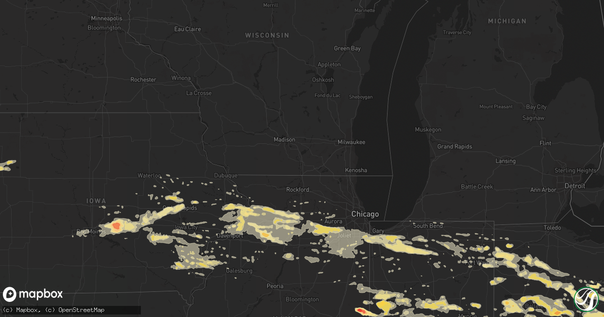
June 29 map
$229
one time, instant access
Download today. No call, no setup
Keep the $229
Bought the map and want the full workflow? Apply the entire $229 to a subscription within 7 days. None of it is wasted.
Every map, not just this one
This buys you this map. Subscription and you get every map we run, in the markets you choose from a few cities to whole states to nationwide. Plus real-time alerts the moment a storm fires.
Contact data
Name, contact info, occupancy, even credit band for addresses in the footprint. You go from where it hit to who to call.
Become the source they trust
Unlimited branding weather history reports on demand. You already have the documented answer ready for the property owner, and you are the one who showed up with it.
Property data and RoofTrace estimates
Pull up any address you have got, its value and the exact code rules for that jurisdiction, straight from One Click Code. Then RoofTrace estimates the squares, pitch, and roof value, priced the way you price.
Storm reports in Virginia
Virginia
| Date | Description |
|---|---|
| 06/29/201210:56 AM CDT | A local report indicates 63 MPH wind near FORT EUSTIS |
| 06/29/201210:55 AM CDT | A local report indicates 74 MPH wind near FRANKLIN/J_B_ROSE |
| 06/29/20129:10 AM CDT | Several large trees...power poles...power lines and branches down county wide in louisa county. Trees reported down on homes and cars in mineral. |
| 06/28/201211:43 PM CDT | A local report indicates 61 MPH wind near OCEANA NAS |
| 06/28/201211:35 PM CDT | Large oak trees down on hwy. At rt 1 and layhill ave... Blocking 3 lanes |
| 06/28/201211:30 PM CDT | A local report indicates 58 MPH wind near KIPTOPEKE |
| 06/28/201211:30 PM CDT | Multiple trees down. |
| 06/28/201211:27 PM CDT | A local report indicates 64 MPH wind near HAMPTON |
| 06/28/201211:24 PM CDT | 61 mph gust measured at portsmouth eoc |
| 06/28/201211:17 PM CDT | Large oak tree down with several additional large branches down in grafton. |
| 06/28/201211:10 PM CDT | Trees down...estimated wind gust 60 mph |
| 06/28/201211:00 PM CDT | A local report indicates 62 MPH wind near WINDSOR |
| 06/28/201210:56 PM CDT | A local report indicates 63 MPH wind near FORT EUSTIS |
| 06/28/201210:55 PM CDT | A local report indicates 74 MPH wind near FRANKLIN/J_B_ROSE |
| 06/28/201210:55 PM CDT | Large tree downed blocking road near intersection of green springs and tyler in jamestown |
| 06/28/201210:53 PM CDT | A local report indicates 71 MPH wind near FRANKLIN |
| 06/28/201210:45 PM CDT | Numerous trees downed along highway 14...ne of gloucester |
| 06/28/201210:40 PM CDT | Large tree branches partially blocking us 460 |
| 06/28/201210:25 PM CDT | Numerous trees down |
| 06/28/201210:25 PM CDT | Trees falling on cars along interstate 95 near exit 86. Several downed trees west of ashland. |
| 06/28/201210:22 PM CDT | One and a half to two feet diameter tree blocking roadway of rt 617 |
| 06/28/201210:18 PM CDT | Numerous trees down throughout the county |
| 06/28/201210:16 PM CDT | 2 foot diameter tree into a house with 1 entrapment along indian hollow rd |
| 06/28/201210:15 PM CDT | Trees down on powerlines and on house vicinity of garys church rd and college rd |
| 06/28/201210:05 PM CDT | Multiple trees down near fall hill ave and normandy ave. Some 1-2 inches in diameter. Some 7-8 inches in diameter. A few trees onto vehicles. |
| 06/28/201210:05 PM CDT | Numerous trees down at whippernock marina and campground |
| 06/28/20129:56 PM CDT | 58 mph gust at kenbridge |
| 06/28/20129:52 PM CDT | A local report indicates 71 MPH wind near 1 NNE DULLES INTERNATIO |
| 06/28/20129:52 PM CDT | Several trees down. Power lines down. |
| 06/28/20129:50 PM CDT | Multiple 1 to 2 inch tree branches down along fall hill ave and near hughey ct and near heritage pl |
| 06/28/20129:50 PM CDT | Several large trees down along penola rd |
| 06/28/20129:48 PM CDT | One foot diameter limb down on powerlines. |
| 06/28/20129:48 PM CDT | Large tree limbs down. |
| 06/28/20129:45 PM CDT | A local report indicates 82 MPH wind near 2 SE DAHLGREN |
| 06/28/20129:45 PM CDT | Trees down and blocking va 723 in lunenburg |
| 06/28/20129:44 PM CDT | Large tree down near intersection of route 50 and manchester street. |
| 06/28/20129:44 PM CDT | A local report indicates 66 MPH wind near 1 SW QUANTICO |
| 06/28/20129:41 PM CDT | A local report indicates 60 MPH wind near 1 E CHERRYDALE |
| 06/28/20129:40 PM CDT | Large trees down on coatesville rd near beaverdam |
| 06/28/20129:40 PM CDT | Time is approximate and based on radar estimate. Multiple trees down at intersection of va 522 and va 711. |
| 06/28/20129:40 PM CDT | Wind gusts on parham and pemberton roads |
| 06/28/20129:39 PM CDT | Medium to large trees down on lorton road. |
| 06/28/20129:39 PM CDT | Multiple trees down near intersection of north mclinkley street and 25th road. |
| 06/28/20129:39 PM CDT | Small limbs were down. |
| 06/28/20129:38 PM CDT | *** 1 fatal *** motorist struck by falling tree |
| 06/28/20129:36 PM CDT | Several trees down |
| 06/28/20129:35 PM CDT | Three large branches blocked two lanes of prosperity avenue. |
| 06/28/20129:35 PM CDT | Tree limbs of 2 to 3 inch diameter snapped along a 0.1 mile stretch of fairfax county parkway |
| 06/28/20129:35 PM CDT | A local report indicates 79 MPH wind near RESTON |
| 06/28/20129:35 PM CDT | Three inch diameter tree down at intersection of lee highway and nutley street. |
| 06/28/20129:35 PM CDT | Large tree downed and blocking roadway on sleepy hollow rd in richmond |
| 06/28/20129:35 PM CDT | Multiple trees and power lines down. |
| 06/28/20129:31 PM CDT | Quarter sized hail on shelton shop road. |
| 06/28/20129:30 PM CDT | Branches of at least 4 inches in diameter blocking valewood drive. |
| 06/28/20129:30 PM CDT | Tree down on post forest drive at black ironwood drive |
| 06/28/20129:30 PM CDT | Numerous trees fallen across roads in and around partlow. |
| 06/28/20129:30 PM CDT | Trees down in sandy hook and hadensville |
| 06/28/20129:30 PM CDT | Numerous trees down in and around brokenburg. |
| 06/28/20129:30 PM CDT | Tree with diameter of over a foot and height of 50-60 feet was downed. Several smaller trees also fell. |
| 06/28/20129:30 PM CDT | At least ten trees sheared off 20 to 40 feet above ground. Large branches spread many yards in all directions. |
| 06/28/20129:28 PM CDT | Multiple branches... Some 4 inches in diameter... Down as well as a residents gutter torn off side of house. |
| 06/28/20129:28 PM CDT | Two limbs of at least 12 inches in diameter were snapped. |
| 06/28/20129:28 PM CDT | A local report indicates 80 MPH wind near 1 W FREDERICKSBURG |
| 06/28/20129:28 PM CDT | Multiple trees down approx 4.5 to 5 inches in diameter. |
| 06/28/20129:27 PM CDT | Powerlines down. |
| 06/28/20129:27 PM CDT | Large tree down blocking intersection of elden street and ferndale avenue. |
| 06/28/20129:26 PM CDT | Multiple trees down near fall hill ave and normandy ave. Some 1-2 inches in diameter. Some 7-8 inches in diameter. A few trees onto vehicles. |
| 06/28/20129:26 PM CDT | Trunk of large pine tree snapped in half. |
| 06/28/20129:26 PM CDT | Multiple 1 to 2 inch tree branches down along fall hill ave and near hughey ct and near heritage pl |
| 06/28/20129:26 PM CDT | Numerous trees fallen across roads in spotsylvania county. |
| 06/28/20129:25 PM CDT | Numerous trees down on winding creek road. |
| 06/28/20129:25 PM CDT | 40 gusting to 60 mph |
| 06/28/20129:25 PM CDT | Large oak trees down on hwy. At rt 1 and layhill ave... Blocking 3 lanes |
| 06/28/20129:25 PM CDT | A local report indicates 62 MPH wind near 2 E COUNTRYSIDE |
| 06/28/20129:25 PM CDT | Numerous trees down throughout county. Widespread power outages. |
| 06/28/20129:25 PM CDT | Trees down on grit road. |
| 06/28/20129:23 PM CDT | Medium sized tree blocking southbound algonkian pkwy near hardwood forest drive. |
| 06/28/20129:23 PM CDT | Large tree into townhouse on sugarland square...causing structural damage. |
| 06/28/20129:23 PM CDT | Large tree limb down over 20 to 30 feet high powerlines on holly avenue. |
| 06/28/20129:23 PM CDT | Large tree down over powerlines. Power pole broken off and wrapped into tree. Cedar drive was blocked. |
| 06/28/20129:23 PM CDT | One foot diameter tree down across roadway and on top of occupied vehicle near intersection of lowes island blvd and saulty drive. |
| 06/28/20129:23 PM CDT | A local report indicates 71 MPH wind near 1 NNE DULLES INTERNATIO |
| 06/28/20129:23 PM CDT | Medium sized tree down across roadway. |
| 06/28/20129:23 PM CDT | Large tree down onto house. |
| 06/28/20129:22 PM CDT | A local report indicates 70 MPH wind near 1 NE ASHBURN |
| 06/28/20129:22 PM CDT | Small limbs snapped on broderick south of waxpool. |
| 06/28/20129:22 PM CDT | A local report indicates 67 MPH wind near 1 SE ASHBURN |
| 06/28/20129:22 PM CDT | Small tree fell onto unoccupied car in a driveway on clear spring terrace. |
| 06/28/20129:22 PM CDT | Large limbs snapped on loudoun county parkway just south of washington and old dominion trail. |
| 06/28/20129:22 PM CDT | Tree blocking the roadway near the intersection of mount view and joshua road. |
| 06/28/20129:22 PM CDT | Numerous trees fallen across roads in spotsylvania county. |
| 06/28/20129:22 PM CDT | Measured near intersection of route 17 and poplar road. |
| 06/28/20129:22 PM CDT | Numerous trees down on arrowhead drive. |
| 06/28/20129:22 PM CDT | Tree snapped near intersection of broderick and moran. |
| 06/28/20129:21 PM CDT | A local report indicates 66 MPH wind near 2 E HOLLY CORNER |
| 06/28/20129:21 PM CDT | Large limbs on route 606. |
| 06/28/20129:20 PM CDT | A local report indicates 61 MPH wind near 1 SE GAINESVILLE |
| 06/28/20129:20 PM CDT | A local report indicates 63 MPH wind near 2 NNE BELMONT |
| 06/28/20129:19 PM CDT | A local report indicates 68 MPH wind near 3 NE NOKESVILLE |
| 06/28/20129:19 PM CDT | Deck partially removed from townhouse on huron terrace. |
| 06/28/20129:18 PM CDT | Maple tree tops were snapped off...shingles were blown off roofs. |
| 06/28/20129:18 PM CDT | Numerous trees down throughout the county |
| 06/28/20129:15 PM CDT | A local report indicates 60 MPH wind near 2 SSW LEESBURG |
| 06/28/20129:15 PM CDT | Warrenton airport awos |
| 06/28/20129:15 PM CDT | A local report indicates 60 MPH wind near 2 WNW GROTTOES |
| 06/28/20129:15 PM CDT | Numerous trees down. |
| 06/28/20129:14 PM CDT | Two foot diameter tree down near intersection of route 15 and gap road. |
| 06/28/20129:10 PM CDT | Several large trees down in mineral. |
| 06/28/20129:10 PM CDT | Damage to roof of home. Many trees two and a half to three feet in diameter snapped in half along thicket ct. |
| 06/28/20129:10 PM CDT | Several large trees...power poles...power lines and branches down county wide in louisa county. Trees reported down on homes and cars in mineral. |
| 06/28/20129:09 PM CDT | Two large trees down on main street in purcellville. |
| 06/28/20129:09 PM CDT | Multiple large trees down on furnace mountain road...making it impassible between route 15 and taylorstown road. |
| 06/28/20129:09 PM CDT | Large tree uprooted on golf course just west of purcellville |
| 06/28/20129:09 PM CDT | Numerous trees down along roadways...some onto houses and cars in a stretch from 5 miles west of marshall through marshall to warrenton. |
| 06/28/20129:08 PM CDT | A local report indicates 60 MPH wind near 2 ENE LOVETTSVILLE |
| 06/28/20129:06 PM CDT | Trees and large branches down on timberlake drive. |
| 06/28/20129:05 PM CDT | Large tree uprooted. |
| 06/28/20129:05 PM CDT | Tree was downed on a house along the 400 block of west main street. |
| 06/28/20129:05 PM CDT | One and a half to two feet diameter tree blocking roadway of rt 617 |
| 06/28/20129:05 PM CDT | Large tree downed...damaging fence on pickwick street. |
| 06/28/20129:03 PM CDT | *** 1 inj *** multiple reports of large trees down along west main street and windsor heights subdivision. Person injured by falling tree limb...fell on persons arm. |
| 06/28/20129:02 PM CDT | Numerous trees and power lines around blairs. |
| 06/28/20129:01 PM CDT | Numerous trees down blocking road. |
| 06/28/20129:00 PM CDT | Appox. 100 reports of trees and powerlines down between 1000 pm and 1050 pm. |
| 06/28/20129:00 PM CDT | 50-75 reports of downed trees and powerlines across the county between 1000 pm and 1050 pm. Hardest hit area was aspen...in the western part of the county. Couple repor |
| 06/28/20129:00 PM CDT | Numerous trees down. |
| 06/28/20129:00 PM CDT | Numerous 4 to 6 in limbs down. Power out. Route 620. |
| 06/28/20129:00 PM CDT | Trees down on route 20 and route 522. |
| 06/28/20129:00 PM CDT | Large trees blocking the intersection of route 601 and mount weather. |
| 06/28/20128:56 PM CDT | Tree limbs down on electrical wires. |
| 06/28/20128:56 PM CDT | Trees down countywide. Trees on houses. |
| 06/28/20128:55 PM CDT | More than 50 reports of trees and power lines blown down across buckingham county. First report of damage was trees down on howardsville road around 955 pm. Storms exit |
| 06/28/20128:55 PM CDT | A local report indicates 61 MPH wind near 2 SE WINCHESTER |
| 06/28/20128:51 PM CDT | Several trees fell on houses |
| 06/28/20128:49 PM CDT | A local report indicates 69 MPH wind near 1 NNE HARRISONBURG |
| 06/28/20128:48 PM CDT | Numerous trees and power lines down throughout madison county. |
| 06/28/20128:48 PM CDT | Widespread trees down |
| 06/28/20128:48 PM CDT | Five trees down near intersection of wolfe and washington. |
| 06/28/20128:46 PM CDT | Several trees fell on houses |
| 06/28/20128:45 PM CDT | Tree knocked over onto tractor trailer along us 50. |
| 06/28/20128:45 PM CDT | Trees down blocking rt 58 |
| 06/28/20128:45 PM CDT | 150 to 175 calls of trees and powerlines down across the county from a thunderstorm gust front which moved across the county between 930 and 1000 pm. Tree fell on house |
| 06/28/20128:45 PM CDT | Several trees and branches down. Largest tree about 15 inches in diameter. |
| 06/28/20128:45 PM CDT | Multiple trees down |
| 06/28/20128:45 PM CDT | Trees and power lines down along indian hills road. |
| 06/28/20128:44 PM CDT | Tree down on house on washington street. |
| 06/28/20128:44 PM CDT | Trees down countywide |
| 06/28/20128:44 PM CDT | Few trees knocked down onto trailer homes near rt 37 and us 522. |
| 06/28/20128:43 PM CDT | Numerous trees down throughout the county with one house damaged. Strongest winds entered the county around 945 pm and exited around 1035 pm. |
| 06/28/20128:43 PM CDT | *** 1 fatal *** tree struck man on his porch |
| 06/28/20128:42 PM CDT | Multiple trees down with telephone poles on fire at 1590 bassett heights road. |
| 06/28/20128:42 PM CDT | Trees down |
| 06/28/20128:40 PM CDT | Numerous trees down throughout warren county |
| 06/28/20128:40 PM CDT | A local report indicates 68 MPH wind near 2 E HARRISONBURG |
| 06/28/20128:40 PM CDT | 400 reports of trees and powerlines down across henry county and the city of martinesville. Some vehicles and personal property damaged...overall scope of damage unknow |
| 06/28/20128:40 PM CDT | Tree on house |
| 06/28/20128:40 PM CDT | 2 foot diameter tree into a house with 1 entrapment along indian hollow rd |
| 06/28/20128:40 PM CDT | Large...mature oak tree was blown into house on plank road. Extensive roof and significant structural damage. |
| 06/28/20128:39 PM CDT | A local report indicates 63 MPH wind near 2 E WINCHESTER |
| 06/28/20128:39 PM CDT | Four large trees down and minor siding damage. |
| 06/28/20128:39 PM CDT | Tree over tasker road |
| 06/28/20128:37 PM CDT | Over 25 reports of trees and power lines down across appomattoax county. Based on radar...damage began around 937 pm and continued through 1015 pm. |
| 06/28/20128:35 PM CDT | Trees and power lines down. |
| 06/28/20128:35 PM CDT | Trees and limbs blown down..winds estimated bear 80 mph. |
| 06/28/20128:35 PM CDT | Several trees were blown down along the blue ridge parkway. |
| 06/28/20128:35 PM CDT | Several pine trees toppled over near lawsons farm rd and lawsons farm circle. |
| 06/28/20128:34 PM CDT | Multiple trees down. |
| 06/28/20128:32 PM CDT | Multiple trees down. |
| 06/28/20128:32 PM CDT | In campbell county hundreds of trees were blown down. The greatest concentration of damage was in the northern portion of the county. No significant structural damage w |
| 06/28/20128:30 PM CDT | Tree limbs down |
| 06/28/20128:30 PM CDT | A few trees were blown down along mckinney avenue. |
| 06/28/20128:30 PM CDT | Multiple trees down. |
| 06/28/20128:30 PM CDT | Several trees down at mile marker 192 on the blue ridge parkway. |
| 06/28/20128:30 PM CDT | Several trees down...both snapped off and uprooted. Roads are impassable due to downed trees |
| 06/28/20128:30 PM CDT | Tree down on lakeside drive across from lynchburg college. |
| 06/28/20128:30 PM CDT | Numerous trees down on wagon trail road. |
| 06/28/20128:30 PM CDT | Numerous large trees down in and around earlysville. |
| 06/28/20128:30 PM CDT | A few trees down on elm street. |
| 06/28/20128:30 PM CDT | Two trees reported down in clifford. Several large limbs also blown down in the town of amherst. |
| 06/28/20128:30 PM CDT | Large tree fell into power lines. |
| 06/28/20128:28 PM CDT | Trees down. |
| 06/28/20128:28 PM CDT | Tree blown down and numerous large limbs down on ginger lane. |
| 06/28/20128:28 PM CDT | Four trees blown down on woodway drive. |
| 06/28/20128:26 PM CDT | Five trees down. One structure damaged by one of the trees. |
| 06/28/20128:26 PM CDT | Two large trees down on 1615 windsor ave |
| 06/28/20128:26 PM CDT | Tree limbs down. |
| 06/28/20128:26 PM CDT | Fireworks stand demolished downtown |
| 06/28/20128:25 PM CDT | Trees and power lines down. |
| 06/28/20128:25 PM CDT | Tree down and power lines down on wayne drive. |
| 06/28/20128:25 PM CDT | Numerous trees and power lines down. Over 60 homes damaged by the winds and falling trees. Some homes are uninhabitable. Radar estimates strongest winds exited lynchbur |
| 06/28/20128:25 PM CDT | Three trees were blown down along cardinal drive. One tree fell on powerlines. |
| 06/28/20128:24 PM CDT | At least a dozen trees down..widths up to 16 inches |
| 06/28/20128:24 PM CDT | Trees down |
| 06/28/20128:22 PM CDT | Numerous trees down |
| 06/28/20128:22 PM CDT | Multiple 3 ft dia trees down. Roof damage. |
| 06/28/20128:22 PM CDT | Trees down. Possible roof blown off structure |
| 06/28/20128:22 PM CDT | Roof damage at highland ave and 9th street. |
| 06/28/20128:22 PM CDT | Large tree down |
| 06/28/20128:22 PM CDT | Fallen trees damaged 10 apartments in 800 block of lyndhurst road in waynesboro |
| 06/28/20128:22 PM CDT | Trees on houses..roads..cars. Power lines down throughout the county |
| 06/28/20128:20 PM CDT | A local report indicates 87 MPH wind near 4 NW WINTERGREEN |
| 06/28/20128:20 PM CDT | Large tree split. Another tree uprooted |
| 06/28/20128:18 PM CDT | Trees power lines down throughout the city |
| 06/28/20128:18 PM CDT | Trees and power lines down on rt 24 and beagle club road. |
| 06/28/20128:16 PM CDT | *** 1 inj *** fallen trees damaged 10 apartments in 800 block of lyndhurst road in waynesboro |
| 06/28/20128:15 PM CDT | *** 1 fatal *** tree fell on vfd firefighter in line of duty responding to a call and crushed him in his vehicle...age 54. Critically inj...passed away july 2. |
| 06/28/20128:15 PM CDT | 3 trailers destroyed on pandapas pond road. |
| 06/28/20128:15 PM CDT | A large tree and powerlines were blown down along wisteria drive. |
| 06/28/20128:15 PM CDT | Multiple trees down on vermillion st. |
| 06/28/20128:15 PM CDT | Tree down on kane street. |
| 06/28/20128:15 PM CDT | Trees down on carroll road. |
| 06/28/20128:10 PM CDT | Three 1-2 ft diameter trees snapped 2-3 feet above the ground. |
| 06/28/20128:10 PM CDT | Numerous trees down. |
| 06/28/20128:10 PM CDT | Trees power lines down throughout the city |
| 06/28/20128:10 PM CDT | Large limbs down in the north side of town. |
| 06/28/20128:08 PM CDT | Trees down on crestview drive. |
| 06/28/20128:08 PM CDT | Wind gust measured at the roanoke regional airport |
| 06/28/20128:07 PM CDT | Trees down |
| 06/28/20128:07 PM CDT | Some damage to roofs..several trees down. |
| 06/28/20128:05 PM CDT | A couple trees were blown down near the intersection of electric road and interstate 81. |
| 06/28/20128:05 PM CDT | Large trees down on echo hills road. |
| 06/28/20128:05 PM CDT | Tree down on cherry branch road |
| 06/28/20128:05 PM CDT | Several trees were blown down along north lake drive. |
| 06/28/20128:05 PM CDT | In bedford county...hundreds of trees were blown down. Power lines were also knocked down. Some trees were blown down on homes. The strongest winds exited the county ar |
| 06/28/20128:05 PM CDT | The wind gust was measured on home weather equipment. |
| 06/28/20128:05 PM CDT | Two trees down..winds estimated up to 60 mph along george edward via road. |
| 06/28/20128:05 PM CDT | Trees down |
| 06/28/20128:04 PM CDT | Tree down on power line and numerous large branches down along poor valley road. |
| 06/28/20128:04 PM CDT | Tree down on power line and numerous large branches down along poor valley road. |
| 06/28/20128:04 PM CDT | Trees down. |
| 06/28/20128:02 PM CDT | Numerous trees downed on collierstown road. |
| 06/28/20128:01 PM CDT | Trees blown down near elliston near big spring drive. |
| 06/28/20128:01 PM CDT | Tree down and several large limbs down on gobblers spur. |
| 06/28/20128:00 PM CDT | A local report indicates 76 MPH wind near 6 ESE PILOT |
| 06/28/20128:00 PM CDT | Large limbs down in the community of new river. |
| 06/28/20128:00 PM CDT | Three trees down on 1600-1800 block of patterson ave. In roanoke. |
| 06/28/20128:00 PM CDT | Tree blown on house on jackson drive. |
| 06/28/20128:00 PM CDT | Several trees were blown down along peppers ferry road. |
| 06/28/20128:00 PM CDT | A large tree and powerlines were blown down along lyons road. |
| 06/28/20128:00 PM CDT | Campers at claytor lake state park reported numerous trees blown down across the park. |
| 06/28/20128:00 PM CDT | Several trees down...campers flipped at new river junction and a tree down on a house. |
| 06/28/20128:00 PM CDT | 20 inch diameter tree uprooted |
| 06/28/20128:00 PM CDT | Several trees snapped off 20-30 feet above the ground. |
| 06/28/20128:00 PM CDT | Winds estimated over 50 mph and signifcant tree damage. |
| 06/28/20128:00 PM CDT | Several trees were blown down near the daleville high school. |
| 06/28/20128:00 PM CDT | Several trees and large tree limbs were blown down near the intersection of timber ridge road and hwy 11. |
| 06/28/20128:00 PM CDT | A local report indicates 66 MPH wind near 3 WSW MOSCOW |
| 06/28/20127:59 PM CDT | A local report indicates 69 MPH wind near 1 NNE HARRISONBURG |
| 06/28/20127:59 PM CDT | Several trees down...some blocking streets. |
| 06/28/20127:58 PM CDT | Rees were snapped and blown down at the dogwood lodge. |
| 06/28/20127:58 PM CDT | Trees down on flat woods road |
| 06/28/20127:58 PM CDT | Barn blown down on north fork road |
| 06/28/20127:58 PM CDT | Tree down on reesedale road |
| 06/28/20127:57 PM CDT | A local report indicates 63 MPH wind near 10 N LEXINGTON CITY |
| 06/28/20127:57 PM CDT | Tree down on house on valley pike. |
| 06/28/20127:57 PM CDT | Trees blown down. |
| 06/28/20127:56 PM CDT | Trees down and tree down on car along wrights valley road. |
| 06/28/20127:56 PM CDT | Trees down in raven. |
| 06/28/20127:56 PM CDT | Hundreds of trees were blown down across roanoke county as well as numerous power lines down. In the southeast portion of roanoke county an uprooted tree flipped a mobi |
| 06/28/20127:55 PM CDT | A large tree was blown down onto a house on broce drive. |
| 06/28/20127:55 PM CDT | Two trees blown down on eakin street southeast. |
| 06/28/20127:55 PM CDT | Tree down on cambridge road. |
| 06/28/20127:55 PM CDT | Several trees down |
| 06/28/20127:55 PM CDT | Numerous trees and powerlines down in north tazewell along fairground road...east riverside drive...cochran hollow road...east fincastle street...hill street...whitley |
| 06/28/20127:55 PM CDT | Across the county there were hundreds of reports of trees down...as well as power lines and numerous power outages. This occurred between 855 pm and 915 pm. In dublin.. |
| 06/28/20127:54 PM CDT | Trees and several large limbs blown down. |
| 06/28/20127:54 PM CDT | Six or seven trees blown down blocking mt. Tabor road. |
| 06/28/20127:53 PM CDT | Several trees down on high meadow drive. One tree fell on...and damaged...a vehicle. |
| 06/28/20127:52 PM CDT | Numerous trees and powerlines down along hubble hill rd...maplewood drive...gratton road...pounding mill branch...cherry hills drive...fincastle road...hill street...po |
| 06/28/20127:52 PM CDT | A tree was blown down onto a car. |
| 06/28/20127:52 PM CDT | Large apple tree down |
| 06/28/20127:52 PM CDT | Several trees down along tip top road and hurt road. |
| 06/28/20127:51 PM CDT | Several large limbs down on mcdaniel drive. |
| 06/28/20127:50 PM CDT | *** 2 inj *** hundreds of reports of trees and power lines down. Two or three people were injured at an outdoor show at natural bridge. Cars were crushed by falling tre |
| 06/28/20127:50 PM CDT | Hundreds of reports of tree and power line damage across montgomery county were called in to the 911 center friday night from the extreme windstorm that entered the cou |
| 06/28/20127:50 PM CDT | At least a dozen large trees and hundreds of medium to large size limbs down along pearman road in preston forest...especially at elevations above 2200 ft. |
| 06/28/20127:47 PM CDT | Numerous large trees down and fencing blown down. |
| 06/28/20127:45 PM CDT | 2 trees were reported blown down off of river road. |
| 06/28/20127:45 PM CDT | Trees down on burton hollow road |
| 06/28/20127:45 PM CDT | Numerous trees down and power outages across the county...starting at 845 pm and lasting until about 915 pm. Roof damage to one barn...otherwise no known significant st |
| 06/28/20127:45 PM CDT | Tree fell on house. |
| 06/28/20127:45 PM CDT | Trees down on jumps road |
| 06/28/20127:44 PM CDT | A tree was blown down onto a trailer on liberty lane. |
| 06/28/20127:44 PM CDT | Trees down on panther branch road |
| 06/28/20127:43 PM CDT | The roof of a home was badly damaged by strong winds on muaney road. |
| 06/28/20127:42 PM CDT | *** 12 inj *** hundreds of trees blown down countywide. Power lines also blown down. Less than 20 structures were damaged...mainly from winds blowing off roofing. Trees |
| 06/28/20127:42 PM CDT | A large tree was blown down along curve road. |
| 06/28/20127:42 PM CDT | Multiple large trees were blown down partially blocking hwy 460. |
| 06/28/20127:42 PM CDT | Trees down on dry fork road |
| 06/28/20127:41 PM CDT | Trees down on stoney ridge road at horsepen road |
| 06/28/20127:40 PM CDT | Several trees were reported down. |
| 06/28/20127:39 PM CDT | Trees down countywide |
| 06/28/20127:38 PM CDT | Trees down on loop road |
| 06/28/20127:37 PM CDT | In craig county hundreds of trees were blown down...power lines down. A few barns were damaged...a porch was destroyed by thunderstorm winds on route 42. Several vehicl |
| 06/28/20127:35 PM CDT | Numerous trees were reported blown down across the city. Some trees were blown down into homes and over cars. A church was badly damaged. |
| 06/28/20127:35 PM CDT | Large apple tree down |
| 06/28/20127:35 PM CDT | Multiple reports of trees and powerl lines down across the county |
| 06/28/20127:35 PM CDT | Several trees down around the county |
| 06/28/20127:34 PM CDT | Trees down on boissevain road |
| 06/28/20127:30 PM CDT | Many trees down throughout buchanan county with power outages reported |
| 06/28/20127:25 PM CDT | Numerous trees and power lines were blown down. A church roof was severely damaged by thunderstorm winds. A portion of the high school roof and a roof at a local hotel |
| 06/28/20127:22 PM CDT | Hundreds of trees and power lines blown down across bath county. One tree fell on a home and a few trees fell on cars causing damage. One person had debris blown in the |
All States Impacted by Hail Map on June 29, 2012
Cities Impacted by Hail Map on June 29, 2012
- Washington, WV
- Belpre, OH
- Parkersburg, WV
- Little Hocking, OH
- Todd, PA
- James Creek, PA
- Parshall, ND
- Roseglen, ND
- New Carlisle, OH
- Bluffton, OH
- Lima, OH
- Harrod, OH
- Columbus Grove, OH
- Beaverdam, OH
- Forest, IN
- Frankfort, IN
- Windfall, IN
- Swayzee, IN
- Kempton, IN
- Kokomo, IN
- Elwood, IN
- Fairmount, IN
- Greentown, IN
- Russiaville, IN
- Michigantown, IN
- Sharpsville, IN
- Tipton, IN
- Richwood, OH
- Lawton, IA
- Sioux City, IA
- Hinton, IA
- Earlville, IL
- Southwest Harbor, ME
- Mount Desert, ME
- Chapmanville, WV
- Westerville, OH
- Tippecanoe, OH
- Breezewood, PA
- Clearville, PA
- Warfordsburg, PA
- Needmore, PA
- Dupree, SD
- Redkey, IN
- Dunkirk, IN
- Hartford City, IN
- Leon, WV
- Fairmont, WV
- Shinnston, WV
- Bridgeport, WV
- Grafton, WV
- Le Claire, IA
- Frenchville, ME
- Madawaska, ME
- Gordonsville, VA
- Louisa, VA
- Williston, ND
- Colton, SD
- Chester, SD
- Dell Rapids, SD
- Walnut, IL
- Holland, MN
- Ruthton, MN
- Tyler, MN
- Pipestone, MN
- Indianapolis, IN
- Brownsburg, IN
- Newark, DE
- Wilmington, DE
- New Castle, DE
- Elkton, MD
- Steward, IL
- Ashton, IL
- West Brooklyn, IL
- Franklin Grove, IL
- Perham, ME
- New Sweden, ME
- Stockholm, ME
- Caribou, ME
- Washburn, ME
- Fort Fairfield, ME
- Limestone, ME
- Calvin, PA
- Colman, SD
- Malta, OH
- Mcconnelsville, OH
- Crooksville, OH
- Chana, IL
- Walton, KY
- Morning View, KY
- Independence, KY
- Hebron, IN
- Valparaiso, IN
- Boone Grove, IN
- McComb, OH
- Groveport, OH
- Moville, IA
- Galva, IA
- Storm Lake, IA
- Pierson, IA
- Cleghorn, IA
- Holstein, IA
- Alta, IA
- Kingsley, IA
- Aurelia, IA
- Quimby, IA
- Washta, IA
- Cherokee, IA
- Correctionville, IA
- Marcus, IA
- Newton, WV
- Left Hand, WV
- Looneyville, WV
- Wallback, WV
- Clendenin, WV
- Procious, WV
- Amma, WV
- Jamestown, OH
- Mount Vernon, OH
- Fredericktown, OH
- Butler, OH
- New Plymouth, OH
- Nelsonville, OH
- New Marshfield, OH
- Shade, OH
- Gallipolis, OH
- Albany, OH
- Rutland, OH
- Thurman, OH
- The Plains, OH
- Langsville, OH
- Patriot, OH
- Wilkesville, OH
- Wellston, OH
- Athens, OH
- Jackson, OH
- Rio Grande, OH
- Pomeroy, OH
- McArthur, OH
- Oak Hill, OH
- Bidwell, OH
- Vinton, OH
- Delaware City, DE
- Prophetstown, IL
- Leipsic, OH
- Findlay, OH
- Luray, VA
- Coolville, OH
- Steuben, ME
- Charlottesville, IN
- Knightstown, IN
- Greenfield, IN
- Wilkinson, IN
- Trenton, OH
- Oxford, OH
- Hamilton, OH
- Somerville, OH
- Middletown, OH
- Mansfield, OH
- Fowler, IN
- Patten, ME
- Independence, IA
- Jesup, IA
- Brandon, IA
- Woodstock, MN
- Marysville, OH
- Morris, IL
- Keswick, VA
- Troy, VA
- Flandreau, SD
- Wood Lake, NE
- Valentine, NE
- New London, IA
- Glenford, OH
- Heath, OH
- Streator, IL
- Franklinville, NJ
- Brigantine, NJ
- Landisville, NJ
- Port Republic, NJ
- Vineland, NJ
- Absecon, NJ
- Vincentown, NJ
- Chatsworth, NJ
- Buena, NJ
- Newtonville, NJ
- Hammonton, NJ
- Tuckerton, NJ
- New Gretna, NJ
- Pleasantville, NJ
- Minotola, NJ
- Egg Harbor City, NJ
- Mays Landing, NJ
- Newfield, NJ
- Atlantic City, NJ
- Malaga, NJ
- Ventnor City, NJ
- Williamstown, NJ
- Egg Harbor Township, NJ
- Pembroke Township, IL
- Saint Anne, IL
- Plainfield, IL
- Sheridan, IL
- Yorkville, IL
- Newark, IL
- Sandwich, IL
- Plano, IL
- Oswego, IL
- Millbrook, IL
- Millington, IL
- Yarmouth, IA
- Mount Union, IA
- Canaan, ME
- Skowhegan, ME
- Pittsfield, ME
- Milledgeville, IL
- Polo, IL
- Woosung, IL
- Oregon, IL
- Chadwick, IL
- Dixon, IL
- Compton, IL
- Sterling, IL
- Laotto, IN
- Avilla, IN
- Gaithersburg, MD
- Aledo, IL
- Sublette, IL
- Fair Oaks, IN
- Wheatfield, IN
- Rensselaer, IN
- Salisbury, PA
- West Salisbury, PA
- Springs, PA
- Fort Hill, PA
- Newton, IA
- Louisa, KY
- West Liberty, IA
- Nichols, IA
- Rockwood, PA
- Ohio City, OH
- Willshire, OH
- Rockford, OH
- Decatur, IN
- Monroe, IN
- Wren, OH
- Van Wert, OH
- Vienna, WV
- Vincent, OH
- Amesville, OH
- Waterford, OH
- Cutler, OH
- Orient, SD
- Beallsville, MD
- Dickerson, MD
- Clarksburg, MD
- Sterling, VA
- Hamilton, VA
- Ashburn, VA
- Tuscarora, MD
- Boyds, MD
- Point Of Rocks, MD
- Montgomery Village, MD
- Potomac, MD
- Rockville, MD
- Paeonian Springs, VA
- Waterford, VA
- Poolesville, MD
- Barnesville, MD
- Purcellville, VA
- Leesburg, VA
- Germantown, MD
- Stafford, VA
- Bucyrus, OH
- Summitville, IN
- Alexandria, IN
- Winner, SD
- Cedar Rapids, IA
- Marion, IA
- Plainview, NE
- Neligh, NE
- Wayland, IA
- Mount Pleasant, IA
- Lockridge, IA
- Brighton, IA
- Hague, VA
- Montross, VA
- Waterloo, IN
- Butler, IN
- Augusta, KY
- Iowa City, IA
- Lone Tree, IA
- Atalissa, IA
- Muscatine, IA
- Freeport, OH
- Hudson, IN
- Ashley, IN
- Clarksburg, OH
- Washington Court House, OH
- Frankfort, OH
- Millinocket, ME
- Lewiston, ME
- Kanorado, KS
- Gaston, IN
- East Millsboro, PA
- Bedford, PA
- Lebanon, IN
- Whitestown, IN
- Arcadia, IN
- Atlanta, IN
- Sheridan, IN
- Noblesville, IN
- Cicero, IN
- Westfield, IN
- Kirklin, IN
- Kellogg, IA
- Keene, ND
- New Town, ND
- West Des Moines, IA
- Shirley, IN
- Lebanon, SD
- Tolstoy, SD
- McHenry, MD
- Accident, MD
- Friendsville, MD
- Bloomfield, NE
- Wyanet, IL
- Fenton, IL
- New Bedford, IL
- Tampico, IL
- Princeton, IL
- Annawan, IL
- Erie, IL
- Sheffield, IL
- Manlius, IL
- Sidney, OH
- Quincy, OH
- De Graff, OH
- Aberdeen, MD
- Abingdon, MD
- Belcamp, MD
- Bellevue, IA
- Milford Center, OH
- North Lewisburg, OH
- Anamosa, IA
- Wyoming, IA
- Center Junction, IA
- Rossville, IL
- Hoopeston, IL
- Ambia, IN
- Seneca, IL
- Marseilles, IL
- Galion, OH
- Waterman, IL
- Hicksville, OH
- Martha, KY
- Sitka, KY
- Keaton, KY
- West Liberty, KY
- Flatgap, KY
- Defiance, OH
- Ney, OH
- Harlan, IN
- Grabill, IN
- Stoutsville, OH
- Amanda, OH
- Alexis, IL
- Little York, IL
- Dana, IN
- Farmland, IN
- Winchester, IN
- Logan, OH
- New Straitsville, OH
- Wapello, IA
- Frederick, MD
- Adamstown, MD
- Osmond, NE
- Friendly, WV
- Middlebourne, WV
- Amboy, IL
- Potomac, IL
- Modoc, IN
- Arcanum, OH
- Losantville, IN
- Eldorado, OH
- New Castle, IN
- Springport, IN
- Lynn, IN
- Richmond, IN
- Middletown, IN
- New Madison, OH
- Hagerstown, IN
- Hollansburg, OH
- Economy, IN
- Fountain City, IN
- Greens Fork, IN
- Lewisburg, OH
- Williamsburg, IN
- New Paris, OH
- Mooreland, IN
- Greenville, OH
- West Manchester, OH
- Carmel, IN
- Fishers, IN
- Boswell, IN
- Oxford, IN
- West Chester, OH
- Swedesboro, NJ
- Mickleton, NJ
- Sewell, NJ
- Pitman, NJ
- Mullica Hill, NJ
- Clarksboro, NJ
- Mantua, NJ
- Glassboro, NJ
- Dola, OH
- Dunkirk, OH
- Ada, OH
- Vanceburg, KY
- Garrison, KY
- Garrison, ND
- Dover, PA
- Thomasville, PA
- Princeton, IA
- Crown Point, IN
- Griffith, IN
- Dyer, IN
- Schererville, IN
- Saint John, IN
- Merrillville, IN
- Bremen, IN
- Albion, IN
- Cromwell, IN
- North Webster, IN
- Churubusco, IN
- Milford, IN
- Kimmell, IN
- Leesburg, IN
- Nappanee, IN
- Larwill, IN
- Columbia City, IN
- Warsaw, IN
- Syracuse, IN
- Pierceton, IN
- Big Creek, WV
- Harts, WV
- Manchester, OH
- Aberdeen, OH
- Maysville, KY
- Dover, KY
- Sunbury, OH
- Galena, OH
- Centerburg, OH
- La Moille, IL
- Eldridge, IA
- Ligonier, PA
- Monrovia, MD
- Damascus, MD
- Ijamsville, MD
- Burnham, ME
- Waterville, ME
- Troy, ME
- Clinton, ME
- Brooks, ME
- Unity, ME
- Thorndike, ME
- Albion, ME
- Buffalo, WV
- Pennsboro, WV
- Sabattus, ME
- Kingwood, WV
- Brookeville, MD
- Dayton, MD
- Glenelg, MD
- Hillsboro, OH
- South Salem, OH
- Greenfield, OH
- Bainbridge, OH
- Manhattan, IL
- Peotone, IL
- Monee, IL
- Mount Zion, WV
- Grantsville, WV
- Hamler, OH
- Ottawa, OH
- Presque Isle, ME
- Mapleton, ME
- Pemberton, OH
- Maplewood, OH
- Henning, IL
- Williamsport, IN
- Collison, IL
- West Lebanon, IN
- Danville, IL
- Alvin, IL
- Bismarck, IL
- Danforth, ME
- Brookton, ME
- Ripley, OH
- Mount Perry, OH
- Hopewell, OH
- Thornville, OH
- Huntsville, OH
- Bellefontaine, OH
- Newark, OH
- Frazeysburg, OH
- Croton, OH
- Utica, OH
- Saint Louisville, OH
- Johnstown, OH
- North English, IA
- Alexandria, OH
- Dresden, OH
- Warsaw, OH
- Trinway, OH
- Coshocton, OH
- Conesville, OH
- Granville, OH
- Homer, NE
- East Liberty, OH
- Raymond, OH
- Woodstock, OH
- Zanesfield, OH
- McConnellsburg, PA
- Fort Loudon, PA
- Mercersburg, PA
- Chambersburg, PA
- Canal Winchester, OH
- Masonville, IA
- Fort Gay, WV
- Windber, PA
- Middletown, DE
- Fort Wayne, IN
- Argos, IN
- Culver, IN
- North Judson, IN
- Hanna, IN
- La Crosse, IN
- Knox, IN
- Wanatah, IN
- Kouts, IN
- Plymouth, IN
- Chillicothe, OH
- New Portland, ME
- North Anson, ME
- Harrisville, WV
- Dwight, IL
- Cornell, IL
- Ransom, IL
- Blackstone, IL
- Mount Gilead, OH
- Bellville, OH
- Epping, ND
- Ripley, WV
- Given, WV
- Walkersville, MD
- Fairmount, IL
- Salesville, OH
- Old Washington, OH
- Cambridge, OH
- Lore City, OH
- Lewisville, OH
- Lottsburg, VA
- Francesville, IN
- Seneca, SD
- Markleton, PA
- Frankfort, IL
- Wilmington, IL
- Aroda, VA
- Timber Lake, SD
- Isabel, SD
- Flora, IN
- Racine, OH
- Portland, OH
- Max, ND
- Coleharbor, ND
- Burlington, KY
- Florence, KY
- Harrington, ME
- Addison, ME
- Beals, ME
- Ellenboro, WV
- Melbourne, IA
- Haverhill, IA
- Swanton, MD
- Schellsburg, PA
- Manns Choice, PA
- Smithfield, OH
- Mingo Junction, OH
- Dillonvale, OH
- Rayland, OH
- Pataskala, OH
- Columbus, OH
- New Albany, OH
- Hebron, OH
- Marengo, IA
- Blairstown, IA
- Newhall, IA
- Fairfax, IA
- Norway, IA
- Atkins, IA
- Watkins, IA
- Marengo, OH
- Eaton, IN
- Portland, IN
- Stahlstown, PA
- Northfield, NJ
- London, OH
- West Jefferson, OH
- Pierce, NE
- Adena, OH
- Watford City, ND
- Vinton, IA
- Meadow Grove, NE
- Tilden, NE
- Marion, OH
- Gloucester, VA
- Dutton, VA
- Blue Grass, IA
- Walcott, IA
- Davenport, IA
- New Bloomington, OH
- Piqua, OH
- Covington, OH
- Miller, SD
- La Fayette, IL
- Magnolia, IL
- Hennepin, IL
- Henry, IL
- Granville, IL
- Putnam, IL
- McNabb, IL
- Southside, WV
- Williamsport, OH
- Crawfordsville, IA
- Goose Lake, IA
- Clinton, IA
- Bryant, IA
- Charlotte, IA
- Oakwood, OH
- Cecil, OH
- Paulding, OH
- Rowley, IA
- Great Cacapon, WV
- Little Orleans, MD
- Lucas, OH
- Petroleum, WV
- Elizabeth, WV
- Davisville, WV
- Walker, WV
- Martinsburg, PA
- Saxton, PA
- Carey, OH
- Wharton, OH
- Elburn, IL
- Mooseheart, IL
- North Aurora, IL
- Sugar Grove, IL
- Batavia, IL
- Aurora, IL
- Palo, IA
- Robins, IA
- Center Point, IA
- Toddville, IA
- Shellsburg, IA
- North East, MD
- Kenton, OH
- Thomson, IL
- Fleming, OH
- Marietta, OH
- Salix, IA
- Bryan, OH
- Mediapolis, IA
- Morning Sun, IA
- Cloverdale, OH
- Grover Hill, OH
- Haviland, OH
- Antwerp, OH
- Latty, OH
- Fort Jennings, OH
- Miles, IA
- Saint Georges, DE
- Bear, DE
- Madison, MD
- Church Creek, MD
- Taylors Island, MD
- Walkerton, IN
- Battle Ground, IN
- West Lafayette, IN
- Beach Haven, NJ
- Shenandoah, VA
- Stanley, VA
- Felicity, OH
- Foster, KY
- California, KY
- Neville, OH
- Bethel, OH
- Butler, KY
- Moscow, OH
- Georgetown, OH
- Gouldsboro, ME
- Milbridge, ME
- Cadiz, OH
- Bloomingdale, OH
- Winfield, IA
- Nevada, IA
- Radiant, VA
- Madison, VA
- Rochelle, VA
- Orange, VA
- Pratts, VA
- Belfast, ME
- Hartland, ME
- Fairfield, ME
- Freedom, ME
- Mount Airy, MD
- Aurora, IN
- Petersburg, KY
- Attica, IN
- De Mossville, KY
- Alexandria, KY
- Keswick, IA
- Keota, IA
- Webster, IA
- Wellman, IA
- South English, IA
- Deep River, IA
- Owings, MD
- Huntingtown, MD
- Sunderland, MD
- Garrett, IN
- Leo, IN
- Huntertown, IN
- Spencerville, IN
- Saint Joe, IN
- Auburn, IN
- South Whitley, IN
- Ryan, IA
- Manchester, IA
- New Palestine, IN
- New Carlisle, IN
- Ottawa, IL
- Tioga, ND
- Ray, ND
- Crete, IL
- Cedar Lake, IN
- Wausa, NE
- Creighton, NE
- Mendota, IL
- Rock Falls, IL
- Eldena, IL
- Harmon, IL
- Anthon, IA
- Selby, SD
- Glenham, SD
- Oakville, IA
- Forest, OH
- Oakland, MD
- Clarksville, MD
- West Friendship, MD
- Olney, MD
- Cooksville, MD
- Sykesville, MD
- Woodbine, MD
- Derwood, MD
- Marriottsville, MD
- Brinklow, MD
- Highland, MD
- Glenwood, MD
- Caledonia, OH
- Ruso, ND
- Lafayette, IN
- Brunswick, NE
- Harmony, ME
- Adamsville, OH
- Joppa, MD
- Baltimore, MD
- Nottingham, MD
- Lutherville Timonium, MD
- Perry Hall, MD
- Gunpowder, MD
- Essex, MD
- Pikesville, MD
- White Marsh, MD
- Rosedale, MD
- Middle River, MD
- Parkville, MD
- Towson, MD
- Kewanee, IL
- Londonderry, OH
- Ainsworth, IA
- Washington, IA
- Mineral, IL
- Leland, IL
- New Boston, IL
- Bealeton, VA
- Sumerduck, VA
- Goldvein, VA
- Fraziers Bottom, WV
- Dekalb, IL
- Port Republic, MD
- Steger, IL
- Park Forest, IL
- Chicago Heights, IL
- Harpster, OH
- La Rue, OH
- Upper Sandusky, OH
- Jenera, OH
- Pandora, OH
- Silver Spring, MD
- Greenbelt, MD
- College Park, MD
- Chevy Chase, MD
- Laurel, MD
- Hyattsville, MD
- Washington, DC
- Glenn Dale, MD
- Takoma Park, MD
- Kensington, MD
- Bethesda, MD
- Beltsville, MD
- Botkins, OH
- Plain City, OH
- West Mansfield, OH
- Jackson Center, OH
- Lewistown, OH
- Rushsylvania, OH
- Russells Point, OH
- Powell, OH
- Lakeview, OH
- Belle Center, OH
- Ostrander, OH
- Wapakoneta, OH
- Anna, OH
- Delaware, OH
- West Liberty, OH
- Stockton, IA
- Harpers Ferry, WV
- Sharpsburg, MD
- Keedysville, MD
- Knoxville, MD
- Shepherdstown, WV
- Townsend, DE
- Millersburg, OH
- Killbuck, OH
- Neillsville, WI
- Inwood, WV
- Martinsburg, WV
- Red House, WV
- Apple Grove, WV
- Gallipolis Ferry, WV
- Sherwood, OH
- Solon, ME
- Kingfield, ME
- Gordonville, PA
- Fort Loramie, OH
- Minster, OH
- Monroeville, IN
- New Haven, IN
- Jeffersonville, OH
- West Union, WV
- Ashland, ME
- Woodburn, IN
- Howard, OH
- Ligonier, IN
- Mitchellville, IA
- Reasnor, IA
- Colfax, IA
- Monroe, IA
- Sully, IA
- Rochelle, IL
- Etlan, VA
- Corunna, IN
- Midland, VA
- Fredericksburg, VA
- Brandy Station, VA
- Richardsville, VA
- Culpeper, VA
- Stevensburg, VA
- Remington, VA
- Elkwood, VA
- Urbana, OH
- Odessa, DE
- Washington Grove, MD
- Central City, IA
- Mechanicsburg, OH
- Dudley, PA
- Broad Top, PA
- Robertsdale, PA
- Milford, IL
- Muncie, IN
- Yorktown, IN
- Waite, ME
- Morral, OH
- Waldo, OH
- Ashley, OH
- Cardington, OH
- Poca, WV
- Le Roy, WV
- Reedy, WV
- Evans, WV
- Kenna, WV
- Sandyville, WV
- Gay, WV
- Spencer, WV
- Charleston, WV
- Liberty, WV
- Gandeeville, WV
- Hoven, SD
- Houston, OH
- Maria Stein, OH
- Chickasaw, OH
- Celina, OH
- Saint Henry, OH
- Yorkshire, OH
- New Bremen, OH
- Versailles, OH
- Russia, OH
- Greensburg, PA
- Meyersdale, PA
- Garrett, PA
- Berlin, PA
- Braddock Heights, MD
- Middletown, MD
- Dexter City, OH
- Caldwell, OH
- Lower Salem, OH
- Mazon, IL
- Lincoln, ME
- Fletcher, OH
- Saint Paris, OH
- Conover, OH
- Batesville, IN
- Greensburg, IN
- Osgood, IN
- Delmar, IA
- Pennsville, NJ
- Mineral Wells, WV
- Clarksburg, WV
- Lumberport, WV
- Encino, TX
- Trent, SD
- Egan, SD
- Wessington Springs, SD
- Guysville, OH
- Wilton, IA
- Moscow, IA
- Everett, PA
- Big Cove Tannery, PA
- Crystal Spring, PA
- Galesburg, IL
- Abingdon, IL
- Low Moor, IA
- Cordova, IL
- Camanche, IA
- De Witt, IA
- Port Byron, IL
- Savanna, IL
- Mount Carroll, IL
- Mandaree, ND
- South Webster, OH
- Brownsville, TX
- Crown City, OH
- Orient, OH
- Westville, IN
- Eaton, OH
- Hillsboro, IN
- Waynetown, IN
- Kingman, IN
- Lagro, IN
- Springfield, ME
- Hood, VA
- Ray, OH
- Arlington, IL
- Otway, OH
- Liberty, IN
- Brownsville, IN
- Blue Rock, OH
- Roseville, OH
- Stanardsville, VA
- Elkton, VA
- Webbville, KY
- Sandy Hook, KY
- Blaine, KY
- Burlington, IA
- Parnell, IA
- What Cheer, IA
- Olds, IA
- Riverside, IA
- Conesville, IA
- Seaton, IL
- Oquawka, IL
- Columbus Junction, IA
- Keithsburg, IL
- Fruitland, IA
- Joy, IL
- Gibson, IA
- Fairfield, IA
- Letts, IA
- Kalona, IA
- Harper, IA
- Sigourney, IA
- Columbus City, IA
- West Portsmouth, OH
- Chatsworth, IL
- Delray, WV
- Vaughnsville, OH
- Payne, OH
- Quaker City, OH
- Arcola, IN
- Homer Glen, IL
- Medaryville, IN
- Freeman, SD
- Emery, SD
- Cascade, IA
- Farley, IA
- Hornick, IA
- West Branch, IA
- Hooversville, PA
- Colfax, IN
- Clarks Hill, IN
- Pine Village, IN
- Templeton, IN
- Otterbein, IN
- Ryder, ND
- Darlington, IN
- Crawfordsville, IN
- Lockport, IL
- Union Mills, IN
- Hobart, IN
- Tippecanoe, IN
- Glenwood, IL
- Reynolds, IL
- Hallettsville, TX
- Bingham, ME
- Lynnville, IA
- Prairie City, IA
- Grinnell, IA
- Searsboro, IA
- Malcom, IA
- Montezuma, IA
- Benedict, ND
- Plaza, ND
- Douglas, ND
- Makoti, ND
- Pendleton, IN
- Mathias, WV
- Verona, OH
- Webster, IN
- Brookville, OH
- Osgood, OH
- New Weston, OH
- Rossburg, OH
- Bernard, IA
- Cable, OH
- Eagle Butte, SD
- Lancaster, OH
- Mccordsville, IN
- Sergeant Bluff, IA
- West Point, VA
- Summerfield, OH
- Jerusalem, OH
- Sarahsville, OH
- Woodsfield, OH
- West Alexandria, OH
- New Lebanon, OH
- Cincinnati, OH
- Watseka, IL
- Pontiac, IL
- Fulton, IL
- Morrison, IL
- Catlett, VA
- Latonia, KY
- Newport, KY
- Maple Park, IL
- Monson, ME
- Abbot, ME
- Guilford, ME
- Walton, WV
- Elmer, NJ
- Monroeville, NJ
- Woodstown, NJ
- Genoa, IL
- Kankakee, IL
- Aroma Park, IL
- Pleasant Hill, OH
- Laura, OH
- Aberdeen Proving Ground, MD
- Brooklyn, IA
- Hartwick, IA
- Tollesboro, KY
- La Porte City, IA
- Byron, IL
- Cambridge City, IN
- New Holland, OH
- Bentonville, VA
- Front Royal, VA
- Taylor Ridge, IL
- Cumberland, MD
- Akron, IN
- Centerville, IN
- Milton, IN
- Martelle, IA
- Franklin, OH
- Lebanon, OH
- Monroe, OH
- Belle Valley, OH
- Sedgwick, ME
- Thurmont, MD
- Rocky Ridge, MD
- Woodsboro, MD
- Keymar, MD
- Northeast Harbor, ME
- Bar Harbor, ME
- Cranberry Isles, ME
- Three Oaks, MI
- La Porte, IN
- Rolling Prairie, IN
- Country Club Hills, IL
- Chelsea, IA
- New Windsor, IL
- Viola, IL
- Myersville, MD
- Adel, IA
- Clive, IA
- Van Meter, IA
- Windsor Heights, IA
- Cumming, IA
- Urbandale, IA
- Waukee, IA
- Des Moines, IA
- Victor, IA
- Onarga, IL
- Gilman, IL
- Crescent City, IL
- Rhoadesville, VA
- Prospect, OH
- Mokena, IL
- Bourbon, IN
- Pella, IA
- Plankinton, SD
- Hiawatha, IA
- Alburnett, IA
- Colo, IA
- Anderson, IN
- Lapel, IN
- Seaboard, NC
- New Concord, OH
- Kimbolton, OH
- Edgerton, OH
- Chesapeake City, MD
- Fayetteville, OH
- Blanchester, OH
- Delphi, IN
- Rossville, IN
- Castine, ME
- Monmouth, IA
- Brandywine, MD
- Henderson, WV
- Cottageville, WV
- Elkview, WV
- Ravenswood, WV
- Springville, IA
- Long Grove, IA
- Catlettsburg, KY
- Mercedes, TX
- Indianola, IL
- Homer, IL
- Piketon, OH
- Lucasville, OH
- Rarden, OH
- Montezuma, IN
- Rockville, IN
- Momence, IL
- Manassas, VA
- Bristow, VA
- Keyser, WV
- Somonauk, IL
- Romeoville, IL
- Joliet, IL
- Minooka, IL
- Crest Hill, IL
- Sicklerville, NJ
- Berlin, NJ
- Blount, WV
- Oneida, IL
- Woodhull, IL
- Altona, IL
- King And Queen Court House, VA
- Wilmington, OH
- Hamersville, OH
- Russellville, OH
- Boswell, PA
- Wardensville, WV
- Guernsey, IA
- Bridgeton, NJ
- Brookston, IN
- Newtown, IN
- Romney, IN
- Covington, IN
- Mulberry, IN
- Earl Park, IN
- Westpoint, IN
- Dayton, IN
- State Line, IN
- Buck Creek, IN
- Linden, IN
- New Richmond, IN
- Stockland, IL
- Wingate, IN
- Veedersburg, IN
- Waldorf, MD
- Hancock, MD
- Six Mile Run, PA
- Cassville, PA
- Goshen, IN
- Millersburg, IN
- New Paris, IN
- Macy, IN
- Rochester, IN
- Bennett, IA
- New Liberty, IA
- Troy, OH
- Casstown, OH
- Senecaville, OH
- Barnesville, OH
- Granger, IN
- Osceola, IN
- Newcomerstown, OH
- Earleville, MD
- Warwick, MD
- Havre De Grace, MD
- Chesapeake Beach, MD
- Luzerne, IA
- Salem, NJ
- Bowdle, SD
- Java, SD
- Easton, ME
- Mobridge, SD
- Sabina, OH
- Ashkum, IL
- Eagle Lake, ME
- Harrison, OH
- Hooven, OH
- Cleves, OH
- West Harrison, IN
- North Bend, OH
- Amity, PA
- Washington, PA
- Arlington, IN
- Peebles, OH
- Strasburg, VA
- Waverly, OH
- Dysart, IA
- Pollock, SD
- Pedricktown, NJ
- Berkeley Springs, WV
- Casey, IA
- Keystone, IA
- Van Horne, IA
- Galva, IL
- Port Republic, VA
- Harrisonburg, VA
- Prosperity, PA
- Illinois City, IL
- Tipton, IA
- Marshalltown, IA
- Central City, PA
- Ladora, IA
- Belle Plaine, IA
- Moores Hill, IN
- Morgantown, WV
- Braidwood, IL
- Triadelphia, WV
- Wheeling, WV
- Piedmont, OH
- Flushing, OH
- Rising Sun, IN
- Maquoketa, IA
- Pleasant Hill, NC
- Tama, IA
- Valley Grove, WV
- Hamilton, IN
- Port Washington, OH
- Olmito, TX
- Kingston, OH
- Circleville, OH
- Reva, VA
- New Creek, WV
- King George, VA
- Ohio, IL
- Hagerstown, MD
- Smithsburg, MD
- Rockham, SD
- Stambaugh, KY
- Vanlue, OH
- Mount Blanchard, OH
- Grant Park, IL
- Catlin, IL
- Edison, OH
- Stewart, OH
- Centerville, SD
- Rockbridge, OH
- Deer Grove, IL
- Faith, SD
- Thorntown, IN
- Zionsville, IN
- Cayuga, IN
- Perrysville, IN
- Georgetown, IL
- Independence, WV
- Connersville, IN
- Fairfield, OH
- Dingess, WV
- Breeden, WV
- Walton, IN
- Glenmont, OH
- Sullivan, ME
- Arlington, OH
- Jamestown, IN
- Cherry Creek, SD
- Bettendorf, IA
- Preston, IA
- Crum Lynne, PA
- Essington, PA
- Gibbstown, NJ
- Ridley Park, PA
- Donovan, IL
- Esmond, IL
- Kirkland, IL
- Bloomingburg, OH
- Springboro, OH
- Channahon, IL
- Albany, IL
- Shabbona, IL
- Hazel Crest, IL
- Gary, IN
- Lyndon, IL
- Bourbonnais, IL
- Calamus, IA
- Shorewood, IL
- Homewood, IL
- Elwood, IL
- Markham, IL
- Manteno, IL
- Bonfield, IL
- Thornton, IL
- Bolingbrook, IL
- Orland Park, IL
- Dixon, IA
- Hillsdale, IL
- San Pierre, IN
- Lost Nation, IA
- Lee, IL
- New Lenox, IL
- Malden, IL
- Essex, IL
- Hooppole, IL
- Bradley, IL
- Gardner, IL
- Grovertown, IN
- Matteson, IL
- Munster, IN
- Richton Park, IL
- Etna Green, IN
- Paw Paw, IL
- Coal City, IL
- Highland, IN
- Hampton, IL
- Grand Mound, IA
- Donahue, IA
- Braceville, IL
- Hamlet, IN
- Rapids City, IL
- Van Orin, IL
- Olympia Fields, IL
- Beecher, IL
- Lansing, IL
- Mentone, IN
- Tinley Park, IL
- Flossmoor, IL
- East Moline, IL
- Dover, IL
- Oak Forest, IL
- Hinckley, IL
- University Park, IL
- Pleasant Valley, IA
- Geneseo, IL
- Bradford, IL
- Tiskilwa, IL
- York, PA
- Woodstock, MD
- Danville, OH
- Chesterville, OH
- Alma, WV
- Union City, IN
- Fort Recovery, OH
- Union City, OH
- Wolcottville, IN
- Rome City, IN
- Topeka, IN
- Danville, IA
- West Burlington, IA
- Hopkinton, IA
- Gerlaw, IL
- Monmouth, IL
- Collins, IA
- Rhodes, IA
- Covington, KY
- Mount Sterling, OH
- Blacklick, OH
- Ansonia, OH
- Ridgeway, OH
- Roundhead, OH
- Magnetic Springs, OH
- Mount Victory, OH
- New Buffalo, MI
- Westville, IL
- Sistersville, WV
- New Matamoras, OH
- Corning, OH
- Lonaconing, MD
- Barton, MD
- Westernport, MD
- Piper City, IL
- Petersburg, VA
- Tipp City, OH
- Vandalia, OH
- Long Bottom, OH
- Reedsville, OH
- Altoona, IA
- Runnells, IA
- Ely, IA
- Bondurant, IA
- Baxter, IA
- Walford, IA
- Killduff, IA
- Winthrop, IA
- Verona, KY
- Warsaw, KY
- North Manchester, IN
- Servia, IN
- South Portsmouth, KY
- Quincy, KY
- Shippensburg, PA
- Corpus Christi, TX
- Wynot, NE
- Seven Mile, OH
- Wayne, IL
- Syria, VA
- Gettysburg, SD
- Leesburg, OH
- Isonville, KY
- Greenville, ME
- Worthington, IA
- Logansport, IN
- Milmay, NJ
- Saluda, VA
- La Motte, IA
- Rapidan, VA
- Locust Dale, VA
- Continental, OH
- Miller City, OH
- New Bavaria, OH
- Camden, OH
- Jeffersonton, VA
- Rixeyville, VA
- Hyndman, PA
- Bowdoinham, ME
- Lowell, IN
- Bringhurst, IN
- Cutler, IN
- Cairnbrook, PA
- Napoleon, OH
- Malinta, OH
- Fort Valley, VA
- Mount Auburn, IA
- Coralville, IA
- North Liberty, IA
- Flintstone, MD
- Artemas, PA
- Nevada, OH
- Cairo, WV
- Verona, IL
- North Liberty, IN
- Gerrardstown, WV
- Lostant, IL
- Laurelville, OH
- Adelphi, OH
- South Bloomingville, OH
- Upland, IN
- Portage, ME
- Oldtown, MD
- Garrison, IA
- Free Union, VA
- Dyke, VA
- Rawson, OH
- Delphos, OH
- Williamstown, OH
- Byesville, OH
- Mount Cory, OH
- Mark Center, OH
- Kipling, OH
- Deshler, OH
- Melrose, OH
- Benton Ridge, OH
- Norwich, OH
- Walhonding, OH
- Gomer, OH
- Cairo, OH
- Holgate, OH
- Beverly, OH
- Brightwood, VA
- Elkhart, IN
- Kiahsville, WV
- Star Tannery, VA
- Arnoldsburg, WV
- Reisterstown, MD
- Cockeysville, MD
- Big Rock, IL
- Dayton, OH
- Shelbyville, IN
- Manilla, IN
- Daleville, IN
- Grand Ridge, IL
- Roanoke, IN
- Prichard, WV
- Rohrersville, MD
- Bremen, OH
- Pleasantville, OH
- Rushville, OH
- Junction City, OH
- Callao, VA
- Farnham, VA
- Bruceton Mills, WV
- Portsmouth, OH
- McDermott, OH
- Faulkton, SD
- French Creek, WV
- Tallmansville, WV
- Oxford Junction, IA
- Seal Cove, ME
- Cheshire, OH
- Point Pleasant, WV
- Hampshire, IL
- Charles Town, WV
- Shenandoah Junction, WV
- Lovettsville, VA
- Ranson, WV
- Millville, WV
- Brunswick, MD
- Boonsboro, MD
- Dallas, WV
- West Finley, PA
- Weston, WV
- Jane Lew, WV
- Battle Creek, NE
- Bel Air, MD
- Lindenwood, IL
- Penns Grove, NJ
- Blackwood, NJ
- Winn, ME
- Searsport, ME
- Traer, IA
- Demotte, IN
- Allen, NE
- Mount Orab, OH
- Masontown, WV
- Albright, WV
- Petersburg, WV
- Lahmansville, WV
- Neponset, IL
- Sinclair, ME
- Laughlintown, PA
- Lucerne, IN
- Nokesville, VA
- Claysville, PA
- Selma, IN
- Parker City, IN
- Albany, IN
- Carroll, OH
- Stillman Valley, IL
- Davis Junction, IL
- Springview, NE
- Crestline, OH
- Hills, IA
- Oxford, IA
- Great Falls, VA
- McLean, VA
- Fairfax, VA
- Herndon, VA
- Falls Church, VA
- Dunn Loring, VA
- Oakton, VA
- Vienna, VA
- Reston, VA
- Annandale, VA
- Randallstown, MD
- Windsor Mill, MD
- Owings Mills, MD
- Silver Lake, IN
- Saint Marys, WV
- West Alexander, PA


