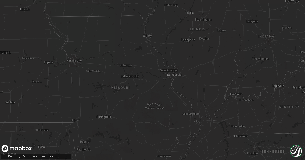
Hail Map on August 14, 2011
Get this storm
August 14 map
$229
one time, instant access
Download today. No call, no setup
Keep the $229
Bought the map and want the full workflow? Apply the entire $229 to a subscription within 7 days. None of it is wasted.
Every map, not just this one
This buys you this map. Subscription and you get every map we run, in the markets you choose from a few cities to whole states to nationwide. Plus real-time alerts the moment a storm fires.
Contact data
Name, contact info, occupancy, even credit band for addresses in the footprint. You go from where it hit to who to call.
Become the source they trust
Unlimited branding weather history reports on demand. You already have the documented answer ready for the property owner, and you are the one who showed up with it.
Property data and RoofTrace estimates
Pull up any address you have got, its value and the exact code rules for that jurisdiction, straight from One Click Code. Then RoofTrace estimates the squares, pitch, and roof value, priced the way you price.
States Impacted by Hail Map on August 14, 2011
Storm reports
Pennsylvania
| Date | Description |
|---|---|
| 08/14/20115:57 PM CDT | A local report indicates 1.00 inch wind near PORT MATILDA |
| 08/14/20115:55 PM CDT | Trees down |
| 08/14/20115:46 PM CDT | Tree down |
| 08/14/20115:37 PM CDT | Large tree limbs broken |
| 08/14/20115:34 PM CDT | Tree limbs and debris on roads in quincy township |
| 08/14/20115:33 PM CDT | Tree limbs and debris blocking roads in washington township |
| 08/14/20115:33 PM CDT | Gazebo blown over |
| 08/14/20115:17 PM CDT | Trees and wires down in antrim township |
| 08/14/20114:10 PM CDT | Wires trees down |
North Dakota
| Date | Description |
|---|---|
| 08/14/20115:00 AM CDT | Slightly larger than quarter sized hail. Estimated wind speeds of 75-80 mph. |
| 08/14/20114:56 AM CDT | Measured wind gust at the hazen airport. |
| 08/14/20114:56 AM CDT | 60 mph gust with pea sized hail observed... |
Maryland
| Date | Description |
|---|---|
| 08/14/20116:57 PM CDT | Trees down on garretts mill rd |
| 08/14/20114:58 PM CDT | Large tree limbs fell off of pine trees. |
| 08/14/20114:55 PM CDT | Large tree limbs fell off of pine trees. |
| 08/13/20118:48 PM CDT | Two trees in cherrywood park snapped off around 4 feet above ground. |
| 08/13/20118:22 PM CDT | Small branches and limbs down |
| 08/13/20117:22 PM CDT | Large tree down on route 15 blocking traffic |
| 08/13/20117:22 PM CDT | Numerous trees down along and near route 464 between brunswick and jefferson. |
| 08/13/20117:22 PM CDT | Trees down over roadway at intersection of maryland route 464 at lander road. |
| 08/13/20117:14 PM CDT | A tree was down in barton. |
| 08/13/20117:00 PM CDT | Trees down along side of rr and c and 0 trail |
| 08/13/20117:00 PM CDT | Trees down along side of rr and c and 0 trail |
| 08/13/20117:00 PM CDT | Intersection of jefferson pike and burkittsville closed due to downed trees. |
Kansas
| Date | Description |
|---|---|
| 08/13/20118:25 PM CDT | Public report was relayed by law enforcement. |
| 08/13/20117:47 PM CDT | Reported lots of nickel size hail with a few stones to quarters covering the ground. |
South Dakota
| Date | Description |
|---|---|
| 08/14/20114:08 PM CDT | A local report indicates 1.00 inch wind near BLACK HAWK |
| 08/14/20114:05 PM CDT | A local report indicates 1.00 inch wind near ESE BLACK HAWK |
| 08/14/20114:05 PM CDT | A local report indicates 1.00 inch wind near BLACK HAWK |
| 08/14/20112:35 PM CDT | A local report indicates 1.25 inch wind near 2 NE DEADWOOD |
| 08/14/20112:33 PM CDT | A local report indicates 1.00 inch wind near 2 NE DEADWOOD |
| 08/13/201111:17 PM CDT | A local report indicates 1.00 inch wind near REDFIELD |
| 08/13/201111:03 PM CDT | A local report indicates 1.00 inch wind near 2 S REDFIELD |
| 08/13/201110:59 PM CDT | A local report indicates 1.00 inch wind near REDFIELD |
| 08/13/201110:00 PM CDT | A local report indicates 1.75 inch wind near 3 ENE TRAIL CITY |
| 08/13/20119:30 PM CDT | Ping pong ball size hail and 1.15 inches of rain |
| 08/13/20119:00 PM CDT | Also had estimated 40 to 45 mph winds |
| 08/13/20118:55 PM CDT | Brief touchdown |
| 08/13/20118:35 PM CDT | Brief tornado touchdown. |
| 08/13/20118:16 PM CDT | A local report indicates 70 MPH wind near 2 S MCLAUGHLIN |
| 08/13/20117:54 PM CDT | A local report indicates 65 MPH wind near 1 S MCLAUGHLIN |
| 08/13/20117:42 PM CDT | A local report indicates 1.00 inch wind near 1 SE MCINTOSH |
| 08/13/20117:39 PM CDT | A local report indicates 60 MPH wind near 1 SE MCLAUGHLIN |
Tennessee
| Date | Description |
|---|---|
| 08/14/20112:00 PM CDT | Spotter reported quarter size hail in kodak. |
| 08/14/201112:40 PM CDT | A few trees down in athens and englewood. |
New Jersey
| Date | Description |
|---|---|
| 08/14/20111:35 PM CDT | Trees and wires down in winslow twp |
| 08/14/20111:25 PM CDT | Trees and wires down in monroe twp |
| 08/14/20111:15 PM CDT | Trees and wires down in malaga |
| 08/14/201112:45 PM CDT | Trees and wires down in pittsgrove twp |
| 08/14/201112:25 PM CDT | Trees and wires down in bridgeton |
| 08/14/201112:10 PM CDT | Trees and wires down in upper deerfield twp |
| 08/14/201112:08 PM CDT | Trees reported down in shiloh. |
Kentucky
| Date | Description |
|---|---|
| 08/14/201112:50 PM CDT | 2 trees were reported down on ky987. |
| 08/14/201112:47 PM CDT | 2 trees blocking ky3001 |
| 08/14/201112:40 PM CDT | Two trees down near ky1216 and ky72 |
Virginia
| Date | Description |
|---|---|
| 08/14/20116:20 PM CDT | Around 40-50 trees down in the area from variety mills rd...williamstown rd and wilson rd. |
| 08/14/20116:14 PM CDT | Trees down on arrington rd |
| 08/14/20115:50 PM CDT | Hail fell on rosemill road. A large oak tree was also blown down. |
| 08/14/20115:48 PM CDT | Trees down in the city of charlottesville |
| 08/14/20115:30 PM CDT | Hail fell on lonesome pine lane. |
| 08/14/20115:25 PM CDT | Law enforcement reported hail up to the size of golfballs on highway 107 between chilhowie and saltville. |
| 08/14/20115:15 PM CDT | Hail fell on stoney run road. |
| 08/14/20115:03 PM CDT | Tree blown down on route 122. |
| 08/14/20114:55 PM CDT | Tree blown down on route 688. |
| 08/14/20114:53 PM CDT | Franklin county dispatch reported trees down in several locations in the county. |
| 08/14/20114:49 PM CDT | Tree blown down on route 692. |
| 08/14/20114:45 PM CDT | Tree blown down on route 919. |
| 08/14/20114:12 PM CDT | Large oak tree blown down on green ridge road. |
| 08/14/20113:57 PM CDT | Hail fell from 457 to 459 pm at auburn drive. |
| 08/14/20113:57 PM CDT | Hail fell on south franklin road. |
| 08/14/20112:00 PM CDT | Quarter size hail fell for 4 min near richlands |
| 08/14/20111:58 PM CDT | Quarter size hail fell for 4 min near richlands |
| 08/13/20117:22 PM CDT | Large tree down on route 15 blocking traffic |
North Carolina
| Date | Description |
|---|---|
| 08/14/20116:44 PM CDT | Tree down at yanceyville rd and archer gate rd |
| 08/14/20116:13 PM CDT | A couple trees and large branches blown down. |
| 08/14/20116:07 PM CDT | Report of a small tree down in cooksville area. |
| 08/14/20116:02 PM CDT | 18 inch diameter tree down on davis rd near creason circle. |
| 08/14/20116:00 PM CDT | A local report indicates 58 MPH wind near 3 WNW WALKERTOWN |
| 08/14/20115:58 PM CDT | Several large limbs blown down. |
| 08/14/20115:50 PM CDT | Several trees down on sideroads off of hwy 90. |
| 08/14/20115:45 PM CDT | Several trees and limbs down in loray and nw part of county. |
| 08/14/20115:45 PM CDT | Tree down |
| 08/14/20115:42 PM CDT | One tree down near nc hwy 18. |
| 08/14/20115:30 PM CDT | Trees blown down on spainhour road. |
| 08/14/20115:30 PM CDT | In tobaccoville |
| 08/14/20115:25 PM CDT | A local report indicates 1.75 inch wind near 1 W KING |
| 08/14/20115:12 PM CDT | Trees down on collinsville rd and landrum road. |
| 08/14/20115:05 PM CDT | Several trees down on trails at pilot mountain state park. |
| 08/14/20114:45 PM CDT | Trees down on walcott farm rd and hunting country road. |
| 08/14/20114:44 PM CDT | Law enforcement reported a tornado at the intersection of new road and 117. |
| 08/14/20113:58 PM CDT | One tree down on ayersville road near squire loop. |
| 08/14/20113:58 PM CDT | One tree down on ayersville road near squire loop. |
| 08/14/20113:35 PM CDT | One tree down on ward road. |
| 08/14/20113:12 PM CDT | One tree down near marshall occurred about the same time as the start of the quarter sized hail based on doppler wind velocity. |
| 08/14/20113:12 PM CDT | Hail up to quarter sized fell for at least 5 minutes as the storm passed. |
| 08/13/201110:51 PM CDT | One tree blown down on ferry bridge road. Time estimated. |
| 08/13/201110:35 PM CDT | One tree down on old bailey highway near simms. Time estimated from radar. |
| 08/13/201110:01 PM CDT | Tree down along 210 |
| 08/13/20119:51 PM CDT | One tree down at the intersection of highway 50 and highway 210 time estimated by radar |
| 08/13/20119:39 PM CDT | Trees down in franklington |
| 08/13/20119:35 PM CDT | Scattered trees blown down from the west side of the city of raleigh into downtown |
| 08/13/20119:25 PM CDT | Large portion of a tree down at conifer dr and gorman st. |
| 08/13/20119:20 PM CDT | Tree down along lloyd stewart rd |
| 08/13/20119:18 PM CDT | Portion of tree down...partially blocking s. Bound right lane of se maynard |
| 08/13/20119:18 PM CDT | Tree down blocking the road at harrison ave and hillsboro st. |
| 08/13/20119:17 PM CDT | Large tree down on west skyhawk dr. |
| 08/13/20119:16 PM CDT | Tree down in right lane of old apex rd at castlefern dr. |
| 08/13/20119:15 PM CDT | Tree down in the road at the intersection of fallsworth and w. Chatham. |
| 08/13/20119:14 PM CDT | Tree down on cary parkway at towne village. |
| 08/13/20119:13 PM CDT | Tree down on powerlines on n salem street between greenlea dr and hwy 64. |
| 08/13/20119:10 PM CDT | Tree down on house |
| 08/13/20118:55 PM CDT | Trees and powerlines down across the county. |
| 08/13/20118:50 PM CDT | 22 inch diameter tree down. |
| 08/13/20118:40 PM CDT | A local report indicates 1.00 inch wind near 5 S ALAMANCE |
| 08/13/20118:35 PM CDT | Tree down |
| 08/13/20118:35 PM CDT | Top half of 12 diameter tree snapped off at intersection of route 87 and mt. Hermon rock creek rd. |
| 08/13/20118:30 PM CDT | Trees down in siler city with 2 reports of fallen trees on homes. |
| 08/13/20118:08 PM CDT | A local report indicates 1.50 inch wind near 2 NNW LIBERTY |
| 08/13/20118:05 PM CDT | 1.5 inch hail reported |
| 08/13/20118:05 PM CDT | Approx 20 ft tall and 4 ft wide tree snapped in half along side of road on hwy 62. |
| 08/13/20117:35 PM CDT | Spotter reports powerlines and a tree down on west main street. |
| 08/13/20117:15 PM CDT | A couple of trees down along hwy 150 near millbridge road. |
| 08/13/20117:05 PM CDT | Trees down on thomasville rd. |
| 08/13/20117:00 PM CDT | Two large pine trees fell near the intersection of perfection avenue and catawba avenue in north belmont. |
| 08/13/20117:00 PM CDT | One tree down in denver. Several reports of power outages in east side of county. |
Colorado
| Date | Description |
|---|---|
| 08/14/20116:30 PM CDT | A local report indicates 60 MPH wind near FLEMING |
| 08/14/20116:30 PM CDT | A local report indicates 1.00 inch wind near FLEMING |
Texas
| Date | Description |
|---|---|
| 08/14/20116:00 PM CDT | A porch was moved away from a house...power lines were downed...and a couple of trees were knocked down |
| 08/14/20115:03 PM CDT | Power lines downed on fm 946 southeast of oakhurst. |
| 08/14/20115:02 PM CDT | Four trees down in waterwood subdivision. |
| 08/14/20114:19 PM CDT | Public sighting of brief tornado touchdown reported to orange county sherrifs office. Few downed tree limbs also reported. |
South Carolina
| Date | Description |
|---|---|
| 08/14/20116:00 PM CDT | Tree down on n knowles island rd near sc hwy 462. |
| 08/14/20115:53 PM CDT | Tree down on jacob smart blvd at i-95. |
| 08/14/20115:44 PM CDT | Tree down on green pond hwy near post office. |
| 08/14/20115:39 PM CDT | Tree down at suttons road and aimwell road. |
| 08/14/20115:36 PM CDT | Trees down at possum corner rd and grays hwy. |
| 08/14/20115:28 PM CDT | 13 ft flagpole based in concrete was bent sideways. Wrought iron patio furniture blown across the yard. Estimated 60 mph winds. |
| 08/14/20115:22 PM CDT | Tree down clover hill rd and ace basin parkway. |
| 08/14/20115:21 PM CDT | Law enforcement reported 1 tree down near the intersection of french santee road and millwood loop. |
| 08/14/20115:20 PM CDT | Law enforcement reported one tree down near the intersection of highway 17a and french santee road. |
| 08/14/20115:13 PM CDT | Trees...large limbs down and structural damage to a few houses and buildings in and near inman. This was passed along by new prospect fire department that helped inman |
| 08/14/20115:09 PM CDT | Tree down on hollis ct near ritter rd. |
| 08/14/20115:09 PM CDT | Tree down at ritter rd and green pond hwy. |
| 08/14/20115:05 PM CDT | Several large branches down. Also had pea sized hail. This coincided with the 36 kt velocity core on doppler. |
| 08/14/20114:48 PM CDT | A few large branches down just east of interstate 26. |
| 08/14/20114:30 PM CDT | Spotter estimated 65 mph wind gust and has 2 inch limbs down in yard. |
| 08/14/20114:23 PM CDT | Former nws employee estimated 60 mph winds near the intersection of ashley phosphate road and interstate 26. |
| 08/14/20114:21 PM CDT | Amateur radio operator reported 6 foot limb on a power line along boonehill rd. |
| 08/14/20114:15 PM CDT | Trees down on st hwy 14 |
| 08/14/20114:12 PM CDT | Trees down on pudding swamp rd. Time estimated by radar. |
| 08/14/20114:12 PM CDT | Tree down at chestnut rd and sidneys rd. |
| 08/14/20113:57 PM CDT | Law enforcement reported 1 tree down near the intersection of carter road and doe run road. |
| 08/14/20113:54 PM CDT | Tree down at charleston hwy and ritter rd. |
| 08/14/20113:50 PM CDT | Tree down on cummings chapel rd near harrell rd. |
| 08/14/20113:45 PM CDT | Law enforcement reported 1 tree down near the intersection of horseford road and ridge road. |
| 08/14/20113:45 PM CDT | Trees down on old five notch rd. |
| 08/14/20113:45 PM CDT | Tree down at maple ridge rd and red bank rd. |
| 08/14/20113:40 PM CDT | Trees and powerlines down on augusta highway. Time estimated by radar. |
| 08/14/20113:23 PM CDT | Tree down on walter farms rd. |
| 08/14/20113:20 PM CDT | Law enforcement reported 1 tree down on friendship road. |
| 08/14/20113:15 PM CDT | Tree on house. |
| 08/14/20113:15 PM CDT | Roof blown off a structure. Numerous trees down in buffalo and union. |
| 08/14/20113:10 PM CDT | Emergency dispatch reports trees down on kearse road. |
| 08/14/20112:36 PM CDT | A local report indicates 1.00 inch wind near 5 SSW FOUNTAIN INN |
| 08/14/20112:15 PM CDT | Emergency manager reported major damage to 2 mobile homes...some outbuildings and numerous trees down ese of inman sc. |
| 08/14/20111:58 PM CDT | Several trees down as doppler velocities of up to 46 kts reached this area. Also some small hail fell at the fire station in inman around or just after 3 pm. |
| 08/14/20111:50 PM CDT | Dime to quarter sized hail fell for a short time. Had briefly strong wind but not enough to blow down anything. |
| 08/14/20111:15 PM CDT | One tree down with the passage of the storm. |
| 08/14/20111:04 PM CDT | One tree in roadway at intersection of highway 183 and highway 130. Another tree down on burntanyard road which may be in this vicinity although could not find it on th |
| 08/14/201112:50 PM CDT | Tree down on oconee creek road. |
Georgia
| Date | Description |
|---|---|
| 08/14/20115:58 PM CDT | 6 to 8 inch tree limbs down in theus park. Time estimated based on radar. |
| 08/14/20115:40 PM CDT | Tree fell on a garage and a power line was also downed on ga hwy 21. |
| 08/14/20115:27 PM CDT | Tree fell on a car and also took down a power line along ga hwy 30. |
| 08/14/20115:18 PM CDT | Tree down on goshen road. Time estimated based on radar. |
| 08/14/20115:10 PM CDT | Ga 17 is closed at blue jay road and at courthouse road due to trees down on the roadway. Time estimated based on radar. |
Utah
| Date | Description |
|---|---|
| 08/14/201112:00 AM CDT | A local report indicates 65 MPH wind near 3 W SYRACUSE |
| 08/13/201111:00 PM CDT | Antelope island state park |
| 08/13/201110:55 PM CDT | Dugway mesonet north salt flats |
| 08/13/201110:50 PM CDT | Dugway mesonet upper cedar mtn |
| 08/13/201110:50 PM CDT | Dugway mesonet playa station |
| 08/13/201110:00 PM CDT | Dugway mesonet i-80 sensor |
Nebraska
| Date | Description |
|---|---|
| 08/14/20113:24 PM CDT | A local report indicates 1.50 inch wind near 15 S BUSHNELL |
| 08/14/20113:16 PM CDT | A local report indicates 1.75 inch wind near 15 S BUSHNELL |
Montana
| Date | Description |
|---|---|
| 08/14/20115:06 AM CDT | A local report indicates 61 MPH wind near LIVINGSTON |
| 08/13/20119:00 PM CDT | Hail stones ranged from pea to quarter size. Hail damaged some of the crops near the house. |
| 08/13/20118:35 PM CDT | Mostly dime sized...few quarters |
Delaware
| Date | Description |
|---|---|
| 08/14/201110:50 AM CDT | Trees reported down. |
| 08/14/201110:35 AM CDT | Trees and wires reported down. |
Cities Impacted by Hail Map on August 14, 2011
- Rapid City, SD
- Black Hawk, SD
- Radford, VA
- Christiansburg, VA
- Bushnell, NE
- Tobaccoville, NC
- Pinnacle, NC
- King, NC
- East Bend, NC
- Wakpala, SD
- Trail City, SD
- Whitetail, MT
- Peerless, MT
- Scobey, MT
- Poolesville, MD
- Saint Francis, KS
- Blythewood, SC
- Lugoff, SC
- Elgin, SC
- Ridgeway, SC
- Beulah, ND
- Golden Valley, ND
- Dodge, ND
- Killdeer, ND
- Halliday, ND
- Mandaree, ND
- Brule, NE
- Dagmar, MT
- Grenora, ND
- Whitewater, MT
- Mandan, ND
- Cozad, NE
- Center, ND
- Stoneham, CO
- Chicora, PA
- Butler, PA
- Wishek, ND
- Williston, ND
- Epping, ND
- Merriman, NE
- Stanton, ND
- Opheim, MT
- Zap, ND
- Fort Pierce, FL
- Sisseton, SD
- New Effington, SD
- Claire City, SD
- Saltville, VA
- Glade Spring, VA
- Baldwin, ND
- Kenesaw, NE
- Lyndhurst, VA
- Stuarts Draft, VA
- Afton, VA
- Rushville, NE
- Abingdon, VA
- Meadowview, VA
- Lebanon, VA
- Honaker, VA
- Charlottesville, VA
- Herreid, SD
- Rural Hall, NC
- Winston Salem, NC
- Pfafftown, NC
- McIntosh, SD
- Watauga, SD
- Sidney, TX
- Juniata, NE
- Hastings, NE
- Atwood, KS
- Carlton, TX
- Hamilton, TX
- Raleigh, NC
- Ashley, ND
- Sand Fork, WV
- Watford City, ND
- Midway, TX
- Leona, TX
- Madisonville, TX
- Mellette, SD
- Brentford, SD
- McLaughlin, SD
- Hazen, ND
- Burlington, NC
- Hazelton, ND
- Mayodan, NC
- Sandy Ridge, NC
- Loring, MT
- Daytona Beach, FL
- Ryder, ND
- Washburn, ND
- Roseglen, ND
- New Salem, ND
- Garrison, ND
- Merino, CO
- Newport, VA
- Heartwell, NE
- Wingina, VA
- Shipman, VA
- Schuyler, VA
- Powell, TN
- Purgitsville, WV
- Old Fields, WV
- Roebuck, SC
- Spartanburg, SC
- Hemingway, SC
- Georgetown, SC
- Jeanerette, LA
- Eureka, SD
- Chilhowie, VA
- Marion, VA
- Blanket, TX
- Buena Vista, VA
- Walterboro, SC
- Green Pond, SC
- Pierpont, SD
- Bristol, SD
- Keene, ND
- Martin, SD
- Eagle Butte, SD
- Crozet, VA
- Free Union, VA
- Slidell, LA
- Blair, SC
- Inman, SC
- Saint George, SC
- Veblen, SD
- Kershaw, SC
- Siloam, NC
- Pilot Mountain, NC
- Morganton, NC
- Richland, MT
- North Platte, NE
- Lake City, SD
- Eden, SD
- Haw River, NC
- Pleasant Garden, NC
- Greensboro, NC
- Liberty, NC
- Graham, NC
- Whitsett, NC
- Climax, NC
- Julian, NC
- Snow Camp, NC
- Lawsonville, NC
- Stuart, VA
- Vernon, CO
- Gann Valley, SD
- Stratton, NE
- McDonald, KS
- Catawba, NC
- Sherrills Ford, NC
- New Raymer, CO
- Campobello, SC
- Heath Springs, SC
- Greeleyville, SC
- Manning, SC
- Ellendale, ND
- Savannah, GA
- Port Wentworth, GA
- Tuscarora, MD
- Adamstown, MD
- Frederick, MD
- Point Of Rocks, MD
- Jefferson, MD
- Hague, ND
- Shawsville, VA
- Lawndale, NC
- Connelly Springs, NC
- Grottoes, VA
- Crimora, VA
- West Union, SC
- Walhalla, SC
- Redfield, SD
- Bismarck, ND
- Menoken, ND
- Pollock, SD
- Venango, NE
- Ruffin, SC
- Port Matilda, PA
- Burlington, CO
- Idalia, CO
- Wray, CO
- Mingus, TX
- McCormick, SC
- Plum Branch, SC
- Akron, CO
- Otis, CO
- Harrogate, TN
- Williamston, SC
- Pelzer, SC
- Lemoyne, NE
- Hinsdale, MT
- Kintyre, ND
- Webster, SD
- Wallace, NE
- Elsie, NE
- Monroe, VA
- Amherst, VA
- Vesuvius, VA
- Lexington, VA
- Dequincy, LA
- Andover, SD
- Groton, SD
- Arrington, VA
- Hickory, NC
- Vale, NC
- Strawberry Plains, TN
- Knoxville, TN
- Iowa, LA
- Lake Charles, LA
- Linton, ND
- Hosmer, SD
- Andrews, SC
- Zahl, ND
- Huntsville, TX
- Oakhurst, TX
- Pointblank, TX
- Pineland, SC
- Early Branch, SC
- Varnville, SC
- Ridgeland, SC
- Maidsville, WV
- Morgantown, WV
- Alamo, ND
- Knoxville, MD
- Sharpsburg, MD
- Brownsville, MD
- Rohrersville, MD
- Comanche, TX
- Dorchester, SC
- Edgefield, SC
- Fort Morgan, CO
- Tybee Island, GA
- Elwood, NE
- Stoneville, NC
- Clarksburg, MD
- Germantown, MD
- Boyds, MD
- Stanardsville, VA
- Hardeeville, SC
- Ararat, NC
- Plentywood, MT
- White Earth, ND
- Saint Rose, LA
- Wirtz, VA
- Boones Mill, VA
- West Palm Beach, FL
- Kimper, KY
- Troy, SC
- Garnett, SC
- Estill, SC
- Smoaks, SC
- Branchville, SC
- Bell City, LA
- Parshall, ND
- Hico, TX
- Adams Run, SC
- Ridgeville, SC
- Cottageville, SC
- Zeeland, ND
- Medina, ND
- Elm Creek, NE
- Rockville, MD
- Gaithersburg, MD
- Fleming, CO
- Perry, FL
- Mooresville, NC
- Cornelius, NC
- Desdemona, TX
- Ranger, TX
- Wellfleet, NE
- North Garden, VA
- Covesville, VA
- Beaufort, SC
- Seabrook, SC
- Mount Airy, NC
- Dobson, NC
- Roseland, VA
- Ashton, SD
- Bristol, TN
- Blountville, TN
- Register, GA
- Julesburg, CO
- Steeles Tavern, VA
- Middlebrook, VA
- Greenville, VA
- Eastover, SC
- Gadsden, SC
- Ramseur, NC
- Staley, NC
- Ruckersville, VA
- Bradley, SC
- Modoc, SC
- Winnsboro, SC
- Eldorado, TX
- Hemphill, TX
- Livingston, TX
- May, TX
- Hull, TX
- Morgan City, LA
- Ararat, VA
- Cleveland, VA
- Davenport, VA
- Greencastle, PA
- Live Oak, FL
- Shenandoah, VA
- Maywood, NE
- Minden, NE
- Buffalo, SC
- Round O, SC
- Kountze, TX
- Grantsboro, NC
- Morrisdale, PA
- Munson, PA
- Winburne, PA
- Grassflat, PA
- Lanse, PA
- Philipsburg, PA
- Bird City, KS
- Statesville, NC
- Goldsboro, NC
- Princeton, NC
- Wildrose, ND
- Wilton, ND
- Leesburg, VA
- Beallsville, MD
- Barnesville, MD
- Montgomery Village, MD
- Dickerson, MD
- Buna, TX
- Strasburg, ND
- Travelers Rest, SC
- Vero Beach, FL
- Aylett, VA
- Gassaway, WV
- Outlook, MT
- Ludell, KS
- Redstone, MT
- Ogallala, NE
- Hephzibah, GA
- Augusta, GA
- Wedgefield, SC
- Camden, SC
- Gregory, SD
- Hardy, VA
- Mullins, SC
- Burke, SD
- Call, TX
- Gurley, NE
- Lancaster, SC
- Cleveland, ND
- Jonesville, SC
- Tioga, ND
- Oneill, NE
- Huger, SC
- Reserve, MT
- Marshall, NC
- Northville, SD
- Pomaria, SC
- Phelps, KY
- Pippa Passes, KY
- Normangee, TX
- Marquez, TX
- Lodge, SC
- Ehrhardt, SC
- Duncan, SC
- Moore, SC
- Boonville, NC
- Clarkton, NC
- McLeansville, NC
- Kelly, NC
- Hiddenite, NC
- Stony Point, NC
- Iliff, CO
- Superior, NE
- Landrum, SC
- Silver Spring, MD
- Hyattsville, MD
- Hankinson, ND
- Yadkinville, NC
- Sheldon, SC
- Pounding Mill, VA
- Tazewell, VA
- Chamberlain, SD
- Fort Thompson, SD
- Holyoke, CO
- Gonzales, LA
- Riner, VA
- Blacksburg, VA
- Geddes, SD
- Huntersville, NC
- Lexington, NE
- Raphine, VA
- Taylorsville, NC
- Ayr, NE
- Glenvil, NE
- Swords Creek, VA
- Fairfield, NE
- Lidgerwood, ND
- Smithfield, NE
- Bertrand, NE
- Metter, GA
- Westlake, LA
- Sulphur, LA
- Bullhead, SD
- Mims, FL
- Piney River, VA
- Vansant, VA
- Onalaska, TX
- Trinity, TX
- Pooler, GA
- Lewisville, NC
- Saint Lawrence, SD
- Sorrento, LA
- Great Falls, SC
- Underwood, ND
- Turton, SD
- Rockbridge Baths, VA
- Cary, NC
- Morrisville, NC
- Wake Forest, NC
- Paoli, CO
- Lehr, ND
- Sterling, CO
- Tulare, SD
- Hitchcock, SD
- Creedmoor, NC
- Lacombe, LA
- Colmesneil, TX
- Cocoa, FL
- Sumner, NE
- Pauline, SC
- Union, SC
- Mount Solon, VA
- Haxtun, CO
- Columbus, NC
- Tryon, NC
- Burnsville, WV
- Copen, WV
- Guyton, GA
- Grant, NE
- Glenville, WV
- Siler City, NC
- Pittsboro, NC
- Westby, MT
- Antelope, MT
- Madison, VA
- Hi Hat, KY
- Beaver, KY
- Gladstone, VA
- Appomattox, VA
- Claxton, GA
- Fountain Inn, SC
- Mocksville, NC
- Clemmons, NC
- Advance, NC
- Kinder, LA
- Dyke, VA
- New Town, ND
- Overton, NE
- Knightdale, NC
- Holstein, NE
- Mansfield, SD
- Fairfield, VA
- Ansley, NE
- Rocky Mount, VA
- McCook, NE
- Oakdale, LA
- Lovettsville, VA
- Chester, SC
- Blackstock, SC
- Cedar Bluff, VA
- Richlands, VA
- Walkertown, NC
- Germanton, NC
- Richburg, SC
- Bolton, NC
- Lovelady, TX