Hail Map in South Carolina on August 14, 2011
Get this storm
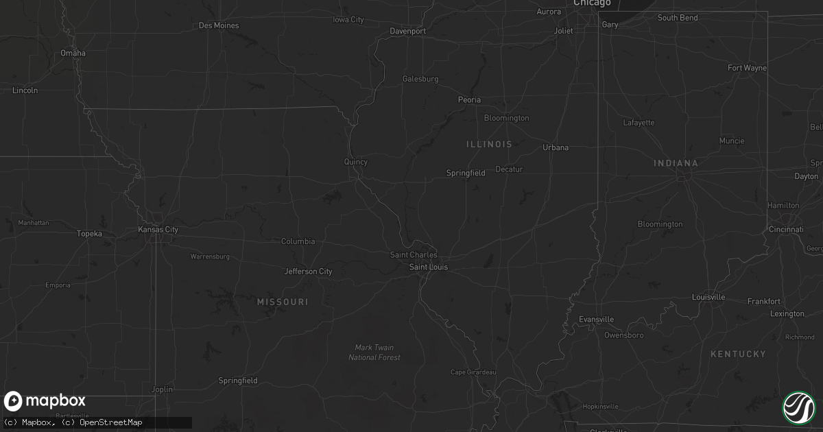
August 14 map
$229
one time, instant access
Download today. No call, no setup
Keep the $229
Bought the map and want the full workflow? Apply the entire $229 to a subscription within 7 days. None of it is wasted.
Every map, not just this one
This buys you this map. Subscription and you get every map we run, in the markets you choose from a few cities to whole states to nationwide. Plus real-time alerts the moment a storm fires.
Contact data
Name, contact info, occupancy, even credit band for addresses in the footprint. You go from where it hit to who to call.
Become the source they trust
Unlimited branding weather history reports on demand. You already have the documented answer ready for the property owner, and you are the one who showed up with it.
Property data and RoofTrace estimates
Pull up any address you have got, its value and the exact code rules for that jurisdiction, straight from One Click Code. Then RoofTrace estimates the squares, pitch, and roof value, priced the way you price.
Storm reports in South Carolina
South Carolina
| Date | Description |
|---|---|
| 08/14/20116:00 PM CDT | Tree down on n knowles island rd near sc hwy 462. |
| 08/14/20115:53 PM CDT | Tree down on jacob smart blvd at i-95. |
| 08/14/20115:44 PM CDT | Tree down on green pond hwy near post office. |
| 08/14/20115:39 PM CDT | Tree down at suttons road and aimwell road. |
| 08/14/20115:36 PM CDT | Trees down at possum corner rd and grays hwy. |
| 08/14/20115:28 PM CDT | 13 ft flagpole based in concrete was bent sideways. Wrought iron patio furniture blown across the yard. Estimated 60 mph winds. |
| 08/14/20115:22 PM CDT | Tree down clover hill rd and ace basin parkway. |
| 08/14/20115:21 PM CDT | Law enforcement reported 1 tree down near the intersection of french santee road and millwood loop. |
| 08/14/20115:20 PM CDT | Law enforcement reported one tree down near the intersection of highway 17a and french santee road. |
| 08/14/20115:13 PM CDT | Trees...large limbs down and structural damage to a few houses and buildings in and near inman. This was passed along by new prospect fire department that helped inman |
| 08/14/20115:09 PM CDT | Tree down at ritter rd and green pond hwy. |
| 08/14/20115:09 PM CDT | Tree down on hollis ct near ritter rd. |
| 08/14/20115:05 PM CDT | Several large branches down. Also had pea sized hail. This coincided with the 36 kt velocity core on doppler. |
| 08/14/20114:48 PM CDT | A few large branches down just east of interstate 26. |
| 08/14/20114:30 PM CDT | Spotter estimated 65 mph wind gust and has 2 inch limbs down in yard. |
| 08/14/20114:23 PM CDT | Former nws employee estimated 60 mph winds near the intersection of ashley phosphate road and interstate 26. |
| 08/14/20114:21 PM CDT | Amateur radio operator reported 6 foot limb on a power line along boonehill rd. |
| 08/14/20114:15 PM CDT | Trees down on st hwy 14 |
| 08/14/20114:12 PM CDT | Trees down on pudding swamp rd. Time estimated by radar. |
| 08/14/20114:12 PM CDT | Tree down at chestnut rd and sidneys rd. |
| 08/14/20113:57 PM CDT | Law enforcement reported 1 tree down near the intersection of carter road and doe run road. |
| 08/14/20113:54 PM CDT | Tree down at charleston hwy and ritter rd. |
| 08/14/20113:50 PM CDT | Tree down on cummings chapel rd near harrell rd. |
| 08/14/20113:45 PM CDT | Law enforcement reported 1 tree down near the intersection of horseford road and ridge road. |
| 08/14/20113:45 PM CDT | Tree down at maple ridge rd and red bank rd. |
| 08/14/20113:45 PM CDT | Trees down on old five notch rd. |
| 08/14/20113:40 PM CDT | Trees and powerlines down on augusta highway. Time estimated by radar. |
| 08/14/20113:23 PM CDT | Tree down on walter farms rd. |
| 08/14/20113:20 PM CDT | Law enforcement reported 1 tree down on friendship road. |
| 08/14/20113:15 PM CDT | Tree on house. |
| 08/14/20113:15 PM CDT | Roof blown off a structure. Numerous trees down in buffalo and union. |
| 08/14/20113:10 PM CDT | Emergency dispatch reports trees down on kearse road. |
| 08/14/20112:36 PM CDT | A local report indicates 1.00 inch wind near 5 SSW FOUNTAIN INN |
| 08/14/20112:15 PM CDT | Emergency manager reported major damage to 2 mobile homes...some outbuildings and numerous trees down ese of inman sc. |
| 08/14/20111:58 PM CDT | Several trees down as doppler velocities of up to 46 kts reached this area. Also some small hail fell at the fire station in inman around or just after 3 pm. |
| 08/14/20111:50 PM CDT | Dime to quarter sized hail fell for a short time. Had briefly strong wind but not enough to blow down anything. |
| 08/14/20111:15 PM CDT | One tree down with the passage of the storm. |
| 08/14/20111:04 PM CDT | One tree in roadway at intersection of highway 183 and highway 130. Another tree down on burntanyard road which may be in this vicinity although could not find it on th |
| 08/14/201112:50 PM CDT | Tree down on oconee creek road. |
All States Impacted by Hail Map on August 14, 2011
Cities Impacted by Hail Map on August 14, 2011
- Rapid City, SD
- Black Hawk, SD
- Radford, VA
- Christiansburg, VA
- Bushnell, NE
- Tobaccoville, NC
- Pinnacle, NC
- King, NC
- East Bend, NC
- Wakpala, SD
- Trail City, SD
- Whitetail, MT
- Peerless, MT
- Scobey, MT
- Poolesville, MD
- Saint Francis, KS
- Blythewood, SC
- Lugoff, SC
- Elgin, SC
- Ridgeway, SC
- Beulah, ND
- Golden Valley, ND
- Dodge, ND
- Killdeer, ND
- Halliday, ND
- Mandaree, ND
- Brule, NE
- Dagmar, MT
- Grenora, ND
- Whitewater, MT
- Mandan, ND
- Cozad, NE
- Center, ND
- Stoneham, CO
- Chicora, PA
- Butler, PA
- Wishek, ND
- Williston, ND
- Epping, ND
- Merriman, NE
- Stanton, ND
- Opheim, MT
- Zap, ND
- Fort Pierce, FL
- Sisseton, SD
- New Effington, SD
- Claire City, SD
- Saltville, VA
- Glade Spring, VA
- Baldwin, ND
- Kenesaw, NE
- Lyndhurst, VA
- Stuarts Draft, VA
- Afton, VA
- Rushville, NE
- Abingdon, VA
- Meadowview, VA
- Lebanon, VA
- Honaker, VA
- Charlottesville, VA
- Herreid, SD
- Rural Hall, NC
- Winston Salem, NC
- Pfafftown, NC
- McIntosh, SD
- Watauga, SD
- Sidney, TX
- Juniata, NE
- Hastings, NE
- Atwood, KS
- Carlton, TX
- Hamilton, TX
- Raleigh, NC
- Ashley, ND
- Sand Fork, WV
- Watford City, ND
- Midway, TX
- Leona, TX
- Madisonville, TX
- Mellette, SD
- Brentford, SD
- McLaughlin, SD
- Hazen, ND
- Burlington, NC
- Hazelton, ND
- Mayodan, NC
- Sandy Ridge, NC
- Loring, MT
- Daytona Beach, FL
- Ryder, ND
- Washburn, ND
- Roseglen, ND
- New Salem, ND
- Garrison, ND
- Merino, CO
- Newport, VA
- Heartwell, NE
- Wingina, VA
- Shipman, VA
- Schuyler, VA
- Powell, TN
- Purgitsville, WV
- Old Fields, WV
- Roebuck, SC
- Spartanburg, SC
- Hemingway, SC
- Georgetown, SC
- Jeanerette, LA
- Eureka, SD
- Chilhowie, VA
- Marion, VA
- Blanket, TX
- Buena Vista, VA
- Walterboro, SC
- Green Pond, SC
- Pierpont, SD
- Bristol, SD
- Keene, ND
- Martin, SD
- Eagle Butte, SD
- Crozet, VA
- Free Union, VA
- Slidell, LA
- Blair, SC
- Inman, SC
- Saint George, SC
- Veblen, SD
- Kershaw, SC
- Siloam, NC
- Pilot Mountain, NC
- Morganton, NC
- Richland, MT
- North Platte, NE
- Lake City, SD
- Eden, SD
- Haw River, NC
- Pleasant Garden, NC
- Greensboro, NC
- Liberty, NC
- Graham, NC
- Whitsett, NC
- Climax, NC
- Julian, NC
- Snow Camp, NC
- Lawsonville, NC
- Stuart, VA
- Vernon, CO
- Gann Valley, SD
- Stratton, NE
- McDonald, KS
- Catawba, NC
- Sherrills Ford, NC
- New Raymer, CO
- Campobello, SC
- Heath Springs, SC
- Greeleyville, SC
- Manning, SC
- Ellendale, ND
- Savannah, GA
- Port Wentworth, GA
- Tuscarora, MD
- Adamstown, MD
- Frederick, MD
- Point Of Rocks, MD
- Jefferson, MD
- Hague, ND
- Shawsville, VA
- Lawndale, NC
- Connelly Springs, NC
- Grottoes, VA
- Crimora, VA
- West Union, SC
- Walhalla, SC
- Redfield, SD
- Bismarck, ND
- Menoken, ND
- Pollock, SD
- Venango, NE
- Ruffin, SC
- Port Matilda, PA
- Burlington, CO
- Idalia, CO
- Wray, CO
- Mingus, TX
- McCormick, SC
- Plum Branch, SC
- Akron, CO
- Otis, CO
- Harrogate, TN
- Williamston, SC
- Pelzer, SC
- Lemoyne, NE
- Hinsdale, MT
- Kintyre, ND
- Webster, SD
- Wallace, NE
- Elsie, NE
- Monroe, VA
- Amherst, VA
- Vesuvius, VA
- Lexington, VA
- Dequincy, LA
- Andover, SD
- Groton, SD
- Arrington, VA
- Hickory, NC
- Vale, NC
- Strawberry Plains, TN
- Knoxville, TN
- Iowa, LA
- Lake Charles, LA
- Linton, ND
- Hosmer, SD
- Andrews, SC
- Zahl, ND
- Huntsville, TX
- Oakhurst, TX
- Pointblank, TX
- Pineland, SC
- Early Branch, SC
- Varnville, SC
- Ridgeland, SC
- Maidsville, WV
- Morgantown, WV
- Alamo, ND
- Knoxville, MD
- Sharpsburg, MD
- Brownsville, MD
- Rohrersville, MD
- Comanche, TX
- Dorchester, SC
- Edgefield, SC
- Fort Morgan, CO
- Tybee Island, GA
- Elwood, NE
- Stoneville, NC
- Clarksburg, MD
- Germantown, MD
- Boyds, MD
- Stanardsville, VA
- Hardeeville, SC
- Ararat, NC
- Plentywood, MT
- White Earth, ND
- Saint Rose, LA
- Wirtz, VA
- Boones Mill, VA
- West Palm Beach, FL
- Kimper, KY
- Troy, SC
- Garnett, SC
- Estill, SC
- Smoaks, SC
- Branchville, SC
- Bell City, LA
- Parshall, ND
- Hico, TX
- Adams Run, SC
- Ridgeville, SC
- Cottageville, SC
- Zeeland, ND
- Medina, ND
- Elm Creek, NE
- Rockville, MD
- Gaithersburg, MD
- Fleming, CO
- Perry, FL
- Mooresville, NC
- Cornelius, NC
- Desdemona, TX
- Ranger, TX
- Wellfleet, NE
- North Garden, VA
- Covesville, VA
- Beaufort, SC
- Seabrook, SC
- Mount Airy, NC
- Dobson, NC
- Roseland, VA
- Ashton, SD
- Bristol, TN
- Blountville, TN
- Register, GA
- Julesburg, CO
- Steeles Tavern, VA
- Middlebrook, VA
- Greenville, VA
- Eastover, SC
- Gadsden, SC
- Ramseur, NC
- Staley, NC
- Ruckersville, VA
- Bradley, SC
- Modoc, SC
- Winnsboro, SC
- Eldorado, TX
- Hemphill, TX
- Livingston, TX
- May, TX
- Hull, TX
- Morgan City, LA
- Ararat, VA
- Cleveland, VA
- Davenport, VA
- Greencastle, PA
- Live Oak, FL
- Shenandoah, VA
- Maywood, NE
- Minden, NE
- Buffalo, SC
- Round O, SC
- Kountze, TX
- Grantsboro, NC
- Morrisdale, PA
- Munson, PA
- Winburne, PA
- Grassflat, PA
- Lanse, PA
- Philipsburg, PA
- Bird City, KS
- Statesville, NC
- Goldsboro, NC
- Princeton, NC
- Wildrose, ND
- Wilton, ND
- Leesburg, VA
- Beallsville, MD
- Barnesville, MD
- Montgomery Village, MD
- Dickerson, MD
- Buna, TX
- Strasburg, ND
- Travelers Rest, SC
- Vero Beach, FL
- Aylett, VA
- Gassaway, WV
- Outlook, MT
- Ludell, KS
- Redstone, MT
- Ogallala, NE
- Hephzibah, GA
- Augusta, GA
- Wedgefield, SC
- Camden, SC
- Gregory, SD
- Hardy, VA
- Mullins, SC
- Burke, SD
- Call, TX
- Gurley, NE
- Lancaster, SC
- Cleveland, ND
- Jonesville, SC
- Tioga, ND
- Oneill, NE
- Huger, SC
- Reserve, MT
- Marshall, NC
- Northville, SD
- Pomaria, SC
- Phelps, KY
- Pippa Passes, KY
- Normangee, TX
- Marquez, TX
- Lodge, SC
- Ehrhardt, SC
- Duncan, SC
- Moore, SC
- Boonville, NC
- Clarkton, NC
- McLeansville, NC
- Kelly, NC
- Hiddenite, NC
- Stony Point, NC
- Iliff, CO
- Superior, NE
- Landrum, SC
- Silver Spring, MD
- Hyattsville, MD
- Hankinson, ND
- Yadkinville, NC
- Sheldon, SC
- Pounding Mill, VA
- Tazewell, VA
- Chamberlain, SD
- Fort Thompson, SD
- Holyoke, CO
- Gonzales, LA
- Riner, VA
- Blacksburg, VA
- Geddes, SD
- Huntersville, NC
- Lexington, NE
- Raphine, VA
- Taylorsville, NC
- Ayr, NE
- Glenvil, NE
- Swords Creek, VA
- Fairfield, NE
- Lidgerwood, ND
- Smithfield, NE
- Bertrand, NE
- Metter, GA
- Westlake, LA
- Sulphur, LA
- Bullhead, SD
- Mims, FL
- Piney River, VA
- Vansant, VA
- Onalaska, TX
- Trinity, TX
- Pooler, GA
- Lewisville, NC
- Saint Lawrence, SD
- Sorrento, LA
- Great Falls, SC
- Underwood, ND
- Turton, SD
- Rockbridge Baths, VA
- Cary, NC
- Morrisville, NC
- Wake Forest, NC
- Paoli, CO
- Lehr, ND
- Sterling, CO
- Tulare, SD
- Hitchcock, SD
- Creedmoor, NC
- Lacombe, LA
- Colmesneil, TX
- Cocoa, FL
- Sumner, NE
- Pauline, SC
- Union, SC
- Mount Solon, VA
- Haxtun, CO
- Columbus, NC
- Tryon, NC
- Burnsville, WV
- Copen, WV
- Guyton, GA
- Grant, NE
- Glenville, WV
- Siler City, NC
- Pittsboro, NC
- Westby, MT
- Antelope, MT
- Madison, VA
- Hi Hat, KY
- Beaver, KY
- Gladstone, VA
- Appomattox, VA
- Claxton, GA
- Fountain Inn, SC
- Mocksville, NC
- Clemmons, NC
- Advance, NC
- Kinder, LA
- Dyke, VA
- New Town, ND
- Overton, NE
- Knightdale, NC
- Holstein, NE
- Mansfield, SD
- Fairfield, VA
- Ansley, NE
- Rocky Mount, VA
- McCook, NE
- Oakdale, LA
- Lovettsville, VA
- Chester, SC
- Blackstock, SC
- Cedar Bluff, VA
- Richlands, VA
- Walkertown, NC
- Germanton, NC
- Richburg, SC
- Bolton, NC
- Lovelady, TX


