Hail Map in North Carolina on August 14, 2011
Get this storm
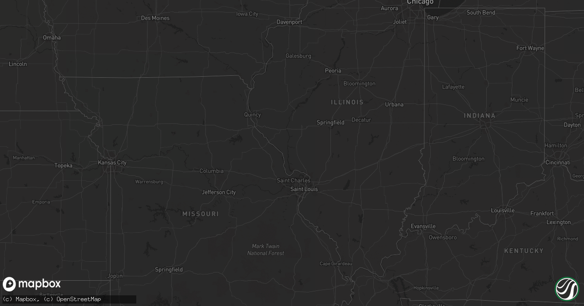
August 14 map
$229
one time, instant access
Download today. No call, no setup
Keep the $229
Bought the map and want the full workflow? Apply the entire $229 to a subscription within 7 days. None of it is wasted.
Every map, not just this one
This buys you this map. Subscription and you get every map we run, in the markets you choose from a few cities to whole states to nationwide. Plus real-time alerts the moment a storm fires.
Contact data
Name, contact info, occupancy, even credit band for addresses in the footprint. You go from where it hit to who to call.
Become the source they trust
Unlimited branding weather history reports on demand. You already have the documented answer ready for the property owner, and you are the one who showed up with it.
Property data and RoofTrace estimates
Pull up any address you have got, its value and the exact code rules for that jurisdiction, straight from One Click Code. Then RoofTrace estimates the squares, pitch, and roof value, priced the way you price.
Storm reports in North Carolina
North Carolina
| Date | Description |
|---|---|
| 08/14/20116:44 PM CDT | Tree down at yanceyville rd and archer gate rd |
| 08/14/20116:13 PM CDT | A couple trees and large branches blown down. |
| 08/14/20116:07 PM CDT | Report of a small tree down in cooksville area. |
| 08/14/20116:02 PM CDT | 18 inch diameter tree down on davis rd near creason circle. |
| 08/14/20116:00 PM CDT | A local report indicates 58 MPH wind near 3 WNW WALKERTOWN |
| 08/14/20115:58 PM CDT | Several large limbs blown down. |
| 08/14/20115:50 PM CDT | Several trees down on sideroads off of hwy 90. |
| 08/14/20115:45 PM CDT | Several trees and limbs down in loray and nw part of county. |
| 08/14/20115:45 PM CDT | Tree down |
| 08/14/20115:42 PM CDT | One tree down near nc hwy 18. |
| 08/14/20115:30 PM CDT | In tobaccoville |
| 08/14/20115:30 PM CDT | Trees blown down on spainhour road. |
| 08/14/20115:25 PM CDT | A local report indicates 1.75 inch wind near 1 W KING |
| 08/14/20115:12 PM CDT | Trees down on collinsville rd and landrum road. |
| 08/14/20115:05 PM CDT | Several trees down on trails at pilot mountain state park. |
| 08/14/20114:45 PM CDT | Trees down on walcott farm rd and hunting country road. |
| 08/14/20114:44 PM CDT | Law enforcement reported a tornado at the intersection of new road and 117. |
| 08/14/20113:58 PM CDT | One tree down on ayersville road near squire loop. |
| 08/14/20113:58 PM CDT | One tree down on ayersville road near squire loop. |
| 08/14/20113:35 PM CDT | One tree down on ward road. |
| 08/14/20113:12 PM CDT | One tree down near marshall occurred about the same time as the start of the quarter sized hail based on doppler wind velocity. |
| 08/14/20113:12 PM CDT | Hail up to quarter sized fell for at least 5 minutes as the storm passed. |
| 08/13/201110:51 PM CDT | One tree blown down on ferry bridge road. Time estimated. |
| 08/13/201110:35 PM CDT | One tree down on old bailey highway near simms. Time estimated from radar. |
| 08/13/201110:01 PM CDT | Tree down along 210 |
| 08/13/20119:51 PM CDT | One tree down at the intersection of highway 50 and highway 210 time estimated by radar |
| 08/13/20119:39 PM CDT | Trees down in franklington |
| 08/13/20119:35 PM CDT | Scattered trees blown down from the west side of the city of raleigh into downtown |
| 08/13/20119:25 PM CDT | Large portion of a tree down at conifer dr and gorman st. |
| 08/13/20119:20 PM CDT | Tree down along lloyd stewart rd |
| 08/13/20119:18 PM CDT | Portion of tree down...partially blocking s. Bound right lane of se maynard |
| 08/13/20119:18 PM CDT | Tree down blocking the road at harrison ave and hillsboro st. |
| 08/13/20119:17 PM CDT | Large tree down on west skyhawk dr. |
| 08/13/20119:16 PM CDT | Tree down in right lane of old apex rd at castlefern dr. |
| 08/13/20119:15 PM CDT | Tree down in the road at the intersection of fallsworth and w. Chatham. |
| 08/13/20119:14 PM CDT | Tree down on cary parkway at towne village. |
| 08/13/20119:13 PM CDT | Tree down on powerlines on n salem street between greenlea dr and hwy 64. |
| 08/13/20119:10 PM CDT | Tree down on house |
| 08/13/20118:55 PM CDT | Trees and powerlines down across the county. |
| 08/13/20118:50 PM CDT | 22 inch diameter tree down. |
| 08/13/20118:40 PM CDT | A local report indicates 1.00 inch wind near 5 S ALAMANCE |
| 08/13/20118:35 PM CDT | Top half of 12 diameter tree snapped off at intersection of route 87 and mt. Hermon rock creek rd. |
| 08/13/20118:35 PM CDT | Tree down |
| 08/13/20118:30 PM CDT | Trees down in siler city with 2 reports of fallen trees on homes. |
| 08/13/20118:08 PM CDT | A local report indicates 1.50 inch wind near 2 NNW LIBERTY |
| 08/13/20118:05 PM CDT | Approx 20 ft tall and 4 ft wide tree snapped in half along side of road on hwy 62. |
| 08/13/20118:05 PM CDT | 1.5 inch hail reported |
| 08/13/20117:35 PM CDT | Spotter reports powerlines and a tree down on west main street. |
| 08/13/20117:15 PM CDT | A couple of trees down along hwy 150 near millbridge road. |
| 08/13/20117:05 PM CDT | Trees down on thomasville rd. |
| 08/13/20117:00 PM CDT | Two large pine trees fell near the intersection of perfection avenue and catawba avenue in north belmont. |
| 08/13/20117:00 PM CDT | One tree down in denver. Several reports of power outages in east side of county. |
All States Impacted by Hail Map on August 14, 2011
Cities Impacted by Hail Map on August 14, 2011
- Rapid City, SD
- Black Hawk, SD
- Radford, VA
- Christiansburg, VA
- Bushnell, NE
- Tobaccoville, NC
- Pinnacle, NC
- King, NC
- East Bend, NC
- Wakpala, SD
- Trail City, SD
- Whitetail, MT
- Peerless, MT
- Scobey, MT
- Poolesville, MD
- Saint Francis, KS
- Blythewood, SC
- Lugoff, SC
- Elgin, SC
- Ridgeway, SC
- Beulah, ND
- Golden Valley, ND
- Dodge, ND
- Killdeer, ND
- Halliday, ND
- Mandaree, ND
- Brule, NE
- Dagmar, MT
- Grenora, ND
- Whitewater, MT
- Mandan, ND
- Cozad, NE
- Center, ND
- Stoneham, CO
- Chicora, PA
- Butler, PA
- Wishek, ND
- Williston, ND
- Epping, ND
- Merriman, NE
- Stanton, ND
- Opheim, MT
- Zap, ND
- Fort Pierce, FL
- Sisseton, SD
- New Effington, SD
- Claire City, SD
- Saltville, VA
- Glade Spring, VA
- Baldwin, ND
- Kenesaw, NE
- Lyndhurst, VA
- Stuarts Draft, VA
- Afton, VA
- Rushville, NE
- Abingdon, VA
- Meadowview, VA
- Lebanon, VA
- Honaker, VA
- Charlottesville, VA
- Herreid, SD
- Rural Hall, NC
- Winston Salem, NC
- Pfafftown, NC
- McIntosh, SD
- Watauga, SD
- Sidney, TX
- Juniata, NE
- Hastings, NE
- Atwood, KS
- Carlton, TX
- Hamilton, TX
- Raleigh, NC
- Ashley, ND
- Sand Fork, WV
- Watford City, ND
- Midway, TX
- Leona, TX
- Madisonville, TX
- Mellette, SD
- Brentford, SD
- McLaughlin, SD
- Hazen, ND
- Burlington, NC
- Hazelton, ND
- Mayodan, NC
- Sandy Ridge, NC
- Loring, MT
- Daytona Beach, FL
- Ryder, ND
- Washburn, ND
- Roseglen, ND
- New Salem, ND
- Garrison, ND
- Merino, CO
- Newport, VA
- Heartwell, NE
- Wingina, VA
- Shipman, VA
- Schuyler, VA
- Powell, TN
- Purgitsville, WV
- Old Fields, WV
- Roebuck, SC
- Spartanburg, SC
- Hemingway, SC
- Georgetown, SC
- Jeanerette, LA
- Eureka, SD
- Chilhowie, VA
- Marion, VA
- Blanket, TX
- Buena Vista, VA
- Walterboro, SC
- Green Pond, SC
- Pierpont, SD
- Bristol, SD
- Keene, ND
- Martin, SD
- Eagle Butte, SD
- Crozet, VA
- Free Union, VA
- Slidell, LA
- Blair, SC
- Inman, SC
- Saint George, SC
- Veblen, SD
- Kershaw, SC
- Siloam, NC
- Pilot Mountain, NC
- Morganton, NC
- Richland, MT
- North Platte, NE
- Lake City, SD
- Eden, SD
- Haw River, NC
- Pleasant Garden, NC
- Greensboro, NC
- Liberty, NC
- Graham, NC
- Whitsett, NC
- Climax, NC
- Julian, NC
- Snow Camp, NC
- Lawsonville, NC
- Stuart, VA
- Vernon, CO
- Gann Valley, SD
- Stratton, NE
- McDonald, KS
- Catawba, NC
- Sherrills Ford, NC
- New Raymer, CO
- Campobello, SC
- Heath Springs, SC
- Greeleyville, SC
- Manning, SC
- Ellendale, ND
- Savannah, GA
- Port Wentworth, GA
- Tuscarora, MD
- Adamstown, MD
- Frederick, MD
- Point Of Rocks, MD
- Jefferson, MD
- Hague, ND
- Shawsville, VA
- Lawndale, NC
- Connelly Springs, NC
- Grottoes, VA
- Crimora, VA
- West Union, SC
- Walhalla, SC
- Redfield, SD
- Bismarck, ND
- Menoken, ND
- Pollock, SD
- Venango, NE
- Ruffin, SC
- Port Matilda, PA
- Burlington, CO
- Idalia, CO
- Wray, CO
- Mingus, TX
- McCormick, SC
- Plum Branch, SC
- Akron, CO
- Otis, CO
- Harrogate, TN
- Williamston, SC
- Pelzer, SC
- Lemoyne, NE
- Hinsdale, MT
- Kintyre, ND
- Webster, SD
- Wallace, NE
- Elsie, NE
- Monroe, VA
- Amherst, VA
- Vesuvius, VA
- Lexington, VA
- Dequincy, LA
- Andover, SD
- Groton, SD
- Arrington, VA
- Hickory, NC
- Vale, NC
- Strawberry Plains, TN
- Knoxville, TN
- Iowa, LA
- Lake Charles, LA
- Linton, ND
- Hosmer, SD
- Andrews, SC
- Zahl, ND
- Huntsville, TX
- Oakhurst, TX
- Pointblank, TX
- Pineland, SC
- Early Branch, SC
- Varnville, SC
- Ridgeland, SC
- Maidsville, WV
- Morgantown, WV
- Alamo, ND
- Knoxville, MD
- Sharpsburg, MD
- Brownsville, MD
- Rohrersville, MD
- Comanche, TX
- Dorchester, SC
- Edgefield, SC
- Fort Morgan, CO
- Tybee Island, GA
- Elwood, NE
- Stoneville, NC
- Clarksburg, MD
- Germantown, MD
- Boyds, MD
- Stanardsville, VA
- Hardeeville, SC
- Ararat, NC
- Plentywood, MT
- White Earth, ND
- Saint Rose, LA
- Wirtz, VA
- Boones Mill, VA
- West Palm Beach, FL
- Kimper, KY
- Troy, SC
- Garnett, SC
- Estill, SC
- Smoaks, SC
- Branchville, SC
- Bell City, LA
- Parshall, ND
- Hico, TX
- Adams Run, SC
- Ridgeville, SC
- Cottageville, SC
- Zeeland, ND
- Medina, ND
- Elm Creek, NE
- Rockville, MD
- Gaithersburg, MD
- Fleming, CO
- Perry, FL
- Mooresville, NC
- Cornelius, NC
- Desdemona, TX
- Ranger, TX
- Wellfleet, NE
- North Garden, VA
- Covesville, VA
- Beaufort, SC
- Seabrook, SC
- Mount Airy, NC
- Dobson, NC
- Roseland, VA
- Ashton, SD
- Bristol, TN
- Blountville, TN
- Register, GA
- Julesburg, CO
- Steeles Tavern, VA
- Middlebrook, VA
- Greenville, VA
- Eastover, SC
- Gadsden, SC
- Ramseur, NC
- Staley, NC
- Ruckersville, VA
- Bradley, SC
- Modoc, SC
- Winnsboro, SC
- Eldorado, TX
- Hemphill, TX
- Livingston, TX
- May, TX
- Hull, TX
- Morgan City, LA
- Ararat, VA
- Cleveland, VA
- Davenport, VA
- Greencastle, PA
- Live Oak, FL
- Shenandoah, VA
- Maywood, NE
- Minden, NE
- Buffalo, SC
- Round O, SC
- Kountze, TX
- Grantsboro, NC
- Morrisdale, PA
- Munson, PA
- Winburne, PA
- Grassflat, PA
- Lanse, PA
- Philipsburg, PA
- Bird City, KS
- Statesville, NC
- Goldsboro, NC
- Princeton, NC
- Wildrose, ND
- Wilton, ND
- Leesburg, VA
- Beallsville, MD
- Barnesville, MD
- Montgomery Village, MD
- Dickerson, MD
- Buna, TX
- Strasburg, ND
- Travelers Rest, SC
- Vero Beach, FL
- Aylett, VA
- Gassaway, WV
- Outlook, MT
- Ludell, KS
- Redstone, MT
- Ogallala, NE
- Hephzibah, GA
- Augusta, GA
- Wedgefield, SC
- Camden, SC
- Gregory, SD
- Hardy, VA
- Mullins, SC
- Burke, SD
- Call, TX
- Gurley, NE
- Lancaster, SC
- Cleveland, ND
- Jonesville, SC
- Tioga, ND
- Oneill, NE
- Huger, SC
- Reserve, MT
- Marshall, NC
- Northville, SD
- Pomaria, SC
- Phelps, KY
- Pippa Passes, KY
- Normangee, TX
- Marquez, TX
- Lodge, SC
- Ehrhardt, SC
- Duncan, SC
- Moore, SC
- Boonville, NC
- Clarkton, NC
- McLeansville, NC
- Kelly, NC
- Hiddenite, NC
- Stony Point, NC
- Iliff, CO
- Superior, NE
- Landrum, SC
- Silver Spring, MD
- Hyattsville, MD
- Hankinson, ND
- Yadkinville, NC
- Sheldon, SC
- Pounding Mill, VA
- Tazewell, VA
- Chamberlain, SD
- Fort Thompson, SD
- Holyoke, CO
- Gonzales, LA
- Riner, VA
- Blacksburg, VA
- Geddes, SD
- Huntersville, NC
- Lexington, NE
- Raphine, VA
- Taylorsville, NC
- Ayr, NE
- Glenvil, NE
- Swords Creek, VA
- Fairfield, NE
- Lidgerwood, ND
- Smithfield, NE
- Bertrand, NE
- Metter, GA
- Westlake, LA
- Sulphur, LA
- Bullhead, SD
- Mims, FL
- Piney River, VA
- Vansant, VA
- Onalaska, TX
- Trinity, TX
- Pooler, GA
- Lewisville, NC
- Saint Lawrence, SD
- Sorrento, LA
- Great Falls, SC
- Underwood, ND
- Turton, SD
- Rockbridge Baths, VA
- Cary, NC
- Morrisville, NC
- Wake Forest, NC
- Paoli, CO
- Lehr, ND
- Sterling, CO
- Tulare, SD
- Hitchcock, SD
- Creedmoor, NC
- Lacombe, LA
- Colmesneil, TX
- Cocoa, FL
- Sumner, NE
- Pauline, SC
- Union, SC
- Mount Solon, VA
- Haxtun, CO
- Columbus, NC
- Tryon, NC
- Burnsville, WV
- Copen, WV
- Guyton, GA
- Grant, NE
- Glenville, WV
- Siler City, NC
- Pittsboro, NC
- Westby, MT
- Antelope, MT
- Madison, VA
- Hi Hat, KY
- Beaver, KY
- Gladstone, VA
- Appomattox, VA
- Claxton, GA
- Fountain Inn, SC
- Mocksville, NC
- Clemmons, NC
- Advance, NC
- Kinder, LA
- Dyke, VA
- New Town, ND
- Overton, NE
- Knightdale, NC
- Holstein, NE
- Mansfield, SD
- Fairfield, VA
- Ansley, NE
- Rocky Mount, VA
- McCook, NE
- Oakdale, LA
- Lovettsville, VA
- Chester, SC
- Blackstock, SC
- Cedar Bluff, VA
- Richlands, VA
- Walkertown, NC
- Germanton, NC
- Richburg, SC
- Bolton, NC
- Lovelady, TX


