Hail Map on November 16, 2011
Get this storm
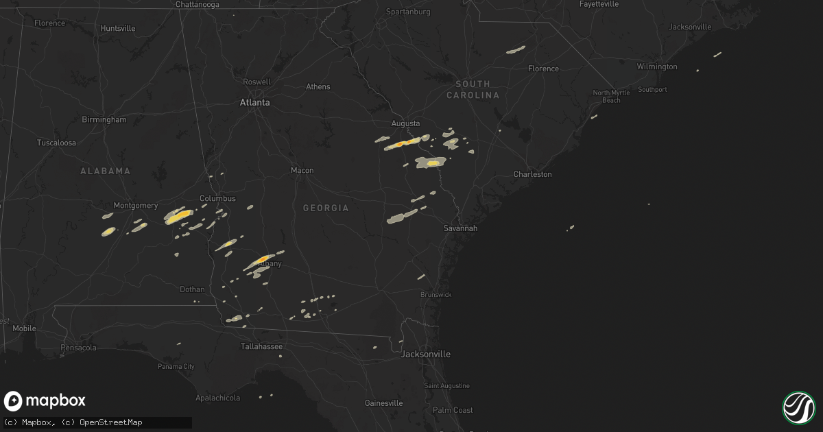
November 16 map
$229
one time, instant access
Download today. No call, no setup
Keep the $229
Bought the map and want the full workflow? Apply the entire $229 to a subscription within 7 days. None of it is wasted.
Every map, not just this one
This buys you this map. Subscription and you get every map we run, in the markets you choose from a few cities to whole states to nationwide. Plus real-time alerts the moment a storm fires.
Contact data
Name, contact info, occupancy, even credit band for addresses in the footprint. You go from where it hit to who to call.
Become the source they trust
Unlimited branding weather history reports on demand. You already have the documented answer ready for the property owner, and you are the one who showed up with it.
Property data and RoofTrace estimates
Pull up any address you have got, its value and the exact code rules for that jurisdiction, straight from One Click Code. Then RoofTrace estimates the squares, pitch, and roof value, priced the way you price.
States Impacted by Hail Map on November 16, 2011
Storm reports
Florida
| Date | Description |
|---|---|
| 11/15/20119:00 PM CST | Damage was reported to a shed and shingles were torn from roof of a house at 4976 nw 42nd place. Several trees down with numerous potted plants knocked over. A 3/4 inch |
Louisiana
| Date | Description |
|---|---|
| 11/16/20116:15 AM CST | Damage reported in kingspoint subdivision. Trees snapped with one falling through roof of home. Fences blown down. |
South Carolina
| Date | Description |
|---|---|
| 11/16/20115:56 PM CST | Allendale county warning point reported numerous trees and power lines down on barton rd...citadel st...blanton rd. Time estimated by radar |
| 11/16/20115:52 PM CST | County sheriff reports trees down near olar. |
| 11/16/20115:43 PM CST | Sheriff office reported trees down in the cities of barnwell...hilda...and blackville. |
| 11/16/20114:41 PM CST | *** 3 fatal *** structural damage to 3 homes reported at highway 324 and williamson roads south of rock hill. 3 confirmed fatalities thus far. |
| 11/16/20114:06 PM CST | Tree reported on a vehicle on river rd near old ferry rd.also...neal shaols rd blocked with downed trees and power lines. |
| 11/16/20114:06 PM CST | Swirling debris went across spotters house and blew shingles off his roof and knocked a tree down on the road. Winds estimated 50 mph plus. |
| 11/16/20114:02 PM CST | County communications called to report additional damage observed near the intersection of neal shoals road and fairview church circle. A roof blown off a barn...power |
| 11/16/20113:21 PM CST | Laurens county sheriffs deputy observed a funnel cloud with possible debris. |
| 11/15/20117:54 PM CST | Used car dealership sign blown over damaging three cars. Time estimated based off radar. |
| 11/15/20117:27 PM CST | A large tree was reported down at the intersection of bartells road and old georgetown road. The time was estimated based on radar data. |
| 11/15/20117:20 PM CST | A large tree was reported down on cedar swamp road. The time was estimated based on radar data. |
| 11/15/20117:15 PM CST | A local report indicates 60 MPH wind near WILLIAMSBURG CTY ARPT |
| 11/15/20117:10 PM CST | A large tree was reported down on mcclam road. The time was estimated based on radar data. |
| 11/15/20117:10 PM CST | Trees down at intersection of sc hwy 6 and hampton street |
| 11/15/20117:00 PM CST | A large tree was reported down on manning highway. The time was estimated by radar data. |
| 11/15/20116:40 PM CST | Trees down at old river road and coveside circle |
| 11/15/20116:15 PM CST | Hampton county warning point reported 2 trees down on deer road. Time estimated by radar. |
| 11/15/20116:00 PM CST | Nws employee reported several trees down along highway 301. Time estimated by radar. |
Virginia
| Date | Description |
|---|---|
| 11/16/20115:56 PM CST | Extensive roof damage to unique industries. Numerous tractor trailers blown over. |
| 11/16/20115:55 PM CST | An ef1 tornado tracked east-northeast from white oak mountin road to the intersection of us hwy 29 and toy lane. Numerous trees were snapped or uprooted. Three large ve |
| 11/15/20119:00 PM CST | Several trees down north of dinwiddie. |
| 11/15/20118:00 PM CST | Several trees down north of dinwiddie. |
| 11/15/20117:25 PM CST | Tree down near the intersection of rt 614 and rt 615 |
| 11/15/20117:18 PM CST | Tree blown down on ashe avenue. |
| 11/15/20116:40 PM CST | Tree down |
| 11/15/20116:36 PM CST | Tree blown down on rodgers chapel road |
| 11/15/20116:16 PM CST | Tree blown down on clarkton road. |
| 11/15/20116:13 PM CST | Two trees blown down on stage coach road |
| 11/15/20116:00 PM CST | Trees down and water tanks tossed about on carter lodge road. |
Georgia
| Date | Description |
|---|---|
| 11/16/20115:48 PM CST | Screven county warning point and trained spotter reported one tree down along highway 17 north. Time estimated by radar. |
| 11/16/20115:44 PM CST | Trained spotter reported several large pecan tree limbs down near lewis. Time estimated by radar. |
| 11/16/20115:40 PM CST | Screven county warning point reported 2 trees down on hiltonia creek road. Time estimated by radar. |
| 11/16/20115:39 PM CST | Burke county em reports 3 recreational vehicles flipped over...powerlines down and a large tree blown onto the roof of a house near seven oak road and hwy 23 in the she |
| 11/16/20115:30 PM CST | 1 large pine tree down near highway 319 about 9 miles north of thomasville in between thomasville and coolidge. Delayed report from wednesday. |
| 11/16/20115:11 PM CST | Jenkins county warning point reported one tree down along west old savannah road. Time estimated by radar. |
| 11/16/20115:00 PM CST | Trees down on whigham road |
| 11/16/20114:56 PM CST | Amateur radio relayed reports of trees blocking mcgarrs mill pond road and quarter-sized hail. |
| 11/16/20114:56 PM CST | Trees down on old highway 179n. |
| 11/16/20114:56 PM CST | Trees down on open pond road |
| 11/16/20114:56 PM CST | Trees down on tired creek road |
| 11/16/20114:48 PM CST | Trees down on jones road |
| 11/16/20114:42 PM CST | Trees down near 267 n pelham road. |
| 11/16/20114:42 PM CST | 1 tree down on highway 97 south. |
| 11/16/20114:31 PM CST | Public report of storage building blown over in waynesboro - relayed by wrdw photo - time estimated with radar |
| 11/16/20114:10 PM CST | Johnson county emergency management reported hail at least the size of quarters and strong gusty winds in wrightsville. |
| 11/16/20114:06 PM CST | Six homes damaged...one significantly when a large pine tree fell through the structure. A portion of a carport blown up on the roof of a home. Several pump houses bein |
| 11/16/20114:05 PM CST | Ags asos reports 58 mph wind gust |
| 11/16/20113:57 PM CST | Public report of tornado near windsor springs road in hephzibah - photo from wrdw augusta |
| 11/16/20113:53 PM CST | Laurens county emergency management reported several downed trees in the northern part of the county. |
| 11/16/20113:50 PM CST | Jefferson county relayed reports of 4 downed trees and 2 downed powerlines. |
| 11/16/20113:41 PM CST | Law enforcement reports golf ball size hail in western lee county. |
| 11/16/20113:18 PM CST | Public reports nickle to quarter sized hail in sandersville. |
| 11/16/20113:09 PM CST | Twiggs county 911 relayed reports of 2 downed trees along long street in the southern portion of the county. |
| 11/16/20112:52 PM CST | Two trees down. |
| 11/16/20112:52 PM CST | Three trees down. |
| 11/16/20112:25 PM CST | Several trees down on i-16. |
| 11/16/20112:23 PM CST | Two trees down on hwy 129. |
| 11/16/20112:09 PM CST | Monroe county 911 relayed reports of a few downed trees in between the forsyth and johnstonville areas. |
| 11/16/20111:10 PM CST | Possible continuation of tornado from harris county. Several downed trees and power lines in far northwest talbot county on old shiloh rd. |
| 11/16/201112:54 PM CST | Amatuer radio relayed a report of damage to the high school and cars in the parking lot of the high school. This damage is possibly the result of a tornado. |
| 11/16/201112:54 PM CST | Amatuer radio relayed a report of damage to the high school and cars in the parking lot of the high school. This damage is possibly the result of a tornado. Damage also |
| 11/16/201112:45 PM CST | Possible tornado bent highway signs 90 degrees and caused very strong winds. |
| 11/16/201112:41 PM CST | *** 1 fatal *** forsyth county emergency management reported a tree downed onto a vehicle killing the occupant. |
| 11/16/201112:36 PM CST | Harris county 911 relayed reports of numerous downed trees in the western portions of the county. |
| 11/16/201112:35 PM CST | A nws damage assessment team determined than an ef-2 tornado with maximum winds of 125 mph originated in alabama and moved into harris county. The tornado crossed the s |
| 11/16/201112:32 PM CST | Cobb county 911 relayed reports of several downed trees in the marietta and smyrna areas. Power outages were reported in the powder springs area. |
| 11/16/201112:30 PM CST | 15 to 20 trees down...most near old federal rd north. |
| 11/15/20117:45 PM CST | The 911 call center reported damage to roofs in the palmetto subdivision near cameron lane and us-1. Time is estimated from radar. |
| 11/15/20117:45 PM CST | The 911 call center reported trees down along us-1 near waycross. Time is estimated from radar. |
| 11/15/20117:40 PM CST | Nws storm survey confirms ef1 tornado at 5000 hunt trail. Roof was taken off a gazebo and porch and carports were damaged. At peak intensity near 100 mph the tornado li |
| 11/15/20117:39 PM CST | The 911 call center reported trees down along lovett road in waresboro. Time is estimated from radar. |
| 11/15/20117:35 PM CST | Storm survey confirmed thunderstorm winds blew down a barn with sheet metal ripped off roof at 3661 luvett road. Straight line winds estimated at 70 mph and damage was |
| 11/15/20117:28 PM CST | Effingham county warning point reported trees down at the intersection of porter road and highway 17. Time estimated by radar. |
| 11/15/20117:15 PM CST | Trained spotter reported quarter size hail for 3 minutes. |
| 11/15/20117:15 PM CST | The 911 center reported a tree blown down on a powerline just off of 441 north near homerville. The time given was based on radar. |
| 11/15/20117:00 PM CST | Evans county warning point reported a tree down on clark street. Time estimated by radar. |
| 11/15/20116:51 PM CST | 1 tree down across highway 135n |
| 11/15/20116:50 PM CST | The emergency management reported that the trees down on highway 32 west 1 mile east of the county line was caused by straight line winds or a microburst. |
| 11/15/20116:50 PM CST | Tattnall county warning point reported a tree down on queen street. Time estimated by radar. |
| 11/15/20116:45 PM CST | Tattnall county warning point reported quarter-size hail at the intersection of highways 23 and 292. Time estimated by radar. |
| 11/15/20116:45 PM CST | Tattnall county had numerous reports of trees down in collins. Time estimated by radar. |
| 11/15/20116:43 PM CST | Roof blown off a barn along bolling road |
Alabama
| Date | Description |
|---|---|
| 11/16/20112:55 PM CST | 1 tree down at 102 5th avenue in ashford. Delayed report from wednesday. |
| 11/16/20112:55 PM CST | 1 tree down at 5832 old webb road. Delayed report from wednesday. |
| 11/16/20112:55 PM CST | 1 tree down at 490 n state highway 95. Delayed report from wednesday. |
| 11/16/20112:50 PM CST | 1 tree down at 12901 e county road 8. Delayed report from wednesday. |
| 11/16/201112:35 PM CST | Several buildings and boathouses were damaged along lake harding |
| 11/16/201112:15 PM CST | Possible tornado. Major damage to trailer park. Trailers and vehicles totally demolished. |
| 11/16/201112:07 PM CST | Possible tornado. Significant damage at terrace acres apartment complex. |
| 11/16/201112:00 PM CST | Possible tornado. Building blown down. |
| 11/16/201111:52 AM CST | *** 1 inj *** an ef1 tornado with winds of 110 mph touched down in macon county and moved northeast into lee county crossing city of auburn and lake harding before movi |
| 11/16/201111:42 AM CST | Several trees were blown down in reeltown. |
| 11/16/201111:32 AM CST | Several trees were blown down near shorter. |
| 11/16/201111:27 AM CST | Several trees down across rigsby rd just south of rifle range rd. Possible tornado. |
| 11/16/201111:22 AM CST | Trees down on highway 97 after a strong circulation passed from southwest to northeast. |
| 11/16/201111:08 AM CST | An ef1 tornado touched at the alabama christian academy and knocked over a scoreboard and snapped a large pine tree. The tornado traveled northeast where several mobile |
| 11/16/201111:02 AM CST | Trees down in the cloverdale section of montgomery. Possible tornado. Time estimated from radar. |
| 11/16/201110:40 AM CST | Power outages reported in hayneville as well as several trees down across the county. |
| 11/16/20119:25 AM CST | Tree reported down on home in the northwest half of huntsville. A few power lines were also reported down. |
| 11/16/20119:17 AM CST | A johnson high school sign was blown down. This is located at cecil fain drive and winchester road in northwest huntsville. Time estimated. |
| 11/16/20119:15 AM CST | 65 mph wind gust estimated in the providence area |
| 11/16/20119:15 AM CST | 65 mph wind gust estimated in the providence area |
| 11/16/20119:15 AM CST | 911 center in northwest huntsville. |
| 11/16/20119:07 AM CST | Trees and power lines down from woody anderson ford to meridian street. |
| 11/16/20119:00 AM CST | One-quarter mile swath of 6 inch diameter young pine tree trucks snapped off about 5 feet above the ground. |
| 11/16/20117:35 AM CST | Structural roof damage reported in downtown demopolis. Also a boat was overturned at a boat dealership. |
| 11/16/20117:32 AM CST | An ef0 tornado touched down in demopolis along maria ave and lifted 2.57 miles to the northeast along us highway 80. Approx 20 homes sustained minor roof damage and sev |
| 11/16/20117:07 AM CST | *** 1 inj *** an ef2 tornado touched down along county road 42 and moved northeast for 1.50 miles. It snapped 150 softwoods and uprooted 50 hardwoods. Five outbuildings |
| 11/16/20117:04 AM CST | Sheriff office reports trees down and homes damaged from a possible tornoado in the whitfield area near county road 42 and state road 17. |
Tennessee
| Date | Description |
|---|---|
| 11/16/201110:15 AM CST | Dispatch reported large tree limbs down and a tree blown across the road at the intersection of highway 28 and condra switch road. |
North Carolina
| Date | Description |
|---|---|
| 11/16/20115:35 PM CST | Front of residence damaged... Vehicle blown into road... Walnut ridge road at morning glory road |
| 11/16/20115:30 PM CST | Trees down at intersection of north friendship rd and flat shoals rd |
| 11/16/20115:20 PM CST | Truck blown into road... Front of house blown off at fuller mill road and finch farm road |
| 11/16/20115:15 PM CST | Commerical buildings and homes damaged near the intersection of us 64 and route 109. Time estimated by radar. |
| 11/16/20115:14 PM CST | Trees down at 3500 hwy 704 west |
| 11/16/20115:11 PM CST | Trees down at 1346 va line rd |
| 11/16/20115:10 PM CST | Multiple homes damaged with people trapped inside near the 2600 block of young road. Time estimated by radar. |
| 11/16/20115:06 PM CST | Trees down at 2687 flat rock rd |
| 11/16/20115:06 PM CST | Trees down 1946 hwy 704 east |
| 11/16/20115:06 PM CST | Multiple homes destoyed on burkhart road. Time estimated by radar. |
| 11/16/20115:06 PM CST | Major structural damage to wood frame housing at sliver ridge and allred road |
| 11/16/20115:05 PM CST | Multiple trees and power lines down... Roof damage... At allred road and nc 47 |
| 11/16/20115:03 PM CST | Trees down at 2893 hart rd |
| 11/16/20115:02 PM CST | Trees down at hwy 704 and creasy rd. |
| 11/16/20115:01 PM CST | A local report indicates 1.75 inch wind near 4 N SALISBURY |
| 11/16/20114:52 PM CST | 1 hail near old salisbury road |
| 11/16/20114:46 PM CST | 1 tree reported down on vehicle just north of salisbury. |
| 11/15/201110:15 PM CST | Nws storm survey of an ef-0 tornado which tracked 1.6 miles. |
| 11/15/201110:07 PM CST | Two trees were uprooted just south of severn. Several road signs were also damaged. |
| 11/15/20117:55 PM CST | A large tree was reported down on stackhouse road. The time was estimated based on radar data. |
| 11/15/20117:55 PM CST | Large trees were reported down on progressive farm road. The time was estimated based on radar data. |
Cities Impacted by Hail Map on November 16, 2011
- Bainbridge, GA
- Spencer, NC
- Mooresville, NC
- Linwood, NC
- Mount Ulla, NC
- China Grove, NC
- Salisbury, NC
- Cuthbert, GA
- Leesburg, GA
- Albany, GA
- Ramer, AL
- Whigham, GA
- Buena Vista, GA
- Quincy, FL
- Attapulgus, GA
- Blackville, SC
- Jackson, SC
- Louisville, GA
- Waynesboro, GA
- Keysville, GA
- Wrens, GA
- Hephzibah, GA
- Holly Hill, SC
- Quitman, GA
- Valdosta, GA
- Morven, GA
- Coleman, GA
- Denmark, SC
- Ulmer, SC
- Olar, SC
- Barnwell, SC
- Fort Deposit, AL
- Minter, AL
- Letohatchee, AL
- Forest Home, AL
- Bamberg, SC
- Adel, GA
- Midway, AL
- Sylvania, GA
- Omaha, GA
- Cusseta, GA
- Lodge, SC
- Ruffin, SC
- Smoaks, SC
- Fairfax, SC
- Girard, GA
- Sardis, GA
- Allendale, SC
- Martin, SC
- Millen, GA
- Union Springs, AL
- Tuskegee, AL
- Boston, GA
- Clayton, AL
- Saint George, GA
- Hurtsboro, AL
- Leary, GA
- Dawson, GA
- Camilla, GA
- Hortense, GA
- Brunswick, GA
- Eufaula, AL
- Lyons, GA
- Collins, GA
- Claxton, GA
- Reidsville, GA
- Lakeland, GA
- Nashville, GA
- Statesboro, GA
- Louisville, AL
- Banks, AL
- Oakfield, GA
- Warwick, GA
- Blakely, GA
- Brooklet, GA
- Williston, SC
- Morris, GA
- Lapine, AL
- Highland Home, AL
- Grady, AL
- Arlington, GA
- Damascus, GA
- Cottonwood, AL
- Newton, GA
- Moultrie, GA
- Pavo, GA
- Hayneville, AL
- Tyler, AL
- Lowndesboro, AL
- Fort Mitchell, AL
- Pittsview, AL
- Donalsonville, GA
- Clio, AL
- Weston, GA
- Parrott, GA
- Montgomery, AL
- Colquitt, GA
- Ray City, GA
- Bethune, SC
- McBee, SC
- Hartsville, SC
- Chipley, FL
- Register, GA
- Fort Davis, AL
- Hahira, GA
- Hatchechubbee, AL
- Seale, AL
- Matthews, GA
- Blythe, GA
- Stapleton, GA
- Brinson, GA
- Newington, GA
- Naylor, GA
- West Point, GA
- Hamilton, GA
- Cairo, GA
- Climax, GA