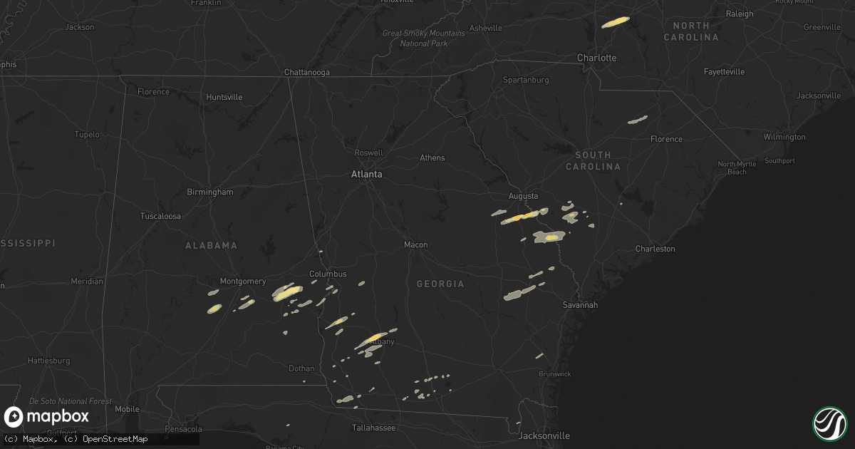
Hail Map in Georgia on November 16, 2011
Get this storm
November 16 map
$229
one time, instant access
Download today. No call, no setup
Keep the $229
Bought the map and want the full workflow? Apply the entire $229 to a subscription within 7 days. None of it is wasted.
Every map, not just this one
This buys you this map. Subscription and you get every map we run, in the markets you choose from a few cities to whole states to nationwide. Plus real-time alerts the moment a storm fires.
Contact data
Name, contact info, occupancy, even credit band for addresses in the footprint. You go from where it hit to who to call.
Become the source they trust
Unlimited branding weather history reports on demand. You already have the documented answer ready for the property owner, and you are the one who showed up with it.
Property data and RoofTrace estimates
Pull up any address you have got, its value and the exact code rules for that jurisdiction, straight from One Click Code. Then RoofTrace estimates the squares, pitch, and roof value, priced the way you price.
Storm reports in Georgia
Georgia
| Date | Description |
|---|---|
| 11/16/20115:48 PM CST | Screven county warning point and trained spotter reported one tree down along highway 17 north. Time estimated by radar. |
| 11/16/20115:44 PM CST | Trained spotter reported several large pecan tree limbs down near lewis. Time estimated by radar. |
| 11/16/20115:40 PM CST | Screven county warning point reported 2 trees down on hiltonia creek road. Time estimated by radar. |
| 11/16/20115:39 PM CST | Burke county em reports 3 recreational vehicles flipped over...powerlines down and a large tree blown onto the roof of a house near seven oak road and hwy 23 in the she |
| 11/16/20115:30 PM CST | 1 large pine tree down near highway 319 about 9 miles north of thomasville in between thomasville and coolidge. Delayed report from wednesday. |
| 11/16/20115:11 PM CST | Jenkins county warning point reported one tree down along west old savannah road. Time estimated by radar. |
| 11/16/20115:00 PM CST | Trees down on whigham road |
| 11/16/20114:56 PM CST | Trees down on tired creek road |
| 11/16/20114:56 PM CST | Trees down on open pond road |
| 11/16/20114:56 PM CST | Trees down on old highway 179n. |
| 11/16/20114:56 PM CST | Amateur radio relayed reports of trees blocking mcgarrs mill pond road and quarter-sized hail. |
| 11/16/20114:48 PM CST | Trees down on jones road |
| 11/16/20114:42 PM CST | 1 tree down on highway 97 south. |
| 11/16/20114:42 PM CST | Trees down near 267 n pelham road. |
| 11/16/20114:31 PM CST | Public report of storage building blown over in waynesboro - relayed by wrdw photo - time estimated with radar |
| 11/16/20114:10 PM CST | Johnson county emergency management reported hail at least the size of quarters and strong gusty winds in wrightsville. |
| 11/16/20114:06 PM CST | Six homes damaged...one significantly when a large pine tree fell through the structure. A portion of a carport blown up on the roof of a home. Several pump houses bein |
| 11/16/20114:05 PM CST | Ags asos reports 58 mph wind gust |
| 11/16/20113:57 PM CST | Public report of tornado near windsor springs road in hephzibah - photo from wrdw augusta |
| 11/16/20113:53 PM CST | Laurens county emergency management reported several downed trees in the northern part of the county. |
| 11/16/20113:50 PM CST | Jefferson county relayed reports of 4 downed trees and 2 downed powerlines. |
| 11/16/20113:41 PM CST | Law enforcement reports golf ball size hail in western lee county. |
| 11/16/20113:18 PM CST | Public reports nickle to quarter sized hail in sandersville. |
| 11/16/20113:09 PM CST | Twiggs county 911 relayed reports of 2 downed trees along long street in the southern portion of the county. |
| 11/16/20112:52 PM CST | Two trees down. |
| 11/16/20112:52 PM CST | Three trees down. |
| 11/16/20112:25 PM CST | Several trees down on i-16. |
| 11/16/20112:23 PM CST | Two trees down on hwy 129. |
| 11/16/20112:09 PM CST | Monroe county 911 relayed reports of a few downed trees in between the forsyth and johnstonville areas. |
| 11/16/20111:10 PM CST | Possible continuation of tornado from harris county. Several downed trees and power lines in far northwest talbot county on old shiloh rd. |
| 11/16/201112:54 PM CST | Amatuer radio relayed a report of damage to the high school and cars in the parking lot of the high school. This damage is possibly the result of a tornado. |
| 11/16/201112:54 PM CST | Amatuer radio relayed a report of damage to the high school and cars in the parking lot of the high school. This damage is possibly the result of a tornado. Damage also |
| 11/16/201112:45 PM CST | Possible tornado bent highway signs 90 degrees and caused very strong winds. |
| 11/16/201112:41 PM CST | *** 1 fatal *** forsyth county emergency management reported a tree downed onto a vehicle killing the occupant. |
| 11/16/201112:36 PM CST | Harris county 911 relayed reports of numerous downed trees in the western portions of the county. |
| 11/16/201112:35 PM CST | A nws damage assessment team determined than an ef-2 tornado with maximum winds of 125 mph originated in alabama and moved into harris county. The tornado crossed the s |
| 11/16/201112:32 PM CST | Cobb county 911 relayed reports of several downed trees in the marietta and smyrna areas. Power outages were reported in the powder springs area. |
| 11/16/201112:30 PM CST | 15 to 20 trees down...most near old federal rd north. |
| 11/15/20117:45 PM CST | The 911 call center reported trees down along us-1 near waycross. Time is estimated from radar. |
| 11/15/20117:45 PM CST | The 911 call center reported damage to roofs in the palmetto subdivision near cameron lane and us-1. Time is estimated from radar. |
| 11/15/20117:40 PM CST | Nws storm survey confirms ef1 tornado at 5000 hunt trail. Roof was taken off a gazebo and porch and carports were damaged. At peak intensity near 100 mph the tornado li |
| 11/15/20117:39 PM CST | The 911 call center reported trees down along lovett road in waresboro. Time is estimated from radar. |
| 11/15/20117:35 PM CST | Storm survey confirmed thunderstorm winds blew down a barn with sheet metal ripped off roof at 3661 luvett road. Straight line winds estimated at 70 mph and damage was |
| 11/15/20117:28 PM CST | Effingham county warning point reported trees down at the intersection of porter road and highway 17. Time estimated by radar. |
| 11/15/20117:15 PM CST | Trained spotter reported quarter size hail for 3 minutes. |
| 11/15/20117:15 PM CST | The 911 center reported a tree blown down on a powerline just off of 441 north near homerville. The time given was based on radar. |
| 11/15/20117:00 PM CST | Evans county warning point reported a tree down on clark street. Time estimated by radar. |
| 11/15/20116:51 PM CST | 1 tree down across highway 135n |
| 11/15/20116:50 PM CST | Tattnall county warning point reported a tree down on queen street. Time estimated by radar. |
| 11/15/20116:50 PM CST | The emergency management reported that the trees down on highway 32 west 1 mile east of the county line was caused by straight line winds or a microburst. |
| 11/15/20116:45 PM CST | Tattnall county had numerous reports of trees down in collins. Time estimated by radar. |
| 11/15/20116:45 PM CST | Tattnall county warning point reported quarter-size hail at the intersection of highways 23 and 292. Time estimated by radar. |
| 11/15/20116:43 PM CST | Roof blown off a barn along bolling road |
All States Impacted by Hail Map on November 16, 2011
Cities Impacted by Hail Map on November 16, 2011
- Bainbridge, GA
- Spencer, NC
- Mooresville, NC
- Linwood, NC
- Mount Ulla, NC
- China Grove, NC
- Salisbury, NC
- Cuthbert, GA
- Leesburg, GA
- Albany, GA
- Ramer, AL
- Whigham, GA
- Buena Vista, GA
- Quincy, FL
- Attapulgus, GA
- Blackville, SC
- Jackson, SC
- Louisville, GA
- Waynesboro, GA
- Keysville, GA
- Wrens, GA
- Hephzibah, GA
- Holly Hill, SC
- Quitman, GA
- Valdosta, GA
- Morven, GA
- Coleman, GA
- Denmark, SC
- Ulmer, SC
- Olar, SC
- Barnwell, SC
- Fort Deposit, AL
- Minter, AL
- Letohatchee, AL
- Forest Home, AL
- Bamberg, SC
- Adel, GA
- Midway, AL
- Sylvania, GA
- Omaha, GA
- Cusseta, GA
- Lodge, SC
- Ruffin, SC
- Smoaks, SC
- Fairfax, SC
- Girard, GA
- Sardis, GA
- Allendale, SC
- Martin, SC
- Millen, GA
- Union Springs, AL
- Tuskegee, AL
- Boston, GA
- Clayton, AL
- Saint George, GA
- Hurtsboro, AL
- Leary, GA
- Dawson, GA
- Camilla, GA
- Hortense, GA
- Brunswick, GA
- Eufaula, AL
- Lyons, GA
- Collins, GA
- Claxton, GA
- Reidsville, GA
- Lakeland, GA
- Nashville, GA
- Statesboro, GA
- Louisville, AL
- Banks, AL
- Oakfield, GA
- Warwick, GA
- Blakely, GA
- Brooklet, GA
- Williston, SC
- Morris, GA
- Lapine, AL
- Highland Home, AL
- Grady, AL
- Arlington, GA
- Damascus, GA
- Cottonwood, AL
- Newton, GA
- Moultrie, GA
- Pavo, GA
- Hayneville, AL
- Tyler, AL
- Lowndesboro, AL
- Fort Mitchell, AL
- Pittsview, AL
- Donalsonville, GA
- Clio, AL
- Weston, GA
- Parrott, GA
- Montgomery, AL
- Colquitt, GA
- Ray City, GA
- Bethune, SC
- McBee, SC
- Hartsville, SC
- Chipley, FL
- Register, GA
- Fort Davis, AL
- Hahira, GA
- Hatchechubbee, AL
- Seale, AL
- Matthews, GA
- Blythe, GA
- Stapleton, GA
- Brinson, GA
- Newington, GA
- Naylor, GA
- West Point, GA
- Hamilton, GA
- Cairo, GA
- Climax, GA


